Martletwy

Martletwy

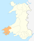
Martletwy is a village and community in the county of Pembrokeshire, Wales.

Martletwy lies in south of the county, the nearest town is Narberth some 7 miles distant to its north and east. The Martletwy community lies mainly to the west of the A4075 road, which links Carew in the south with the Canaston Bridge junction at the A40 road, although part of the Cross Hands area bridges the main road. To the west and south, the area's boundary is the Eastern Cleddau, to the southeast the River Cresswell forms its boundary. [1]

Martletwy consists of the following parishes: Martletwy, Coedcanlas, Minwear, Newton North and Lawrenny.

The village is best known for being home to the Oakwood theme park.

References

External links

Coordinates: 51°45′34″N 4°50′55″W / 51.75952°N 4.84868°W / 51.75952; -4.84868


Wikimedia Foundation. 2010.

Игры ⚽ Нужно сделать НИР?

Look at other dictionaries:

  • Pembrokeshire — Pembrokeshire …   Wikipedia

  • Coedcanlas — is a hamlet and parish in Pembrokeshire, Wales. It is situated on the eastern shore of the Daugleddau estuary, 8 km north of Pembroke. It is part of the Pembrokeshire Coast National Park. The parish, together with the parishes of Martletwy,… …   Wikipedia

  • Middleholm — Middleholm, also known as Midland Island, is a small island lying off southwest Pembrokeshire in Wales, southeast of Skomer. The island is known for its seabirds, including Manx Shearwaters and Atlantic Puffins, and for its plants, including Red… …   Wikipedia

  • Milford Haven — This article is about the town. For the waterway, see Milford Haven Waterway. Coordinates: 51°42′51″N 5°02′34″W / 51.71418°N 5.04274°W / …   Wikipedia

  • Newport, Pembrokeshire — Newport and the Nyfer estuary from Carn Ingli Coordinates …   Wikipedia

  • Tenby — Coordinates: 51°40′28″N 4°42′16″W / 51.6745°N 4.7044°W / 51.6745; 4.7044 …   Wikipedia

  • Pembroke Dock — Coordinates: 51°41′36″N 4°56′45″W / 51.69333°N 4.94584°W / 51.69333; 4.94584 …   Wikipedia

  • Cilgerran — Coordinates: 52°03′12″N 4°38′02″W / 52.05322°N 4.63396°W / 52.05322; 4.63396 …   Wikipedia

  • Neyland — Not to be confused with Nayland. Coordinates: 51°42′41″N 4°56′43″W / 51.711272°N 4.945231°W / 51.711272; 4.945231 …   Wikipedia

  • Manorbier — Coordinates: 51°38′40″N 4°47′53″W / 51.644444°N 4.798056°W / 51.644444; 4.798056 …   Wikipedia

Share the article and excerpts

Direct link
Do a right-click on the link above
and select “Copy Link”