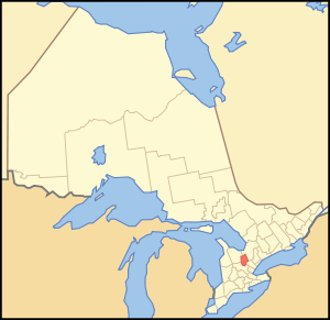
- Dufferin County
-
Dufferin County — County — Location of Dufferin County Country  Canada
Province  Ontario
County seat Orangeville Municipalities List- Town of Mono
- Town of Orangeville
- Town of Shelburne
- Township of Amaranth
- Township of East Garafraxa
- Township of East Luther Grand Valley
- Township of Melancthon
- Township of Mulmur
Area - Total 1,456.1 km2 (562.2 sq mi) Time zone EST (UTC-5) - Summer (DST) EDT (UTC-4) Website www.dufferincounty.on.ca Dufferin County is a county and census division of the Canadian province of Ontario. The county seat is Orangeville, and the current Warden is Deputy Mayor Warren Maycock of the Town of Orangeville, Ontario[1]. The Current Chief Administrative Officer is Linda J. Dean [2]. Dufferin covers an area of 359,812 acres (562 sq mi; 1,456 km2), and its population is 54,436 (2006). Dufferin County is the highest plateau immediately west of Georgian Bay, and as such forms the watershed between the four lakes: Huron, Erie, Ontario and Simcoe. Four rivers — Saugeen, Grand, Credit and Nottawasaga — take their rise in Dufferin or in adjacent townships and drain through the county.
The county is a lofty table-land that is about 1,700 feet (518 m) above sea-level and about 1,400 feet (427 m) above the level of downtown Toronto. A continuation of the Caledon Mountains skirts the eastern side of the county. The highest peaks, however, are no match for the Blue Mountains north of Dufferin or the Caledon Mountains on the south.
The County of Dufferin, sits on the fringe of the Greater Toronto Area, about 100 kilometres northwest of Toronto. It consists of eight municipalities: three towns, Mono, Orangeville and Shelburne; and five rural townships, Amaranth, East Garafraxa, East Luther-Grand Valley, Melancthon and Mulmur. Dufferin is largely a rural county with three urban settlement areas, namely Grand Valley, Orangeville and Shelburne. The Town of Orangeville, the county seat, is situated on the southern border of the county and is the largest urban centre, with just over half the population. Although Orangeville dominates in terms of population, in area it is very small and geographically compact.
Dufferin was formed in 1881 from parts of the counties of Grey and Simcoe, on the north and east, and from the County of Wellington on the south and west. The county gets its name from the Marquess of Dufferin, who was Governor General of Canada between 1872-1878. (Several local comedians have joked that Dufferin gets its name from a "headache remedy for Canadian golfers"; a portmanteau of duffer and Bufferin.) Originally an agriculturally based economy, Dufferin's economy has diversified to include commercial and retail businesses, industries related to residential and commercial construction (building, supplies, aggregates, real estate) and manufacturing. A portion of Dufferin’s economy still depends on agriculture but tourism is becoming more important as the county takes a more positive role in attracting visitors.
It consists of the following municipalities:
- Town of Mono
- Town of Orangeville
- Town of Shelburne
- Township of Amaranth
- Township of East Garafraxa
- Township of East Luther Grand Valley
- Township of Melancthon
- Township of Mulmur
Historical townships
- Amaranth Township, area: 63,471 acres (99 sq mi; 257 km2). Opened in 1821 and named from a common weed-plant (Amaranth) with green or purplish flowers, or it might be named after the "un-fading flower" of the classic poets. Settled mainly between 1840 and 1873. Communities were Orangeville, Laurel, Shelburne, Waldemar, Bowling Green
- Township of East Garafraxa, area: 40,835 acres (64 sq mi; 165 km2). Opened in 1821. Settled mostly between 1833 and 1850. (community centre, Marsville)
- Township of East Luther, area: 38,599 acres (60 sq mi; 156 km2). Settled mainly between 1860 and 1875. Community centres: Grand Valley, Monticello and Colbeck.
- Township of Melancthon, area: 74,705 acres (117 sq mi; 302 km2). Opened in 1821 and named after one of the leaders of the German Reformation (Philipp Melanchthon). A swampy township like East Luther so it was slow to be settled. Not generally settled until after 1850. Community centres: Melancthon, Corbetton, Riverview, Hornings Mills.
- Township of Mulmur, area: 70,291 acres (110 sq mi; 284 km2). Opened in 1822. Origin of the name is forgotten, possibly a corruption of an Indian word or name. Settled mainly after 1867. Community centres: Mansfield, Honeywood, Terra Nova, Primrose.
Source: Province of Ontario -- A History 1615 to 1927 by Jesse Edgar Middleton & Fred Landon, copyright 1927, Dominion Publishing Company, Toronto
See also
- List of Ontario Census Divisions
- Southern Ontario
External links
Categories:
Wikimedia Foundation. 2010.

