- Darmstadt, Indiana
-
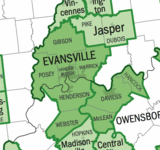
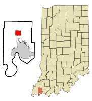
Darmstadt, Indiana — Suburb — Location in the state of Indiana Coordinates: 38°5′28″N 87°34′34″W / 38.09111°N 87.57611°WCoordinates: 38°5′28″N 87°34′34″W / 38.09111°N 87.57611°W Country United States State Indiana County Vanderburgh Township Armstrong, Center, German, Scott Government – Type Town Council – Clerk-Treasurer Mallory Lowe Area – Total 4.7 sq mi (12.3 km2) – Land 4.7 sq mi (12.2 km2) – Water 0.0 sq mi (0.1 km2) Elevation 479 ft (146 m) Population (2010) – Total 1,407 – Density 278.2/sq mi (107.4/km2) Time zone CST (UTC-6) – Summer (DST) CDT (UTC-5) ZIP codes 47720, 47725 Area code(s) 812 FIPS code 18-16858[1] GNIS feature ID 0433320[2] Website http://www.darmstadt-indiana.org Addresses in Darmstadt are referred to as Darmstadt, IN there is an Inglefield, Indiana 47618 post office in Darmstadt that also has the Darmstadt, IN address Darmstadt is a northern suburb of Evansville, Indiana Scott Township, Vanderburgh County, Indiana, United States. It also extends slightly into Armstrong, Center and German townships. The population was 14,407 at the 2010 census. Darmstadt is just north of the core and is part of the Evansville Metropolitan Area.
Contents
Geography
Darmstadt is located at 38°5′28″N 87°34′34″W / 38.09111°N 87.57611°W (38.091041, -87.576207)[3].
According to the United States Census Bureau, the town has a total area of 4.7 square miles (12 km2), of which, 4.7 square miles (12 km2) of it is land and 0.04 square miles (0.10 km2) of it (0.42%) is water.
Demographics
As of the census[1] of 2000, there were 1,313 people, 490 households, and 605 families residing in the town. The population density was 262.1 people per square mile (107.4/km²). There were 503 housing units at an average density of 106.6 per square mile (41.1/km²). The racial makeup of the town was 99.16% White, 0.23% African American, 0.15% Asian, and 0.46% from two or more races. Hispanic or Latino of any race were 0.08% of the population.
There were 490 households out of which 34.3% had children under the age of 18 living with them, 76.3% were married couples living together, 4.3% had a female householder with no husband present, and 17.3% were non-families. 15.3% of all households were made up of individuals and 9.4% had someone living alone who was 65 years of age or older. The average household size was 2.68 and the average family size was 2.97.
In the town the population was spread out with 25.5% under the age of 18, 5.3% from 18 to 24, 24.7% from 25 to 44, 29.0% from 45 to 64, and 15.5% who were 65 years of age or older. The median age was 43 years. For every 100 females there were 98.3 males. For every 100 females age 18 and over, there were 98.4 males.
The median income for a household in the town was $68,359, and the median income for a family was $72,813. Males had a median income of $50,605 versus $28,750 for females. The per capita income for the town was $31,898. About 0.5% of families and 1.1% of the population were below the poverty line, including none of those under age 18 and 1.0% of those age 65 or over.
Transportation
Darmstadt is connected to the rest of the Evansville area by a series of smaller roads like Darmstadt Rd, St. Joseph Ave, and Boonville- New Harmony Rd. However most of the populations gets into Evansville using the U.S. 41 corridor. in 2012 University Parkway will open in Darmstadt giving the city direct highway access to Evansville's west side as well as the growing University of Southern Indiana U.S. 41 runs north-to-south directly east of Darmstadt, providing yet another access point to Evansville, as well as access to I-64.
Businesses
Much of Darmstadts business is conducted in the Northview business park located near the intersection of U.S. 41 and Boonville- New Harmony Rd. In 2012 a major renovation of the town center on the corner of Darmstadt Rd and Boonville- New Harmony Rd. is planned.
See also
World Peace Tree, a historically significant tree in Darmstadt
References
- ^ a b "American FactFinder". United States Census Bureau. http://factfinder.census.gov. Retrieved 2008-01-31.
- ^ "US Board on Geographic Names". United States Geological Survey. 2007-10-25. http://geonames.usgs.gov. Retrieved 2008-01-31.
- ^ "US Gazetteer files: 2010, 2000, and 1990". United States Census Bureau. 2011-02-12. http://www.census.gov/geo/www/gazetteer/gazette.html. Retrieved 2011-04-23.
External links
Evansville-Henderson, IN-KY Metropolitan Statistical Area Central City 
Municipalities with population
over 10,000 in 2007Municipalities with population
1,000-10,000 in 2007Boonville • Chandler • Darmstadt • Fort Branch • Haubstadt • Mt. Vernon • Newburgh • New Harmony • Oakland City • Owensville • Poseyville • ProvidenceIndiana Counties Kentucky Counties Municipalities and communities of Vanderburgh County, Indiana City Town Darmstadt
Townships CDPs Unincorporated
communitiesArmstrong | Belknap | Country Club Meadows | Cypress | Daylight | Earle | Elliott | Harwood | Hillsdale | Inglefield | Kasson | Knob Hill | Lakewood Hills | Lamasco | Martin | McCutchanville | Mechanicsville | Mud Center | Nisbet | Rahm | Red Bank | Saint Joseph | Saint Wendel | Stacer | Stringtown | Vaughan |
Categories:- Populated places in Vanderburgh County, Indiana
- Towns in Indiana
- Populated places established in 1822
- Communities of Southwestern Indiana
- Evansville metropolitan area
Wikimedia Foundation. 2010.


