- Melody Hill, Indiana
-
Melody Hill, Indiana — CDP — 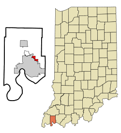
Coordinates: 38°1′31″N 87°30′57″W / 38.02528°N 87.51583°WCoordinates: 38°1′31″N 87°30′57″W / 38.02528°N 87.51583°W Country United States State Indiana County Vanderburgh Area – Total 1.4 sq mi (3.5 km2) – Land 1.4 sq mi (3.5 km2) – Water 0.0 sq mi (0.0 km2) Elevation 427 ft (130 m) Population (2000) – Total 3,066 – Density 2,252.0/sq mi (869.5/km2) Time zone Central (CST) (UTC-6) – Summer (DST) CDT (UTC-5) FIPS code 18-48330[1] GNIS feature ID 0438974[2] Melody Hill is a census-designated place (CDP) in Vanderburgh County, Indiana, United States. The population was 3,066 at the 2000 census.
Geography
Melody Hill is located at 38°1′31″N 87°30′57″W / 38.02528°N 87.51583°W (38.025242, -87.515813)[3].
According to the United States Census Bureau, the CDP has a total area of 1.4 square miles (3.6 km2), of which, 1.4 square miles (3.6 km2) of it is land and 0.73% is water.
The CDP consists of two neighborhoods off of St. George Road between U.S. 41 and Oak Hill Road. Melody Hills does not include the newer homes and neighborhoods built to the east and north in the 1980s and 1990s.
The older section consists of smaller tract homes. It is on the south side of St. George Road between Oak Hill Road and Cunningham Court.
The newer section, consisting of larger homes built on a hill, is on the north side of St. George Road between Ward Road on the east and Twickingham Road on the west. It is south the Evansville Regional Airport and east of the Sunset Memorial Gardens cemetery. To the east is the "Knob Hill" area, another street of homes on a smaller hill. This does not include the newer neighborhoods that have been built since the 1970s.
Demographics
As of the census[1] of 2000, there were 3,066 people, 1,159 households, and 935 families residing in the CDP. The population density was 2,252.0 people per square mile (870.4/km²). There were 1,193 housing units at an average density of 876.3/sq mi (338.7/km²). The racial makeup of the CDP was 97.23% White, 1.57% African American, 0.20% Native American, 0.49% Asian, 0.16% from other races, and 0.36% from two or more races. Hispanic or Latino of any race were 0.68% of the population.
There were 1,159 households out of which 35.5% had children under the age of 18 living with them, 72.0% were married couples living together, 6.6% had a female householder with no husband present, and 19.3% were non-families. 16.7% of all households were made up of individuals and 9.0% had someone living alone who was 65 years of age or older. The average household size was 2.64 and the average family size was 2.97.
In the CDP the population was spread out with 26.1% under the age of 18, 5.2% from 18 to 24, 27.9% from 25 to 44, 25.0% from 45 to 64, and 15.9% who were 65 years of age or older. The median age was 40 years. For every 100 females there were 95.0 males. For every 100 females age 18 and over, there were 92.0 males.
The median income for a household in the CDP was $60,764, and the median income for a family was $62,000. Males had a median income of $43,553 versus $25,850 for females. The per capita income for the CDP was $23,880. About 0.9% of families and 1.1% of the population were below the poverty line, including 1.0% of those under age 18 and 0.9% of those age 65 or over.
It may be worth noting that residents of this area remain somewhat mystified by the fact that their neighborhood is dotted on maps and designated as a CDP, as it is actually a suburban residential neighborhood and not a separate town or settlement of any sort.
References
- ^ a b "American FactFinder". United States Census Bureau. http://factfinder.census.gov. Retrieved 2008-01-31.
- ^ "US Board on Geographic Names". United States Geological Survey. 2007-10-25. http://geonames.usgs.gov. Retrieved 2008-01-31.
- ^ "US Gazetteer files: 2010, 2000, and 1990". United States Census Bureau. 2011-02-12. http://www.census.gov/geo/www/gazetteer/gazette.html. Retrieved 2011-04-23.
Municipalities and communities of Vanderburgh County, Indiana City 
Town Townships CDPs Highland | Melody Hill
Unincorporated
communitiesArmstrong | Belknap | Country Club Meadows | Cypress | Daylight | Earle | Elliott | Harwood | Hillsdale | Inglefield | Kasson | Knob Hill | Lakewood Hills | Lamasco | Martin | McCutchanville | Mechanicsville | Mud Center | Nisbet | Rahm | Red Bank | Saint Joseph | Saint Wendel | Stacer | Stringtown | Vaughan |
Categories:- Census-designated places in Indiana
- Communities of Southwestern Indiana
- Populated places in Vanderburgh County, Indiana
- Evansville metropolitan area

Wikimedia Foundation. 2010.