- Mount Myōkō
-
Mount Myōkō (妙高山 Myōkō-san) 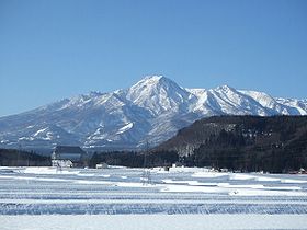
A view from northeast.Elevation 2,454 m (8,051 ft) Pronunciation Japanese: [mjoːkoːsaɴ] Location Location Chūbu region, Honshū, Japan Range Kubiki Mountains Coordinates 36°53′17.1″N 138°06′59.9″E / 36.888083°N 138.116639°E Geology Type Stratovolcano Last eruption 2360 BC ± 150 years Climbing Easiest route Hike Mount Myōkō (妙高山 Myōkō-san) is an active stratovolcano in Honshū-island, Japan. It is situated at the southwest of Myōkō city, Niigata Prefecture, and a part of Joshinetsu Kogen National Park. Mount Myōkō is listed as one of 100 Famous Japanese Mountains, and together with Mount Yahiko (弥彦山 Yahiko-yama), it is well known as the "famous mountain" of Niigata Prefecture.
Contents
Name
Echigofuji (越後富士) is another name given to this mountain. Being close to the border with Nagano Prefecture, it is linked to those on the Nagano side as one of the Five Peaks in Hokushin (北信五岳 hokushingogaku). The mountain was originally named Mount Koshinonaka (越の中山 koshinonakayama) but was later changed to Mount Myōkō (名香山 Myōkōsan). This can be also written as 妙高山, in order to make use of two "lucky" characters.
Geology and geography
Mount Myōkō was formed beginning about 300,000 years ago, in a series of eruptions producing a broad spectrum of lava types including basalt, andesite, and dacite. Its maximum height is estimated to have been between 2,800 metres (9,200 ft) and 2,900 metres (9,500 ft), but it presently reaches only 2,454 metres (8,051 ft). Around 19,000 years ago, the top was blown off in a major eruption, forming a 3 km (2 mi) wide caldera. About 6,000 years ago, the central crater developed and assumed its present shape. A lava dome forms the volcano's present summit. The most recent eruptions about 4,300 years ago produced pyoclastic flows down the eastern flanks. Present activity is solfataric from fumaroles near the lava dome, where sulfur was once mined.
There are onsen and ski resorts at the foot of the mountain, including Akakura, Suginohara and Ikenotaira.
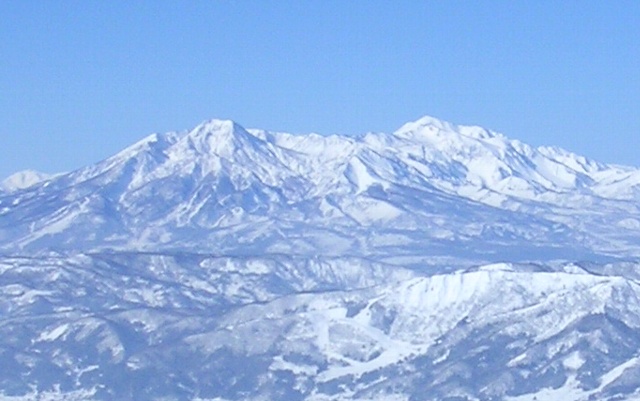
 Mount Myōkō (left) and Mount Hiuchi (right) from the Nozawa Onsen ski area.
Related Facts
The heavy cruiser Myōkō of the Imperial Japanese Navy and an Aegis destroyer of the Japan Maritime Self-Defense Force are named after this mountain.
The mountain appears invariably in school songs of elementary and middle schools in the Joetsu Region.
In 1990 the Nippon Jamboree, a camping festival, was held on the Myōkō plateau (妙高高原 myōkōkōgen) during which the participants climbed the mountain.
See also
References
External links
- Myōkō City official website (Japanese)
- Topographic map (1:25,000)
Categories:- Mountains of Niigata Prefecture
- Visitor attractions in Niigata Prefecture
- Stratovolcanoes
- Volcanoes of Honshū

Wikimedia Foundation. 2010.