- Mount Azuma
-
Mount Azuma 
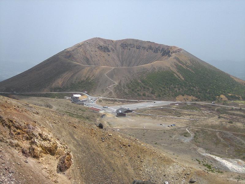
Mount Azuma, May 2007.Elevation 1,705 m (5,594 ft) Location Location Fukushima, Tōhoku region, Japan 
Range Azuma Mountain Range Coordinates 37°44′N 140°15′E / 37.73°N 140.25°E Geology Type Stratovolcano Last eruption 1977 Mount Azuma-kofuji (吾妻小富士) is an active stratovolcano in Fukushima prefecture, Japan.
It has a conical-shaped crater and as the name "Kofuji" (small Mount Fuji) suggests, the shape of Mount Azuma is like that of Mount Fuji.[1] Mount Azuma's appealing symmetrical crater and the nearby fumarolic area with its many onsen have made it a popular tourist destination.
The Bandai-Azuma Skyline passes just below the crater, allowing visitors to drive to within walking distance of the crater and other various hiking trails on the mountain. There is also a visitor center along the roadway near the crater, where a collection of eateries, facilities, a parking lot, and a stop for busses from Fukushima Station are located.
The Azuma volcanic group contains several volcanic lakes, including Goshiki-numa, the 'Five Colored Lakes'.
Each Spring, as the snow melts away, a white rabbit appears on the side of Mount Azuma. The melting snow shaped like a rabbit is known as the 'seeding rabbit' and signals to the people of Fukushima that the farming season has come.[2]
Notes
References
- Takeda, Toru; Hishinuma, Tomio; Kamieda, Kinuyo; Dale, Leigh; Oguma, Chiyoichi (August 10, 1988), Hello! Fukushima - International Exchange Guide Book (1988 ed.), Fukushima City: Fukushima Mimpo Press
- Takeda, Toru; Hishinuma, Tomio; Oguma, Chiyoichi; Takiguchi, R. (July 7, 2001), Fukushima - Today & Tomorrow, Rekishi Shunju Publishing Co., ISBN 4-89757-432-3
- "Azuma". Global Volcanism Program, Smithsonian Institution. http://www.volcano.si.edu/world/volcano.cfm?vnum=0803-18=.
See also
 Media related to Mount Azuma-kofuji at Wikimedia Commons
- List of volcanoes in Japan
- List of the 100 famous mountains in Japan
Categories:- Volcanology stubs
- Visitor attractions in Fukushima Prefecture
- Mountains of Fukushima Prefecture
- Volcanoes of Honshū
- Stratovolcanoes
- Active volcanoes
- Volcanic groups
Wikimedia Foundation. 2010.