- Mount Kumotori
-
Mount Kumotori 雲取山 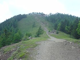
Top of Mount KumotoriElevation 2,017 m (6,617 ft) Location Boundary of Tokyo, Saitama, and Yamanashi Prefectures, Honshū, Japan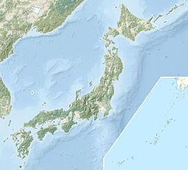
 Mount Kumotori
Range Okutama Mountains, Okuchichibu Mountains Coordinates 35°51′19″N 138°56′37″E / 35.85528°N 138.94361°ECoordinates: 35°51′19″N 138°56′37″E / 35.85528°N 138.94361°E Climbing Easiest route Hiking Mount Kumotori (雲取山 Kumotoriyama) stands at the boundary of Tokyo, Saitama, and Yamanashi Prefectures on the island of Honshū, Japan. With an elevation of 2,017 metres (6,617 ft), its summit is the highest point in Tokyo. It separates the Okutama Mountains and the Okuchichibu Mountains. While it marks the end of the Ishione (石尾根) mountain ridge that begins near the JR Okutama Station, the highest mountain ridge in Tokyo, its remote location amongst a group of mountains from both mountain ranges makes access difficult.
Kumotori-san features an "emergency" hut sometimes used by hikers as overnight shelter. Hikers not used to the altitude (if coming from Tokyo) may prefer overnighting at a lower elevation. The top of Kumotori-san, in good weather, offers a splendid view of Fuji-san.
The prominence of the mountain in the region resulted in its summit being established as a fixed first-class triangulation point. As the triangulation point was established in December 1882, this was also one of the earliest ones established in Japan.
Kumotori is one of the 100 Famous Mountains of Japan.
See also
- Okutama
- Okuchichibu Mountains
- List of the 100 famous mountains in Japan
External links
- Topographic map (in Japanese)
Categories:- Mountains of Saitama Prefecture
- Mountains of Tokyo
- Mountains of Yamanashi Prefecture
- Western Tokyo
- Saitama geography stubs
- Tokyo geography stubs
- Yamanashi geography stubs


Wikimedia Foundation. 2010.