Mount Ena

Mount Ena
Mount Ena
恵那山
Elevation 2,191 m (7,188 ft)
Location
Mount Ena is located in Japan
Mount Ena
Nakatsugawa, Gifu Prefecture
Achi, Nagano Prefecture
Japan Japan
Range Kiso Mountains
Coordinates 35°26′35″N 137°35′49″E / 35.44306°N 137.59694°E / 35.44306; 137.59694Coordinates: 35°26′35″N 137°35′49″E / 35.44306°N 137.59694°E / 35.44306; 137.59694

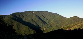
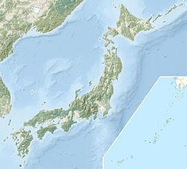
Mount Ena (恵那山 Ena-san?) is a mountain located on the border between Nakatsugawa, Gifu Prefecture, and Achi, Nagano Prefecture in the Chūbu region of Japan. It is 2,191 m (7,188 ft) tall.[1] It is considered part of the Kiso Mountains and is included on the list of "100 Famous Japanese Mountains."

Contents

Hiking routes

There are four hiking routes to the mountain's peak. They are the Kuroisawa Route (黒井沢ルート), the Misaka Pass Route (神坂峠ルート), the Hirogawara Route (広河原ルート) and the Maemiya Route (前宮ルート).

Scenery from top

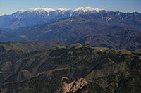
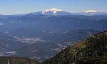
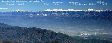
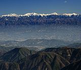
The Japanese Alps, Mount Ontake, Mount Haku and part of Mount Fuji can be seen from the surrounding of the top.

Mount Fujimidai from Mount Ena 2010-12-12.jpg
Mount Ontake and Mount Norikura from Mount Ena 2010-12-12.jpg
Central Alps Mount Ontake and Mount Norikura
Akaishi Mountains north from Mount Ena 2010-12-12.jpg
Akaishi Mountains2 from Mount Ena 2010-12-12.JPG
Southern Alps in northern part Southern Alps in southern part

See also

External links

References

  1. ^ Mount Ena Outdoor Information. (Japanese) Take-net. Retrieved June 27, 2008.


Wikimedia Foundation. 2010.

Игры ⚽ Поможем написать реферат

Look at other dictionaries:

  • Ena — or ENA may refer to:Organizations* École nationale d administration, a school where many of France s senior officials are instructed * Energy Networks Association, a trade association representing natural gas and electricity companies in the… …   Wikipedia

  • Ena (Berg) — Ena Höhe 2.189,8 m …   Deutsch Wikipedia

  • Mount Hotaka — 穂高岳 Mount Hotaka from Tokugō tōge Elevation …   Wikipedia

  • Mount Jōnen — 常念岳 Mount Jōnen , Mount Yokotooshi and Azusa River in spring from Azumi Basin …   Wikipedia

  • Mount Yakushi — 薬師岳 Mount Yakushi seen from Mount Suishō Elevation …   Wikipedia

  • Mount Aino — 間ノ岳 Mount Aino and Mountain Hut Kita seen from Mount Kita in summer …   Wikipedia

  • Mount-Kenya-Nationalpark — Mount Kenya Massiv Kontinent: Ost Afrika Typ: Hochgebirge/Vulkan Land: Zentral Kenia Nationalpark: Mount Kenya Nationalpark Länge / Breite: 90 km / 55 km Höchster Berg …   Deutsch Wikipedia

  • Mount Kenia — Mount Kenya Massiv Kontinent: Ost Afrika Typ: Hochgebirge/Vulkan Land: Zentral Kenia Nationalpark: Mount Kenya Nationalpark Länge / Breite: 90 km / 55 km Höchster Berg …   Deutsch Wikipedia

  • Mount Kenya — Massiv Kontinent: Ost Afrika Typ: Hochgebirge/Vulkan Land: Zentral Kenia Nationalpark: Mount Kenya Nationalpark Länge / Breite: 90 km / 55 km Höchster Berg …   Deutsch Wikipedia

  • Mount Kenya-Massiv — Kontinent: Ost Afrika Typ: Hochgebirge/Vulkan Land: Zentral Kenia Nationalpark: Mount Kenya Nationalpark Länge / Breite: 90 km / 55 km Höchster Berg …   Deutsch Wikipedia

Share the article and excerpts

Direct link
Do a right-click on the link above
and select “Copy Link”