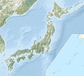
- Mount Ishizuchi
-
Mount Ishizuchi 石鎚山 
Elevation 1,982 m (6,503 ft) Prominence 1,982 m (6,503 ft) Listing Ultra Location On the border of Saijō and Kumakōgen, Ehime, Japan Range Shikoku Mountains Coordinates 33°46′00″N 133°6′00″E / 33.7666667°N 133.1°ECoordinates: 33°46′00″N 133°6′00″E / 33.7666667°N 133.1°E Geology Type Ruins of old volcano Mount Ishizuchi (石鎚山 Ishizuchi-san) is a 1,982 metres (6,503 ft) high mountain on the border of Saijō and Kumakōgen, in Ehime, Japan. This mountain is one of the 100 famous mountains in Japan. It is the tallest mountain in Western Japan.
Contents
Outline
Mount Ishizuchi is the highest mountain on the island of Shikoku and also the highest mountain west of Mount Haku on the border of Ishikawa and Gifu prefectures. It is known as 'the roof of Shikoku' and the sharp, rocky summit resembles a huge stone hammer (石鎚 ishizuchi).
Mount Ishizuchi is an important object of worship in this region and one of the major centers of Shugendō, a sect of mixture of Shintoism and Buddhism. On the top of the mountain there is a small shrine called the Ishizuchi Shrine. This mountain is also known as one of Seven Holy Mountains (七霊山 nana reizan). There are several sets of heavy chains (鎖 kusari) leading up to the summit and this is the route many pilgrims opt to take, the longest set being 68m.
The climbing season opens every year on July 1, women being forbidden from climbing the mountain on this day.[1] Between mid-October and mid-November, people come from far and wide to view the autumn colours.
The area around Mount Ishizuchi is a major part of Ishizuchi Quasi-National Park.
Access
- Sanchōjōju Station of Ishizuchi Ropeway
- Ishizuchi Tsuchigoya Bus Stop of Iyotetsu Bus
Footnotes
References
- the Geographical Survey Institute in Japan
- Ishizuchi Quasi-National Park
- ‘Yama to Shinko: Ishizuchisan’
Categories:- Visitor attractions in Ehime Prefecture
- Mountains of Ehime Prefecture
Wikimedia Foundation. 2010.


