- Mount Aino
-
Mount Aino 間ノ岳 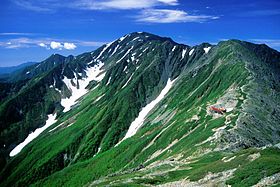
Mount Aino and Mountain Hut Kita
seen from Mount Kita in summerElevation 3,189.13 m (10,463 ft) [1] Listing 100 Famous Japanese Mountains Translation middle mountain (Japanese) Pronunciation Japanese: [ainodake] Location Location Chūbu region, Honshū, Japan Range Akaishi Mountains Coordinates 35°38′46″N 138°13′42″E / 35.64611°N 138.22833°E[2] Topo map Geographical Survey Institute, 25000:1 間ノ岳, 50000:1 大河原 Climbing Easiest route Hike 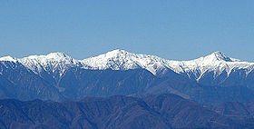 Shiranesanzan (from left to right: Mount Nōtori, Mount Aino, Mount Kita), view from Mount Kenashi in Shizuoka Prefecture (November 2006)
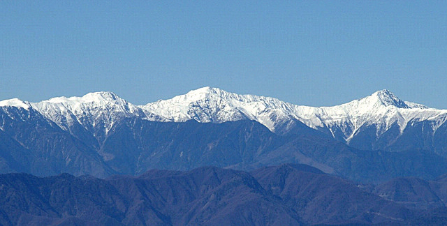
Mount Aino (間ノ岳 Aino-dake), or Ainodake, is one of the 100 Famous Japanese Mountains. At 3,189 m (10,463 ft),[3] its peak lies in the Akaishi Mountains (referred to as the Southern Alps) of Japan on the border of Aoi-ku, Shizuoka, Shizuoka Prefecture, and Minami-Alps, Yamanashi Prefecture. It is the fourth tallest peak in Japan and the second highest in the Akaishi Mountains.[3]
Contents
Location
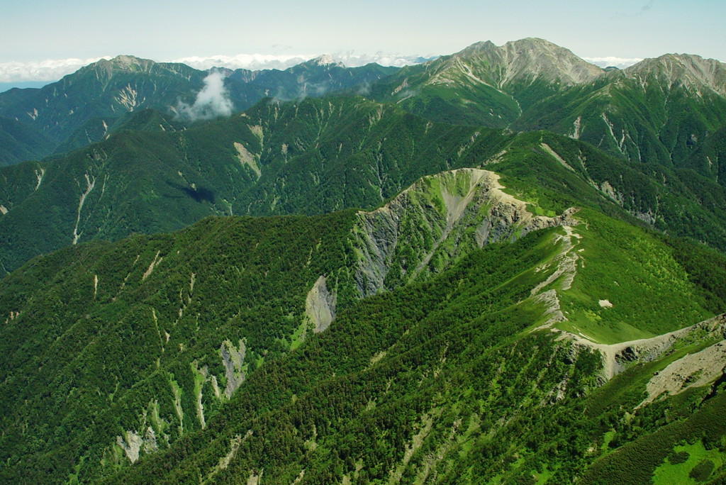
Within the Akaishi Mountains, Mount Aino is situated roughly 3 km (2 mi) south of Mount Kita, the ranges' tallest peak. Together with Mount Nōtori (農鳥岳 Nōtori-dake) to the south the three mountains may be referred to as Shiranesanzan (白峰三山 Shiranesanzan).
East of the summit lies the cirque Hosozawa Kar (細沢カール hosozawa-karu).
Geography
Mount Aino, like most of the Shiranesanzan, abounds with alpine plants. The neighborhood of the summit is dominated by rocks where few plants can survive. It is conceivable that landslides around the summit have led to the growth of linear hollows. Taking into account such landslides, Mount Aino might have been dozens of metres higher in the past compared to its present altitude. It may have been Japan's tallest mountain during the Last Glacial Maximum. At that time, Mount Fuji had not reached its present height, and the second and third mountains (Mount Kita and Mount Hotaka) are presently only 4 and 1 metre taller, respectively.
Even though Mount Aino does not reach the height of Mount Kita, in its shape and dimension, it bears equally great mass.
Mountain trails
Mount Aino lies on the traversal route between Mount Kita and Mount Nōtori. On the summit a trail forks towards Mount Mibu (三峰岳 Mibu-dake) in the west, where it connects to the Senshio Ridge (仙塩尾根 senshio-one) traversal route.
The nearest alpine hut is Nōtori hut (農鳥小屋 nōtori-koya), which lies on a saddle to the south below Mount Nishinōtori (西農鳥岳 Nishinōtori-dake). Another Kitadake mountain cottage (北岳山荘 kitadakesansou) is situated to the north on a saddle between Mount Aino and Mount Kita.
Gallery
-

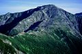
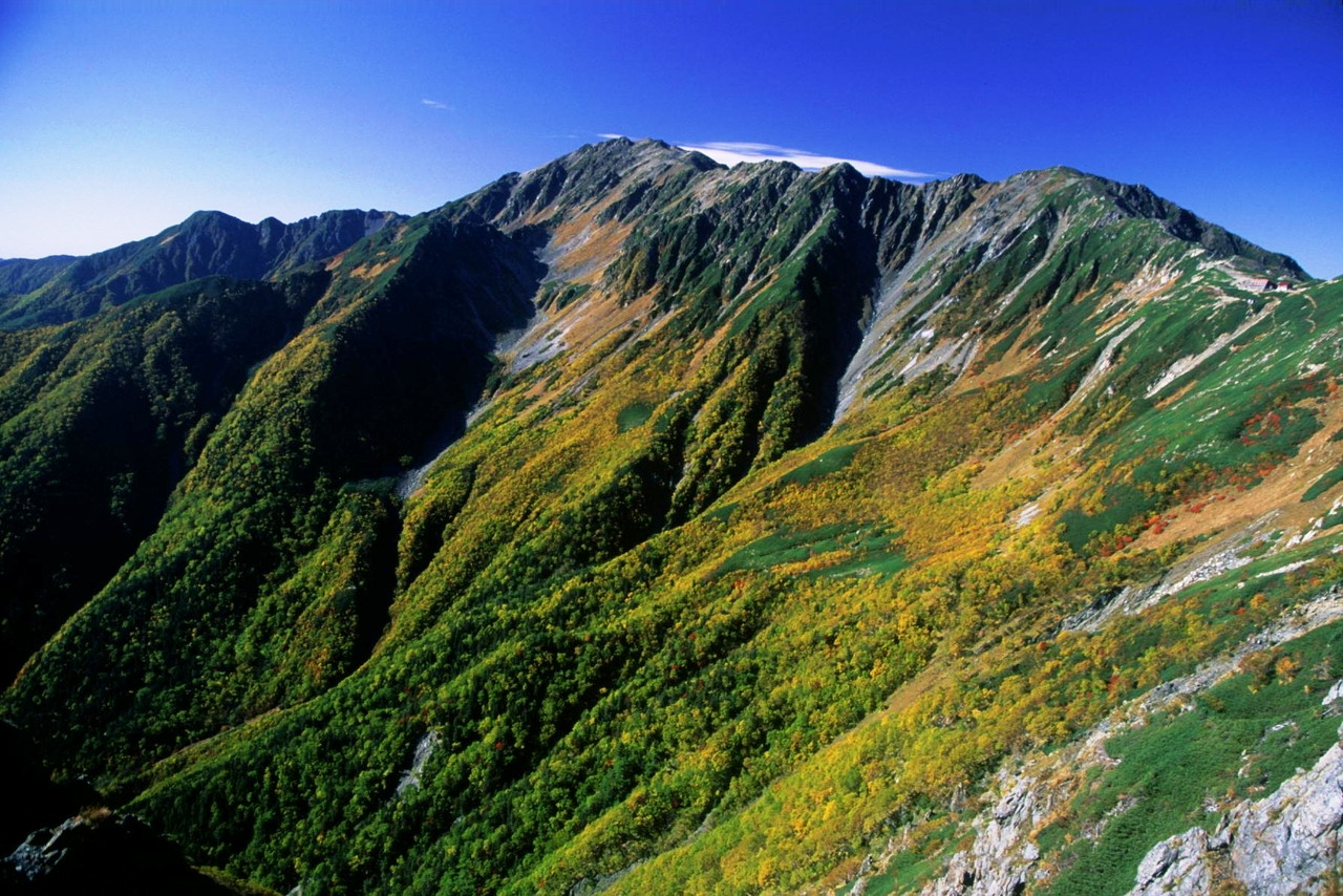
Mount Aino in autumn
from Mount Kita -
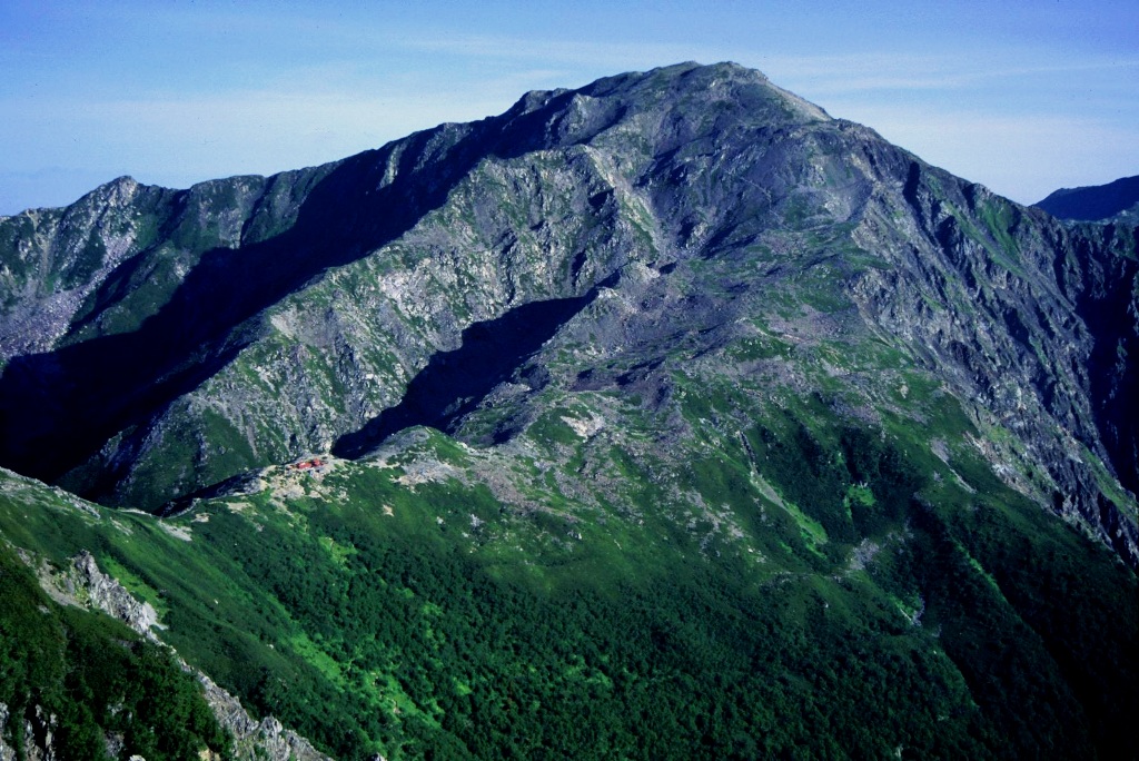
Mount Aino
from Mount NishiNōtori -
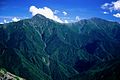
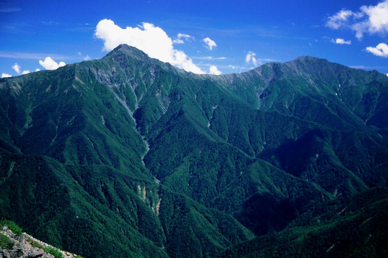
Mount Kita and Mount Aino
from Mount Senjō
References
- ^ "Information inspection service of the Triangulation station". Geospatial Information Authority of Japan,(間ノ岳-甲府). http://sokuservice1.gsi.go.jp/datums/. Retrieved December 17, 2010.
- ^ "Mountains altitude list in Japan(Yamanashi prefecture)". Geospatial Information Authority of Japan. http://www.gsi.go.jp/KOKUJYOHO/MOUNTAIN/mountain.html. Retrieved December 17, 2010.
- ^ a b Mount Aino. (Japanese) Minami Alps Net. Accessed July 1, 2008.
See also
- List of mountains in Japan
- 100 Famous Japanese Mountains
- Three-thousanders (in Japan)
- Akaishi Mountains
- Minami Alps National Park
External links
- Topographic map (1:25,000)
Independent peak Hida Mountains (Northern Alps) Mt. Okuhotaka - Mt. Yari - Mt. Karasawa - Mt. Kitahotaka - Mt. Ōbami - Mt. Maehotaka - Mt. Naka - Mt. Minami - Mt. Norikura - Mt. TateAkaishi Mountains (Southern Alps) Mt. Kita - Mt. Aino - Mt. Warusawa - Mt. Akaishi - Mt. Arakawa - Mt. NishiNōtori - Mt. Shiomi - Mt. Senjō - Mt. Hijiri100 Famous Japanese Mountains - List of mountains in Japan Categories:- Mountains of Shizuoka Prefecture
- Mountains of Yamanashi Prefecture
- Visitor attractions in Shizuoka Prefecture
- Visitor attractions in Yamanashi Prefecture
-

Wikimedia Foundation. 2010.