- Mount Azumaya
-
Mount Azumaya 四阿山 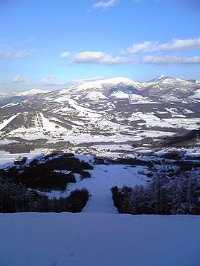
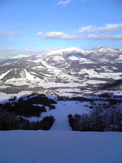
Mount Azumaya (right), Mount Neko (left) beyond SugadairaElevation 2,354 m (7,723 ft) Listing 100 Famous Japanese Mountains Translation arbour mountain (Japanese) Pronunciation [adzumajasaɴ] Location Kantō region, Honshū, Japan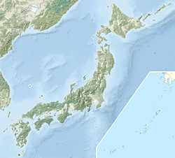
 Mount Azumaya
Coordinates 36°32′30″N 138°24′47″E / 36.54167°N 138.41306°ECoordinates: 36°32′30″N 138°24′47″E / 36.54167°N 138.41306°E Geology Type Stratovolcano Climbing Easiest route Hike Mount Azumaya (四阿山 azumayasan) is one of the 100 Famous Japanese Mountains. The 2,354 m (7,723 ft) high peak lies, on the border of Nagano Prefecture and Gunma Prefecture. There exist alternative spellings of the mountain's name, like: 吾妻山 and 吾嬬山 which is read as "Agatsumayama" (Mount Agatsuma). In the village Tsumagoi, the mountain is spelled 吾妻山.
The mountain should not be confused with Mount Azumaya (四阿屋山 azumayasan) of which there are two, one in Nagano Prefecture and the other in Saitama Prefecture. Though the reading is the same, the name written in Kanji differs from the mountain in this article.
Contents
Outline
Mount Azumaya was formed between 900,000 and 300,000 years ago by andesite lava flowing out of a Stratovolcano. An eruption 340,000 years ago formed a caldera of circa 3 kilometers in diameter. Through erosion the mountain has arrived at its present form with several peaks. Azumaya Volcano (四阿火山 azumaya kazan) is the general term for the following peaks lying roughly on a circle: Mount Neko (根子岳 nekodake), Mount Azumaya, Mount Urakura (浦倉山 urakurayama), Mount Kimyō (奇妙山 kimyōsan).
The famous Sugadaira Kōgen ski area is found on the mountains's southwest (Nagano-) side. Also on the Gunma-side there exists a ski area. In addition, north of the mountain lies Yonakodaibakufu (米子大瀑布) which is one of the 100 Selected Japanese Waterfalls.
Main ascent routes
The mountain is well connected with several hiking trails:
- Sugadaibokujō (菅平牧場) - Mount Neko (根子岳 nekodake) - Mount Azumaya
- Azumaya Kōgen (四阿高原) - Mount Azumaya
- Torii Ridge (鳥居峠 toriitōge) - Mount Azumaya
- Palcall Tsumagoi (パルコール嬬恋) - Mount Azumaya
- The gondola (Gondola Palcabin (ゴンドラパルキャビン)) from Palcall Tsumagoi is also operating during the summer season and can be used to climb the mountain
Mountain in the vicinity
- Mount Neko (根子岳 nekodake) (2,207m)
External links
- Mount Azumaya at the National Institute of Advanced Industrial Science and Technology, Geological Survey of Japan
- Topographic map (1:25,000)
- Nagano's 100 best highlights (長野の大地みどころ100選)
Categories:- Volcanoes of Honshū
- Mountains of Nagano Prefecture
- Mountains of Gunma Prefecture

Wikimedia Foundation. 2010.