- Tsumagoi, Gunma
Japanese city
Name = Tsumagoi
JapaneseName = 嬬恋村
Prefecture =Gunma Prefecture
Region = Kantō
Area_km2 = 337.51
Population = 10,743
PopDate =September 1 ,2007
Density_km2 = 31.18
Coords = coord|36|31|N|138|32|E|region:JP_type:city
Postal code =
Area code =
Mayor =
Tree = Betula platyphylla
Flower =Gentian
Bird =Seema
Symbol
CityHallPostalCode = 377-1692
CityHallAddress = Tsumagoi-mura, 110 Ōaza Ōmae
CityHallPhone = 0279-96-0511
CityHallLink = [http://www.vill.tsumagoi.gunma.jp/ Tsumagoi Village]
City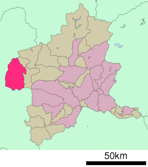
Elevation =nihongo|Tsumagoi|嬬恋村|Tsumagoi-mura is a village located in Agatsuma District, Gunma,
Japan .As of
September 1 ,2007 , the village has an estimatedpopulation of 10,743 and a density of 31.19 persons per km². The total area is 337.51 km².Geography
The village is situated on the northwestern corner of
Gunma prefecture , touchingNagano prefecture to the north, south, and west. Because of its elevated location and the ash deposits ofMount Asama , Tsumagoi is fit and well known for growingcabbages . It has a cool climate, with an average yearly temperature of 8℃. [ [http://www.vill.tsumagoi.gunma.jp/syoukai/enkaku-tisei.htm 沿革 ] ] citebook|page=57|title=考える社会科地図 Kangaeru Shakaika Chizu|year=2005|publisher=四谷大塚出版 Yotsuya-Ōtsuka Shuppan]*
Mountains :Mount Asama , Mount Motoshirane, Mount Kusatsushirane, Mount Azumaya
*Rivers : Azuma River
*Lakes : Lake Baragi, Lake Tashirourrounding municipalities
*
Gunma Prefecture
** Kusatsu
** Naganohara
*Nagano Prefecture
** Karuizawa
** Komoro
** Takayama
** Suzaka
** Ueda
** Tōmi
** MiyotaTransportation
There are two train stations on the Agatsuma Line in Tsumagoi:Manza-Kazawaguchi and Ōmae.
Education
* High Schools
** Tsumagoi High School
*Junior High Schools
** Nishi Junior High School
** Higashi Junior High School
*Primary Schools
** Higashi Elementary School
** Tashiro Elementary School
** Nishi Elementary School
** Hoshimata Elementary School
** Kanbara Elementary SchoolReferences
External links
*ja icon [http://www.vill.tsumagoi.gunma.jp/ Tsumagoi official website]

Wikimedia Foundation. 2010.