- Mount Nantai
-
Mount Nantai 男体山 
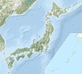
Mount Nantai and Lake ChūzenjiElevation 2,486 m (8,156 ft) Listing List of volcanoes in Japan Location Honshū, Japan Coordinates 36°45′43″N 139°29′38″E / 36.76194°N 139.49389°ECoordinates: 36°45′43″N 139°29′38″E / 36.76194°N 139.49389°E Geology Type Stratovolcano Last eruption Approximately 7000 years ago Mount Nantai (男体山 Nantai-san) (also called Futarasan (二荒山))[1] is a stratovolcano in the Nikkō National Park in central Honshū, the main island of Japan. It stands at 2,486 m high. A prominent landmark, it can be seen on clear days from as far as the Pacific coast, 100 km away.
The mountain is popular with hikers, and the trail to the summit starts through a gate at Futarasan Shrine's Chūgushi (中宮祠 middle shrine). The gate is open between 5 May and 25 October.
Mount Nantai is one of the 100 famous mountains in Japan.
In September 2008, the Japan Meteorological Agency was asked to reclassify Mount Nantai as "active" based upon work by Yasuo Ishizaki and colleagues of Toyama University showing evidence of an eruption approximately 7000 years ago.[2]
Contents
Mount Nantai as a sacred mountain
Archeologists affirm that during the Yayoi period the most common go-shintai (御神体) (a yorishiro housing a kami) in the earliest Shinto shrines was a nearby mountain peak supplying with its streams water, and therefore life, to the plains below where people lived.[3]
Mount Nantai constitutes Futarasan Shrine's go-shintai, and the shrine is an important example of this ancient type of mountain cult.[3] Significantly, the name Nantai (男体) itself means "man's body".[3] The mountain not only provides water to the rice paddies below, but has the shape of the phallic stone rods found in pre-agricultural Jōmon sites.[3]
Notes
- ^ * Iwanami Kōjien Japanese
- ^ "Mount Nantai in Nikko may still be active volcano, say researchers". Mainichi Daily News. 13 September 2008. Archived from the original on 2008-09-18. http://web.archive.org/web/20080918200225/http://mdn.mainichi.jp/mdnnews/national/archive/news/2008/09/13/20080913p2a00m0na014000c.html.
- ^ a b c d Cambridge History of Japan (1993:524)
References
- Iwanami Kōjien (広辞苑) Japanese dictionary, 6th Edition (2008), DVD version
- Brown, Delmer M. (1993). The Early Evolution of Historical Consciousness in "Cambridge History of Japan", Vol. 1. Cambridge, New York & Victoria: Cambridge University Press. ISBN 978-0521223522.
External links
Categories:- Mountains of Tochigi Prefecture
- Volcanoes of Honshū
- Stratovolcanoes
- Visitor attractions in Tochigi Prefecture
- Sacred mountains
- Tochigi geography stubs
Wikimedia Foundation. 2010.

