- Mount Tekari
-
Mount Tekari 光岳 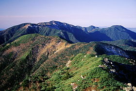
Mount Tekari from Mount ChausuElevation 2,591 m (8,501 ft) Listing List of mountains and hills of Japan by height
100 Famous Japanese MountainsLocation Location in Japan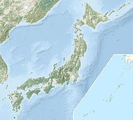
 Mount Tekari
Location Shizuoka Prefecture
Nagano Prefecture
Japan
Range Akaishi Mountains Coordinates 35°20′17″N 138°05′02″E / 35.33806°N 138.08389°ECoordinates: 35°20′17″N 138°05′02″E / 35.33806°N 138.08389°E Mount Tekari (光岳 Tekari-dake) is part of the Akaishi Mountains on the border of Shizuoka and Nagano prefectures in Japan. It is the southernmost mountain in the Akaishi Mountains and the southernmost mountain over 2,500 metres (8,202 ft) in Japan.
Outline
The mountain's peak just exceeds the tree line, and Siberian Dwarf Pines and other alpine plants can be found on its southern face. This mountain is the southernmost point at which Siberian Dwarf Pines can be found throughout the world.
References
Categories:- Mountains of Nagano Prefecture
- Mountains of Shizuoka Prefecture
- Nagano geography stubs
- Shizuoka geography stubs


Wikimedia Foundation. 2010.