- Gifu Prefecture
Infobox Prefecture Japan
Name = Gifu
JapaneseName = 岐阜県
Rōmaji = Gifu-ken
Symbol = PrefSymbol-Gifu.png
Region = Chūbu
Island =Honshū
TotalArea = 10,621.17
AreaRank = 7th
PCWater = 0.2
PopDate =February 1 ,2008
Population = 2,101,683
PopRank = 18th
Density = 198
Districts = 9
Municipalities = 42
ISOCode = JP-21
Flower = Chinese milk vetch ("Astragalus sinicus")
Tree =Japanese yew ("Taxus cuspidata")
Bird = Rockptarmigan ("Lagopus muta")
Website = [http://www.pref.gifu.lg.jp/pref/index_e.htm Gifu Prefectural Website]
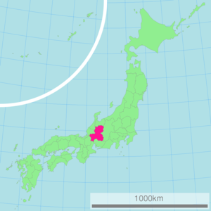
Governor =Hajime Furuta nihongo|Gifu Prefecture|岐阜県|Gifu-ken is a prefecture located in the Chūbu region of centralJapan . Its capital is the city of Gifu. Located in the center of Japan, it has long played an important part as the crossroads of Japan, connecting the east to the west through such routes as theNakasendō . During theSengoku period , many people referred to Gifu by saying, "control Gifu and you control Japan.""Instant Gifu". Gifu International Center, 1995.]History
The land area that makes up modern-day Gifu became part of the Yamato Court around the middle of the fourth century. Because it is in the middle of the island of
Honshū , it has been the site of many decisive battles throughout Japan's history, the oldest major one being theJinshin War in 672, which led to the establishment ofEmperor Temmu as the 40th emperor of Japan.The land area of Gifu Prefecture consists of the old provinces of Hida and Mino, as well as smaller parts of Echizen and Shinano. The name of the prefecture derives from its capital city, Gifu, which was named by
Oda Nobunaga during his campaign to unify all of Japan in 1567.Stone ledger in front ofKashimori Shrine . Erected by Kashimori Shrine.] The first character used comes from Qishan (岐山), a legendary mountain from which most of China was unified, whereas the second character comes fromQufu (曲阜), the birthplace ofConfucius . [http://www.kankou-gifu.jp/en/outline/index.html Gifu tour guide - Outline of Gifu Prefecture] . Gifu Prefecture Tourist Federation. AccessedSeptember 9 ,2007 .] Nobunaga chose those characters because he wanted to unify all of Japan and he wanted to be viewed as a great mind.Historically, the prefecture served as the center of swordmaking in all of Japan, with Seki being known for making the best swords in Japan. More recently, its strengths have been in fashion (primarily in the city of Gifu) and aerospace engineering (Kakamigahara).
On
October 28 ,1891 , the present-day city of Motosu was theepicenter for the Mino-Owari Earthquake, the largest earthquake to ever hit Japan. [http://research.kahaku.go.jp/rikou/namazu/04nobi/noubi.html Mino Earthquake] . ja icon Tokyo Science Museum. AccessedJuly 5 ,2007 .] The earthquake, estimated at 8.0 earthquake, left a huge cleft in the ground that can still be seen today.Geography
One of the few landlocked prefectures in Japan, Gifu Prefecture shares borders with seven other prefectures: Aichi, Fukui, Ishikawa, Mie, Nagano, Shiga and Toyama Prefectures. Japan's postal codes all start with a three-digit number, ranging from 001 to 999. Part of Gifu has the 500 prefix, giving further proof of its location in the center of Japan.
Regions
Gifu Prefecture has five unofficial regions, which allows local municipalities to work together to promote the surrounding area. The five regions are
Seinō , [http://www.ginet.or.jp/nisimino/index.shtml Nishi Mino Portal Site] . ja icon Ginet. AccessedJune 24 ,2008 .] Gifu, [http://www.pref.gifu.lg.jp/pref/s20501/index.htm Gifu Regional Promotion Office] . ja icon Gifu Prefecture. AccessedJune 24 ,2008 .]Chūnō , [http://www.pref.gifu.lg.jp/pref/s20504/ Chūnō Promotion Office] . ja icon Gifu Prefecture. AccessedJune 24 ,2008 .]Tōnō [http://www.pref.gifu.lg.jp/pref/s20507/ Tōnō Promotional Office] . ja icon Gifu Prefecture. AccessedJune 24 ,2008 .] and Hida. [http://www.pref.gifu.lg.jp/pref/s20509/ Hida Promotional Office] . ja icon Gifu Prefecture. AccessedJune 24 ,2008 .] The borders of the regions are loosely defined, but they are usually delineated among major cities.Topography
The northern Hida region is dominated by tall mountains, including parts of the
Japanese Alps . The southern Mino region is mostly made up of parts of the fertileNōbi Plain , a vast plains area with arable soil. Most of the prefecture's population resides in the southern part of the prefecture, near the designated city of Nagoya.The mountainous Hida region contains both the
Hida Mountains ,which are referred to as the "Northern Alps," and theKiso Mountains , which are known as the "Central Alps" in Japan. TheRyōhaku Mountains are also located in the Hida region. Other major ranges include theIbuki Mountains and theYōrō Mountains .Much of the Mino region is made up of the
alluvial plain of theKiso Three Rivers , which are theIbi River ,Kiso River andNagara River . The source for all three rivers is located in Nagano Prefecture and they eventually run through Aichi and Mie prefectures before emptying intoIse Bay . Other major rivers in the prefecture include the Jinzū, Takahara, Shō, Shōnai, Yahagi and Itoshiro rivers.Weather
Because the Mino region is surrounded by low mountains, the temperature fluctuates through the year, from hot summers to cold winters. The eastern city of Tajimi, for example, generally records the hottest temperature throughout all of Japan each year and, on
August 16 ,2007 , it set the record for hottest recorded day in Japan's history—40.9 degrees Celsius. [ [http://www.japannewsreview.com/society/national/20070816page_id=1553 Gifu Prefecture sees highest temperature ever recorded in Japan - 40.9] - [http://www.japannewsreview.com Japan News Review] ] The summers are made hotter because the landlocked area becomes a heat island, which is further worsened when hot, dryfoehn winds blow over the Ibuki Mountains out of theKansai region . The Hida region, with its higher elevation, is generally cooler than the Mino region, though there are sometimes extremely hot days there, as well. Shōkawa-chō, part of the city of Takayama, is located up in the mountains and its location has led it to be called the coldest inhabitted place on Honshū.Economy
Gifu's economy includes many traditional industries such as paper-making and agriculture, but it is dominated by manufacturing industries extending from the Nagoya area, such as aerospace and automotive industry. A major characteristic of Gifu's industry is a wealth of small component manufacturers, such as precision machining, die and mold making, and plastic forming.
Traditional industries
The Mino region has long been known for its high-quality paper called "
Mino washi ", which is stronger and thinner than most other papers in Japan and was used by the Japanese military duringWorld War II . [http://www.faqs.org/docs/air/avfusen.html The Fire Balloons] . Greg Goebel. AccessedNovember 23 ,2007 .] Other paper-based industries includeGifu Lanterns andGifu Umbrellas , which are made in the capital city. Other traditional goods include "Mino-yaki" pottery (in Tajimi, Toki and Mizunami),cutlery (in Seki) andlacquerware (in Takayama).Because Gifu has vast, arable plains, agriculture is also a large industry. The forests to the north also provide plenty of source material for wood-working (which includes the viewing boats used in cormorant fishing). The clear-flowing rivers are also often used to brew
sake .Modern industries
Kakamigahara has a large role in the prefecture's modern industries. It boasts large aerospace facilities of both
Kawasaki Heavy Industries andMitsubishi Heavy Industries , as well as manymetalworking andmanufacturing companies.Information technology (IT) is gaining a foothold in the prefecture with bothSoftopia Japan in Ōgaki and VR Techno Japan (part of Techno Plaza) in Kakamigahara. The capital city of Gifu, located between Ōgaki and Kakamigahara, is also working to strengthen its IT fields, too.Tourism
".
In addition to international tourists, Gifu also plays host to many international events. The
World Event and Convention Complex Gifu is available for many types of events. Other areas of Gifu, too, bring international events, such as in 2005 when theWorld Rowing Championships were held in the city of Kaizu.cience
The Kamioka area of the city of Hida is home to the
Super-Kamiokande andKamLAND experiments, neutrino and antineutrino observatories, respectively. Located Convert|1000|m|ft|0|abbr=on underground in Kamioka Mining and Smelting Co.'s Mozumi Mine, the detector searches for neutrinos (and antineutrinos) from the high atmosphere, the sun and supernovae, and for KamLAND, from regional nuclear reactors. The Super-Kamiokande consists of a cylindrical stainless steel tank that is Convert|41.4|m|ft|1|abbr=on tall and Convert|39.3|m|ft|1|abbr=on in diameter holding 50,000 tons of ultra-pure water. Some of the 11,146 photomultiplier tubes are on display at the [http://www.miraikan.jst.go.jp/index_e.html Miraikan] in Tokyo.Demographics
As of
September 1 ,2007 , the prefecture's population is 2,101,969, with approximately 1.8 million people living in the cities and the rest living in towns and villages. [http://www.pref.gifu.lg.jp/pref/s11111/data/data.htm Statistics Division of Gifu Prefecture] . ja icon Gifu Prefecture. AccessedNovember 2 ,2007 .] The percentage of male and female residents is 48.4% and 51.6%, respectively. 14.4% of the population is no more than 14 years old, with 22.1% of the population being at least 65 years old.According to Japan's census, the country's
center of population is located in Gifu Prefecture. In 2000, it was located in the former town of Mugi, which has since merged with Seki. In the most reason census in 2005, the center of population has moved slightly more to the east, but is still located within Gifu.Education
*
Asahi University
*Chubu Gakuin University
*Chukyo Gakuin University
*Gifu City Women's College
*Gifu College of Nursing
*Gifu Keizai University
*Gifu Pharmaceutical University
*Gifu Shotoku Gakuen University
*Gifu University
*Gifu University of Medical Science
*Gifu Women's University
*Institute of Advanced Media Arts and Sciences
*Tokai Gakuin University Prefectural symbols
.]
The prefectural logo ("see right") expands from the red dot into the center to the outer two lines and, finally, the yellow plain. This symbol was chosen in 1991 for the development and expansion of the prefecture.
The prefecture also has two plants (the milk vetch and the Japanese yew) and two animals (the snow grouse and the
ayu ) as symbols. The milk vetch was chosen in 1954, because the prefecture is well known for its abundance of blooming milk vetch each spring. The yew was chosen in 1966, because it is the tree used to make ornamental sceptors for the emperor, many of which came from the Hida district. The snow grouse was chosen in 1961, as the birds live up in the Japanese alps and is a nationally-protected species. Ayu were chosen in 1989, because the fish is found in many prefectural rivers and is prized for its sweet taste.Municipalities
All of the cities, towns, villages and districts of Gifu Prefecture are listed below
Cities
Twenty-one cities are located in Gifu Prefecture:
Towns and villages
Towns and villages in each district:
*Anpachi District:Anpachi:Gōdo:Wanouchi
*Fuwa District:Sekigahara:Tarui
*Hashima District:Ginan:Kasamatsu
*Ibi District:Ibigawa:Ikeda:Ōno
*Kamo District:Hichisō:Higashishirakawa:Kawabe:Sakahogi:Shirakawa:Tomika:Yaotsu
*Kani District:Mitake
*Motosu District:Kitagata
*Ōno District:Shirakawa
*Yōrō District:YōrōMergers
References
External links
*Wikitravel|Gifu (prefecture)
* [http://www.pref.gifu.lg.jp/pref/index_e.htm Official Gifu Prefecture homepage]
* [http://jpimg.digital.archives.go.jp/jpg_prg/jgmWeb?%TmpFileDisp%env=jpeg2k_images/ezu/fukenchizu/017_gifu_e.env Map of Gifu Prefecture in 1891] . National Archives of Japan.

Wikimedia Foundation. 2010.