- Mexico–United States border
-
 The border between the United States and Mexico spans four U.S. states, six Mexican states, and has over twenty commercial railroad crossings.
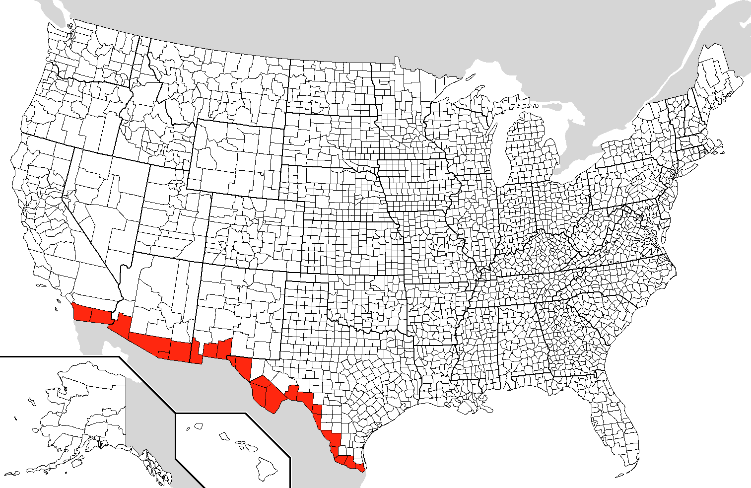
 Border counties in the United States along the Mexican border
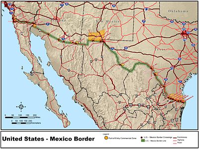
The United States–Mexico border is the international border between the United States and Mexico. It runs from Imperial Beach, California, and Tijuana, Baja California, in the west to Matamoros, Tamaulipas, and Brownsville, Texas, in the east, and traverses a variety of terrains, ranging from major urban areas to inhospitable deserts. From the Gulf of Mexico it follows the course of the Rio Grande (Río Bravo del Norte) to the border crossing at El Paso, Texas, and Ciudad Juárez, Chihuahua; westward from that binational conurbation it crosses vast tracts of the Sonoran and Chihuahuan Desert, the Colorado River Delta, westward to the binational conurbation of San Diego and Tijuana before reaching the Pacific Ocean. The US-Mexican border is considered an open border.[1]
The border's total length is 3,169 km (1,969 mi), according to figures given by the International Boundary and Water Commission.[2] It is the most frequently crossed international border in the world,[3][4][5] with approximately three hundred fifty million (350,000,000) crossings per year.[6][4]
Contents
Geography
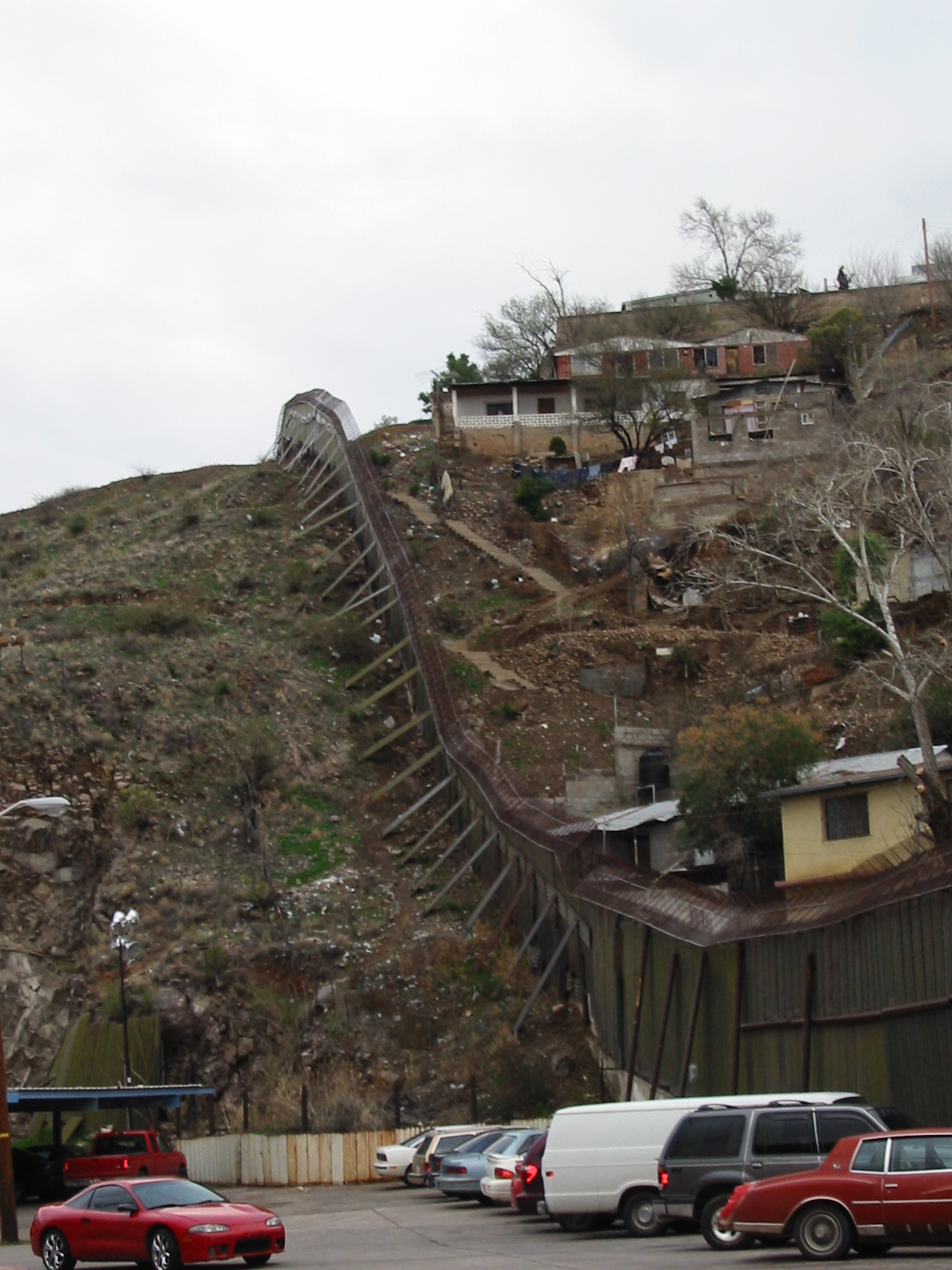
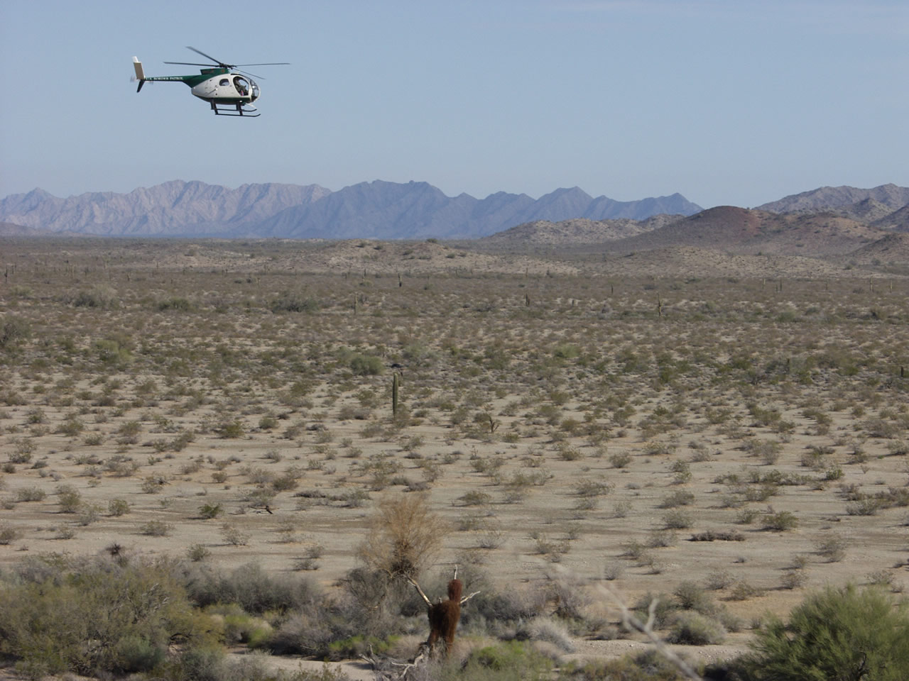
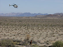 U.S. Border Patrol helicopter along El Camino del Diablo, Arizona-Sonora border, 2004
The nearly 2,000-mile (3,138 km or 1,969 miles) international border follows the middle of the Rio Grande—according to the 1848 Treaty of Guadalupe Hidalgo between the two nations, "along the deepest channel" (also known as the thalweg)—from its mouth on the Gulf of Mexico a distance of 2,019 km (1,255 mi) to a point just upstream of El Paso and Ciudad Juárez. It then follows an alignment westward overland and marked by monuments a distance of 858 km (533 mi) to the Colorado River, during which it reaches its highest elevation at the intersection with the Continental Divide. Thence it follows the middle of that river northward a distance of 38 km (24 mi), and then it again follows an alignment westward overland and marked by monuments a distance of 226 km (140 mi) to the Pacific Ocean.
The region along the boundary is characterized by deserts, rugged hills, abundant sunshine, and two major rivers—the Colorado and the Rio Grande (Río Bravo del Norte)—which provide life-giving waters to the largely arid but fertile lands along the rivers in both countries.
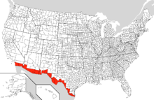
The U.S. states along the border, from west to east, are:
- California, Arizona, New Mexico, and Texas.
The Mexican states are:
- Baja California, Sonora, Chihuahua, Coahuila, Nuevo León, and Tamaulipas.
In the United States, Texas has the longest stretch of the border of any State, while California has the shortest. In Mexico, Chihuahua has the longest border, while Nuevo León has the shortest.
Texas borders four Mexican states—Tamaulipas, Nuevo León, Coahuila, and Chihuahua—the most of any U.S. state. New Mexico and Arizona each border two Mexican states (Chihuahua and Sonora; Sonora and Baja California, respectively). California borders only Baja California.
Three Mexican states border two U.S. states each: Baja California borders California and Arizona; Sonora, borders Arizona and New Mexico; and Chihuahua borders New Mexico and Texas. Tamaulipas, Nuevo León, and Coahuila each border only one U.S. state: Texas.
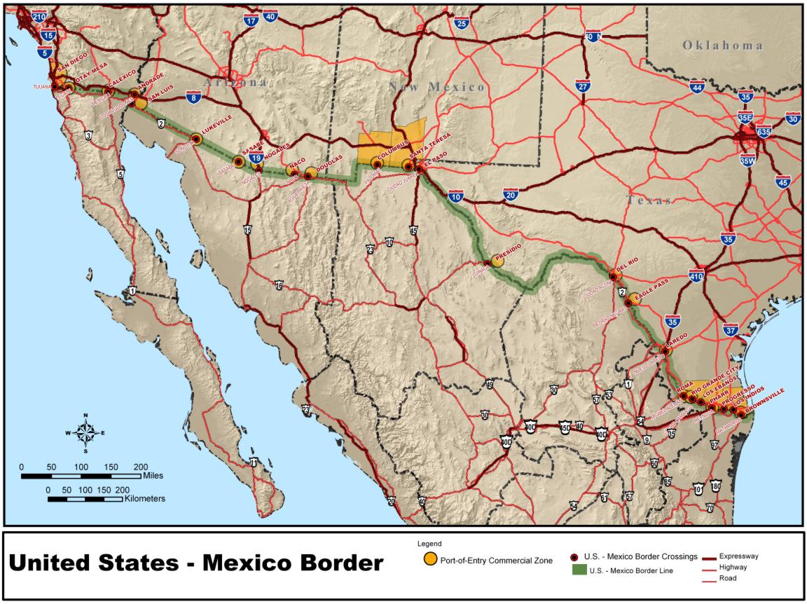
There are currently 42 U.S.–Mexico border crossings. From west to east, below is a list of the border city twinnings.
- San Diego, California (San Ysidro) – Tijuana, Baja California (San Diego–Tijuana Metro.)
- Otay Mesa, California – Tijuana, Baja California
- Tecate, California – Tecate, Baja California
- Calexico, California – Mexicali, Baja California
- Andrade, California – Los Algodones, Baja California
- San Luis, Arizona – San Luis Río Colorado, Sonora
- Lukeville, Arizona – Sonoita, Sonora
- Sasabe, Arizona – Altar, Sonora
- Nogales, Arizona – Nogales, Sonora
- Naco, Arizona – Naco, Sonora
- Douglas, Arizona – Agua Prieta, Sonora
- Antelope Wells, New Mexico – El Berrendo, Chihuahua
- Columbus, New Mexico – Palomas, Chihuahua
- Santa Teresa, New Mexico – San Jerónimo, Chihuahua
- El Paso, Texas – Ciudad Juárez, Chihuahua
- Fabens, Texas – Práxedis G. Guerrero, Chihuahua municipality
- Presidio, Texas – Ojinaga, Chihuahua
- Heath Canyon, Texas – La Linda, Coahuila (closed)
- Del Rio, Texas – Ciudad Acuña, Coahuila
- Eagle Pass, Texas – Piedras Negras, Coahuila
- Laredo, Texas – Nuevo Laredo, Tamaulipas
- Laredo, Texas – Colombia, Nuevo León
- Falcon Heights, Texas – Presa Falcón, Tamaulipas
- Roma, Texas – Ciudad Miguel Alemán, Tamaulipas
- Rio Grande City, Texas – Ciudad Camargo, Tamaulipas
- Mission, Texas – Reynosa, Tamaulipas (future)
- Hidalgo, Texas – Reynosa, Tamaulipas
- Pharr, Texas – Reynosa, Tamaulipas
- Progreso Lakes, Texas – Nuevo Progreso, Tamaulipas
- Los Indios, Texas – Matamoros, Tamaulipas
- Brownsville, Texas – Matamoros, Tamaulipas.
The total population of the borderlands—defined as those counties and municipios lining the border on either side—stands at some 12 million people.
History
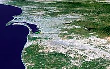
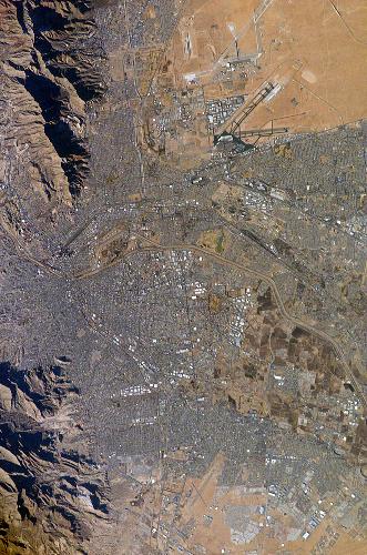
See also: Rio Grande border disputes and Adams-Onís Treaty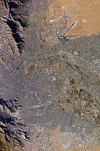 El Paso (top) and Ciudad Juárez (bottom) seen from earth orbit; the Rio Grande is the thin line separating the two cities through the middle of the photograph. El Paso and Juarez make up the second largest international metroplex, San Diego and Tijuana being the largest.
In the mid-16th century, with the discovery of silver, settlers from a variety of countries and backgrounds began to arrive in the area. This period of sparse settlement included colonizers from different backgrounds. The area technically was part of the Spanish colony, but due to the lack of population and the diverse citizenry it had, it did not seem to belong to any country. This period lasted until the early 19th century at which point the United States bought the lands known as the Louisiana Purchase from France and began to expand steadily westward in its pursuit of Manifest Destiny.[7]
The border itself was now clearly defined and remained so until the Mexican colony became independent from Spain and entered a period of political instability. Mexico attempted to create a buffer zone at the border that would prevent possible invasion from the North. In order to do so the Mexican government encouraged thousands of their own citizens to settle in the region that is now known as Texas and even offered very inexpensive land to settlers from the United States in exchange for populating the area. The influx of people did not provide the defense that Mexico had hoped for and instead the Texas territory declared its independence in 1836. That independence lasted until 1845 when the United States annexed Texas.
The constant conflicts in the Texas region in the mid 19th century eventually led to the Mexican-American War, which began in 1846 and ended in 1848 with the Treaty of Guadalupe Hidalgo. Due to the treaty Mexico lost more than 960,000 square miles (about 2,500,000 km²) of land, 55%[8] of its national territory, including what is today California, Arizona, New Mexico, Utah, Nevada and parts of Colorado, Wyoming, Kansas, and Oklahoma in addition, all disputes over Texas and the disputed territory between Rio Grande and Rio Nueces were abandoned. Five years later the Gadsden Purchase completed the creation of the current United States–Mexico border. These purchases left approximately 300,000 people living in the once disputed lands, many of whom were Mexican nationals. Following the establishment of the current border a number of towns sprang up along this boundary and many of the Mexican citizens were given free land in the northern regions of Mexico in exchange for returning and repopulating the area.[9]
 Map of Mexico in 1842.
The economic development of the border region on the Mexican side of the border depended largely on its proximity to the United States due to its remoteness from the commercial centers in Mexico. During the years of Mexican President Porfirio Díaz, between 1876 and 1910, growth of the border communities boomed due mostly to its close ties to the United States and the Mexican governments support for financial investments from the United States.[10] Railroads were built that connected the northern Mexican states more to the United States than to Mexico and the population grew tremendously. The mining industry also developed, as did the United States’ control of it. By the early 20th century companies from the United States controlled 81% of the mining industry and had invested five hundred million dollars in the Mexican economy overall, twenty-five percent of which went to the border regions alone.[11]
The Mexican Revolution, caused at least partially by the increasing animosity towards foreign ownership of Mexican properties, began in 1910. The Revolution increased the political instability in Mexico, but actually did not significantly slow United States investment. It did reduce economic development within Mexico however, and the border regions reflected this. As the infrastructure of communities on the United States side of the boundary continued to improve, its Mexican counterparts began to fall behind in the construction of important transportation networks and systems necessary to municipal development as well as the upkeep of systems already in place.[11]
Security
U.S.–Mexico border enforcement
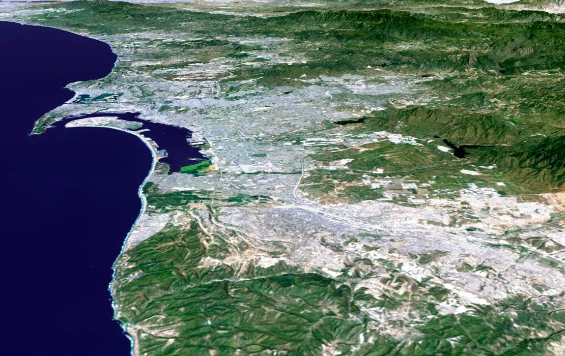
See also: Illegal immigration to the United States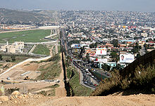 To the right lies Tijuana, and on the left is San Diego. The building in the foreground on the San Diego side is a sewage treatment plant built to clean the Tijuana River.
The U.S.–Mexico border has the second highest number of both legal and illegal crossings of any land border in the world, behind the Canada – United States border.[citation needed] The border is guarded by more than twenty thousand border patrol agents, more than any time in its history.[12] However they only have "effective control" of less than 700 miles (1,100 km) of the 1,954 miles (3,145 km) of total border,[13] with an ability to actually prevent or stop illegal entries along 129 miles (208 km) of that border.[14] The border is paralleled by United States Border Patrol Interior Checkpoints at major roads generally between 25 and 75 miles (121 km) to the U.S. side of the border, and garitas generally within 50 km of the border on the Mexican side.[15][16][17]
 Vehicle barrier in the New Mexico desert.
There are an estimated half a million illegal entries into the United States each year.[18] Border Patrol activity is concentrated around big border cities such as San Diego and El Paso which do have extensive border fencing. This means that the flow of illegal immigrants is diverted into rural mountainous and desert areas, leading to several hundred migrant deaths along the Mexico-U.S. border of those attempting to cross into the United States from Mexico without authorization from the Federal government of the United States.[19]
For a period in the 1990s, United States Army personnel were stationed along the U.S.-Mexico border to help stem the flow of illegal immigrants and drug smugglers. These military units brought their specialized equipment such as FLIR (forward looking infrared) devices and helicopters. In conjunction with the United States Border Patrol, they would deploy along the border and, for a brief time, there would be no traffic across that border which was actively watched by "coyotes" paid to assist border crossers. The smugglers and the alien traffickers simply ceased operations over the one hundred mile sections of the border sealed at a time. It was very effective but temporary as the illegal traffic resumed as soon as the military withdrew.[20] After the September 11 attacks the United States looked at the feasibility of placing soldiers along the U.S.-Mexico border as a security measure, but made no mention of the Canada – United States border. Some believe the whole U.S.-Mexico border could be sealed with as few as 100 helicopters equipped with FLIR scopes, and a few hundred men equipped with state-of-the-art sensors, scopes, and other electronics.[20] Another strategy suggests that the U.S. Military or Border Patrol could easily eliminate 100% of illegal mainland crossings by placing a guard every 500–1000 feet along the 2,000-mile (3,200 km) border with Mexico, arguing that even this low tech, manpower intensive option would represent a tiny fraction of the annual Defense and Homeland Security budgets.[citation needed] Opposition says this is a violation of Posse Comitatus. Former U.S. Border Patrol Supervisor David Stoddard has responded to this by stating "Posse Comitatus prohibits the use of troops for domestic law enforcement. Border security is not domestic law enforcement. It is protecting our nation from foreign intruders." He also points out that the army patrolled the border for more than 46 years after the passage of the Posse Comitatus act.[20]
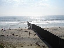 Beach in Tijuana at the border.
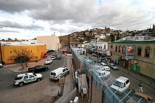
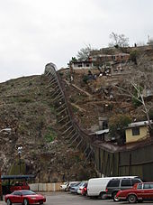
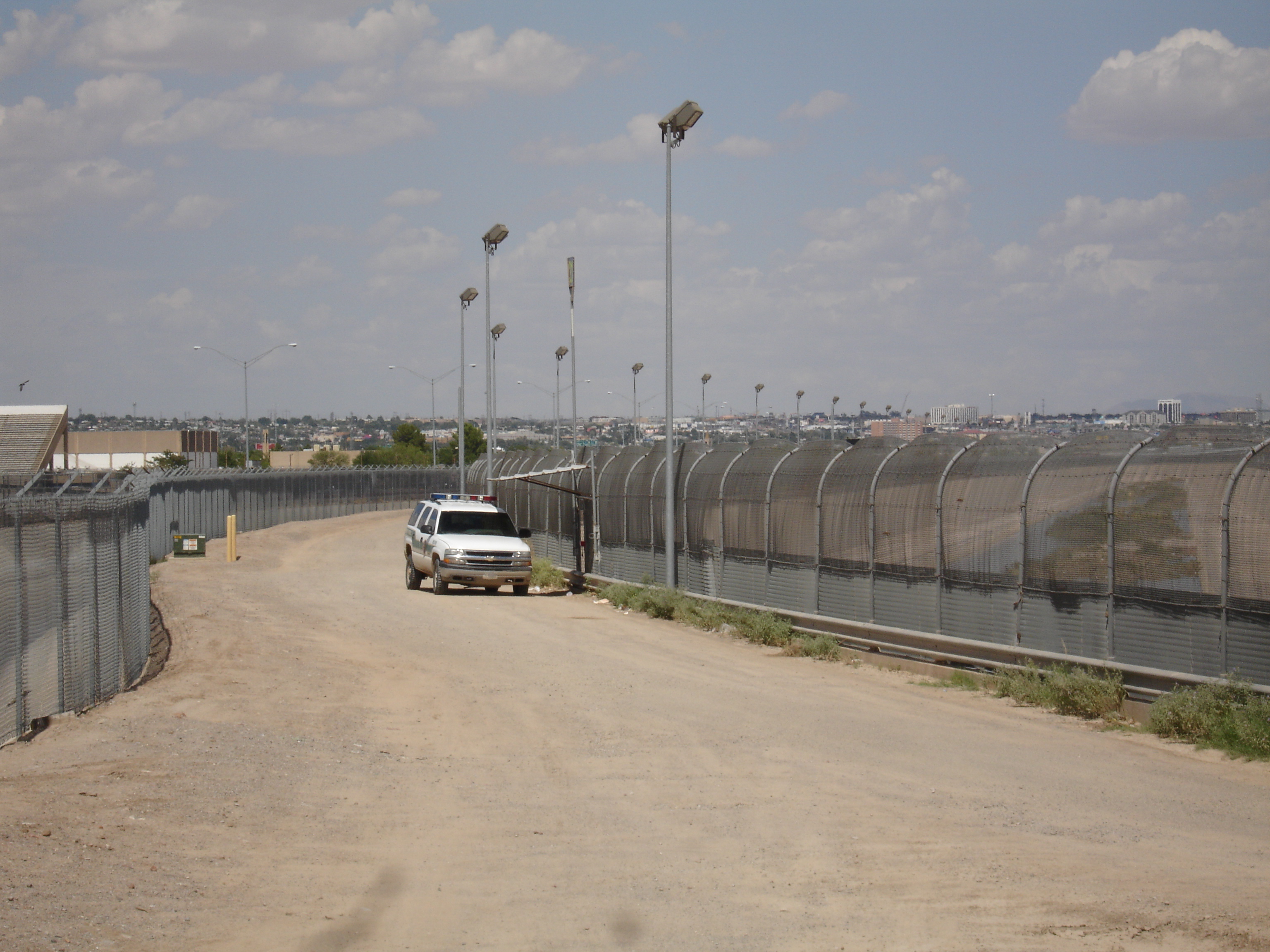
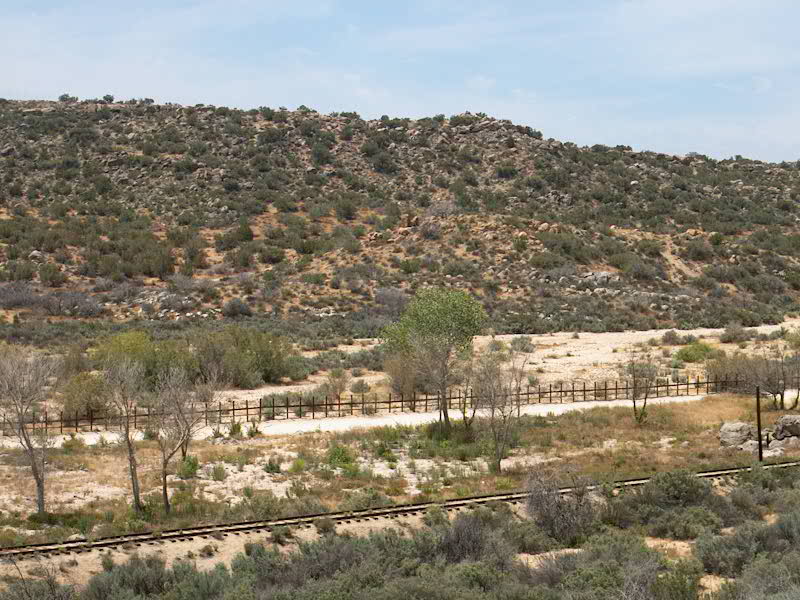
 The U.S.-Mexico border fence near San Diego, California. The Secure Fence Act of 2006 authorizes the construction of 700 additional miles of the double chain link and barbed wire fences with light and infrared camera poles.
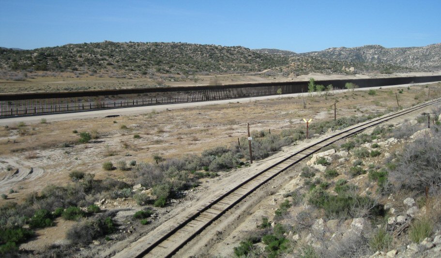
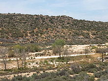 Portion of border near Jacumba, California in 2003
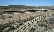 Portion of border near Jacumba, California in 2009 with enhanced security
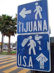 Border for pedestrians in Tijuana
Each state in the United States has a National Guard organization that could, in principle, be placed on the border at a state governor's discretion to assist with border security; many states also have a backup to the National Guard called the State Defense Force that could, in an emergency, also be activated for this purpose. However, few governors have done this. Many governors fear a backlash from local businesses and ever increasing communities of Latinos. Arizona and New Mexico have currently declared the counties that border Mexico to be under serious duress caused by uncontrolled illegal migration, thereby enabling governors to deploy National Guardsmen to the international border. However, Senator John McCain (R-Arizona) has opposed some measures intended to reduce illegal immigration through enforcement and proposed a bill calling for earned legalization (which many call amnesty) in the Senate. Texas governor Rick Perry has called for the deployment of national guardsmen to watch certain high-traffic spots of the Texas/Mexico border, partly as a response to an incident in 2006 where U.S. officers involved in a pursuit in western Texas lost suspected drug smugglers when their 4x4 vehicle crossed the Rio Grande and was met by several men armed with assault rifles and dressed in Mexican military uniforms. In May 2006, President Bush announced a plan whereby up to 6,000 National Guardsmen would help build facilities on the border to assist the Border Patrol with tactical and technical measures but not enforcement duties. There has been some resistance: in California, Governor Arnold Schwarzenegger initially denied Bush's request to deploy 3,000 National Guard troops to the California-Baja California border.[21] Later Schwarzenegger changed his mind after being reassured of reimbursement and replacement if they are needed elsewhere and deployed over 1600 California National Guard troops to the border.
Attempts to complete the construction of the United States–Mexico barrier have been challenged by the Mexican government, illegal immigrants living in the United States, and various U.S.-based Chicano organizations. According to proponents of open border policies, agricultural work is one of the many types of work that illegal immigrants fill that could not be easily filled by United States citizens. Opponents counter that U.S. citizens would gladly take these jobs if offered decent wages.
In December 2005, the United States House of Representatives voted to build a separation barrier along parts of the border. A companion vote in the United States Senate on May 17, 2006 included a plan to blockade 860 miles (1,380 km) of the border with vehicle barriers and triple-layer fencing. Although those bills died in committee, eventually the Secure Fence Act of 2006 was passed providing for the construction of 700 miles (1,100 km) of high-security fencing. Proponents[who?] hope that barriers of various types running the length of the border will reduce illegal drug smuggling and illegal immigration drastically.
According to Dr. Douglas Massey of Princeton University[22] and other experts[23] the efforts to curtail illegal immigration by means of security has done nothing but redirect the migration flows into the most desolate and desert areas of the border, thus increasing the mortality rate of illegal immigrants. Instead, they remain in the U.S. for longer periods of time and eventually bring their families with them. President Bush has presented an initiative to reinstate a Guest worker program or expand the H-2B program to fill the perceived needs of labor for some areas of the U.S. and, at the same time, has pushed to strengthen the security measures at the border to stop suspected illegal immigrants, terrorists, and narcotics dealers from entering the U.S.
Border incursions
In the fiscal year of 2006, there have been twenty-nine confirmed border incursions by Mexican government officials, of which seventeen have been by armed individuals. Since 1996 there have been 253 incursions by Mexican government officials.[24][25][26]
The Washington Times has reported that on Sunday, August 3, 2008, Mexican Military personnel who crossed into Arizona from Mexico encountered a U.S. Border Patrol agent, whom they held at gunpoint. The soldiers later returned to Mexico, as backup Border Patrol agents came to investigate.[27][28]
As of September 4, 2009. Mexico and the U.S. will create a trans-border communications network that will help police on both sides of the border to fight crime and violence. According to the U.S. State Department secure voice, data and video channels costing $7 million on the U.S. side, are expected to be online within three years. The Department of Homeland Security and Mexico's Secretary of Public Security will work out the details. William H. Grigsby of the State Department said Thursday that secure networks will allow federal, state and local police to "coordinate a broad array of law enforcement activities."[29]
Cost to local governments
In a new study conducted by the authorities of Mexico together with San Diego State University, it showed that due to law enforcement and criminal prosecution cost relating to illegal aliens their costs increased 39% within the border counties of Arizona. This study was commissioned by the U.S.-Mexico Border Counties Coalition.[30]
Travel
Western Hemisphere Travel Initiative
Main article: Western Hemisphere Travel InitiativeIn late 2006, the United States Department of Homeland Security (DHS) announced a rule regarding new identification requirements for U.S. citizens and international travelers entering the U.S. implemented on January 23, 2007, this final rule and first phase of the WHTI specifies nine forms of identification—one of which is required in order to enter the U.S. by air: a valid passport; a passport card; a state enhanced driver's license or state enhanced non-driver ID card (available in Michigan, New York, Vermont and Washington[31]) approved by the Secretary of Homeland Security; a trusted traveler program card (NEXUS, FAST, or SENTRI); an enhanced tribal identification card; a Native American Tribal Photo Identification Card; Form I-872 - American Indian Card; a valid Merchant Mariner Document when traveling in conjunction with official maritime business; or a valid U.S. military identification card when traveling on official orders.[32][33][34][35]
Auto insurance
Auto insurance does not travel across the Mexico-United States border. Therefore, people wishing to cross the border with a vehicle may choose to buy a short-term auto insurance policy for the country and/or state that they are crossing into. If the state in the country requires auto insurance, a policy that meets the state's liability requirements must be purchased before the vehicle may cross. Those in the U.S. who want to cross into Mexico with a car may choose to purchase a short-term Mexican auto insurance policy. If an auto accident occurs and drivers do not have insurance and/or cannot pay for the damage and/or injuries, they could be arrested until the damage and/or injuries are rectified.[36]
The Fence
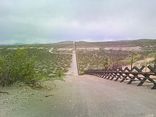
Main article: Mexico–United States barrier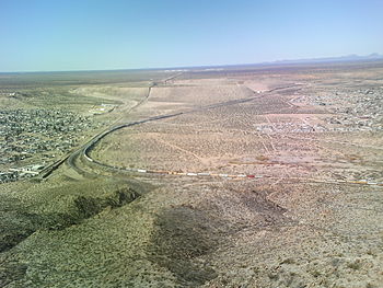 The start of the border fence in the state of New Mexico—just west of El Paso, Texas, U.S.A.
The U.S. government had plans in 2006 to erect a border fence along the U.S.-Mexico border. The controversial proposal included creating many individual fences. In between these fences are cameras and sensors, giving the name a "virtual fence". In 2010, the initiative was terminated due to costs after having completed 640 miles (1,030 km) of either barrier fence or vehicle barriers that was either new or had been rebuilt over older inferior fencing. The Boeing-built SBInet systems of using radar, watchtowers and sensors (without a fence or physical barrier) was scrapped for being overbudget, full of glitches and far behind schedule.[37]
Animals
When animals are imported from one country to another, there is the possibility that diseases and parasites can move with them. For this reason, most countries impose animal health regulations on the importation of animals. Most animals imported to the United States must be accompanied by:
- Import permits obtained in advance from the U.S. Department of Agriculture's Animal and Plant Health Inspection Service (APHIS).
- Health certification papers from the country of origin.
Veterinary inspections are often required, and are available only at designated ports;[38] advance contact with port veterinarians is recommended.[39] Animals crossing the United States-Mexico border may have a country of origin other than the country where they present for inspection. Such animals include those from the U.S. that cross to Mexico and return, and animals from other countries that travel overland through Mexico or the U.S. before crossing the border.
Horses and cattle
Crossing from Mexico to the United States
APHIS imposes precautions to keep out several equine diseases,[40] including glanders, dourine, equine infectious anemia (EIA), equine piroplasmosis (EP), Venezuelan equine encephalitis (VEE), and contagious equine metritis (CEM). APHIS also checks horses to prevent the introduction of ticks and other parasites. In the Lower Rio Grande Valley, U. S. Department of Agriculture inspectors look for horses and livestock that stray across the border carrying ticks. These animals are often called wetstock, and the inspectors are referred to as tickriders.[41]
Per APHIS,[40] horses originating from Canada can enter the United States with a Canadian government veterinary health certificate and a negative test for EIA. Horses from Mexico must have a health certificate; pass negative tests for EIA, dourine, glanders, and EP at a USDA import center; and undergo precautionary treatments for external parasites at the port of entry. Horses from other Western Hemisphere countries must have the same tests as those from Mexico and, except for horses from Argentina, must be held in quarantine for at least 7 days as a check for VEE.
APHIS imposes similar testing and certification requirements on horses from other parts of the world but without the quarantine for VEE. These horses are held in quarantine—usually three days—or until tests are completed. Because the disease equine piroplasmosis (equine babesiosis) is endemic in Mexico but not established in the United States,[42] transportation of horses from Mexico to the United States requires evaluation of horses for the presence of this disease.
Transportation of horses from Mexico to the United States normally requires at least three days in quarantine, which is incompatible with most recreational equestrian travel across the border. A leading exception to this rule is the special waiver obtained by riders participating in the Cabalgata Binacional Villista (see cavalcade).
Crossing from the United States to Mexico
Import from the United States to Mexico requires evidence within the prior 45 days of freedom from equine infectious anemia, among other requirements.[43]
See also
- Aztlán
- Border Field State Park
- Border Film Project
- Border Protection, Anti-terrorism, and Illegal Immigration Control Act of 2005
- International Boundary and Water Commission
- List of crossings of the Rio Grande
- List of Mexico–United States border crossings
- List of municipalities (municipios) and counties on the Mexico – United States border
- Mexico–United States relations
- Migrant deaths along the Mexico – United States border
- Minuteman Project
- New River (Mexico-United States)
- No More Deaths
- Open Border
- Reconquista (Mexico)
- Rio Grande border disputes
- Roosevelt Reservation
- S. 2611
- San Diego–Tijuana metropolitan area
- Secure Fence Act of 2006
- Southwest Border Security Consortium
- United States–Mexico barrier
- Texas Virtual Border Watch
Notes
- ^ http://www.pbs.org/newshour/bb/law/jan-june10/immigration2_05-20.html
- ^ "United States Section Directive". http://www.ibwc.gov/Files/US-Mx_Boundary_Map.pdf. Retrieved 2011-11-11.
- ^ Edwin Mora (19 May 2010). "Senate Democratic Whip Compares Sealing the Mexican Border to Trying to Keep Drugs Off of I-95". Cybercast News Service. http://www.cnsnews.com/node/66271. Retrieved 9 March 2011.
- ^ a b Golson, Barry; Thia Golson (2008). Retirement Without Borders: How to Retire Abroad--in Mexico, France, Italy, Spain, Costa Rica, Panama, and Other Sunny, Foreign Places. New York, New York: Simon and Schuster. p. 75. ISBN 9780743297011. http://books.google.com/books?id=hknZxFWtWnQC&lpg=PA75&ots=YF226kNpKr&dq=most%20frequently%20crossed%20international%20border&pg=PA75#v=onepage&q=most%20frequently%20crossed%20international%20border&f=false. Retrieved 9 March 2011.
- ^ Glenday, Craig (2009). Guinness World Records 2009. Random House Digital, Inc.. p. 457. ISBN 9780553592566. http://books.google.com/books?id=aHYt0RNSDfgC&lpg=PA457&ots=mKCCPrVx7y&dq=most%20frequently%20crossed%20border%20guinness&pg=PA457#v=onepage&q&f=false. Retrieved 9 March 2011.
- ^ "US, Mexico open first new border crossing in 10 years". AFP. 12 January 2010. http://www.france24.com/en/20100112-us-mexico-open-first-new-border-crossing-10-years. Retrieved 9 March 2011.
- ^ Martínez, Oscar J. Troublesome Border. Tucson, University of Arizona Press: 1988.
- ^ "Treaty of Guadalupe Hidalgo". www.ourdocuments.gov. http://www.ourdocuments.gov/doc.php?flash=true&doc=26. Retrieved 27 June 2007.
- ^ Byrd, Bobby and Susannah Mississippi (eds). The Late Great Mexican Border: Reports from a Disappearing Line. El Paso, Cinco Puntos Press: 1996.
- ^ Hart, John M. “The Mexican Revolution, 1910–1920”. Oxford History of Mexico. New York: Oxford University Press, 2000 pp 433-466.
- ^ a b Lorey, David E. The U.S.-Mexican Border in the Twentieth Century. Wilmington, Scholarly Resources, Inc.: 1999.
- ^ U.S. Department of Homeland Security (23 June 2010). "Fact Sheet: Southwest Border Next Steps". http://www.dhs.gov/ynews/releases/pr_1277310093825.shtm. Retrieved 6 August 2010.
- ^ Jeffrey, Terence P. (24 September 2009). "Administration Will Cut Border Patrol Deployed on U.S-Mexico Border". Cybercast News Service. http://www.cnsnews.com/news/article/54514. Retrieved 25 September 2009.
- ^ Terence P. Jeffrey (31 March 2011). "Federal Auditor: Border Patrol Can Stop Illegal Entries Along Only 129 Miles of 1,954-Mile Mexican Border". Cybercast News Service. http://cnsnews.com/news/article/federal-auditor-border-patrol-can-stop-i. Retrieved 31 March 2011.
- ^ "BORDER PATROL: Available Data on Interior Checkpoints Suggest Differences in Sector Performance". United States General Accounting Office. 2005-07. http://www.gao.gov/new.items/d05435.pdf.
- ^ "BORDER PATROL: Checkpoints Contribute to Border Patrol’s Mission, but More Consistent Data Collection and Performance Measurement Could Improve Effectiveness". United States General Accounting Office. 2009-08. http://www.gao.gov/new.items/d09824.pdf.
- ^ Aduana Mexico. 2007. Aduanas 25 de las Reglas de Caracter General en Materia de Comercio Exterior para 2007.
- ^ "Border-Crossing Deaths Have Doubled Since 1995; Border Patrol’s Efforts to Prevent Deaths Have Not Been Fully Evaluated" (PDF). Government Accountability Office. August 2006. p. 42. http://www.gao.gov/new.items/d06770.pdf.
- ^ "GAO-06-770" (PDF). United States Government Accountability Office. August 2006. http://www.gao.gov/new.items/d06770.pdf.
- ^ a b c Sher Zieve (July 13, 2006), Mexican government running US immigration policy--Part III, http://www.renewamerica.us/columns/zieve/060713.
- ^ "Schwarzenegger defies Bush on border troops". Washington Times. June 25, 2006. http://washingtontimes.com/national/20060625-122212-5574r.htm. Retrieved 2006-07-10.
- ^ (Beyond Smoke and Mirrors: Mexican Immigration in an Era of Economic Integration, Russel Sage, 2003).
- ^ Migration Policy Institute.
- ^ "Report: Border Patrol confirms 29 incursions by Mexican officials into U.S. in 2007". San Diego Union Tribune. http://www.signonsandiego.com/news/mexico/20080109-1533-mexico-us-borderincursions.html. Retrieved 2008-01-17.
- ^ "MSNBC report on Border incursion Oct 18 2007". MSNBC. http://www.youtube.com/watch?v=pEKUJGT2xr4. Retrieved 2008-01-17.
- ^ "Mexican incursions inflame border situation". MSNBC. http://www.msnbc.msn.com/id/11226144. Retrieved 2008-01-17.
- ^ "Border patrol agent held at gunpoint". Washington Times. http://washingtontimes.com/news/2008/aug/06/soldiers-cross-into-us-hold-guns-to-agent/. Retrieved 2008-08-08.
- ^ "Mexican Military Holds Border Patrol Agent at Gunpoint in the USA: Mexican Military Continues to Escort Drug Smugglers". http://www.bluesheepdog.com/2008/08/14/mexican-military-holds-border-patrol-agent-at-gunpoint-in-the-usa-mexican-military-continues-to-escort-drug-smugglers/.
- ^ http://tech.yahoo.com/news/ap/20090904/ap_on_hi_te/lt_mexico_border_communication_2
- ^ "Tucson Study: Illegal immigration costs border counties millions". 4 News 4. March 5, 2008. (Web link). Retrieved 2008-03-05.
- ^ WHTI: Enhanced Drivers License
- ^ DHS Announces Final Western Hemisphere Air Travel, Association of Cotpotrate Travel Executives, 5 December 2006, http://www.acte.org/resources/view_article.php?id=105, retrieved 2007-12-02Rule
- ^ Western Hemisphere Travel Initiative: The Basics, U.S. Department of Homeland Security, http://www.dhs.gov/xtrvlsec/crossingborders/whtibasics.shtm, retrieved 2007-12-02
- ^ Western Hemisphere Travel Initiative, U.S. Department of State, Bureau of Consular Affairs, January 13, 2008, http://travel.state.gov/travel/cbpmc/cbpmc_2223.html, retrieved 2007-01-12.
- ^ http://www.nmborder.com/travel_usa.html
- ^ [1]
- ^ Hsu, Spencer S. (2010-03-16). "Work to cease on 'virtual fence' along U.S.-Mexico border". The Washington Post. http://www.washingtonpost.com/wp-dyn/content/article/2010/03/16/AR2010031603573.html.
- ^ "Ports Designated for the Importation of Animals". Animal and Plant Health Inspection Service (APHIS). Archived from the original on 2007-02-02. http://web.archive.org/web/20070202135654/http://www.aphis.usda.gov/vs/ncie/portlist.html. Retrieved 2011-10-05.
- ^ "Port Veterinarian List". Animal and Plant Health Inspection Service (APHIS). Archived from the original on 2006-12-09. http://web.archive.org/web/20061209004821/http://www.aphis.usda.gov/vs/ncie/portvet.html. Retrieved 2011-10-05.
- ^ a b "Equine Importation". Animal and Plant Health Inspection Service (APHIS). Archived from the original on 2010-10-17. http://web.archive.org/web/20101017004412/http://www.aphis.usda.gov/import_export/animals/animal_import/equine/equine_import_quarantine.shtml. Retrieved 2011-10-05.
- ^ Miller, Tom. On the Border: Portraits of America’s Southwestern Frontier, pp. 72–73.
- ^ Equine Disease Quarterly, Volume 12, Number 3 (October 2003)
- ^ "Import health requirements of Mexico for horses (non slaughter) exported from the United States". Animal and Plant Health Inspection Service (APHIS). December 2005. Archived from the original on 2010-10-17. http://web.archive.org/web/20090419233214/http://www.aphis.usda.gov/regulations/vs/iregs/animals/downloads/mx_eq.pdf. Retrieved 2011-10-05.
References
- Parts of this article have been adapted from The International Boundary and Water Commission, Its Mission, Organization and Procedures for Solution of Boundary and Water Problems.
- Arbelaez, Harvey, and Claudio Milman. "The New Business Environment of Latin America and the Caribbean". International Journal of Public Administration (2007): 553
- Kelly, Patricia, and Douglas Massey. "Borders for Whom? The Role of NAFTA in Mexico-U.S. Migration". The ANNALS of the American Academy of Political Science 610 (2007): 98–118.
- Miller, Tom. On the Border: Portraits of America’s Southwestern Frontier, 1981.
- Thompson, Olivia N. (2009). "Binational Water Management: Perspectives of Local Texas Officials in the U.S.-Mexico Border Region". Applied Research Projects. Texas State University. Paper 313.
External links
- U.S.-Mexico Business Council
- Picture of U.S.-Mexico Border
- Border Stories: a mosaic documentary on the U.S.-Mexico Border
- Border Town—Dallas Observer
Categories:


Wikimedia Foundation. 2010.