- Bridge in East Fallowfield Township (Mortonville, Pennsylvania)
-
Mortonville Bridge
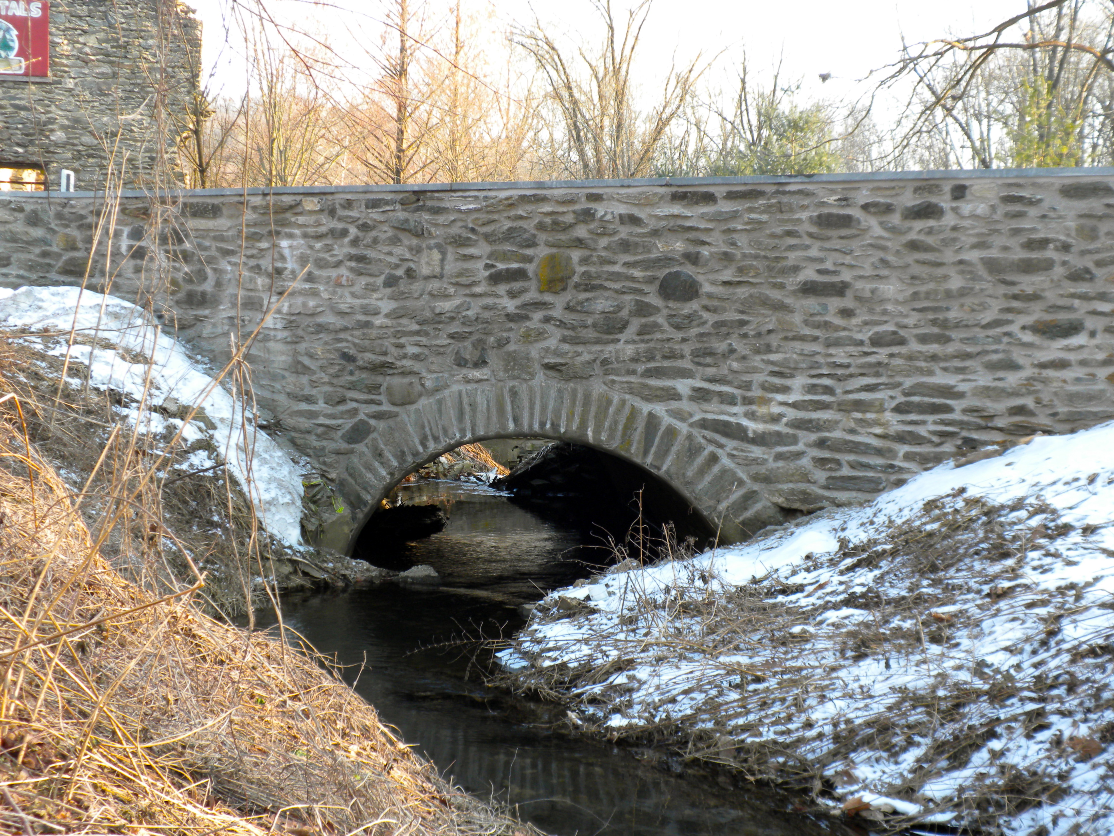
 Mortonville Bridge being widened in 2009.

Coordinates: 39°56′47″N 75°46′47″W / 39.94639°N 75.77972°W Area: 2.1 acres (0.85 ha) Built: 1826 Architectural style: Other, Stone Arch Governing body: State MPS: Strasburg Road TR;East Fallowfield Township MRA NRHP Reference#: 85002392[1] Significant dates Added to NRHP: September 18, 1985 Removed from NRHP: July 16, 2010 Bridge in East Fallowfield Township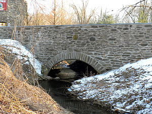 Mill Race Bridge, with ruins of mill in background.
Location: Strasburg Rd. over Mill Race, Mortonville, Pennsylvania Coordinates: 39°56′46″N 75°46′43″W / 39.94611°N 75.77861°WCoordinates: 39°56′46″N 75°46′43″W / 39.94611°N 75.77861°W Area: less than one acre Governing body: State MPS: Highway Bridges Owned by the Commonwealth of Pennsylvania, Department of Transportation TR NRHP Reference#: 88000878[1] Added to NRHP: June 22, 1988 The Mortonville Bridge and Mill Race Bridge are stone arch bridges carrying Strasburg Road across the West Branch Brandywine Creek and an abandoned millrace at Mortonville, Pennsylvania. The Mortonville Bridge was placed on the National Register of Historic Places on September 18, 1985, while the Mill Race Bridge was added as the Bridge in East Fallowfield Township on June 22, 1988. The Mortonville Bridge was removed from the Register on July 16, 2010, following reconstruction; the Mill Race Bridge remains registered.
The first bridges on the site were probably built about 1772 when Strasburg Road was surveyed and constructed. A wooden bridge over the Brandywine was built in 1789. Of the current bridges, the millrace bridge was built about 1800 as a single stone arch, using stone from a local quarry upstream. It spanned the head race for Hayes Mill. A four-arch stone bridge over the Brandywine replaced the 1789 wooden structure in 1826, also using local stone.[2]
From the 1980s to 2002, PennDOT put forth a series of plans for the replacement of both bridges by a single modern structure.[2] However, local opposition was considerable, and PennDOT ultimately rebuilt and widened the bridge by 6 feet in 2009 during a 10-month closure. It was closed again in 2010 to lengthen retaining walls on the approach.[3]
References
- ^ a b "National Register Information System". National Register of Historic Places. National Park Service. 2010-07-09. http://nrhp.focus.nps.gov/natreg/docs/All_Data.html.
- ^ a b Dorchester, Jane E. (2008-10-04). "The Bridges of Mortonville". Chester County Day (62): 16.
- ^ Pickering, Anne (2010-07-07). "Mortonville Bridge to be closed again". Kennett Paper. http://www.southernchestercountyweeklies.com/articles/2010/07/07/kennett_paper/news/doc4c349459a20a8110389583.txt.
External links
Bridges and tunnels on the National Register of Historic Places Alabama · Alaska · Arizona · Arkansas · California · Colorado · Connecticut · Delaware · Florida · Georgia · Guam · Hawaii · Idaho · Illinois · Indiana · Iowa · Kansas · Kentucky · Louisiana · Maine · Maryland · Massachusetts · Michigan · Minnesota · Mississippi · Missouri · Montana · Nebraska · Nevada · New Hampshire · New Jersey · New Mexico · New York · North Carolina · North Dakota · Ohio · Oklahoma · Oregon · Pennsylvania (covered) · Puerto Rico · Rhode Island · South Carolina · South Dakota · Tennessee · Texas · Utah · Vermont · Virginia · Washington · Washington, D.C. · West Virginia · Wisconsin · Wyoming
Categories:- Bridges in Chester County, Pennsylvania
- Bridges completed in 1826
- Bridges on the National Register of Historic Places in Pennsylvania
- Deck arch bridges
- Stone bridges
- Road bridges in Pennsylvania


Wikimedia Foundation. 2010.