Park Slope Jewish Center

Park Slope Jewish Center
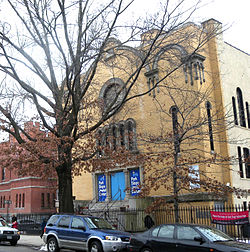
Park Slope Jewish Center, March 2010
Park Slope Jewish Center is located in New York City
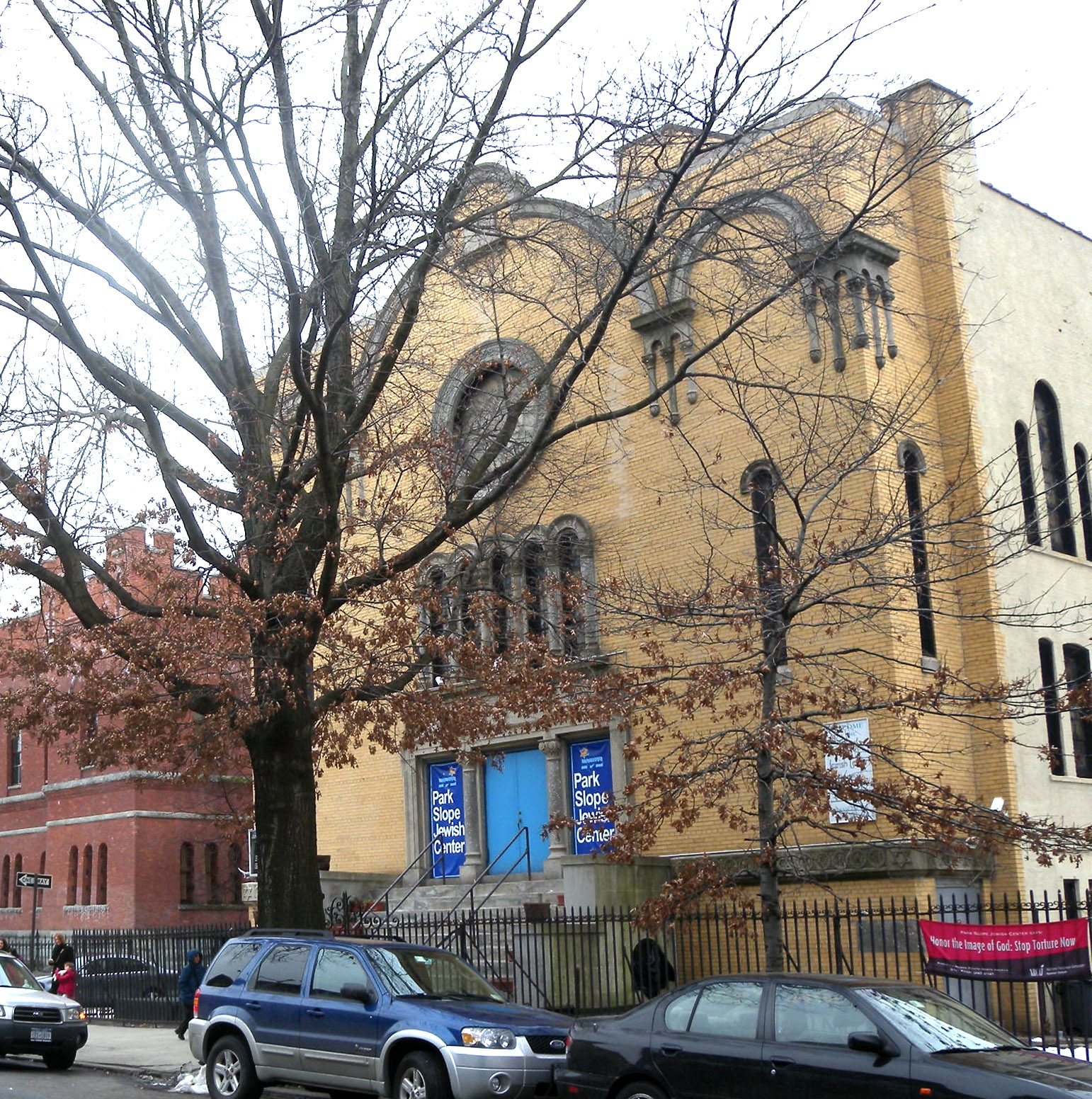
Location: 1320 Eight Ave., Brooklyn, New York
Coordinates: 40°39′46.7″N 73°58′54″W / 40.662972°N 73.98167°W / 40.662972; -73.98167Coordinates: 40°39′46.7″N 73°58′54″W / 40.662972°N 73.98167°W / 40.662972; -73.98167
Area: 0.2 acres (0.081 ha)
Built: 1925
Architect: Blaustein, Allen A.
Architectural style: Late 19th And 20th Century Revivals
Governing body: Private
NRHP Reference#: 01001442
Added to NRHP: January 11, 2002

The Park Slope Jewish Center, known from 1925 to 1960 as Congregation Tifereth Israel, is a Conservative synagogue at 1320 Eight Avenue in Park Slope, Brooklyn, New York, New York. It was built in 1925 and is a 2 12-story brick building with Romanesque and Baroque style elements. It features the Star of David on exterior masonry, the rose window, and domed skylight.[1]

It was listed on the National Register of Historic Places in 2002.

Notes

External links


Wikimedia Foundation. 2010.

Игры ⚽ Поможем написать курсовую

Look at other dictionaries:

  • Park Slope, Brooklyn — Park Slope is a neighborhood in the western section of Brooklyn, New York City s most populous borough. Park Slope is roughly bounded by Prospect Park West to Fourth Avenue, Park Place to the Green Wood Cemetery according to the New York City… …   Wikipedia

  • Glen Canyon Park — Aerial photograph of Glen Canyon Park; the Bosworth St., Sussex St., and Diamond Heights Shopping Center entrances are labeled. O Shaughnessy Blvd. divides Glen Canyon Park (on the east) from O Shaughnessy Hollow (to the west). Typ …   Wikipedia

  • Marine Park — For the public park of the same name, see Marine Park, Brooklyn. Gerritsen Avenue, a major traffic corridor in the neighborhood. Marine Park is a neighborhood located in the New York City borough of Brooklyn, that lies between Mill Basin and… …   Wikipedia

  • National Register of Historic Places listings in Kings County, New York — Location of Kings County in New York Map of …   Wikipedia

  • Congregation Beth Elohim (Brooklyn, New York) — This article is about a Jewish congregation founded in 1861 in Brooklyn, New York. For the birthplace of American Reform Judaism, see Congregation Kahal Kadosh Beth Elohim. Not to be confused with Kahal Kadosh Beth Elohim/Temple Beth Elohim, a… …   Wikipedia

  • Catskill Park — Geobox|Protected Area name = Catskill Park native name = other name = category = New York Forest Preserve image caption = View to central Catskills from Twin Mountain image size = 300px country = USA state = New York region = Catskill Mountains… …   Wikipedia

  • Congregation Tifereth Israel — may refer to: New York City Congregation Tifereth Israel (Brooklyn, New York) (the Park Slope Jewish Center ), a Conservative synagogue in Park Slope, Brooklyn Congregation Tifereth Israel (Queens, New York) (the Home Street Synagogue ), a… …   Wikipedia

  • Brooklyn — Infobox Settlement name = Brooklyn official name = Kings County other name = native name = settlement type =Borough of New York City total type = motto = imagesize = image caption = View of Brooklyn Heights from South Street Seaport. flag size =… …   Wikipedia

  • Midwood, Brooklyn — Coordinates: 40°37′24″N 73°57′42″W / 40.623334°N 73.961678°W / 40.623334; 73.961678 …   Wikipedia

  • List of eruvin — An eruv chatzerot ( he. עירוב חצרות), commonly known in English as a community eruv, is a symbolic boundary that allows Jews who observe the traditional rules concerning Shabbat to carry certain items outside of their homes that would otherwise… …   Wikipedia

Share the article and excerpts

Direct link
Do a right-click on the link above
and select “Copy Link”