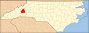
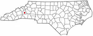
- Marion, North Carolina
-
Marion, North Carolina — City — 

SealMotto: "Where Main Street Meets the Mountains" Location of Marion, North Carolina
Coordinates: 35°40′59″N 82°0′21″W / 35.68306°N 82.00583°WCoordinates: 35°40′59″N 82°0′21″W / 35.68306°N 82.00583°W Country United States State North Carolina County McDowell Founded 1844 Government – Mayor Steve Little Area – Total 5.2 sq mi (8.8 km2) – Land 5.2 sq mi (8.8 km2) – Water 0.0 sq mi (0.0 km2) Elevation 1,404 ft (428 m) Population (2000) – Total 4,943 – Density 1,452.1/sq mi (560.7/km2) Time zone Eastern (EST) (UTC-5) – Summer (DST) EDT (UTC-4) ZIP codes 28737, 28752 Area code(s) 828 FIPS code 37-41420[1] GNIS feature ID 1013324[2] Website http://www.marionnc.org/ Marion is a city in McDowell County, North Carolina, United States. The population was 7,943 at the 2008 estimated census. It is the county seat of McDowell County[3].
Contents
Geography
Marion is located at 35°40′59″N 82°0′21″W / 35.68306°N 82.00583°W (35.683150, -82.005855)[4].
According to the United States Census Bureau, the city has a total area of 5.2 square miles (13 km2), all o.
Demographics
As of 2008, there were 5,144 people, 2,146 households, and 1,283 families residing in the city. The population density was 1,452.1 people per square mile (561.3/km²). There were 2,351 housing units at an average density of 690.7 per square mile (267.0/km²). The racial makeup of the city was 83.23% White, 10.54% Black, 0.28% Native American, 1.05% Asian, 0.04% Pacific Islander, 3.82% from other races, and 1.03% from two or more races. Hispanic or Latino of any race were 7.04% of the population.
There were 2,146 households out of which 24.4% had children under the age of 18 living with them, 41.1% were married couples living together, 14.6% had a female householder with no husband present, and 40.2% were non-families. 37.0% of all households were made up of individuals and 20.4% had someone living alone who was 65 years of age or older. The average household size was 2.19 and the average family size was 2.84.
In the city the population was spread out with 20.7% under the age of 18, 8.1% from 18 to 24, 27.5% from 25 to 44, 23.0% from 45 to 64, and 20.6% who were 65 years of age or older. The median age was 40 years. For every 100 females there were 82.8 males. For every 100 females age 18 and over, there were 79.6 males.
The median income for a household in the city was $24,753, and the median income for a family was $35,463. Males had a median income of $25,403 versus $21,671 for females. The per capita income for the city was $16,569. About 12.6% of families and 17.3% of the population were below the poverty line, including 23.5% of those under age 18 and 21.8% of those age 65 or over.
Climate
With an elevation of 1,400 feet, Marion's climate is comfortably warm during summer, when temperatures tend to be in the 70s and 80s, and moderately cold during the winter, with temperatures typically in the 30s and 40s.
The warmest month of the year is July, with an average maximum of 86.7 degrees Fahrenheit, while the coldest month of the year is January with an average minimum of 25.5 degrees.
The annual average precipitation at Marion is 54 inches. Rainfall in fairly evenly distributed throughout the year, with the wettest month of the year being March with an average rainfall of 5.59 Inches.
Climate data for Marion, North Carolina Month Jan Feb Mar Apr May Jun Jul Aug Sep Oct Nov Dec Year Average high °F (°C) 47
(8)52
(11)57
(14)69
(21)77
(25)83
(28)87
(31)85
(29)79
(26)69
(21)60
(16)51
(11)67 Average low °F (°C) 26
(−3)28
(−2)35
(2)44
(7)53
(12)61
(16)66
(19)64
(18)58
(14)46
(8)36
(2)28
(−2)45 Precipitation inches (cm) 4.18
(6)4.36
(7)5.59
(10)4.43
(8)5.34
(7)4.68
(8)4.25
(8)4.33
(10)4.44
(7)4.13
(6)4.35
(6)3.93
(6)54.01
(89)Source: Idcide[5] 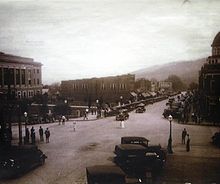 Bustling Downtown Marion in the '20s
 McDowell County Courthouse on Main Street
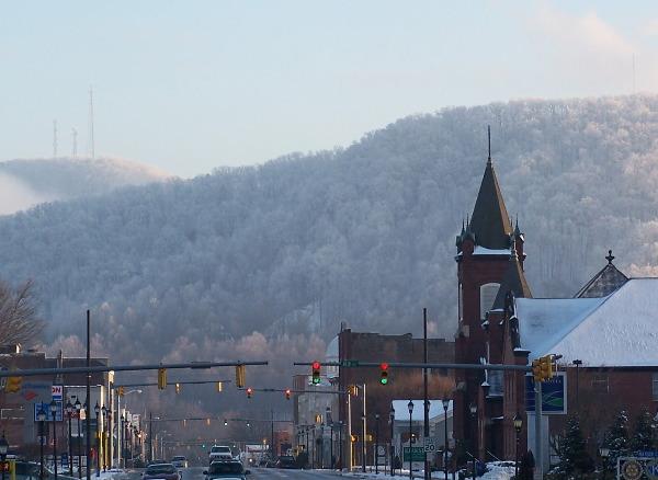
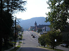 Looking down Main Street in Marion
History
Marion, the county seat of McDowell County, was planned and built on land selected by the first McDowell County Commissioners on March 14, 1844 at the Historic Carson House on Buck Creek. It was not until 1845, however, that the official name of Marion was sanctioned as the county seat by the state legislature. The name of Marion came from Francis Marion, the American Revolutionary War hero, known as the “Swamp Fox” and the man upon whom the movie "The Patriot" was based. Over the years, Marion was also home to Sgt. Daniel Kanipe, one of only two survivors of General Custer's 7th Cavalry that was massacred at the Battle of Little Bighorn. The nearby Lake James is a popular local and tourist attraction, and has been the backdrop for movies such as The Last of the Mohicans and The Hunt for Red October.
Another famous home in Marion is the Joseph McDowell House, built in 1787 by the county's namesake, Joseph McDowell. McDowell played a large role in the Battle of Cowpens when he helped defeat the British in January 1781. McDowell went on to serve as a member of the North Carolina Constitutional Convention in 1788 and was a member of the 3rd United States Congress. Restoration plans are underway to preserve this historic house and ensure that it remains a vital part of Marion's history. In 2010, construction began on a greenway system that will soon stretch from the Joseph McDowell House to the nearby West McDowell Junior High School area.
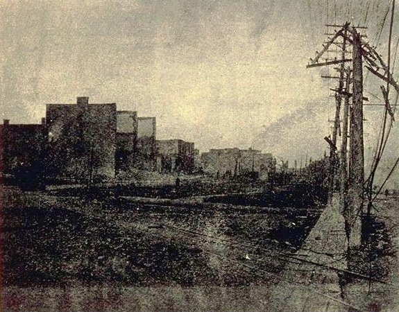
The Big Fire
Until the late 19th century, Main Street was a collection of mostly wooden huts, houses, and buildings. On Sunday morning, November 25, 1894 a fire sprang up in an old building known as the “Ark” located behind the Courthouse. The fire spread to Main Street and rushed down the street at an incredible pace. The wooden buildings were quickly consumed by the enormous inferno. The few brick buildings on Main Street were also gutted, and because there was no public water supply, bucket brigades were hurriedly formed to halt the advance of the fire. It was not enough, however, and most of Main Street was burned to the ground. Showing the resiliency possessed by the citizens, the city came together and took on the rebuilding process, making Marion larger and stronger than before. Today, downtown Marion is listed in the National Register of Historic Places.
Depression Era & Labor Conflict
On Oct. 2, 1929, the McDowell County sheriff and several deputies faced a group of workers outside the fence in front of the Marion Manufacturing Company, whose 600 employees had been on strike for four months. A gunfight quickly ensued between the two groups. Sheriff Oscar Adkins would later swear in court that the strikers opened fire first, although no weapons were ever found on any of the strikers. 36 strikers were shot, 6 mortally, during the confrontation. Sinclair Lewis wrote a syndicated newspaper report entitled "Cheap and Contented Labor: The Picture of the Southern Mill Town." He concluded: "The workers, especially in Marion, have become discouraged. They are hungry, tired, bewildered. They are sick of being shot down. Unless the whoe country encourages them [financially], they will crawl back into the slavery I have sought to picture here." However, since the Great Depression was in full force, little such help would arrive.
Historic District
Eleven structures make up the Main Street Historic District in the downtown area. Four churches, St. John's Episcopal Church (1882), First Baptist (1914), First Presbyterian (1923), and St. Matthews Lutheran (1935); two former hotels, the Eagle Hotel, which survived the 1894 fire, and the Hotel Marianna (1910); a bank on Main Street built in 1903; the McDowell County Courthouse, which was constructed in 1928; the Marion Depot (1860s), which is the oldest surviving depot on the Western Rail Line; the Public Library (1937), which was originally built as a post office; and the Marion Community Building, built in 1937.[6] Projects are currently underway to revitalize the downtown area as well as to maintain and restore the character of the long-standing buildings.
21st Century
Today, Marion stands as a small congenial town at the edge of the Blue Ridge Mountains, "Where Main Street Meets the Mountains." Just off Interstate 40, Marion is located approximately 35 miles east of Asheville and 20 miles west of Morganton.
Marion serves as a gateway from Interstate 40 to many nearby attractions and recreation activities in the Blue Ridge Mountains. A contemporary rest area located on the US 221 bypass west of Marion serves as a welcome center for visitors to the area. The rest area and visitor center is staffed with travel counselors during daylight hours. In addition to providing visitor information, it also has picnic facilities and vending machines on the premises.
Current North Carolina Tar Heels men's basketball coach Roy Williams was born and spent a part of his childhood in Marion. In 2011, the town placed a historical marker downtown in front of City Hall, listing Marion as the birthplace and childhood home of Coach Williams, as well as his many awards and accomplishments. Marion continues to be a city that values athletics, especially the "Fightin' Titans" of McDowell High, whose girl's basketball team won the 1992 N.C. 4A State Championship.
Attractions
There are three parks in Marion operated by the city, the main one being downtown beside the Community Building. In 2010, the City opened the Joseph McDowell Greenway, Phase I. Named in honor of the county's namesake, the greenway follows the flow of the Catawba River. Benches, picnic tables and fishing piers are scattered throughout this first phase with access from Highway 70 between the intersections of Highway 221/226 By-Pass and Roby Conley Road (beside Table Rock rock yard). Dogs are permitted. Historic homes such as the Carson House and the Joseph McDowell House have kept the history of Marion alive for decades, and are open weekdays to the public (the latter currently receiving restoration). The recently restored Marion Depot, the oldest surviving depot on the Western Rail Line, hosts numerous community events each month, and is available for rental to individuals and groups for meetings, receptions, parties, and other functions. Lake James provides fishing, camping, and recreation for McDowell and Burke Counties and is just minutes from Marion. Lake Tahoma, Linville Caverns, Linville Falls, and the Blue Ridge Parkway are also very close to the Marion city limits, and exhibit the diverse scenery of Western North Carolina. There are also several golf courses outside of town, as well as two waterparks and numerous campgrounds. Find a place to stay by going to http://www.visitmcdowell.com.
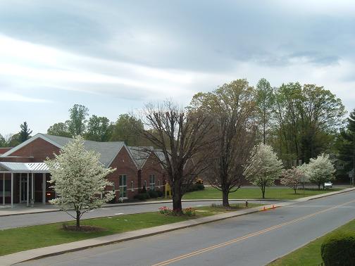
 Marion Elementary
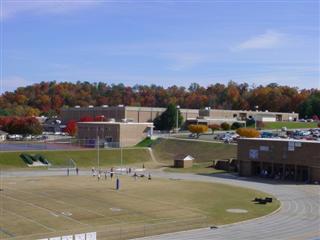
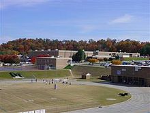 View of McDowell High from the football stadium
Education
The following is a list of schools located in McDowell County:
- Marion Elementary School
- West Marion Elementary School
- Old Fort Elementary School
- Pleasant Gardens Elementary School
- Eastfield Global Magnet School
- Glenwood Elementary School
- North Cove Elementary School
- Nebo Elementary School
- West McDowell Junior High School
- East McDowell Junior High School
- McDowell High School
- McDowell Early College
- Phoenix Academy
- New Manna Christian School
- McDowell Technical Community College
Media
- Newspaper: The McDowell News [7]
- Radio: WBRM - 1250 AM
- The News Bulletin Of McDowell County
References
- ^ "American FactFinder". United States Census Bureau. http://factfinder.census.gov. Retrieved 2008-01-31.
- ^ "US Board on Geographic Names". United States Geological Survey. 2007-10-25. http://geonames.usgs.gov. Retrieved 2008-01-31.
- ^ "Find a County". National Association of Counties. http://www.naco.org/Counties/Pages/FindACounty.aspx. Retrieved 2011-06-07.
- ^ "US Gazetteer files: 2010, 2000, and 1990". United States Census Bureau. 2011-02-12. http://www.census.gov/geo/www/gazetteer/gazette.html. Retrieved 2011-04-23.
- ^ "Weather: Weather for Marion, North Carolina, United States of America". http://www.idcide.com/weather/nc/marion.htm=. Retrieved Feb 13 2009.
- ^ "National Register of Historic Places: McDowell County". NationalRegisterOfHistoricPlacesDotCom (a private website mirroring National Park Service NRIS data). http://www.nationalregisterofhistoricplaces.com/NC/McDowell/state.html. Retrieved 2009-02-12.
- ^ "McDowell News". http://www.mcdowellnews.com/. Retrieved 2009-02-14.
External links
Municipalities and communities of McDowell County, North Carolina County seat: MarionCity Marion
Town CDP Unincorporated
communitiesGlenwood | Linville Falls‡ | Little Switzerland‡ | Nebo | Pleasant Gardens | Providence
Footnotes ‡This populated place also has portions in an adjacent county or counties
Categories:- Cities in North Carolina
- Populated places in McDowell County, North Carolina
- County seats in North Carolina
- Populated places established in 1844


Wikimedia Foundation. 2010.