- Old Fort, North Carolina
-
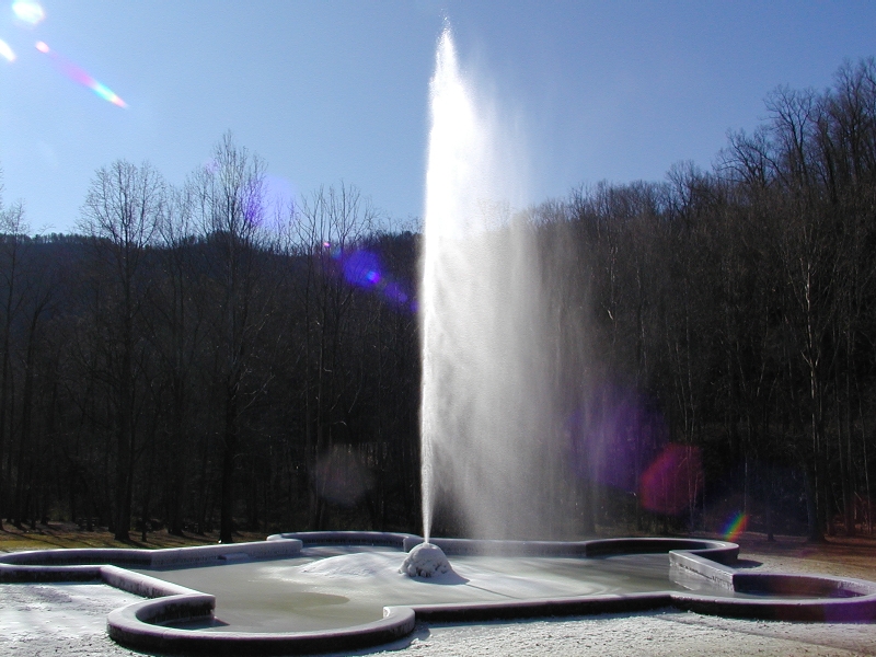
Old Fort, North Carolina — Town — Andrews Geyser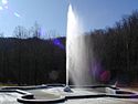
Motto: Once you get here you never want to leave Location of Old Fort, North Carolina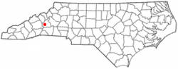
Coordinates: 35°37′46″N 82°10′45″W / 35.62944°N 82.17917°WCoordinates: 35°37′46″N 82°10′45″W / 35.62944°N 82.17917°W Country United States State North Carolina County McDowell Area – Total 1.3 sq mi (3.2 km2) – Land 1.3 sq mi (3.2 km2) – Water 2.0 sq mi (0.0 km2) Elevation 1,447 ft (440 m) Population (2008) – Total 959 – Density 769.4/sq mi (297.1/km2) Time zone Eastern (EST) (UTC-5) – Summer (DST) EDT (UTC-4) ZIP code 28762 Area code(s) 828 FIPS code 37-48920[1] GNIS feature ID 1014094[2] Website www.visitoldfort.com Old Fort is a town in McDowell County, North Carolina, United States. The population was 959 at the 2008 estimated census. The town is well known for its weekly Mountain Music concerts, attracting large audiences and many musicians from the surrounding areas to Old Fort's downtown each Friday at 7:30 p.m. Concerts are performed in the historic Rockett Building and admission is free. In 2010, the N.C. Wildlife Commission added it to their list of N.C. Mountain Heritage Trout Towns. This designation includes a special $5.00 fishing license that is active for three days and good for use in any of the state's mountain trout towns. In downtown Old Fort, the section of Mill Creek bordering Mountain Gateway Museum at 102 Water Street is a public portion of this stream and is a delayed harvest stream.
Old Fort festivals include popular annual events such as Pioneer Day hosted by Mountain Gateway Museum on the last Saturday in April. The N.C. Gold Festival is held the first Friday/Saturday in June, also on the grounds of Mountain Gateway Museum. Old Fort's Chamber of Commerce continues their annual event with Octoberfest taking place the first weekend in October, again on the grounds of Mountain Gateway Museum. This is a N.C. State museum and is part of the N.C. Dept. of Cultural Resources.
Old Fort has several attractions, including Andrews Geyser and the Arrowhead Monument. The granite arrowhead was built as a symbol of peace between the two Native American tribes; the Cherokee and Catawba. At the dedication ceremony in 1930, thousands of on-lookers gathered at town square to see the 14 ft. rose granite arrowhead sitting atop a natural stone base. The Arrowhead serves as the focal point for the town, which is traversed by United States Highway 70 and Interstate 40. Additionally, residents of Old Fort are reconstructing Davidson Fort, the Revolutionary War fort that gave Old Fort its current name, it was first known as Catawba Vale. Catawba Falls, the largest waterfall in McDowell County and the headwaters of the Catawba River, is located just outside the town limits. In 2009, a partnership between the N.C. DOT, the local county and town governments with assistance from the U.S.F.S. and the local trails association, a portion of Old Highway 70 reopened to bicycle and foot traffic. Point Lookout Trail is a popular paved trail ascending almost 1,000 feet through the Swannanoa Gap in just under 4 miles. Point Lookout was once a popular tourist stop for travelers driving west to Asheville and the Smokey Mountains.
Lodging information, directions to these attractions and an event calendar are available at http://www.visitoldfort.com.
Contents
Climate
Old Fort, NC temperatures average in the 80s in the summer and in the 20s for lows in the winter.
The warmest month of the year is July with an average maximum temperature of 86.7 degrees Fahrenheit, while the coldest month of the year is January with an average minimum temperature of 25.5 degrees Fahrenheit.
Temperature variations between night and day tend to be moderate during summer with a difference that can reach 21 degrees Fahrenheit, and moderate during winter with an average difference of 23 degrees Fahrenheit.
 Snow in Old Fort, North Carolina caused by the 2009 Blizzard
The annual average precipitation at Old Fort is 54.01 Inches. Rainfall in is fairly evenly distributed throughout the year. The wettest month of the year is March with an average rainfall of 5.59 Inches.
Geography
Old Fort is located at 35°37′46″N 82°10′45″W / 35.62944°N 82.17917°W (35.629541, -82.179178)[3].
According to the United States Census Bureau, the town has a total area of 1.2 square miles (3.1 km2), all of it land.
Demographics
As of the census[1] of 2000, there were 963 people, 441 households, and 269 families residing in the town. The population density was 769.4 people per square mile (297.5/km²). There were 496 housing units at an average density of 396.3 per square mile (153.2/km²). The racial makeup of the town was 79.13% White, 17.24% African American, 0.21% Native American, 0.10% Asian, 0.83% from other races, and 2.49% from two or more races. Hispanic or Latino of any race were 1.66% of the population.
There were 441 households out of which 25.9% had children under the age of 18 living with them, 37.9% were married couples living together, 14.5% had a female householder with no husband present, and 39.0% were non-families. 35.8% of all households were made up of individuals and 16.1% had someone living alone who was 65 years of age or older. The average household size was 2.18 and the average family size was 2.76.
In the town the population was spread out with 23.3% under the age of 18, 6.1% from 18 to 24, 27.0% from 25 to 44, 23.6% from 45 to 64, and 20.0% who were 65 years of age or older. The median age was 40 years. For every 100 females there were 91.5 males. For every 100 females age 18 and over, there were 87.1 males.
The median income for a household in the town was $25,000, and the median income for a family was $28,854. Males had a median income of $25,347 versus $21,058 for females. The per capita income for the town was $20,782. About 8.7% of families and 17.0% of the population were below the poverty line, including 20.2% of those under age 18 and 15.3% of those age 65 or over.
References
- ^ a b "American FactFinder". United States Census Bureau. http://factfinder.census.gov. Retrieved 2008-01-31.
- ^ "US Board on Geographic Names". United States Geological Survey. 2007-10-25. http://geonames.usgs.gov. Retrieved 2008-01-31.
- ^ "US Gazetteer files: 2010, 2000, and 1990". United States Census Bureau. 2011-02-12. http://www.census.gov/geo/www/gazetteer/gazette.html. Retrieved 2011-04-23.
External links
Municipalities and communities of McDowell County, North Carolina City 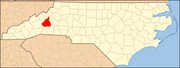
Town Old Fort
CDP Unincorporated
communitiesGlenwood | Linville Falls‡ | Little Switzerland‡ | Nebo | Pleasant Gardens | Providence
Footnotes ‡This populated place also has portions in an adjacent county or counties
Categories:- Populated places in McDowell County, North Carolina
- Towns in North Carolina


Wikimedia Foundation. 2010.