- Wappinger, New York
-
Wappinger, New York — Town — Downtown Wappingers Falls - Historic District Location within the state of New York
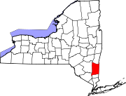
 Wappinger, New York
Coordinates: 41°35′20″N 73°53′59″W / 41.58889°N 73.89972°W Country United States State New York County Dutchess Government – Type Town Council – Town Supervisor Christopher J. Colsey (R) – Town Council Members' ListArea – Total 28.6 sq mi (74.1 km2) – Land 27.3 sq mi (70.6 km2) – Water 1.3 sq mi (3.4 km2) Elevation 197 ft (60 m) Population (2000) – Total 26,274 – Density 963.3/sq mi (371.9/km2) Time zone Eastern (EST) (UTC-5) – Summer (DST) EDT (UTC-4) ZIP code 12590 Area code(s) 845 FIPS code 36-78157[1] GNIS feature ID 0979595[2] Wappinger (although most locals call it Wappingers) is a town of in Dutchess County, New York in the United States. The population was 26,274 at the 2000 census. The name is derived from the Wappani Indians that inhabited the area. The name derives from the Algongian word for inhabitants of the eastern land.
The Town of Wappinger is located in the southern part of the county. US Route 9 passes through the town.
A portion of the village of Wappingers Falls is located within the town of Wappinger.
Contents
History
The town was first settled around 1659. Wappinger was formed from the Town of Fishkill.
The population of the Town of Wappinger was 4,389 in 1900.
Geography
According to the United States Census Bureau, the town has a total area of 28.6 square miles (74 km2), of which, 27.3 square miles (71 km2) of it is land and 1.3 square miles (3.4 km2) of it (4.62%) is water.
Part of the west town line is located at the Hudson River, and borders Orange and Ulster Counties.
Demographics
As of the census[1] of 2000, there were 26,274 people, 9,793 households, and 6,992 families residing in the town. The population density was 963.3 people per square mile (372.0/km²). There were 10,144 housing units at an average density of 371.9 per square mile (143.6/km²). The racial makeup of the town was 86.18% White, 4.96% African American, 0.24% Native American, 4.29% Asian, 0.02% Pacific Islander, 2.44% from other races, and 1.88% from two or more races. Hispanic or Latino of any race were 7.87% of the population.
There were 9,793 households out of which 34.3% had children under the age of 18 living with them, 58.1% were married couples living together, 9.4% had a female householder with no husband present, and 28.6% were non-families. 23.1% of all households were made up of individuals and 6.2% had someone living alone who was 65 years of age or older. The average household size was 2.67 and the average family size was 3.17.
In the town the population was spread out with 25.4% under the age of 18, 7.6% from 18 to 24, 32.5% from 25 to 44, 24.1% from 45 to 64, and 10.4% who were 65 years of age or older. The median age was 36 years. For every 100 females there were 98.8 males. For every 100 females age 18 and over, there were 96.2 males.
The median income for a household in the town was $58,079, and the median income for a family was $66,273. Males had a median income of $49,007 versus $31,444 for females. The per capita income for the town was $25,817. About 3.2% of families and 4.1% of the population were below the poverty line, including 4.1% of those under age 18 and 4.9% of those age 65 or over.
Communities and locations in Wappinger
- Chelsea – A hamlet in the southeast part of the town near the Hudson River.
- Didell – A hamlet in the northeast part of the town.
- Dutchess County Airport (POU) – An airport in the northwest part of the town.
- Hughsonville – A hamlet south of Wappingers Falls.
- Myers Corner – A hamlet on County Route 93.
- New Hackensack – Where county routes 94, 104 and state route 376 intersect near Dutchess County Airport.
- Swartoutville – A location in the southeast part of the town.
- Wappingers Falls – Part of the Village of Wappingers Falls is in eastern part of the town.
- Rockingham Farms – Large neighborhood at White's corner and home of the Rockingham Robins.
References
- ^ a b "American FactFinder". United States Census Bureau. http://factfinder.census.gov. Retrieved 2008-01-31.
- ^ "US Board on Geographic Names". United States Geological Survey. 2007-10-25. http://geonames.usgs.gov. Retrieved 2008-01-31.
External links
Municipalities and communities of Dutchess County, New York Cities Beacon | Poughkeepsie
Towns Amenia | Beekman | Clinton | Dover | East Fishkill | Fishkill | Hyde Park | LaGrange | Milan | North East | Pawling | Pine Plains | Pleasant Valley | Poughkeepsie | Red Hook | Rhinebeck | Stanford | Union Vale | Wappinger | Washington
Villages CDPs Other
hamletsAnnandale-on-Hudson | Barrytown | Boston Corner‡ | Chelsea | Linden Acres | Mabbettsville | New Hamburg | Pleasant Plains | Quaker Hill | Rhinecliff | Salt Point | Shekomeko | Sylvan Lake | Van Keurens | Verbank | Wassaic
Footnotes ‡This populated place also has portions in an adjacent county or counties
Coordinates: 41°35′10″N 73°55′01″W / 41.58611°N 73.91694°W
Categories:- Towns in New York
- Poughkeepsie–Newburgh–Middletown metropolitan area
- Populated places in Dutchess County, New York
- Place names in New York of Native American origin
- Wappinger, New York


Wikimedia Foundation. 2010.