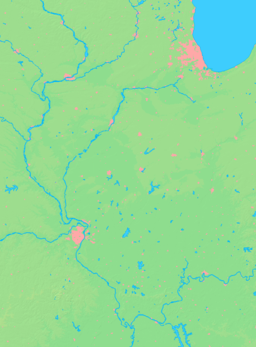
- Maeystown, Illinois
-
Maeystown Village Name origin: Jacob Maeys, early settler Country United States State Illinois County Monroe Precinct 23 Coordinates 38°13′32″N 90°14′1″W / 38.22556°N 90.23361°W Area 0.3 sq mi (1 km2) - land 0.3 sq mi (1 km2) Population 148 (2000) Density 487.3 / sq mi (188 / km2) Founded 1904 Date March 28 Timezone CST (UTC-6) - summer (DST) CDT (UTC-5) Postal code 62256 Area code 618 Wikimedia Commons: Maeystown, Illinois Maeystown is a village in Monroe County, Illinois, United States. The population was 148 at the 2000 census.
Contents
Geography
According to the United States Census Bureau, the village has a total area of 0.3 square miles (0.78 km2), all of it land.
History
The history of the tract of land where what is now Maeystown is situated, began sometime after 1782, when a soldier of the American Revolution, one James McRoberts, staked a claim of 100 acres (Survey 704; Claim 316), he subsequently left the Illinois Territory for Tennessee, where he married Mary Fletcher-Harris, and returned in 1797, adding another 100 acres (0.40 km2) to his holdings. It was on this second tract that he built his home, from cedar logs, and here he raised his family. McRoberts fathered ten children, the eldest, Samuel McRoberts, was the first native-born Illinoisan to serve in the United States Senate.
Maeystown may be said to have begun its growth as a town in the year 1852, when Jacob Maeys here built a sawmill on what had become known as McRoberts Meadow, which he purchased in 1848. For a year after its construction the mill remained idle on account of there not being sufficient water to drive it. Steam engines were then put in place, and the mill successfully operated. The first store was opened in 1858 by Jacob Maeys in partnership with Judge Abraham Poston. By this time some half a dozen houses had been erected in the place. A town had been surveyed and laid off in 1856 by Maeys, and called Maeysville. A post-office was established in 1860 which changed the name to Maeystown with Jacob Maeys appointed as first postmaster.[1]
Demographics
As of the census[2] of 2000, there were 148 people, 54 households, and 44 families residing in the village. The population density was 487.3 people per square mile (190.5/km²). There were 60 housing units at an average density of 197.6 per square mile (77.2/km²). The racial makeup of the village was 97.97% White, 1.35% Asian, and 0.68% from two or more races. Hispanic or Latino of any race were 1.35% of the population.
There were 54 households out of which 35.2% had children under the age of 18 living with them, 70.4% were married couples living together, 5.6% had a female householder with no husband present, and 18.5% were non-families. 16.7% of all households were made up of individuals and 14.8% had someone living alone who was 65 years of age or older. The average household size was 2.74 and the average family size was 3.09.
In the village the population was spread out with 25.0% under the age of 18, 10.8% from 18 to 24, 29.1% from 25 to 44, 18.9% from 45 to 64, and 16.2% who were 65 years of age or older. The median age was 37 years. For every 100 females there were 111.4 males. For every 100 females age 18 and over, there were 94.7 males.
The median income for a household in the village was $40,417, and the median income for a family was $43,750. Males had a median income of $28,750 versus $16,250 for females. The per capita income for the village was $14,432. There were 5.0% of families and 4.1% of the population living below the poverty line, including no under eighteens and 11.1% of those over 64.
Location
References
- ^ Combined History of Randolph, Monroe and Perry Counties, Illinois, J. L. McDonough & Co., Philadelphia, 1883
- ^ "American FactFinder". United States Census Bureau. http://factfinder.census.gov. Retrieved 2008-01-31.
- ^ "US Gazetteer files: 2010, 2000, and 1990". United States Census Bureau. 2011-02-12. http://www.census.gov/geo/www/gazetteer/gazette.html. Retrieved 2011-04-23.
Illinois Metro-East region Counties 
Major Cities (10,000+) Alton | Belleville | Cahokia | Centralia | Collinsville | East St. Louis | Edwardsville | Fairview Heights | Glen Carbon | Godfrey | Granite City | O'Fallon | Swansea | Wood RiverCities (5,000-10,000) Bethalto | Centreville | Columbia | East Alton | Highland | Jerseyville | Maryville | Mascoutah | Pontoon Beach | Shiloh | Staunton | Troy | Washington Park | WaterlooCities (1,000-5,000) Alorton | Aviston | Beckemeyer | Breese | Brighton | Carlyle | Caseyville | Dupo | Fairmont City | Freeburg | Germantown | Hartford | Lebanon | Madison | Marissa | Millstadt | New Athens | New Baden | Rosewood Heights | Roxana | Smithton | South Roxana | Trenton | Valmeyer | Venice | WamacInterstates in the Metro-East Airports/Military Bases List of Colleges in the Metro-East Sports teams based in the Metro East Municipalities and communities of Monroe County, Illinois Cities Villages Precincts 1 | 2 | 3 | 4 | 5 | 6 | 7 | 8 | 9 | 10 | 11 | 12 | 13 | 14 | 15 | 16 | 17 | 18 | 19 | 20 | 21 | 22 | 23 | 24 | 25 | 26 | 27
Unincorporated
communitiesAmes | Burksville | Burksville Station | Chaflin Bridge | Foster Pond | Fountain | Harrisonville | Madonnaville | Merrimac | Monroe City | New Hanover | Renault | St. Joe | Tipton | Wartburg
Footnotes ‡This populated place also has portions in an adjacent county or counties
Categories:- Populated places in Monroe County, Illinois
- Villages in Illinois
- Populated places established in 1904
- Metro-East
Wikimedia Foundation. 2010.


