- Anaheim Hills, Anaheim, California
-
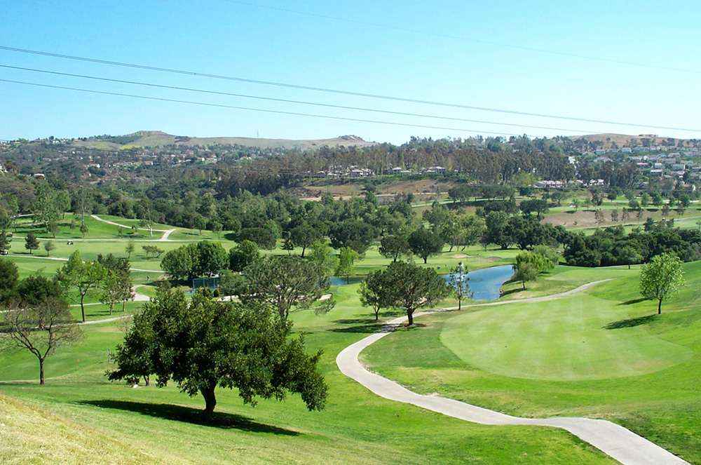
Anaheim Hills — District of Anaheim — A view of Anaheim Hills from the Anaheim Hills Golf Club Location within Anaheim and Northern Orange County
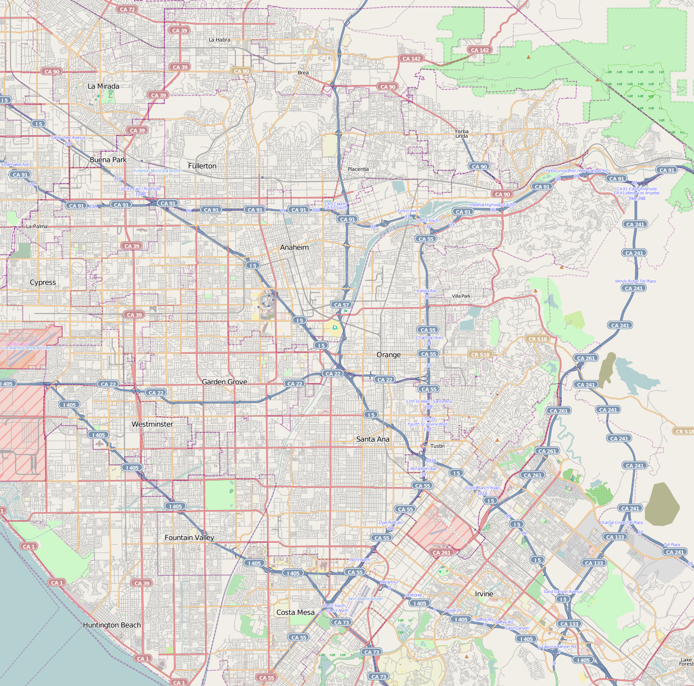
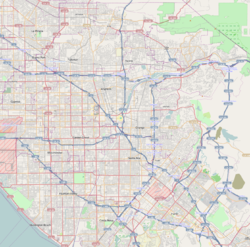
 Anaheim Hills
Coordinates: 33°50′40″N 117°46′35″W / 33.84444°N 117.77639°W Country United States State California County Orange City Anaheim Anaheim Hills is a planned community encompassing the eastern portions of the city of Anaheim, in Orange County, California.[1]
Contents
Location
Anaheim Hills is located just south of Yorba Linda, California, opposite the 91 freeway at Imperial Highway. The western border is the 55 freeway opposite the city of Orange, California. On the northeast side the community extends past Gypsum Canyon, bordered by unincorporated areas of Orange County and the Cleveland National Forest (east). To the south is the Santa Ana foothills opposite the community of Villa Park, California.[2][3]
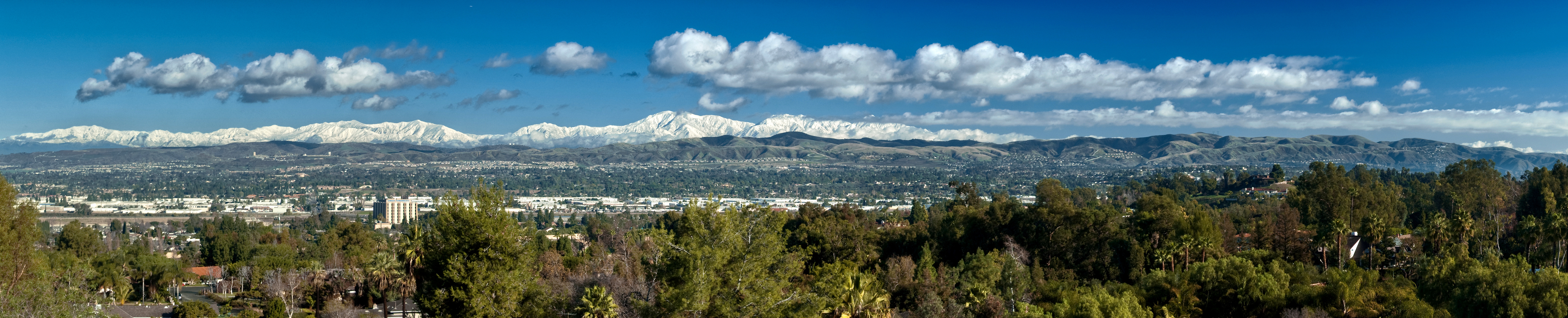
View from Anaheim Hills
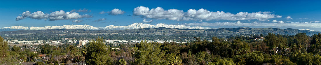

View North History
Prior to the development, a few scattered low density neighborhoods existed in the area including Peralta Hills and Mohler Loop (tracts which still exist today) that were developed primarily in the 1940s and 1950s. The remaining portions of Anaheim Hills were primarily developed in the 1970s after rancher and land owner Louis Nohl sold his massive parcel in the foothills east of Anaheim. The area was taken over by Texaco Industries in 1970 when the company announced plans to develop an expansive and upscale master planned community of 7,000 homes, estates, and townhomes. The original master plan included a proposal for three new lakes with high density condominiums clustered around these water features. The initial master plan proved to be unsustainable due to the topography and geology of the area.[4] Construction of the community began in 1971 and was branded as a rural enclave and alternative to the more dense subdivisions emerging in the Orange County basin with homes on large lots, hiking trails, a golf course, and low densities. Anaheim Hills is the first residential development to utilize "Landform Grading."[5] The community grew quickly and by 1974 the Orange Unified School District had constructed a high school to serve the growing community.[6] In 1990, the city of Anaheim approved several large developments surrounding Weir Canyon Road (East Hills and The Highlands) expanding the community toward the 241 toll road. In 2007, the Irvine Company received approval for additional 2,500 homes just east of the 241 toll road on a parcel of land it has owned for over fifty years. This community will be the last major development in Anaheim Hills.[7]
Neighborhoods
Anaheim Hills consists of several planned neighborhoods, including the following:[8]
- Amber Lane
- Anaheim Foothills
- Anaheim Ridge Estates
- Bauer Ranch
- Belsomet
- Camino Grande Villas
- Canyon Heights
- Canyon View Estates
- Canyon Hills
- Canyon Pointe
- Canyon Rim/Sunset Ridge
- Canyon Terrace
- Canyon Terrace Estates
- Canyon Terrace Townhomes
- Canyon View Estates
- Canyon View Terrace
- Cape Cod Village
- Carriage Hills
- Crown Pointe
- Carriage Hills
- Copa De Oro
- Embassy Pointe
- East Hills
- Feather Hill
- Firenze
- Goldfinch Way
- Haven Hill
- Hidden Canyon Estates
- Horizons
- Hunters Pointe
- Kings Meadow
- Morningview
- Mohler Loop
- Mountain Park
- Nohl Crest
- Old Bridge
- Quail Ridge
- Oak Hills
- Peralta Hills
- Pointe Quissett
- Prado Ridge Estates
- Prado Woods
- Quail Ridge
- Quail Vista
- Renaissance
- Ridge View
- Rimcrest Villas
- Ridgeview
- Rim Crest Villas
- Robin Hill I
- Robin Hill II
- Royal Circle Village
- Scout Trail
- Silverbrook Estates
- Singingwood Hills
- Skygate
- Summit Pointe
- Summit Terrace
- Sycamore Canyon
- Stonegate Hills
- The Highlands
- The Summit
- The Palms
- Windsor Terrace
- View Pointe
- Vista Del Sol
- Village at Fiesole
- Villa Palatino
- Window Hill
- Windsor Terrace
- Westridge
- Yorba Woods
Demographics
2010
The 2010 United States Census reported that Anaheim Hills had a population of 55,036. The racial makeup of Anaheim Hills was 39,728 (72.2%) White, 1,099 (2.0%) African American, 158 (0.3%) Native American, 9,414 (17.1%) Asian, 103 (0.2%) Pacific Islander, 2,003 (3.6%) from other races, and 2,531 (4.6%) from two or more races. Hispanic or Latino of any race were 6,054 persons (12.1%).[9] Anaheim Hills has a median household income of $123,260.[10]
Government
The 92807 zip code serves the western portion and other parts of East Anaheim while the 92808 zip code serves the eastern portion, and although residents typically identify themselves as living in the community of "Anaheim Hills" (as opposed to the city of "Anaheim"), the United States Postal Service considers only the larger incorporated city's name of "Anaheim" as acceptable.[11] Anaheim Hills is served by Anaheim Fire Department Stations 9 and 10.[12] The community is served by two of the City of Anaheim's libraries, the Canyon Hills Library and the East Hills Library.[13]
Twenty three community associations are within Anaheim Hills, led by the Anaheim Hills Planned Community Association, which oversees the entire community of Anaheim Hills. Two councils represent the community, the Canyon Hills Community Council and the Anaheim Hills Citizens Coalition.[citation needed]
The community is listed under the Canyon and Hill General Plan Designations within the City of Anaheim, and thus the "Canyon Hills" name designated to the area for several of the sports teams located within the area.
Politics
Anaheim Hills is part of the 42nd Congressional District, which is represented in the United States House of Representatives by Republican Gary Miller. In the California State Legislature, the community is represented by Senator Mimi Walters (a Republican from the 33rd Senate District) and Assemblyman Curt Hagman (a Republican from the 60th Assembly District). On the Orange County Board of Supervisors, Anaheim Hills is represented by the 3rd District's Bill Campbell.
Education
The Anaheim Hills school system mostly operates under the Orange Unified School District.
Elementary schools
- Canyon Rim Elementary School | 1090 The Highlands • Anaheim, CA 92808
- Anaheim Hills Elementary School | 6450 East Serrano • Anaheim, CA 92807
- Crescent Primary School | 5125 Gerda Drive • Anaheim, CA 92807
- Crescent Intermediate School | 5001 E. Gerda Drive • Anaheim, CA 92807
- Nohl Canyon Elementary School | 4100 Nohl Ranch Road • Anaheim, CA 92807
- Running Springs Elementary School | 8670 Running Springs Drive • Anaheim, CA 92808
- Imperial Elementary School | 400 S. Imperial Hwy. • Anaheim, CA 92807
Middle schools
- El Rancho Charter School | 181 South Del Giorgio Road • Anaheim, CA 92808
High schools
- Canyon High School | 220 S. Imperial Hwy • Anaheim, CA 92807
Specialty schools
- Canyon Hills School | 260 S. Imperial Highway • Anaheim, CA 92807
- Hillsborough School | 191 Old Springs Road • Anaheim, CA 92808
- Fairmont Private School | 5310 East La Palma Ave. • Anaheim, CA 92807
- Hephatha School | 5900 E. Santa Ana Canyon Road • Anaheim, CA 92807
Disasters
Landslides and wildfires have occurred in Anaheim Hills during recent years. Santa Ana Winds are a major factor in fueling the wildfires in the area.[14]
Landslides
A landslide in January 1993, destroyed over 30 homes and impacted over 200 others.[citation needed]
During the winter of 2005, a twenty day rain event in Orange County led to not only flooding, but a landslide that caused the unstable hillside along the street of Ramsgate Drive to give way.[15][16] Three homes and a private street were destroyed in the landslide.
Wildfires
The 1982 Gypsum Canyon fire
The first major wildfire since the development of Anaheim Hills occurred in October 1982. Santa Ana Winds drove a fire that ended up causing $50 million in property damage.[17] The fire burned 17,000 acres (69 km2) and destroyed 14 homes.[18]
The 2006 Sierra Peak wildfire
A wildfire broke out on February 7, 2006 in the Cleveland National Forest, the National Forest that separates Anaheim Hills from the Riverside County Border. This fire grew and firefighters were unable to contain it due to 20 mph (32 km/h) winds and 80 °F (27 °C) temperatures. On the morning of February 9, 2006, the fire worsened, which forced the evacuation of a large section of Anaheim Hills. Nearly 75% of the Community of Anaheim Hills was either under voluntary or mandatory evacuation.[citation needed] This resulted in the closing of two local elementary schools for two days, and several other schools served as shelters for the evacuees during the day.[citation needed]
The fire burned over 10,000 acres (40 km2) of land and caused significant natural resource damage by burning a recovering Tecate cypress grove.[citation needed] It was later determined that a controlled blaze set by the Cleveland National Forest started the fire, and the National Forestry Service was forced to pay the cost from the firefighting efforts.[citation needed]
The 2007 Windy Ridge Fire
On Sunday, March 11, 2007 at 07:53 AM (PST), a fire possibly started by a stolen vehicle on the southbound 241 Windy Ridge Toll Plaza, destroyed over 2,000 acres (8.1 km2) in Anaheim Hills and the city of Orange.[citation needed] Due to winds moving as fast as 35 mph (56 km/h), an estimated 2,500 homes were evacuated, with 2 injuries reported.[citation needed]
The 2008 Freeway Complex Fire
The Freeway Complex Fire broke out in the Corona area at around 9am[19] on Saturday, November 15, 2008,[20] which burned south-westerly into Anaheim Hills, forcing the immediate evacuation of 3,100 homes in the Weir Canyon area. In total, more than 200 residences were destroyed by the fire, of which fourteen houses and 86 apartments were burned within Anaheim Hills.[21]
Notable residents
Anaheim Hills is home to many notable residents, many of whom are affiliated with local major league sports teams. Other significant executives, musicians, and politicians call Anaheim Hills home.
- Rod Carew, Major League Baseball hall of famer[22]
- Kevin Davis, CEO and president of Bristol Farms[23]
- Danielle Fishel, actress[24]
- Ashley Force, drag racer[25]
- Jim Fregosi, former Los Angeles Angels player[26] and Philadelphia Phillies manager
- Robby Gordon, Nascar and off-road racer [27]
- Vladimir Guerrero, Baltimore Orioles player[28]
- Chuck Norris- actor [29]
- Craig Johnson, Anaheim Ducks player[30]
- Adam Kennedy, Major League Baseball player[31]
- David C. Leestma, NASA astronaut[32]
- Donnie Moore, deceased Major League Baseball relief pitcher[33]
- Glenn Hoffman, Third-base coach to San Diego Padres
- Carlos Cavazo, guitarist in Quiet Riot
- Gene Kan, creator of infrasearch.com[34]
- Jefferson Thomas, former accountant for the United States Department of Defense[35]
- Ken Forsch, former Major League baseball pitcher and assistant General Manager of the Los Angeles Angels of Anaheim[36]
- Kerry King, founder of the thrash metal band Slayer[37]
- Julian Whitaker, an American physician, author, practitioner of alternative medicine, and founder of the Whitaker Wellness Institute[38]
- Dave Farrish, Anaheim Ducks Assistant Head Coach
- Sean Skahan, Anaheim Ducks Conditioning Coach
- Brian Hayward, Anaheim Ducks broadcaster and Olympic broadcaster
- Anthony Vernaglia, University of Notre Dame linebacker[39]
- Grant Green, active USC Trojans baseball player[40]
- Christian Colon, San Diego Padres baseball player [41]
- Casey Janssen, Major League Baseball player for the Toronto Blue Jays[42]
- Schae Harrison, soap opera actress[43]
- Tom Daly, politician
- John F. Seymour, former United States Senator
- Eden Espinosa, actress, "Wicked"
- Tony Kanal, bassist, No Doubt
- Mark Langston, major league baseball pitcher for the Los Angeles Angels
- Tony Lewis, European-based singer/songwriter
- Milo Ventimiglia, actor
- Steve Soto, musician, The Adolescents
- Brandon Baker, child actor [44]
- Marie Wilson, musician
- Jack Lindquist, former president of Disneyland
- Jayson Williams, former basketball player and indoor lacrosse player
- Rodger Ward, deceased racecar driver
- Joseph M. Acaba, NASA astronaut
- Stefan Lessard, musician and bassist in the Dave Matthews Band
- Jason Peoples, reality show personality
- Kitana Baker, model and commercial actress[citation needed]
- Chris Draft, football player
- Suzanne Enoch, author
- Debra Maffett, 1983 Miss America
- Hank Edwards, Major League Baseball player
- Al Trost, retired soccer player
- John Sewell, English Football League player and coach
- Chris Snitko, former soccer player
- Harry Sidhu, politician, California Senate candidate
- Dru Sjodin, made notable by her murder at the University of North Dakota
- Anthony Maglica, owner, founder of Maglite[45]
- Alli Mauzey, actress, "Wicked"
- Deacon Jones, football player [46]
- Rebecca Black, teen pop singer[47]
- Alana Lee Hamilton, teen pop singer[48]
- Mike Brown, Los Angeles LakersHead Coach[49]
References
- ^ City of Anaheim General Plan - Land Use Element - See "The Hill and Canyon Area" under "Goals and Policies" for a map and description of the Anaheim Hills area.
- ^ Wildland Defense Section
- ^ Brea, Yorba Linda and Anaheim Hills California real estate listings, home buying, selling and relocation information - NUMBER1EXPERT(tm)
- ^ Landforming: an environmental ... - Google Books. Books.google.com. http://books.google.com/books?id=tvxlMYm6nWYC&pg=PA327&dq=anaheim+hills&hl=en&ei=pMBBTar4KpK6sQOhrZHfCg&sa=X&oi=book_result&ct=result&resnum=11&ved=0CGQQ6AEwCg#v=onepage&q&f=true. Retrieved 2011-03-22.
- ^ Orange Coast Magazine - Google Books. Books.google.com. http://books.google.com/books?id=T10EAAAAMBAJ&pg=PA79&dq=anaheim+hills+grading&hl=en&ei=xsizTO_gB5K2sAO77sn5Bw&sa=X&oi=book_result&ct=result&resnum=3&ved=0CEAQ6AEwAg#v=onepage&q=anaheim%20hills%20grading&f=false. Retrieved 2011-03-22.
- ^ [1][dead link]
- ^ "City of Anaheim - Mountain Park". Anaheim.net. http://www.anaheim.net/article.asp?id=1225. Retrieved 2011-03-22.
- ^ http://www.anaheim.net/citydepartments/planning/specific_plans/highland/1-TOCSection1-Introduction.pdf
- ^ "2010 Census P.L. 94-171 Summary File Data". United States Census Bureau. http://www2.census.gov/census_2010/01-Redistricting_File--PL_94-171/California/.
- ^ [2]
- ^ U.S. Postal Service ZIP Code Lookup
- ^ Anaheim Fire Department - Anaheim Hills Station
- ^ City of Anaheim - Public Library Locations
- ^ California brush fire burns homes
- ^ Geotimes - April 2005 - Dream homes slip away
- ^ News: North: Anaheim Hills house on verge of collapsing - OCRegister.com
- ^ On This Day In Weather History: 4/21/08
- ^ Orange County Register: Fires in OC
- ^ Associated Press - New Calif. wildfire breaks out in Orange County
- ^ My Fox Los Angeles - Evacuations Due to Fire in Corona, Yorba Linda, Anaheim Hills
- ^ OC Register: By the Numbers: Anaheim Hills, Corona, Yorba Linda and Brea Fires
- ^ "Carew's Hopes Fade". The New York Times. 1986-05-13. http://query.nytimes.com/gst/fullpage.html?res=9A0DE4DF133CF930A25756C0A960948260. Retrieved 2008-06-23.
- ^ Santa Monica Mirror: Bristol Farms Moving Into Brentwood Mart
- ^ Skye, Kelli (2009-05-20). "Danielle Fishel dishes on style". Orange County Events. http://www.orangecounty.com/articles/don-341-fashion-love.html. Retrieved 2011-03-22.
- ^ Ashley Force Racing
- ^ The 100 Greatest Angels: # 8 Jim Fregosi - Halos Heaven
- ^ [3][dead link]
- ^ Arangure Jr., Jorge (September 12, 2007). "Who's afraid of a little change?". ESPN The Magazine. ESPN. http://sports.espn.go.com/mlb/news/story?id=3015574. Retrieved May 1, 2010.
- ^ Mueller, Mark (2006-08-13). "Hills of wealth". Orange County Business Journal. http://www.allbusiness.com/north-america/united-states-california-metro-areas/4082799-1.html. Retrieved 2006-08-13.
- ^ The Canyon's Allure
- ^ http://pressbox.mlb.com/pressbox/downloads/y2005/postseason/lcs/laa_lcs_roster.pdf
- ^ NASA biography
- ^ A few paragraphs down describing his Anaheim Hills estate
- ^ http://www.xent.com/FoRK-archive/2001.02/0365.html
- ^ NBA: News & Events
- ^ http://pressbox.mlb.com/pressbox/downloads/y2007/ana/front_office.pdf
- ^ SLAYERIZED :: The Ultimate Slayer Fan Site
- ^ Along Route '66- April 2003
- ^ STATS Hosted Solution
- ^ usctrojans.com - Baseball
- ^ Welcome to USA Baseball: Junior National Team: Roster
- ^ Scout.com: Casey Janssen Profile
- ^ Schae Harrison - Darla - Bold and Beautiful - B&B
- ^ Brandon Baker - TV.com
- ^ Volpe, Michael (August 2, 2010). "OC's Wealthiest". Orange County Business Journal 33 (31): 31.
- ^ [4][dead link]
- ^ O.C.'s Rebecca Black Talks About Friday. Orange County Register.
- ^ O.C. teen promoted as 'the next Rebecca Black'. Orange County Register.
- ^ [5]. Orange County Register.
External links
Coordinates: 33°50′40″N 117°46′35″W / 33.84444°N 117.77639°W
Municipalities and communities of Orange County, California Cities Aliso Viejo | Anaheim | Brea | Buena Park | Costa Mesa | Cypress | Dana Point | Fountain Valley | Fullerton | Garden Grove | Huntington Beach | Irvine | La Habra | La Palma | Laguna Beach | Laguna Hills | Laguna Niguel | Laguna Woods | Lake Forest | Los Alamitos | Mission Viejo | Newport Beach | Orange | Placentia | Rancho Santa Margarita | San Clemente | San Juan Capistrano | Santa Ana | Seal Beach | Stanton | Tustin | Villa Park | Westminster | Yorba Linda
CDPs Unincorporated
communitiesAnaheim Island | Modjeska Canyon | Orange Park Acres | Santa Ana Heights | Santiago Canyon | Silverado | Trabuco Canyon
Categories:- Neighborhoods in Anaheim, California
- Populated places established in 1971

Wikimedia Foundation. 2010.