- Cotonou
-
Cotonou Port of Cotonou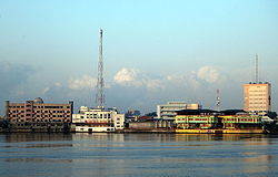 Location of Cotonou in Benin
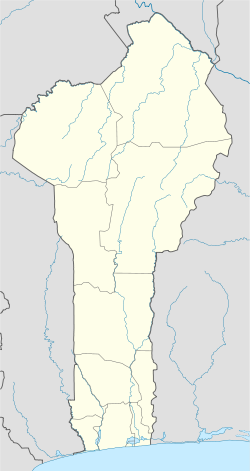
 Cotonou
Coordinates: 6°22′N 2°26′E / 6.367°N 2.433°ECoordinates: 6°22′N 2°26′E / 6.367°N 2.433°E Country  Benin
BeninDepartment Littoral Department Government - Mayor Nicéphore Soglo (2008–2014) Elevation 51 m (167 ft) Population (2006) - Total 761,137 Cotonou is the economic capital of Benin, as well as its largest city. Its official population count was 761,137 inhabitants in 2006; however, some estimates indicate its population may be as high as 1.2 million. The population in 1960 was only 70,000. The urban area continues to expand, notably towards the west. The city lies in the southeast of the country, between the Atlantic Ocean and Lake Nokoué.[1]
In addition to being Benin's largest city, it houses many of its government and diplomatic services; thus, it is Benin's de facto capital, even though the official capital is Porto-Novo. The city is a major port, and is also home to an airport and a railway that links to Parakou. Other features of Cotonou include Cotonou Friendship Stadium, Cotonou Cathedral, Cotonou Central Mosque, the Ancien Pont Bridge and the 20-hectare Dantokpa Market, which has a commercial turnover of over a billion CFA Francs a day. The National University of Benin is located in Cotonou. Another familiar feature of the city is the motorcycle–taxis known as Zémidjans.
Contents
History
The name 'Cotonou' means 'the mouth of the river of death' in the Fon language. At the beginning of the 19th century, Cotonou (then spelled Kotonou) was merely a small fishing village. Originally dominated by the Kingdom of Dahomey, in 1851 the French made a treaty with the Dahomean King Ghezo that allowed them to establish a trading post at Cotonou. During the reign of Glele, his successor (1858–89), the territory was ceded to France by a treaty signed on May 19, 1868. In 1883, the French navy occupied the city to prevent British conquest of the area. After Glele's death in 1889, his son Behanzin tried, unsuccessfully, to challenge the treaty. From then on, the town developed quickly to become the largest harbour in the region.
In June 2000, the Cotonou Agreement treaty was signed between the European Union and the group of African, Caribbean and Pacific states (ACP countries) in Cotonou. The Cotonou Agreement replaced the Lomé Convention which had been the basis for ACP-EU development cooperation since 1975. The Cotonou Agreement has a much broader scope, and is aimed at the reduction and eventual eradication of poverty while contributing to sustainable development and to the gradual integration of ACP countries into the world economy. The revised Cotonou Agreement is also concerned with the fight against impunity and promotion of criminal justice through the International Criminal Court. It was signed by 79 ACP countries and the then fifteen Member States of the European Union. It entered into force in 2003 and is the latest agreement in the history of ACP-EU Development Cooperation.
Geography
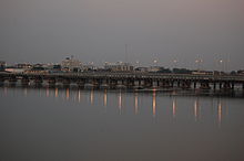
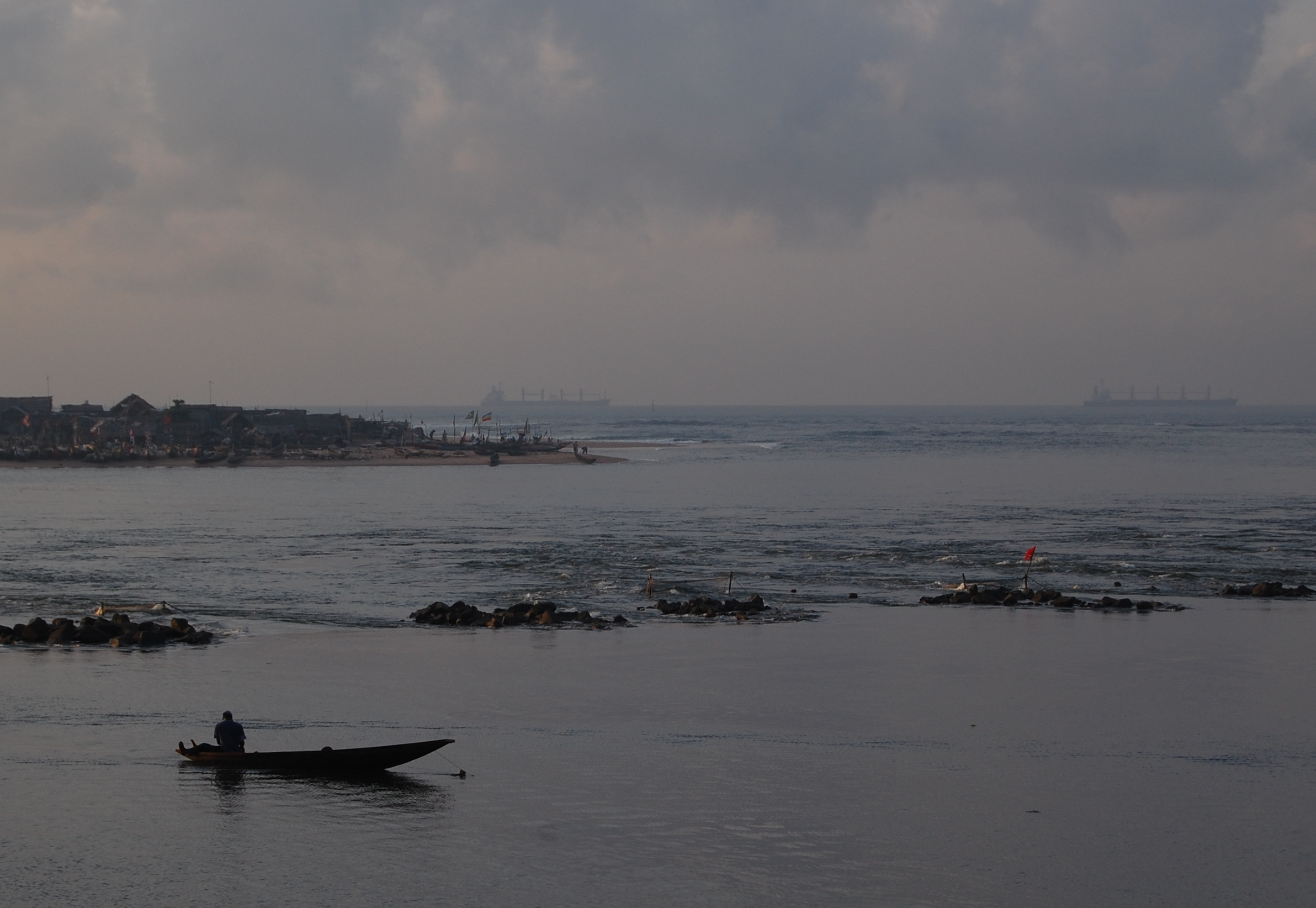
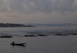 The Oueme River as it flows into the Atlantic Ocean in Cotonou
Cotonou is located on the coastal strip between Lake Nokoué and the Atlantic Ocean. The city is cut in two by a canal, the lagoon of Cotonou, dug by the French in 1855. Three bridges are located in this area. The Oueme River flows into the Atlantic Ocean at Cotonou.
The city has established transportation infrastructure including air, sea, river (to Porto Novo) and land routes that facilitate trade with its neighbors Nigeria, Niger, Burkina Faso and Togo.
The erosion of the coast has noted for several decades. It worsened in 1961 following the major work undertaken in Benin with the construction of the Nangbéto dam and deep-water port of Cotonou, in Ghana with the Akossombo dam and in Togo at the port of Lomé. Houssou Paul, a pilot project funded by the United Nations Environment Program (UNEP) revealed that in 40 years, the coast to the east of Cotonou fell by 400 meters.[citation needed] This erosion has led many people to leave their homes built along the coast. The Beninese state has decided to prohibit the pumping of sea and sand for the construction of protective dikes.
Climate
 Climate
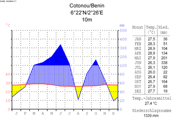
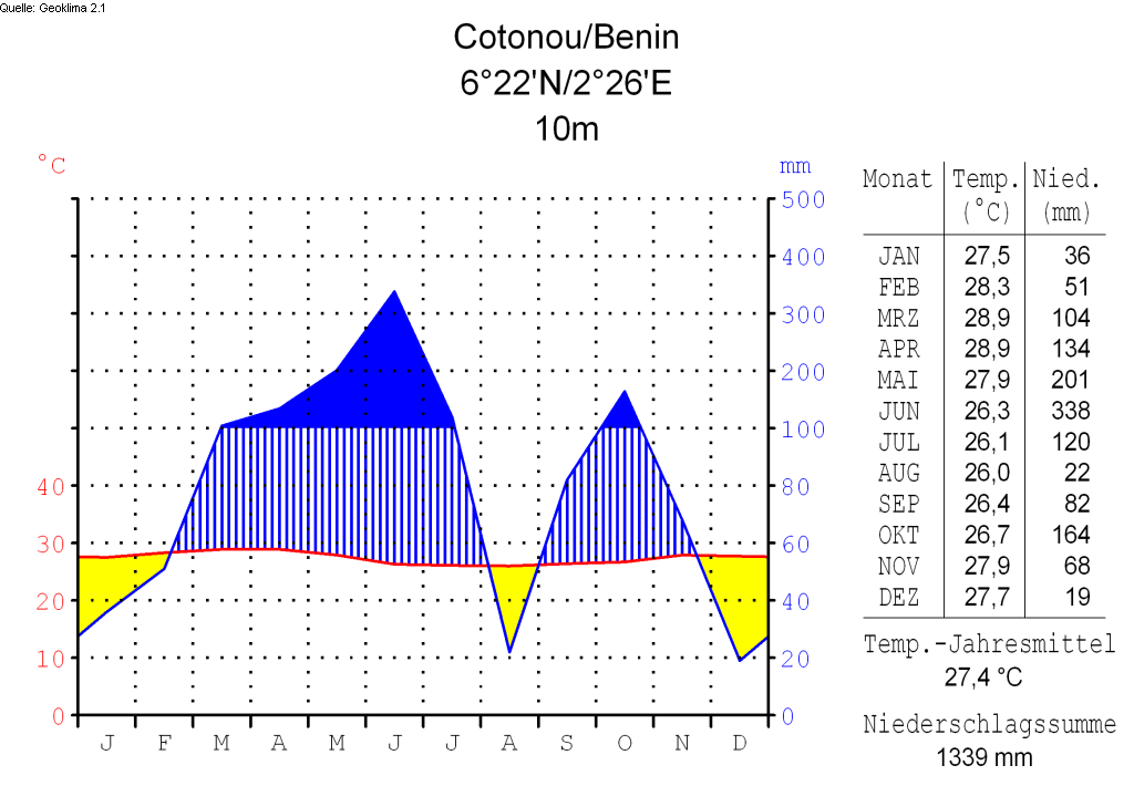
Under Köppen's climate classification, Cotonou features a tropical wet and dry climate, alternating with two rainy seasons (April – July and September – October, 800 to 1,200 mm of rain per year) and two dry seasons. In December and January, the city is affected by harmattan winds. Temperatures are relatively constant throughout the course of the year, with the average high temperatures hovering around 30°C, and average low temperatures at around 25°C.
Climate data for Cotonou Month Jan Feb Mar Apr May Jun Jul Aug Sep Oct Nov Dec Year Average high °C (°F) 27
(81)28
(82)28
(82)28
(82)27
(81)26
(79)26
(79)25
(77)26
(79)27
(81)28
(82)27
(81)26.9
(80.5)Average low °C (°F) 23
(73)25
(77)26
(79)26
(79)24
(75)23
(73)23
(73)23
(73)23
(73)24
(75)24
(75)24
(75)24.0
(75.2)Precipitation mm (inches) 33
(1.3)33
(1.3)117
(4.61)125
(4.92)254
(10)366
(14.41)89
(3.5)38
(1.5)66
(2.6)135
(5.31)58
(2.28)13
(0.51)1,327
(52.24)Avg. rainy days 2 2 5 7 11 13 7 3 6 9 6 1 72 Sunshine hours 217 224 217 210 217 150 124 155 150 186 240 217 2,307 Source: BBC Weather [2] Demographics
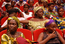 Cotonou women
- 1979: 320,348 (census count)
- 1992: 536,827 (census count)
- 2002: 665,100 (estimate)
- 2005: 690,584 (estimate)
The main languages spoken in Cotonou include the Fon language, Aja language, Yoruba language and French.
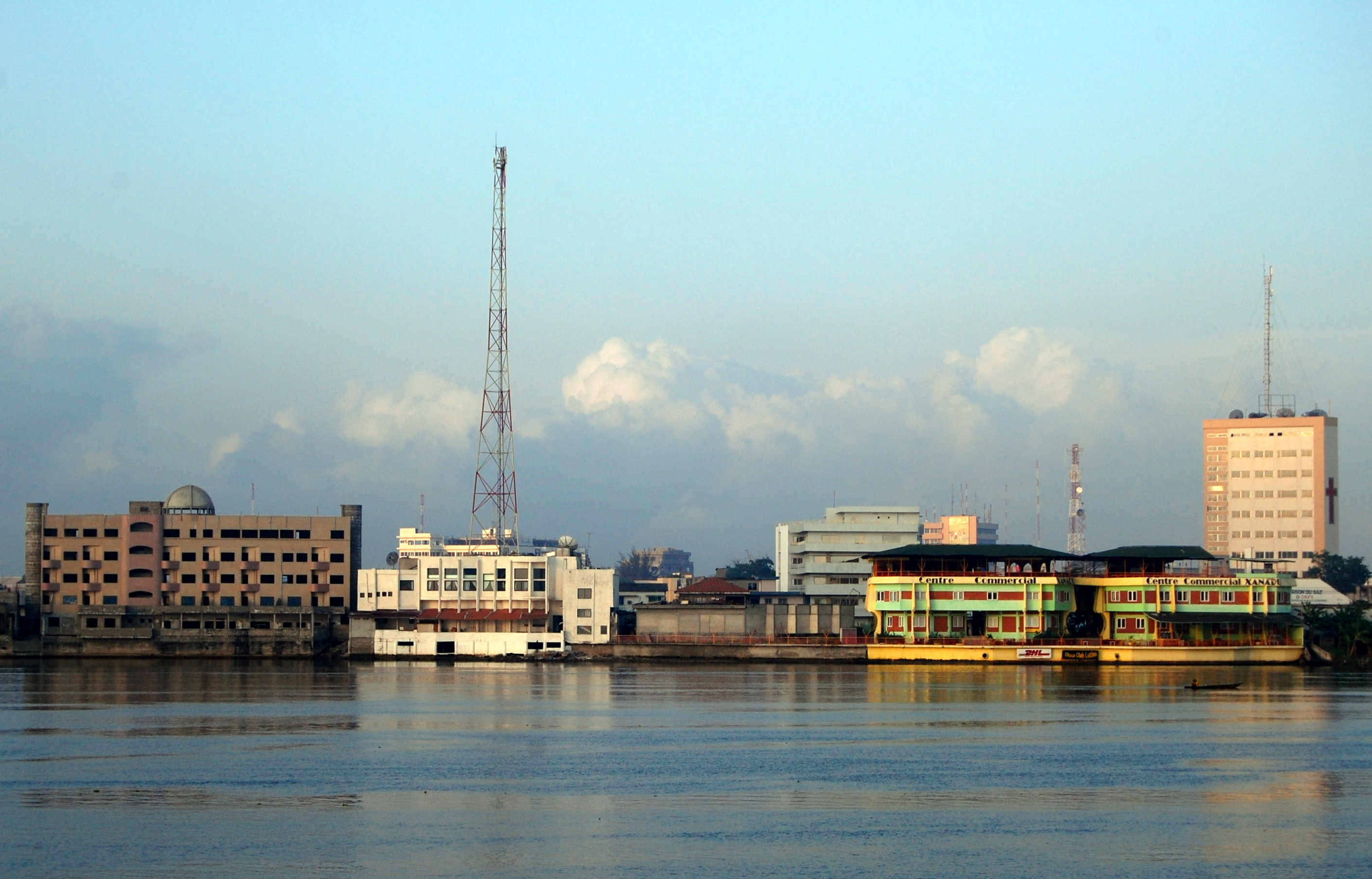
Transport
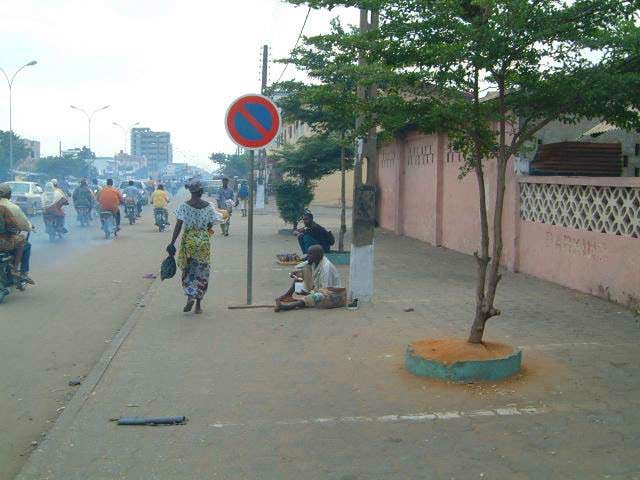
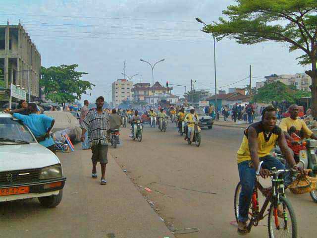
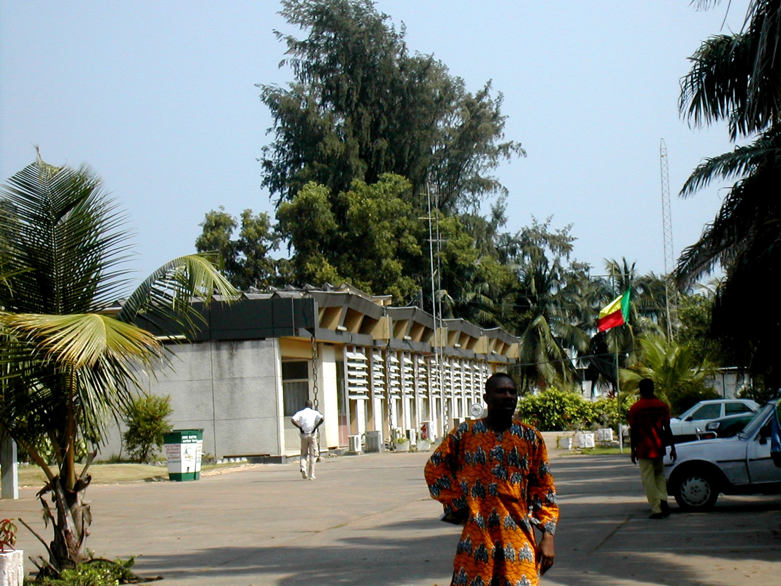
 Boulevard Saint Michel de Cotonou
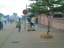
 Street scene in Cotonou
The Autonomous Port of Cotonou is one of the largest ports in West Africa. The city is connected to Parakou in the north of the country by the Benin-Niger railway. Cotonou International Airport provides service to the capitals of the region and to France, as well as the major cities of Benin: Parakou, Kandi, Natitingou, Djougou, and Savé. There are also road connections to several neighboring countries: Nigeria, Burkina Faso, Niger, and Togo. A notable form of transport in the city is known as a Zémidjan.
Economy
Because of its status as a transport hub, Cotonou has become a crossroads of West African commerce, with much trade moving here from Abidjan because of the Ivorian Civil War. The city is a so-called 'market town,' enabling trade with the countries of the African interior, such as Mali, Burkina Faso, and Niger. In addition to the port, there is a free trade zone in the interior of the city for use by the landlocked Saharan states. However, the city is rife with corruption and illegal trade, especially with neighboring Nigeria. It can be considered the economic capital as it houses two-thirds of Benin's industries and is the headquarters of the nation's major enterprises and banks.[citation needed]
Important manufactured goods include palm oil and cake, brewing, textiles, and cement. Motor vehicles and bicycles are assembled, and there are also sawmills in the city. Petroleum products, bauxite, and iron are major exports. There are also offshore platforms drilling for oil. The city is also a center for the automotive trade, with European brands being sold from vast open-air parking lots. In the past, Citroën assembled cars (for instance, the 2CV and Ami 8) locally.[3]
In Missebo area, Cotonou is a textile market of African Print mainly handled by Indian wholesalers and retailers.
Main sights
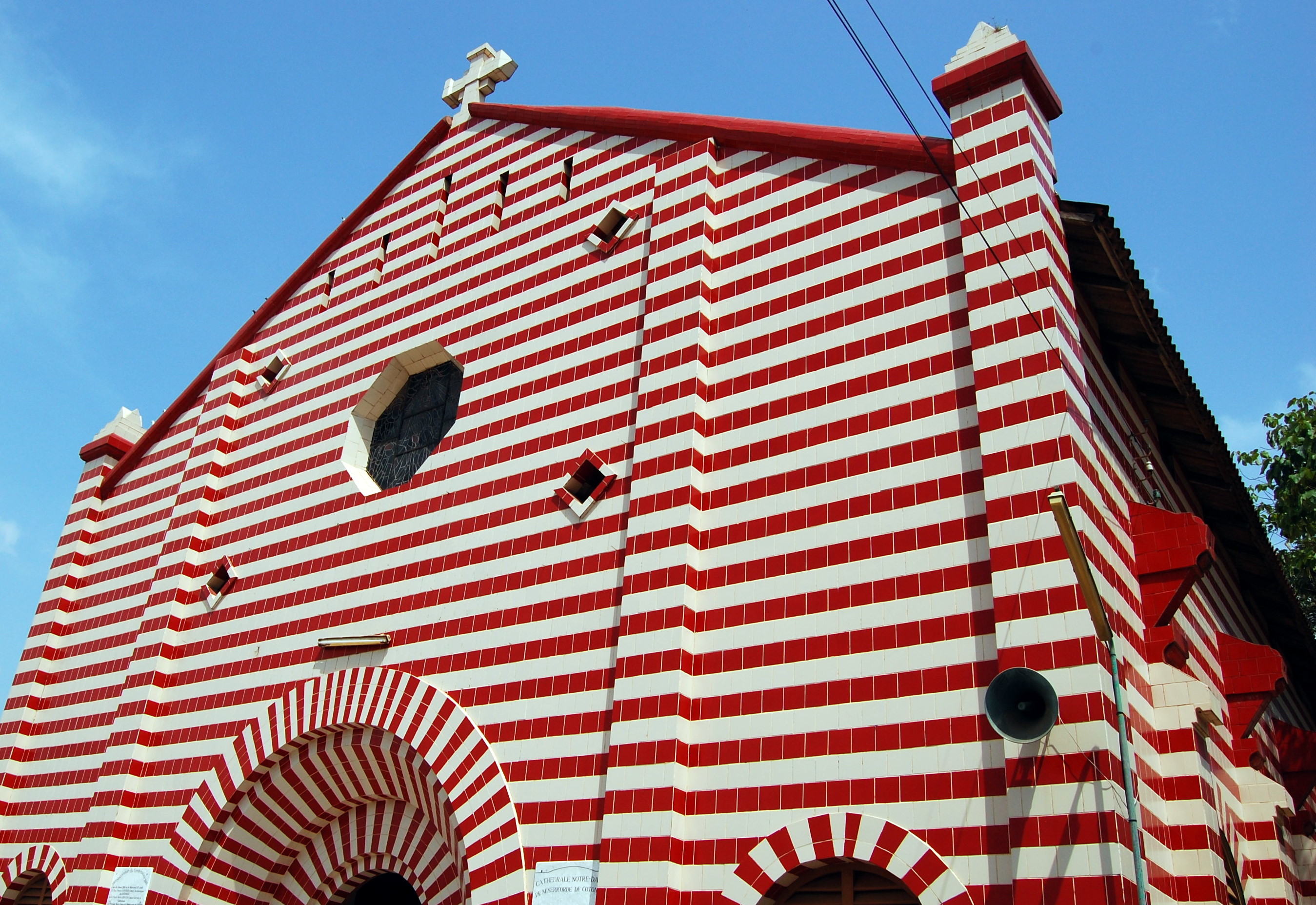
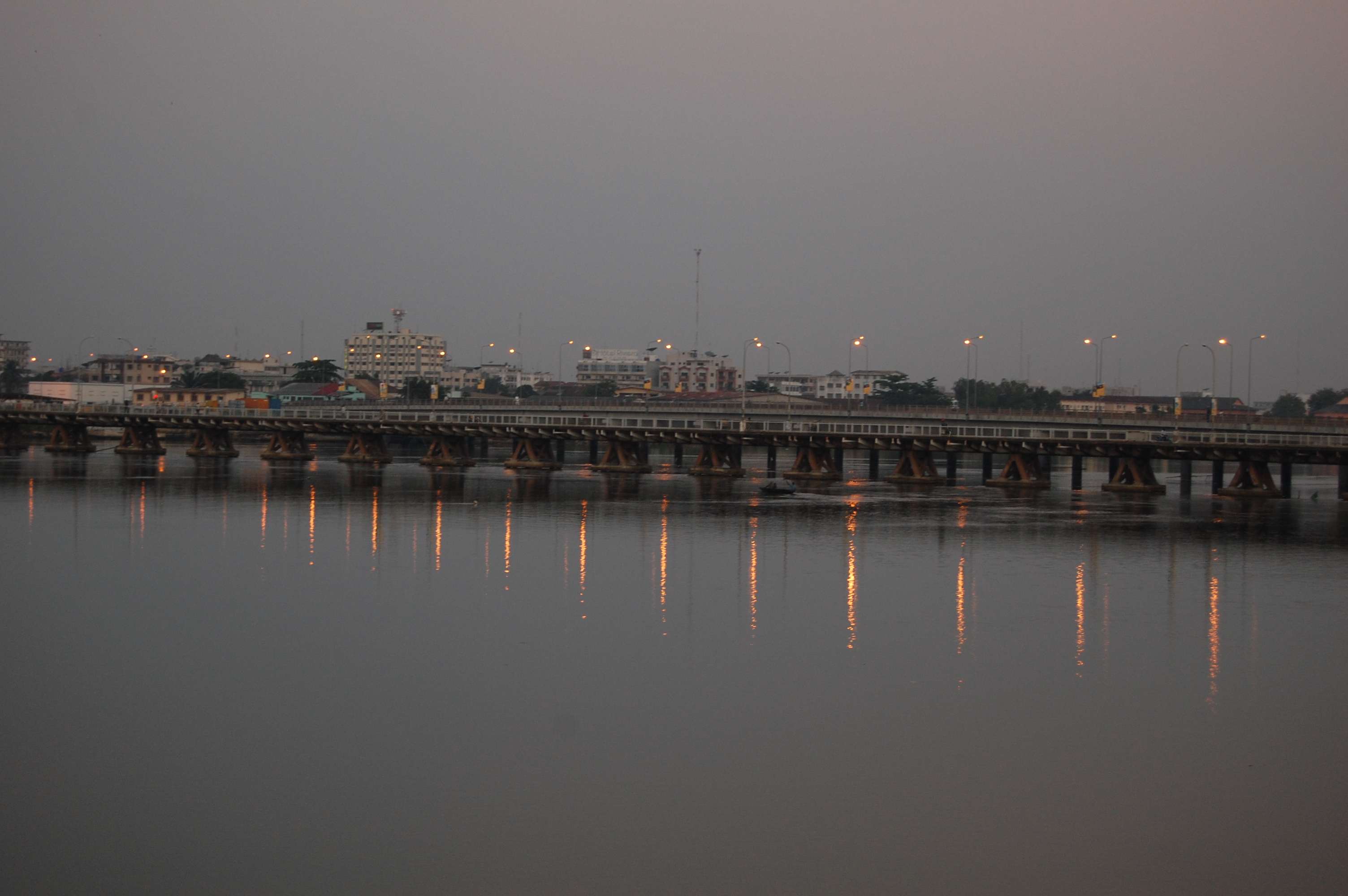
 Ancien Pont Bridge.
- Cotonou Cathedral, or Notre Dame des Apotres, located near the Ancien Pont Bridge. It is noted for its distinct burgundy and white striped tiled architecture. The cathedral is the seat of the Roman Catholic Archdiocese of Cotonou.The diocese was originally created on June 26, 1883, as the Apostolic Prefecture of Dahomey from the Apostolic Vicariate of Benin Coast, Nigeria. After several names changes under Dahomey, on 14 September 1955 it was promoted as the Metropolitan Archdiocese of Cotonou. The cathedral was run by Archbishop Bernardin Gantin (died 2008) from 1960 to 1971. The current archbishop of the cathedral and Cotonou is Marcel Honorat Léon Agboton.
- National University of Benin – is the principal university in Benin. The university was founded in 1970 as the Université du Dahomey. In 1975 the name was changed officially to Université Nationale du Bénin. The school is composed of 19 institutions and six campuses. The main campus is the Université d'Abomey-Calavi (UAC). In 1999 students numbered 16,000, including over 3,300 women.
- Ancien Pont Bridge
- Dantokpa Market
Media
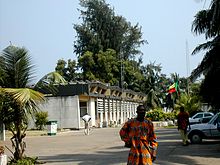 The headquarters in Cotonou of the ORTB
- Office de Radiodiffusion et Télévision du Bénin (ORTB) is the national television and radio operator and is based in Cotonou.
Environment
The city is threatened by the rise waters from the Gulf of Guinea.[4]
Sister cities
 Taipei, Republic of China
 Atlanta, USA
 Salvador, Brazil
See also
References
- ^ GNS: Country Files. Earth-info.nga.mil. Retrieved on 2011-06-15.
- ^ BBC Weather | Cotonou. BBC News (2010-01-29). Retrieved on 2011-06-15.
- ^ World Cars 1972. Automobile Club of Italy/Herald Books, New York: 1972. p. 403, ISBN 0-910714-04-5
- ^ Benin's Cotonou – a city slowly swallowed by waves The Terra Daily, 25 January 2008
External links
Capitals of Africa Abuja, Nigeria
Accra, Ghana
Addis Ababa, Ethiopia
Algiers, Algeria
Antananarivo, Madagascar
Asmara, Eritrea
Bamako, Mali
Bangui, Central African Republic
Banjul, Gambia
Bissau, Guinea-Bissau
Bloemfontein, South Africa 1
Brazzaville, Rep. of the Congo
Bujumbura, Burundi
Cairo, Egypt
Cape Town, South Africa 2
Conakry, GuineaPort Louis, Mauritius
Porto-Novo, Benin
Praia, Cape Verde
Pretoria, South Africa 3
Rabat, Morocco
Saint-Denis, Réunion
São Tomé, São Tomé and Príncipe
Tripoli, Libya
Tunis, Tunisia
Victoria, Seychelles
Windhoek, Namibia
Yaoundé, Cameroon
Yamoussoukro, Côte d'Ivoire1 Judicial. 2 Parliamentary. 3 Executive. 4 An unrecognised or partially-recognised state.Alibori Department 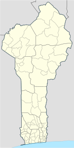
Atakora Department Atlantique Department Borgou Department Collines Department Donga Department Kouffo Department Littoral Department CotonouMono Department Ouémé Department Adjarra • Adjohoun • Aguégués • Akpro-Missérété • Avrankou • Bonou • Dangbo • Porto-Novo • Sèmè-KpodjiPlateau Department Zou Department Categories:- Cotonou
- Communes of Benin
- Populated places in Benin
- Capitals in Africa
- French West Africa


Wikimedia Foundation. 2010.