- Djidja
-
Djidja — Commune and city — Location in Benin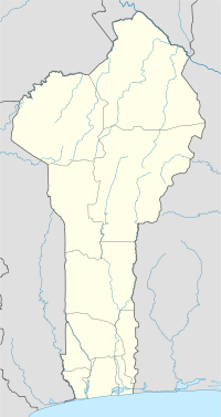
 Djidja
Coordinates: 7°20′N 1°56′E / 7.333°N 1.933°E Country  Benin
BeninDepartment Zou Department Area - Total 843.2 sq mi (2,184 km2) Population (2002) - Total 84,590 - Density 101/sq mi (39/km2) Time zone WAT (UTC+1) Djidja is a town, arrondissement, and commune in the Zou Department of south-western Benin. The commune covers an area of 2184 square kilometres and as of 2002 had a population of 84,590 people.[1][2]
Contents
Geography
Djidja is located 24 kilometres northeast of Abomey and 163 kilometres from Cotonou. It is bounded to the southwest by Couffo, east by the communes of Za-Kpota and Cove and the north by Collines. A main road passes from south to north, but it is hardly passable during the rainy season forcing all users to comply with an average speed of safety of about 40 km / hour (about 25 minutes travel from Abomey).[3]
Djidja is cosmopolitan and has a population of 84,590 inhabitants spread over an area of 2184km ².
Administrative divisions
Djidja is subdivided into 12 arrondissements; Djidja, Agondji, Agouna, Dan, Dohouimè, Gobé, Oungbègamè, Monsourou, Mougnon, Outo, Setto, Zoukou. They contain 64 villages and 11 city districts.[1]
Economy
90% of the population are engaged in agricultural activities followed by trade, transportation and handicrafts.[3] 147 300,00 hectares of land are devoted to agriculture, accounting for 38.76% of the total population.[1] The main crops grown are maize, cotton, cowpeas, peanuts, yams and cassava.[1]
References
- ^ a b c d "Djidja". Atlas Monographique des Communes du Benin. http://atlasbenin.africa-web.org/Zou/Djidja.htm. Retrieved January 5, 2010.
- ^ "Communes of Benin". Statoids. http://www.statoids.com/ybj.html. Retrieved January 5, 2010.
- ^ a b "Djidja". www.djidja.communedubenin.org. http://www.djidja.communedubenin.org/. Retrieved January 8, 2009.
Coordinates: 7°20′N 1°56′E / 7.333°N 1.933°EAlibori Department 
Atakora Department Atlantique Department Borgou Department Collines Department Donga Department Kouffo Department Littoral Department Mono Department Ouémé Department Adjarra • Adjohoun • Aguégués • Akpro-Missérété • Avrankou • Bonou • Dangbo • Porto-Novo • Sèmè-KpodjiPlateau Department Zou Department Abomey Agbokpa · Dètohou · Djègbè · Hounli · Sèhoun · Vidolè · Zounzounmè
Agbangnizoun Adahondjigon · Adingningon · Agbangnizoun · Kinta · Kpota · Lissazounmè · Sahé · Siwé · Tanvé · Zoungoudo
Bohicon Agongointo · Avogbana · Bohicon I · Bohicon II · Gnidjazoun · Lissèzoun · Ouassaho · Passagon · Saclo · Sodohomè
Covè Adogbé · Gounli · Houéko · Houen-Hounso · Lainta-Cogbè · Naogon · Soli · Zogba
Djidja Agondji · Agouna · Dan · Djidja · Dohouimè · Gobè · Monsourou · Mougnon · Oungbègamè · Outo · Setto · Zoukou
Ouinhi Dasso · Ouinhi · Sagon · Tohoué
Za-Kpota Allahé · Assalin · Houngomey · Kpakpamè · Kpozoun · Za-Kpota · Za-Tanta · Zèko
Zagnanado Agonli-Houégbo · Banamè · Don-Tan · Dovi · Kpédékpo · Zagnanado
Zogbodomey
Akiza · Avlamè · Cana I · Cana II · Domè · Koussoukpa · Kpokissa · Massi · Tanwé-Hessou · Zogbodomey · Zoukou Categories:
- Communes of Benin
- Arrondissements of Benin
- Populated places in the Zou Department


Wikimedia Foundation. 2010.