- Malanville
-
Malanville — Commune, arrondissement and city — 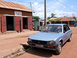 Location in Benin
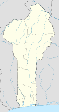
 Malanville
Coordinates: 11°52′N 3°23′E / 11.867°N 3.383°E Country  Benin
BeninDepartment Alibori Department Area - Total 3,016 km2 (1,164.5 sq mi) Population (2002) - Total 101,628 - Density 33.7/km2 (87.3/sq mi) Time zone WAT (UTC+1) Malanville is a city, arrondissement and commune in the Alibori Department of northeastern Benin, located across the River Niger from Niger. It is known as a centre of cross-border trade and has a major market. Malanville is also a centre for rice-growing. The commune covers an area of 3016 square kilometres and as of 2002 had a population of 101,628 people.[1][2][3] As of 2007 the estimated population of town of Malanville is 39,192.
Contents
History
Malanville has an extremely diverse population consisting of a large Muslim community, large Christian community, French speakers and speakers of local languages, as well as several practitioners of local religions. The cuisine is a mixture of African and European. Despite the differences that exist between these groups, they live side-by-side in peace and share public and private sector responsibilities.
Geography
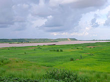 The Niger River at Malanville
Malanville is located in Bénin's northern region, along the Bénin/Niger border, located 733 kilometres from Cotonou. It is connected to Niger via a bridge over the Niger River.[4] It resides approximately 35 km down the Niger River from Karimama which it is indirectly connected to via road. The terrain and climate therefore resemble those of desert regions arid, lots of sunlight, little water.
Communally, Malanville is bounded to the north by Niger, the south by Kandi and Ségbana, to the west by Karimama and to the east by Nigeria.
Administrative divisions
Malanville is subdivided into 5 arrondissements; Malanville, Garou, Guénè, Mandécali and Tomboutou . They contain 20 villages and 12 urban districts.[2]
Economy
The population of Malanville engages primarily in agricultural activities, followed by trade, transportation and handicrafts. The main crops grown are rice, onions, groundnuts and tomatoes.[2]The tourism sector is growing as the shared border with Niger allows visitors to experience National Park W, a game reserve with elephants, giraffe, etc. Services such as hotels and restaurants are starting to develop due to greater levels of tourism.
Culture and Education
There is a high school and three elementary/middle schools, but there is not any type of cultural center or public library in Malanville.
External links
References
- ^ ""The World Gazetteer"". http://www.world-gazetteer.com/wg.php?x=&men=gpro&lng=en&dat=32&geo=-35&srt=npan&col=dq&pt=c&va=&geo=366750338. Retrieved 2007-02-20.
- ^ a b c "Malanville". Atlas Monographique des Communes du Benin. http://atlasbenin.africa-web.org/Alibori/Malanville.htm. Retrieved January 5, 2010.
- ^ "Communes of Benin". Statoids. http://www.statoids.com/ybj.html. Retrieved January 5, 2010.
- ^ ""Britannica Concise Encyclopedia: Niger River"". http://www.secure.britannica.com/ebc/article-37071. Retrieved 2007-02-20.
Coordinates: 11°52′N 3°23′E / 11.867°N 3.383°E
Alibori Department 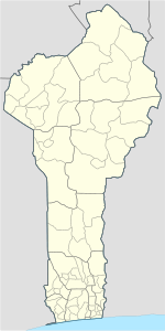
Atakora Department Atlantique Department Borgou Department Collines Department Donga Department Kouffo Department Littoral Department Mono Department Ouémé Department Adjarra • Adjohoun • Aguégués • Akpro-Missérété • Avrankou • Bonou • Dangbo • Porto-Novo • Sèmè-KpodjiPlateau Department Zou Department Banikoara 
Gogounou Kandi Karimama Malanville Ségbana Categories:- Arrondissements of Benin
- Populated places in the Alibori Department
- Communes of Benin
- Benin–Niger border crossings
- Niger River


Wikimedia Foundation. 2010.