- Dangbo
-
Dangbo — Commune and city — Location in Benin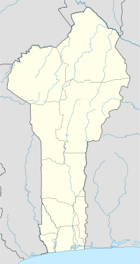
 Dangbo
Coordinates: 6°30′N 2°41′E / 6.5°N 2.683°E Country  Benin
BeninDepartment Ouémé Department Area - Total 131.3 sq mi (340 km2) Population (2002) - Total 66,055 Time zone WAT (UTC+1) Dangbo is a town, arrondissement, and commune in the Ouémé Department of south-eastern Benin.The commune covers an area of 340 square kilometres and as of 2002 had a population of 66,055 people.[1][2]
References
- ^ "Dangbo". Atlas Monographique des Communes du Benin. http://atlasbenin.africa-web.org/Oueme/Dangbo.htm. Retrieved January 5, 2010.
- ^ "Communes of Benin". Statoids. http://www.statoids.com/ybj.html. Retrieved January 5, 2010.
Coordinates: 6°30′N 2°41′E / 6.5°N 2.683°E
Alibori Department 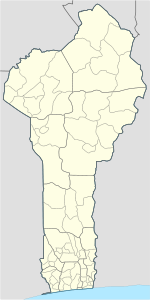
Atakora Department Atlantique Department Borgou Department Collines Department Donga Department Kouffo Department Littoral Department Mono Department Ouémé Department Adjarra • Adjohoun • Aguégués • Akpro-Missérété • Avrankou • Bonou • Dangbo • Porto-Novo • Sèmè-KpodjiPlateau Department Zou Department Adjarra Adjarra I · Adjarra II · Aglogbé · Honvié · Malanhoui · Médédjonou
Adjohoun Aguegues Avagbodji · Houédomè · ZoungamèAkpro-Missérété Avrankou Atchoukpa · Avrankou · Djomon · Gbozounmè · Kouty · Ouanho · SadoBonou Affamè · Atchonsa · Bonou · Damè-Wogon · HouinviguèDangbo Dangbo · Dékin · Gbéko · Houédomey · Hozin · Késsounou · ZounguèPorto-Novo 1st arrondissement · 2nd arrondissement · 3rd arrondissement · 4th arrondissement · 5th arrondissementSèmè-Kpodji Agblangandan · Aholouyèmè · Djrègbè · Ekpè · Sèmè-Kpodji · TohouèCategories:- Benin geography stubs
- Communes of Benin
- Arrondissements of Benin
- Populated places in the Ouémé Department


Wikimedia Foundation. 2010.