- National Register of Historic Places listings in western Cincinnati, Ohio
-
This is a list of the National Register of Historic Places listings in western Cincinnati, Ohio.
This is intended to be a complete list of the properties and districts on the National Register of Historic Places in western Cincinnati, Ohio, United States. Western Cincinnati is defined as being all of the city west of a line running along Interstate 75 from the Ohio River to Central Parkway, east to Vine Street, north to Martin Luther King Drive, west to Interstate 75, north to Interstate 74, and west to the city's western edge. The locations of National Register properties and districts may be seen in a Google map.[1]
There are 242 properties and districts listed on the National Register in Cincinnati, including 12 National Historic Landmarks. Western Cincinnati includes 40 of these properties and districts, including 2 National Historic Landmarks; the city's remaining properties and districts are listed elsewhere.
-
- This National Park Service list is complete through NPS recent listings posted November 10, 2011.[2]
Current listings
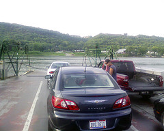
[3] Landmark name[4] Image Date listed Location Summary 1 Anderson Ferry 
June 10, 1982 Off U.S. Route 50
39°4′35″N 84°37′28″W / 39.07639°N 84.62444°W2 Apostolic Bethlehem Temple Church 
April 11, 1973 1205 Elm St.
39°6′29″N 84°31′7″W / 39.10806°N 84.51861°W3 B&O Freight Terminal 
December 29, 1986 700 Pete Rose Way
39°5′44″N 84°31′28″W / 39.09556°N 84.52444°W4 Beech Avenue Houses February 16, 1979 1120 and 1128 Beech Ave.
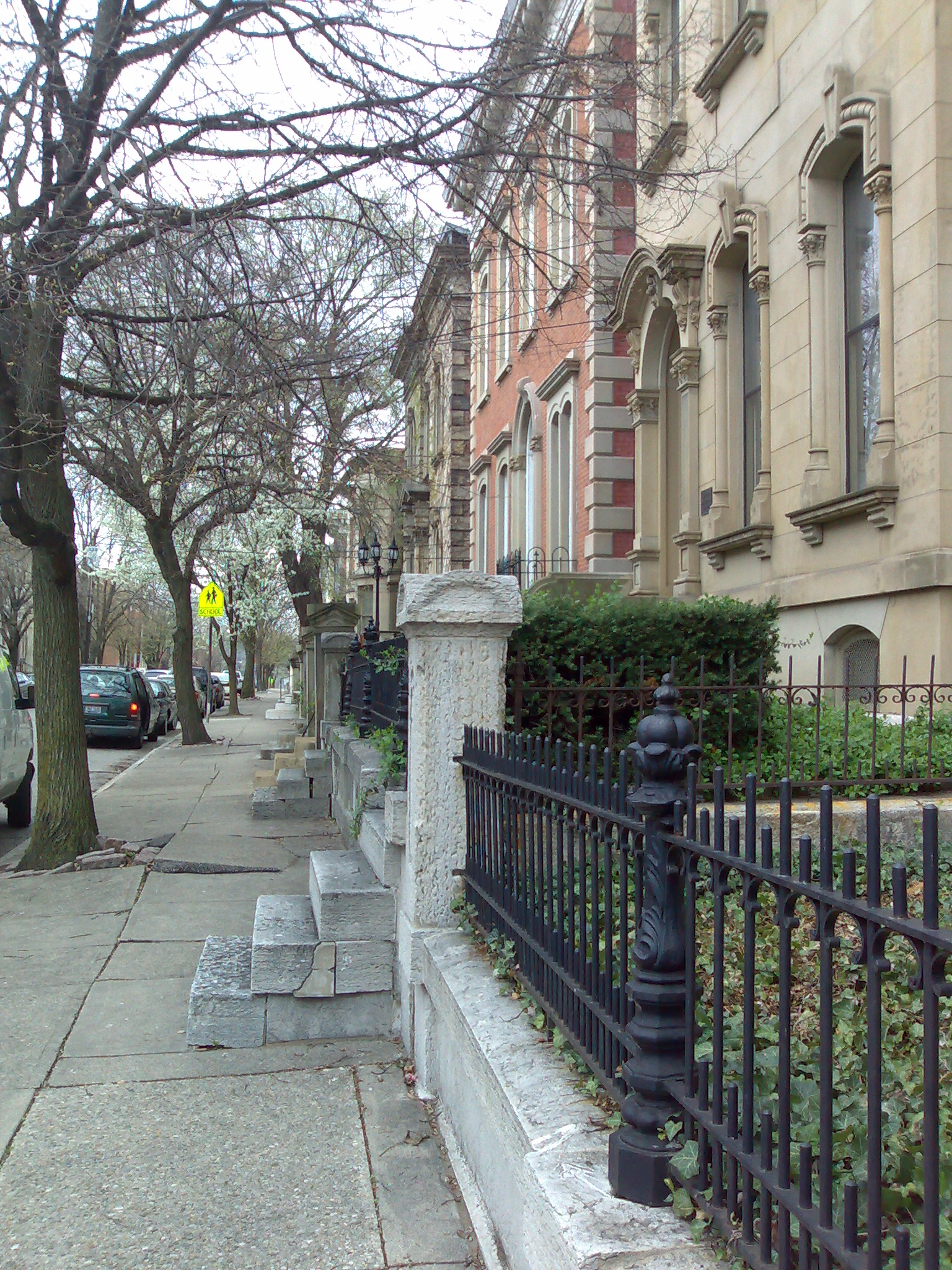
39°6′46″N 84°34′38″W / 39.11278°N 84.57722°W5 Betts-Longworth Historic District 
November 29, 1983 Roughly bounded by Ezzard Charles Dr., Central Ave., and Mound and Old Court Sts.
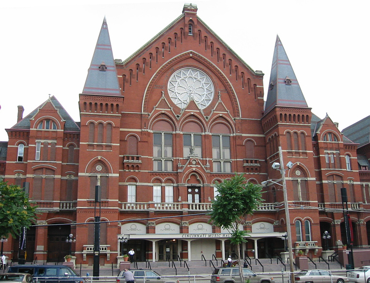
39°6′26″N 84°31′21″W / 39.10722°N 84.5225°W6 Cincinnati Music Hall 
January 26, 1970 1243 Elm St.
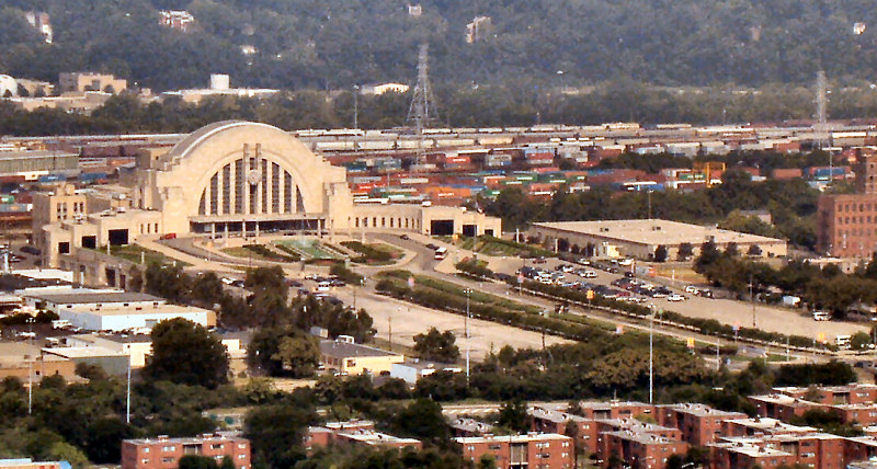
39°6′34″N 84°31′8″W / 39.10944°N 84.51889°W7 Cincinnati Union Terminal 
October 31, 1972 1301 Western Ave.
39°6′36″N 84°32′16″W / 39.11°N 84.53778°W8 Cincinnati Work House and Hospital March 3, 1980 3208 Colerain Ave.
39°8′32″N 84°32′13″W / 39.14222°N 84.53694°W9 Dayton Street Historic District 
January 25, 1973 Roughly bounded by Bank, Linn, and Poplar Sts. and Winchell Ave.
39°7′3″N 84°31′50″W / 39.1175°N 84.53056°W10 Eighteenth District School 
March 3, 1980 1326 Hopple St.
39°8′14″N 84°32′18″W / 39.13722°N 84.53833°W11 Episcopal Church of the Resurrection 
April 13, 1977 7346-48 Kirkwood La.
39°7′36″N 84°42′10″W / 39.12667°N 84.70278°W12 Fairview Public School and Annex 
September 16, 2010 255 Warner St. and 2232 Stratford Ave.
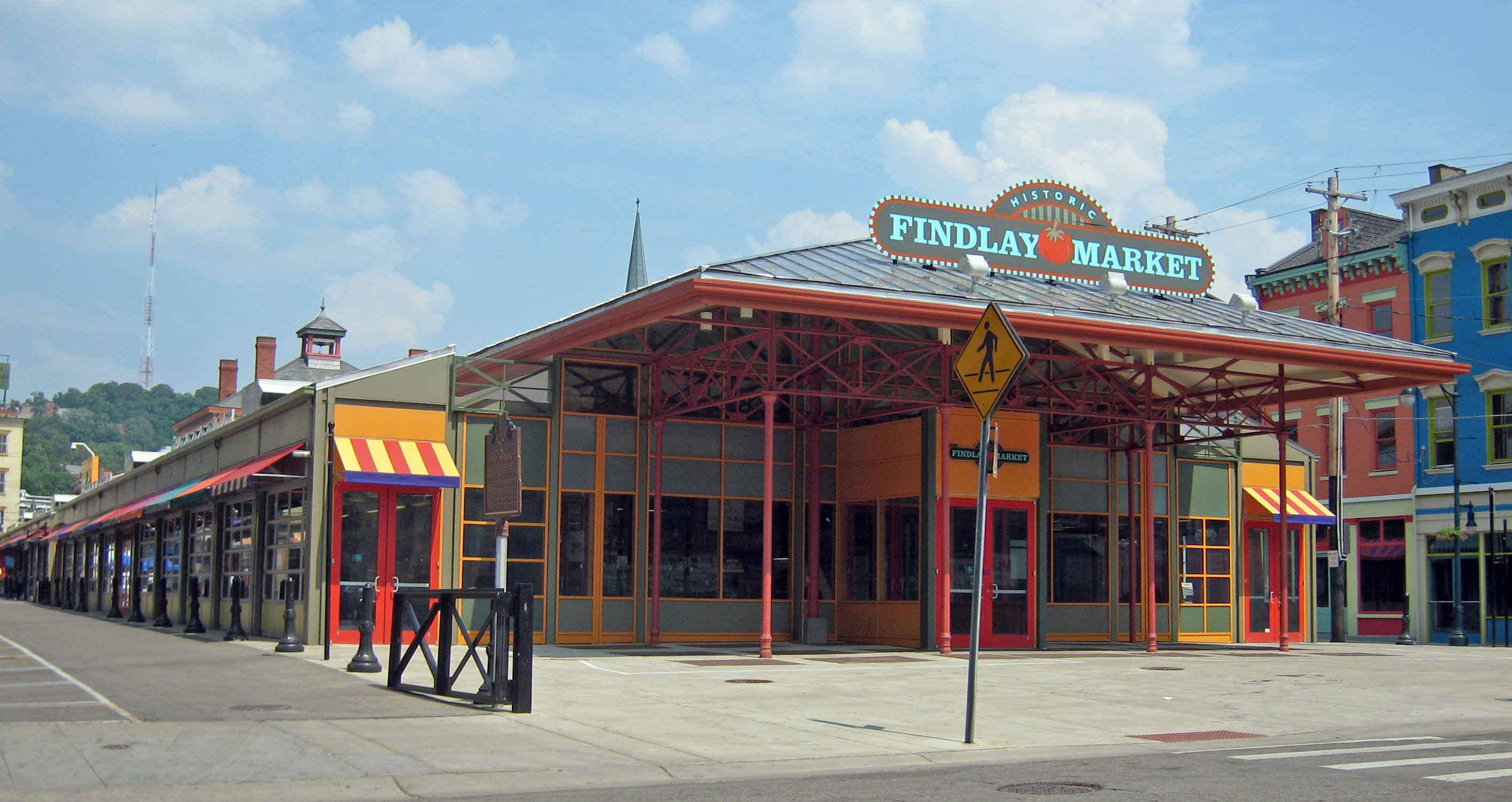
39°7′30″N 84°31′20″W / 39.125°N 84.52222°W13 Findlay Market Building 
June 5, 1972 Esplanade at Elder St., between Elm and Race Sts.
39°6′55″N 84°31′9″W / 39.11528°N 84.51917°W14 First German Methodist Episcopal Church 
March 3, 1980 1310 Race St.
39°6′35″N 84°30′59″W / 39.10972°N 84.51639°W15 Hamilton County Memorial Building 
December 4, 1978 Elm and Grant Sts.
39°6′31″N 84°31′6″W / 39.10861°N 84.51833°W16 George Hatch House 
July 3, 2008 830 Dayton St.
39°7′6.43″N 84°31′41.66″W / 39.1184528°N 84.5282389°W17 Joseph A. Hemann House 
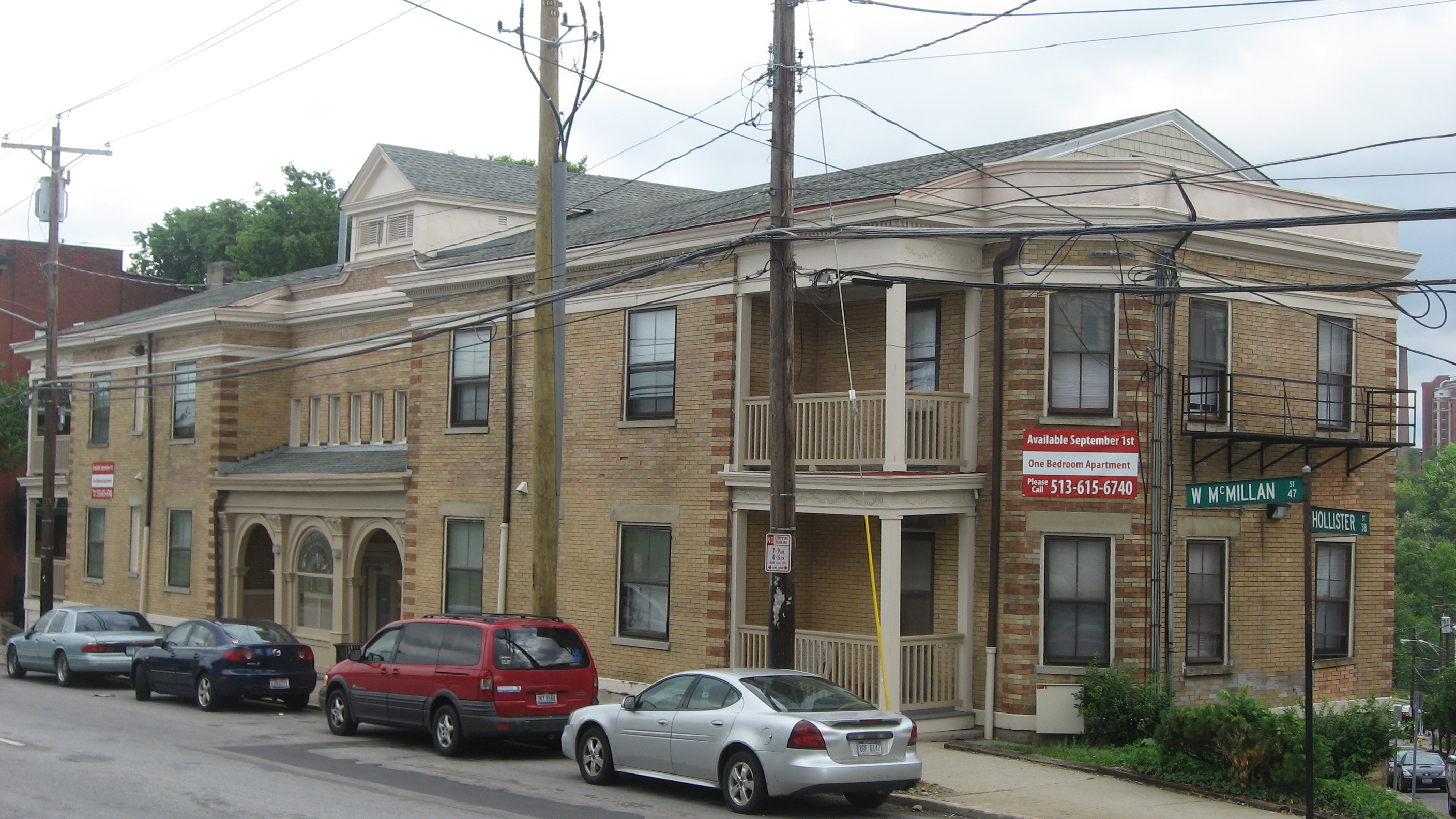
April 16, 1980 49 W. McMillan St.
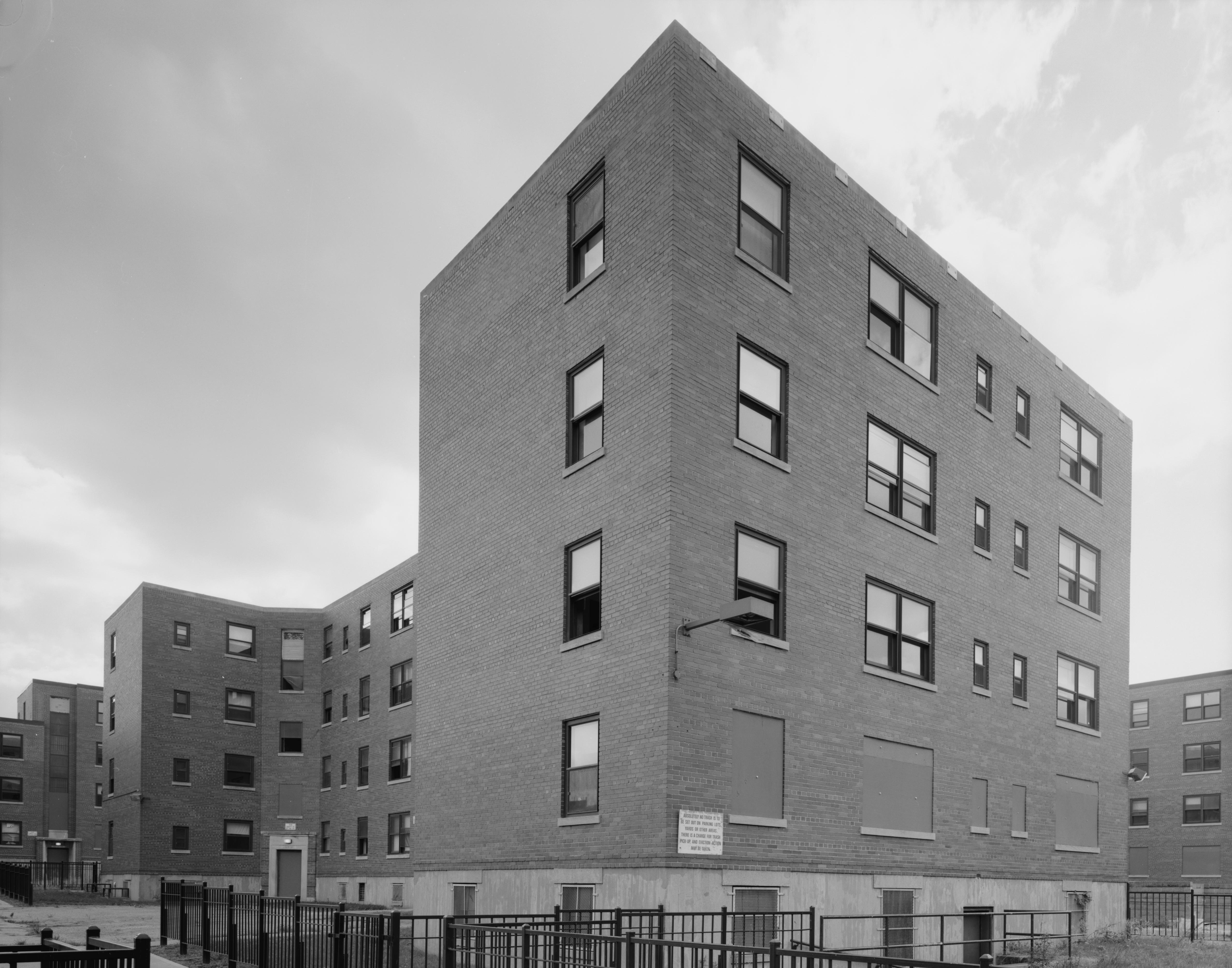
39°7′38″N 84°30′51″W / 39.12722°N 84.51417°W18 Laurel Homes Historic District 
May 19, 1987 Roughly bounded by Liberty and John Sts., Ezzard Charles Dr., and Linn St.
39°6′41″N 84°31′27″W / 39.11139°N 84.52417°W19 Lower Price Hill Historic District November 15, 1988 Roughly bounded by W. 8th, State, Burns, and English St.
39°6′13″N 84°33′8″W / 39.10361°N 84.55222°W20 Matthew McWilliams House April 28, 2005 3586 River Rd.
39°4′51″N 84°35′28″W / 39.08083°N 84.59111°W21 Melbourne Flats 
October 18, 1984 39 W. McMillan St.
39°7′39″N 84°30′48″W / 39.1275°N 84.51333°W22 Oesterlein Machine Company-Fashion Frocks, Inc. Complex October 27, 2005 3301 Colerain Ave., 1326 Monmouth Ave.
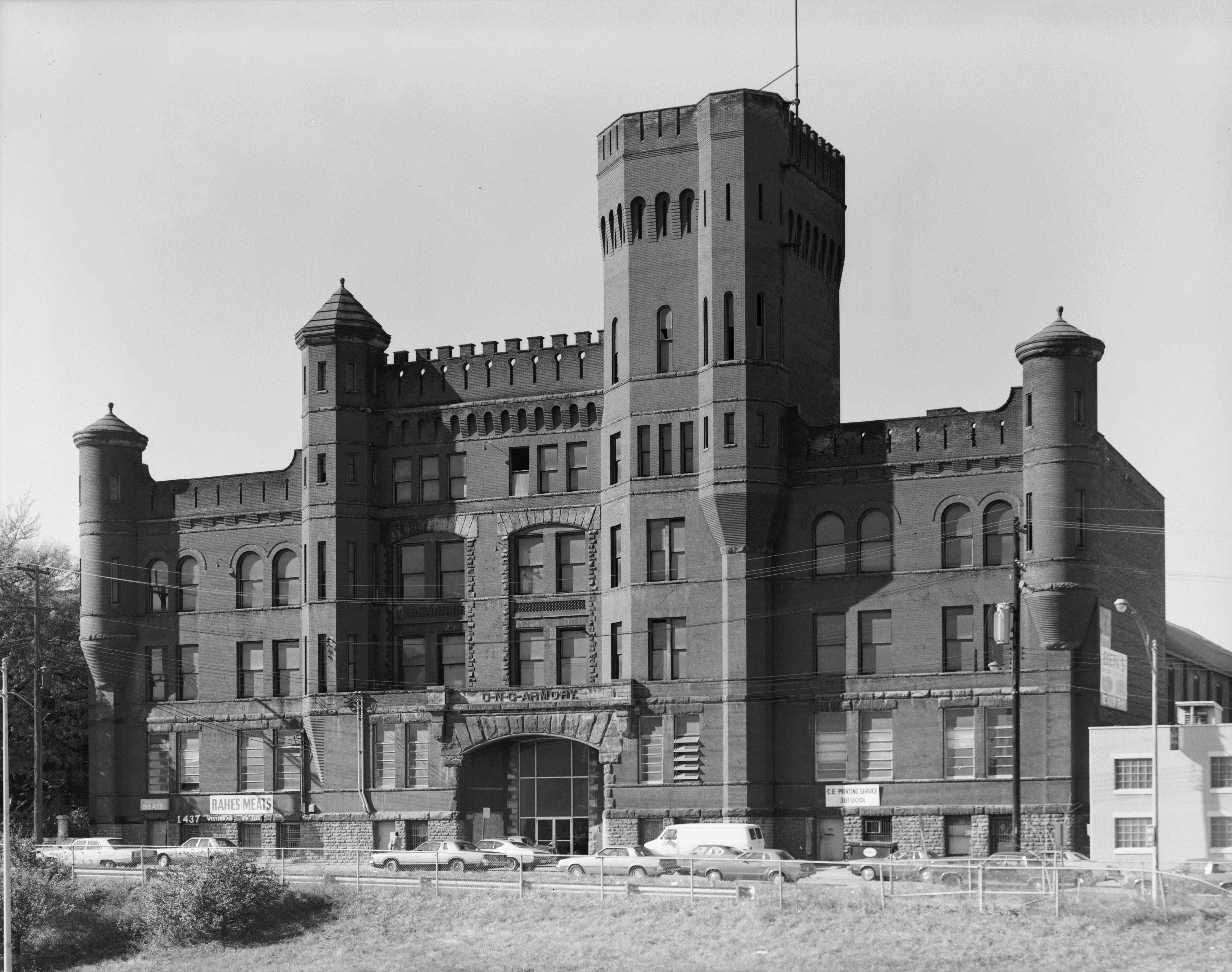
39°8′36″N 84°32′20″W / 39.14333°N 84.53889°W23 Ohio National Guard Armory 
March 3, 1980 1437-1439 Western Ave.
39°6′41″N 84°31′57″W / 39.11139°N 84.5325°W24 Our Lady of Mercy High School March 3, 1980 1409 Western Ave.
39°6′39″N 84°31′57″W / 39.11083°N 84.5325°W25 Over-the-Rhine Historic District 
May 17, 1983 Roughly bounded by Dorsey, Sycamore, Liberty, Reading, Central Parkway, McMicken Ave., and Vine Sts.
39°6′52″N 84°30′54″W / 39.11444°N 84.515°WExtends into eastern Cincinnati 26 Police Station No. 3 May 18, 1981 3201 Warsaw Ave.
39°6′34″N 84°33′47″W / 39.10944°N 84.56306°W27 Police Station No. 5 
March 3, 1980 1024-1026 York St.
39°7′4″N 84°31′57″W / 39.11778°N 84.5325°W28 Police Station No. 7 
May 18, 1981 355 McMillan St.
39°7′41″N 84°31′31″W / 39.12806°N 84.52528°W29 Heinrich A. Rattermann House 
May 23, 1980 510 York St.
39°7′2″N 84°31′25″W / 39.11722°N 84.52361°W30 St. Francis Hospital April 19, 1984 1860 Queen City Ave.
39°7′37″N 84°33′37″W / 39.12694°N 84.56028°W31 St. George Parish and Newman Center 
March 3, 1980 42 Calhoun St.
39°7′43″N 84°30′45″W / 39.12861°N 84.5125°W32 St. Peter's Lick Run Historic District October 4, 1989 2145-2153 Queen City Ave.
39°8′45″N 84°34′17″W / 39.14583°N 84.57139°W33 George Scott House March 3, 1980 565 Purcell Ave.
39°6′9.7″N 84°33′55.1″W / 39.102694°N 84.565306°W34 Sedamsville River Road Historic District 
October 10, 2008 2449-2734 River Rd., 309-317 Mt. Hope Ave., and 604 Mt. Echo Park Dr.
39°5′44″N 84°33′31.5″W / 39.09556°N 84.55875°W35 Short Woods Park Mound 
October 1, 1974 Northern side of Sayler Park
39°7′16.8″N 84°41′42″W / 39.121333°N 84.695°W[5]36 Story Mound 
June 11, 1975 Gracely Dr.
39°7′1″N 84°41′21.6″W / 39.11694°N 84.689333°W[6]In Sayler Park 37 Union Baptist Cemetery September 20, 2002 4933 Cleves Warsaw Pike
39°7′0″N 84°36′10″W / 39.116667°N 84.60278°W38 Westwood Town Center Historic District December 2, 1974 Epworth and Harrison Aves.
39°8′57″N 84°35′56″W / 39.14917°N 84.59889°W39 Westwood United Methodist Church March 3, 1980 Epworth and Edwiler Sts.
39°9′3″N 84°35′57″W / 39.15083°N 84.59917°W40 Daniel Thew Wright House September 28, 1982 3716 River Rd.
39°4′45″N 84°35′46″W / 39.07917°N 84.59611°WSee also
- List of National Historic Landmarks in Ohio
- National Register of Historic Places listings in Cincinnati, Ohio
References
- ^ The latitude and longitude information provided in this table was derived originally from the National Register Information System, which has been found to be fairly accurate for about 99% of listings. For about 1% of NRIS original coordinates, experience has shown that one or both coordinates are typos or otherwise extremely far off; some corrections may have been made. A more subtle problem causes many locations to be off by up to 150 yards, depending on location in the country: most NRIS coordinates were derived from tracing out latitude and longitudes off of USGS topographical quadrant maps created under the North American Datum of 1927, which differs from the current, highly accurate WGS84 GPS system used by Google maps. Chicago is about right, but NRIS longitudes in Washington are higher by about 4.5 seconds, and are lower by about 2.0 seconds in Maine. Latitudes differ by about 1.0 second in Florida. Some locations in this table may have been corrected to current GPS standards.
- ^ "National Register of Historic Places: Weekly List Actions". National Park Service, United States Department of the Interior. Retrieved on November 10, 2011.
- ^ Numbers represent an ordering by significant words. Various colorings, defined here, differentiate National Historic Landmark sites and National Register of Historic Places Districts from other NRHP buildings, structures, sites or objects.
- ^ "National Register Information System". National Register of Historic Places. National Park Service. 2008-04-24. http://nrhp.focus.nps.gov/natreg/docs/All_Data.html.
- ^ Location derived from Mills, William C. Archeological Atlas of Ohio. Columbus: Ohio State Archeological and Historical Society, 1914, 1914, page 31 and plate 31. The NRIS lists the site as "Address Restricted".
- ^ Location derived from its Federal Register notice; the NRIS lists the site as "Address Restricted"
National Register of Historic Places in Ohio Lists by county Adams • Allen • Ashland • Ashtabula • Athens • Auglaize • Belmont • Brown • Butler • Carroll • Champaign • Clark • Clermont • Clinton • Columbiana • Coshocton • Crawford • Cuyahoga • Darke • Defiance • Delaware • Erie • Fairfield • Fayette • Franklin • Fulton • Gallia • Geauga • Greene • Guernsey • Hamilton • Hancock • Hardin • Harrison • Henry • Highland • Hocking • Holmes • Huron • Jackson • Jefferson • Knox • Lake • Lawrence • Licking • Logan • Lorain • Lucas • Madison • Mahoning • Marion • Medina • Meigs • Mercer • Miami • Monroe • Montgomery • Morgan • Morrow • Muskingum • Noble • Ottawa • Paulding • Perry • Pickaway • Pike • Portage • Preble • Putnam • Richland • Ross • Sandusky • Scioto • Seneca • Shelby • Stark • Summit • Trumbull • Tuscarawas • Union • Van Wert • Vinton • Warren • Washington • Wayne • Williams • Wood • Wyandot

Lists by city Other lists Categories:- National Register of Historic Places in Cincinnati, Ohio
-


Wikimedia Foundation. 2010.