- Mansfield Metropolitan Statistical Area
-
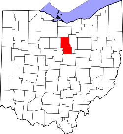 Map of Ohio highlighting the Mansfield Metropolitan Statistical Area.
The Mansfield Metropolitan Statistical Area, as defined by the United States Census Bureau, is an area consisting of one county – Richland – in north central Ohio, anchored by the city of Mansfield. As of the 2010 census, the MSA had a population of 124,475.
Contents
History
The Mansfield metropolitan area was first defined in 1971.[1] Then known as the Mansfield Standard Metropolitan Statistical Area (Mansfield SMSA), it consisted of a single county – Richland – and had a population of 129,997 in the 1970 census.[2] By the census of 1980, the population had grown to 131,205.[2] In 1983, the official name was shortened to the Mansfield Metropolitan Statistical Area (Mansfield MSA), which is still in use to date.[3] The population had declined to 126,137 in 1990.[2] By the census of 2000, the population had grown to 128,852.[4]
Crawford County was added to the MSA in 1999. The two-county area had 175,818 residents in 2000. In 2003, Crawford County was removed from the Mansfield metropolitan area and was re-designated as the Bucyrus Micropolitan Statistical Area (Bucyrus μSA).[5]
Communities
Cities
Villages
Unincorporated places
Townships
Combined Statistical Area
The Mansfield–Bucyrus Combined Statistical Area is made up of two counties in northwest Ohio. The statistical area includes one metropolitan area and one micropolitan area. As of the 2000 Census, the CSA had a population of 175,818 (though a July 1, 2009 estimate placed the population at 167,893).[6]
- Metropolitan Statistical Areas (MSAs)
- Mansfield (Richland County)
- Micropolitan Statistical Areas (μSAs)
- Bucyrus (Crawford County)
See also
References
- ^ "Standard Metropolitan Statistical Areas (SMSAs) and Components, 1971" (TXT). Standard Metropolitan Statistical Areas defined by Office of Management and Budget, February 23, 1971. United States Census Bureau, Population Division. 1 May 2000. http://www.census.gov/population/www/metroareas/lists/historical/71mfips.txt. Retrieved 7 February 2009.
- ^ a b c "Ohio - Population of Counties by Decennial Census: 1900 to 1990". United States Census Bureau, Population Division. 27 March 1995. http://www.census.gov/population/www/censusdata/cencounts/files/oh190090.txt. Retrieved 7 February 2009.
- ^ "About Metropolitan and Micropolitan Statistical Areas". United States Census Bureau, Population Division. http://www.census.gov/population/www/metroareas/aboutmetro.html. Retrieved 7 February 2009.
- ^ "Annual Estimates of the Population of Metropolitan and Micropolitan Statistical Areas: April 1, 2000 to July 1, 2009". United States Census Bureau, Population Division. http://www.census.gov/popest/metro/tables/2009/CBSA-EST2009-01.csv. Retrieved 28 April 2011.
- ^ "Metropolitan Statistical Areas and Components, 2003" (TXT). Metropolitan statistical areas defined by Office of Management and Budget, June 6, 2003. United States Census Bureau, Population Division. 10 July 2003. http://www.census.gov/population/www/metroareas/lists/2003/03msa.txt. Retrieved 7 February 2009.
- ^ "Table 2. Annual Estimates of the Population of Combined Statistical Areas: April 1, 2000 to July 1, 2009 (CBSA-EST2009-02)" (CSV). 2009 Population Estimates. United States Census Bureau, Population Division. 2010-03-23. http://www.census.gov/popest/metro/tables/2009/CBSA-EST2009-02.csv. Retrieved 2010-03-25.
Categories:- Richland County, Ohio
- Metropolitan areas of Ohio
- Mansfield, Ohio
- Metropolitan Statistical Areas (MSAs)

Wikimedia Foundation. 2010.