- Plymouth, Ohio
Infobox Settlement
official_name = Plymouth, Ohio
settlement_type = Village
nickname =
motto =
imagesize =
image_caption =
image_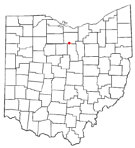
mapsize = 250x200px
map_caption = Location of Plymouth, Ohio
mapsize1 =
map_caption1 =subdivision_type = Country
subdivision_name =United States
subdivision_type1 = State
subdivision_name1 =Ohio
subdivision_type2 = Counties
subdivision_name2 = Richland, Hurongovernment_footnotes =
government_type =
leader_title =
leader_name =
leader_title1 =
leader_name1 =
established_title =
established_date =unit_pref = Imperial
area_footnotes =area_magnitude =
area_total_km2 = 5.8
area_land_km2 = 5.7
area_water_km2 = 0.1
area_total_sq_mi = 2.2
area_land_sq_mi = 2.2
area_water_sq_mi = 0.0population_as_of = 2000
population_footnotes =
population_total = 1852
population_density_km2 = 322.2
population_density_sq_mi = 834.4timezone = Eastern (EST)
utc_offset = -5
timezone_DST = EDT
utc_offset_DST = -4
elevation_footnotes = GR|3
elevation_m = 310
elevation_ft = 1017
latd = 40 |latm = 59 |lats = 46 |latNS = N
longd = 82 |longm = 40 |longs = 0 |longEW = Wpostal_code_type =
ZIP code
postal_code = 44865
area_code = 419
blank_name = FIPS code
blank_info = 39-63800GR|2
blank1_name = GNIS feature ID
blank1_info = 1044654GR|3
website =
footnotes =Plymouth is a village in Huron and Richland counties in the
U.S. state ofOhio . It is part of theMansfield, Ohio Metropolitan Statistical Area . The population was 1,852 at the 2000 census.Geography
Plymouth is located at coor dms|40|59|46|N|82|40|0|W|city (40.996121, -82.666746)GR|1.
According to the
United States Census Bureau , the village has a total area of 2.2square mile s (5.8km² ), of which, 2.2 square miles (5.7 km²) of it is land and 0.04 square miles (0.1 km²) of it (0.89%) is water.The east/west main street in downtown Plymouth know as East Main and West Broadway has the official name "county line road" as it divides Richland and Huron Counties. This puts the village in dual political geographies. This presents several difficulties such as taxes, laws and law enforcement. While the village has its own police force, half shares jurisdiction with the Huron County Sheriff's Department and half with the Richland County Sherrif's Department.
Demographics
As of the
census GR|2 of 2000, there were 1,852 people, 678 households, and 536 families residing in the village. Thepopulation density was 834.4 people per square mile (322.1/km²). There were 744 housing units at an average density of 335.2/sq mi (129.4/km²). The racial makeup of the village was 98.16% White, 0.22% African American, 0.11% Native American, 0.59% from other races, and 0.92% from two or more races. Hispanic or Latino of any race were 1.03% of the population.There were 678 households out of which 40.9% had children under the age of 18 living with them, 61.1% were married couples living together, 13.4% had a female householder with no husband present, and 20.8% were non-families. 18.3% of all households were made up of individuals and 6.9% had someone living alone who was 65 years of age or older. The average household size was 2.73 and the average family size was 3.09.
In the village the population was spread out with 31.0% under the age of 18, 8.3% from 18 to 24, 28.5% from 25 to 44, 22.3% from 45 to 64, and 9.9% who were 65 years of age or older. The median age was 33 years. For every 100 females there were 95.2 males. For every 100 females age 18 and over, there were 89.6 males.
The median income for a household in the village was $36,994, and the median income for a family was $40,559. Males had a median income of $35,737 versus $23,807 for females. The
per capita income for the village was $15,474. About 10.4% of families and 13.3% of the population were below thepoverty line , including 18.8% of those under age 18 and 7.6% of those age 65 or over.History
Plymouth was formerly the headquarters of the
Plymouth Locomotive Works , a builder of industrialrailroad locomotive s. The factory closed in 1999. The company designed and built an automobile named Plymouth in the early part of the century, but it was not mass produced, but there were trucks and tractors produced byCommercial Motor Truck Company under the Plymouth name in the same period. [The Model G truck had 50 horsepower, friction transmission, dual chain drive, 1000-6000 lb payload or 9-20 seats. Clymer, Floyd. "Treasury of Early American Automobiles, 1877-1925" (New York: Bonanza Books, 1950), p.67.] Later, Chrysler Motors developed the Plymouth Automobile Division, but thought the Ohio company had infringed on their name. A court battle ensued over the ownership of the name Plymouth, which Chrysler lost when it was determined the original Plymouth car preceded Chrysler's by several years. During the Depression, the Plymouth Locomotive plant designed and built the famous "Silver King" (originally the "Plymouth") tractor, a somewhat maligned favorite of local farmers and known for its fast road gear. The tractors were produced until the 1950s when it was sold to Mountain State Engineering in West Virginia and then discontinued. The village hosts the annual Silver King Festival during the first week of August when restored Silver Kings tractors from around the world are displayed.Education
Plymouth is located within the Plymouth-Shiloh Local School District. Schools in the district that are located in Plymouth are Plymouth High School. The elementary and middle schools in the district are Shiloh Elementary School and Shiloh Middle School both located in Shiloh. [cite web|last=Great Schools.com|url=http://www.greatschools.net/schools.page?district=547&state=OH|title=District Profile|accessdate=2007-11-26]
Notable natives and residents
*
David Ross Locke , ajournalist and early political commentator during theAmerican Civil War
*Eleanor Searle Whitney McCollum, the spouse ofCornelius Vanderbilt Whitney and founder of the Heritage Center Museum, and the Searle House Bed and Breakfast, a memorial to her mother and father
*John M. C. Smith , aU.S. Representative fromMichigan References
External links
Wikimedia Foundation. 2010.