- Adena, Ohio
Infobox Settlement
official_name = Adena, Ohio
settlement_type = Village
nickname =
motto =
imagesize =
image_caption =
image_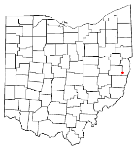
mapsize = 250px
map_caption = Location of Adena, Ohio
mapsize1 =
map_caption1 =subdivision_type = Country
subdivision_name =United States
subdivision_type1 = State
subdivision_name1 =Ohio
subdivision_type2 = Counties
subdivision_name2 = Jefferson, Harrisongovernment_footnotes =
government_type =
leader_title =
leader_name =
leader_title1 =
leader_name1 =
established_title =
established_date =unit_pref = Imperial
area_footnotes =area_magnitude =
area_total_km2 = 1.4
area_land_km2 = 1.4
area_water_km2 = 0.0
area_total_sq_mi = 0.5
area_land_sq_mi = 0.5
area_water_sq_mi = 0.0population_as_of = 2000
population_footnotes =
population_total = 815
population_density_km2 = 584.9
population_density_sq_mi = 1514.9timezone = Eastern (EST)
utc_offset = -5
timezone_DST = EDT
utc_offset_DST = -4
elevation_footnotes = GR|3
elevation_m = 263
elevation_ft = 863
latd = 40 |latm = 13 |lats = 1 |latNS = N
longd = 80 |longm = 52 |longs = 33 |longEW = Wpostal_code_type =
ZIP code
postal_code = 43901
area_code = 740
blank_name = FIPS code
blank_info = 39-00464GR|2
blank1_name = GNIS feature ID
blank1_info = 1037321GR|3
website =
footnotes =Adena is a village in Harrison and Jefferson Counties in the
U.S. state ofOhio . The population was 815 at the 2000 census.History
Founded in 1801 and incorporated in 1908, Adena began in a land fertile for agriculture, and in later years railroads and coal mines provided many jobs. Adena's coal mines were part of eastern Ohio's richest coal area.
By the early twentieth century, many schools, homes, and businesses were established. In 1939, the population reached 1,500 as bus companies made connections to Martins Ferry, Steubenville, Cadiz, and Wheeling, luring business from bigger cities.
Adena is located two miles north of
U.S. Route 250 , fourteen miles east of St. Clairsville, thirty miles south of Steubenville, and nineteen miles northwest ofWheeling, West Virginia .Government
Adena is governed by a village council and Mayor Ray Jeskey, who is serving his second term after being first elected in 2000.fact|date=September 2008
Geography
Adena is located at coor dms|40|13|1|N|80|52|33|W|city (40.216883, -80.875937)GR|1.
According to the
United States Census Bureau , the village has a total area of 0.5square mile s (1.4km² ), all land.Demographics
As of the
census GR|2 of 2000, there were 815 people, 348 households, and 243 families residing in the village. Thepopulation density was 1,514.9 people per square mile (582.7/km²). There were 389 housing units at an average density of 723.1/sq mi (278.1/km²). The racial makeup of the village was 98.28% White, 1.23% African American, 0.12% Asian, and 0.37% from two or more races.There were 348 households out of which 25.0% had children under the age of 18 living with them, 56.9% were married couples living together, 9.5% had a female householder with no husband present, and 29.9% were non-families. 27.9% of all households were made up of individuals and 16.7% had someone living alone who was 65 years of age or older. The average household size was 2.34 and the average family size was 2.85.
In the village the population was spread out with 19.4% under the age of 18, 7.7% from 18 to 24, 26.3% from 25 to 44, 26.6% from 45 to 64, and 20.0% who were 65 years of age or older. The median age was 43 years. For every 100 females there were 91.3 males. For every 100 females age 18 and over, there were 86.6 males.
The median income for a household in the village was $25,341, and the median income for a family was $30,156. Males had a median income of $30,313 versus $17,679 for females. The
per capita income for the village was $14,941. About 16.9% of families and 20.6% of the population were below thepoverty line , including 30.2% of those under age 18 and 14.4% of those age 65 or over.References
External links
* [http://www.adenanews.com link Adena News website]
Wikimedia Foundation. 2010.