- Bacliff, Texas
-
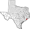
Bacliff, Texas — CDP — Location of Bacliff, Texas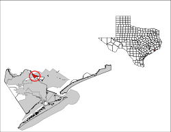
Coordinates: 29°30′19″N 94°59′20″W / 29.50528°N 94.98889°WCoordinates: 29°30′19″N 94°59′20″W / 29.50528°N 94.98889°W Country United States State Texas County Galveston Area – Total 2.5 sq mi (6.5 km2) – Land 2.5 sq mi (6.5 km2) – Water 0.0 sq mi (0.0 km2) Elevation 16 ft (5 m) Population (2000) – Total 6,962 – Density 2,764.6/sq mi (1,067.4/km2) Time zone Central (CST) (UTC-6) – Summer (DST) CDT (UTC-5) ZIP code 77518 Area code(s) 281 FIPS code 48-05180[1] GNIS feature ID 1329909[2] Bacliff is a census-designated place (CDP) in north central Galveston County, Texas, United States, 16 miles (26 km) northwest of Galveston.[3] The population was 6,962 at the 2000 census. Bacliff, originally called Clifton-by-the-Sea, began as a seaside resort town. Bacliff morphed into a fishing community, finding hardship, gang violence, and an increase of sex offenders and felons when the shrimping industry declined. The community never incorporated, with many failed incorporation attempts made. The Bacliff CDP has one elementary school and several parks and boat ramps.
Contents
History
Further information: History of the Galveston Bay AreaBacliff first opened in 1910 as a seaside summer weekend resort called "Clifton-by-the-Sea." Hurricanes, Galveston's recovery after the Hurricane of 1900, and rapid transportation diminished Clifton-by-the-Sea's popularity.[3][4] Clifton-by-the-Sea had 50 residents and two businesses in 1933 and 100 residents and four businesses from 1940 to 1949. During the late 1940s or early 1950s the community became "Bacliff."[3]
Cheap housing and the shrimping industry sustained Bacliff, and at that time there was no pollution in the water and less shore erosion compared to the amount of erosion in the 2000s. "Gator" Miller, publisher of small newspapers such as the monthly magazine Seabreeze and the entertainment magazine Night Moves, said that in the 1950s the The Galveston Daily News bought a large parcel of land and awarded free lots to subscribers; people who canceled subscriptions lost their homesites, which were given to other subscribers.[4] Miller said that this resulted in confused titles and a lack of large business; Miller said that a retailer would not wish to buy land in Bacliff and then discover that an individual claimed a title to the land.[4] In 1961, when the post office opened, both names ("Bacliff" and "Clifton-by-the-Sea") were still used to refer to the community, which had 1,707 residents and 25 businesses during that year. In 1966 this increased to 1,782 residents and 17 businesses.[3]
Around the 1980s, three measures to incorporate the Bacliff area failed by wide margins.[5][6] In April 1985, residents of Bacliff, Bayview, and San Leon considered an incorporation proposal to become the City of Bayshore. Judge Ray Holbrook signed an order for the election to take place on April 6, 1985, freeing the area, which had a population of 11,000, from the extraterritorial jurisdiction of League City and Texas City.[7] Residents rejected the incorporation proposal.[8][9] The vote was tallied with 1,268 against and 399 in favor. Proponents wanted a local police force and the ability to pass ordinances. Opponents said that the tax base was too small to support municipal services including police and road and drainage improvements.[9]
In 1986, residents in Bacliff and Bayview considered incorporating into a general law city. Supporters said that incorporation would establish more local control over affairs, an area police department, and the ability to pass ordinances. Opponents said that the area's tax base could not sufficiently support municipal service, including police protection and road and drainage improvements. At the time the area of 3.6 square miles (9.3 km2) considering incorporation had 7,000 people.[5][6] Galveston County Judge Ray Holbrook signed an order setting the date of the election as Saturday, August 9, 1986 and releasing the area from the extraterritorial jurisdiction of Kemah, League City, and Texas City. In 1986, the Bacliff and Bayview area received water and sewer services from two municipal utility districts; if the incorporation measure had passed the districts would have likely remained. Donna Maples, vice president of the Bacliff-Bayview Community Association, supported the incorporation measure.[8] The officials overseeing the election described turnout as "heavy." Officials announced that the incorporation proposal failed on a 770 to 163 count.[5][6]
By 1986, the community became a bedroom community for workers commuting to jobs in the area; during that year the Bacliff community had 4,851 residents and 19 businesses.[3] Since the 1980s, when the shrimping industry declined, more affluent residents moved to Dickinson and the unincorporated community of San Leon, while illegal immigrants, sex offenders, and other felons moved to Bacliff.[4] In 1990 the community had 5,549 residents, 27 businesses, six churches, and one school.[3]
After Hurricane Ike hit Texas in September 2008, Galveston County officials offered a debris removal program to residents in unincorporated areas, including Bacliff, who could not clear debris by themselves.[10][11]
Geography and climate
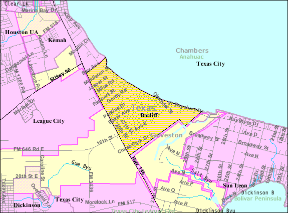
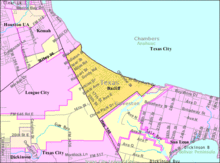 Map of the Bacliff CDP
According to the United States Census Bureau, the CDP has a total area of 2.5 square miles (6.5 km2), of which, 2.5 square miles (6.5 km2) of it is land and 0.40% is water.
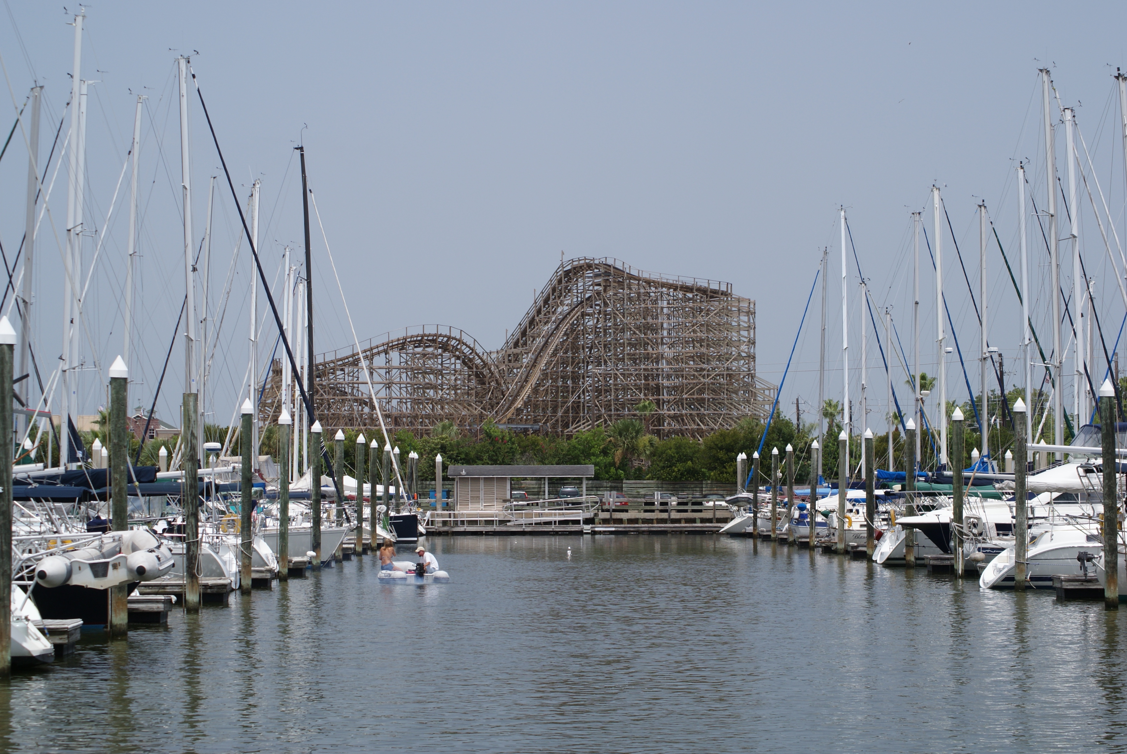
In 2008, the median house price in Bacliff was $80,000. During that year, John Nova Lomax of Houston Press wrote that his impression of the town is that "much of it is a white ghetto almost as hardcore as the roughest parts of Houston's South Park or Fifth Ward," despite that the community has "plenty of nice houses and good people, especially along the waterfront." Lomax said that Grand Avenue, Bacliff's main thoroughfare, "is lined with little more than a nonstop succession of beer joints, liquor stores and gambling halls, while the town's back streets offer up vistas of ramshackle abodes and general deprivation not often seen outside of Appalachia." Lou's, which Lomax said was "the town's one true grocery store," had a lot of cigarettes, beer, and canned food and "offers little else other than wilted vegetables and whole aisles of all-but-bare shelves." Lomax characterized the poverty as "Gulf Coast-style" as "often as not, these houses have the hulks of rusted-out boats in their tiny yards instead of trucks." Bacliff has a strip club and many gambling halls open during many times throughout the day; criminals intending to rob individuals target gambling halls. Bacliff has a ratio of bars per person which Lomax says "rivals those of many hard-drinking British seaside resorts." Jack Nelson, a local resident, told the Houston Press "This is the only town I know that has churches next to bars that are next to gambling halls, and then repeat that all over town."[12]
In the 2000s, a gated complex which Lomax said, "wouldn't look out of place in Clear Lake" opened on Bacliff's southern side. Pam Matranga, constable of the County Precinct 7, said in the 2008 article that 700 new houses were opening along Bayshore Drive, which Lomax described as the, "most pleasant and wealthy thoroughfare" in Bacliff. "Gator" Miller said that, "Just looking at it from an aerial view, you can see that [Bacliff is] destined to be a ghetto. There's no room there the way the streets are laid out, and the only way to relieve that would be if the county came in and condemned half the streets and let grass grow through."[13]
Climate data for Bacliff Month Jan Feb Mar Apr May Jun Jul Aug Sep Oct Nov Dec Year Average high °F (°C) 62
(17)66
(19)72
(22)77
(25)84
(29)89
(32)91
(33)92
(33)88
(31)81
(27)72
(22)65
(18)78.3
(25.7)Average low °F (°C) 43
(6)46
(8)53
(12)60
(16)67
(19)73
(23)74
(23)74
(23)70
(21)60
(16)52
(11)45
(7)59.8
(15.4)Precipitation inches (mm) 4.76
(120.9)2.91
(73.9)3.11
(79)3.22
(81.8)4.92
(125)5.35
(135.9)4.78
(121.4)3.84
(97.5)7.12
(180.8)3.93
(99.8)4.43
(112.5)3.36
(85.3)51.73
(1,313.9)Source: Weather.com[14] Demographics
Historical populations Census Pop. %± 1980 4,851 — 1990 5,549 14.4% 2000 6,962 25.5% source:[15] As of the census[1] of 2000, there were 6,962 people, 2,523 households, and 1,753 families residing in the CDP. The population density was 2,764.6 people per square mile (1,066.7/km²). There were 2,963 housing units at an average density of 1,176.6/sq mi (454.0/km²). The racial makeup of the CDP was 82.65% White, 1.78% African American, 0.78% Native American, 2.99% Asian, 0.01% Pacific Islander, 9.67% from other races, and 2.13% from two or more races. Hispanic or Latino of any race were 23.30% of the population.
There were 2,523 households out of which 36.3% had children under the age of 18 living with them, 51.3% were married couples living together, 12.0% had a female householder with no husband present, and 30.5% were non-families. 23.3% of all households were made up of individuals and 6.7% had someone living alone who was 65 years of age or older. The average household size was 2.76 and the average family size was 3.24.
In the CDP, the population was spread out with 29.0% under the age of 18, 9.1% from 18 to 24, 33.0% from 25 to 44, 20.7% from 45 to 64, and 8.2% who were 65 years of age or older. The median age was 33 years. For every 100 females there were 109.2 males. For every 100 females age 18 and over, there were 108.6 males.
The median income for a household in the CDP was $32,188, and the median income for a family was $35,182. Males had a median income of $30,783 versus $25,172 for females. The per capita income for the CDP was $14,884. About 16.2% of families and 21.7% of the population were below the poverty line, including 30.6% of those under age 18 and 16.3% of those age 65 or over.
In 2008, Bacliff had almost as many unemployed residents as it had residents with university degrees.[12] Bacliff also has a higher than average concentration of sex offenders, with one of 225 Bacliff residents, compared to one in 594 in Houston.[16]
Crime
As of 2008, Bacliff has street gangs consisting of mostly White Americans. The gangs appeared around the period when the shrimping industry declined in the 1980s. In a 2008 Houston Press article, "Gator" Miller said that many Bacliff gangs commit crimes in Kemah. Jack Nelson, a resident interviewed by the Houston Press, said that recreational drugs such as crack cocaine and methamphetamine, rather than gangs per se, are the origins of Bacliff's issues. Miller described Bacliff as "the problem child [in the area]" and added that deputies told him that 90% of their calls go to Bacliff.[12] Miller said that, prior to the 2004 election of Precinct 7 Constable Pam Matranga, meth labs operated in Bacliff prior to the popularity of meth labs around the United States since the local constables allowed them to remain. In addition, the understaffed county police department found difficulty fighting crime in Bacliff.[16] In 2008, the 4th Street Blood Gang faced federal indictment on charges related to trafficking of cocaine, crack cocaine, and methamphetamines. The gang began in the mid-1990s.[17][18]
On September 11, 2004, Bacliff residents attended a "town hall meeting" and demanded area officials to take measures to decrease crime. Miller said that many Bacliff residents want to continue to drink alcohol, gamble, smoke cannabis, and consume methamphetamines, yet they do not like the effects of crack cocaine and the violence associated with crack.[12]
Pam Matranga said that a nickname given to the city, "Felon City," is not deserved since outsiders, not longtime Bacliff residents, cause crime in Bacliff. Matranga said that cheap rental prices encourage criminals to settle in Bacliff.[16] John Nova Lomax of the Houston Press said that, due to economic pressures such as new development and rising housing prices along coastlines, Bacliff residents began to believe that efforts to lower Bacliff's crime rates would intensify. Miller believes that Bacliff will change only if drastic change such as mass redevelopment would occur.[13]
Economy
Bacliff CDP had 3,147 employed civilians as of the 2000 Census, including 1,360 females. Of the civilian workers, 2,435 (77.4%) were private for profit wage and salary workers. Of them 56 (1.8% of the total Bacliff CDP civilian workforce) were employees of their own corporations, 82 (2.6%) were private non-profit wage and salary workers, 151 (4.8%) worked for local governments, 144 (4.6%) were state government workers, 53 (1.7%) were federal workers, 268 (9.3%) were self-employed, and 14 of them (less than 1% of the total Bacliff CDP workforce) worked in agriculture, forestry, fishing, or hunting. 14 (Less than 1%) were unpaid family workers.[19]
Government and infrastructure
Local government
Two municipal utility districts serve the Bacliff CDP. Some sections of the Bacliff CDP are served by the Bacliff Municipal Utility District, while other sections are served by the Bayview Municipal Utility District.[20] The Bacliff Volunteer Fire Department provides fire protection services.[21]
County, state, and federal representation
The community is within Galveston County Precinct 1.[22] As of 2008, Patrick Doyle is the commissioner of the precinct.[23][24] The Galveston County Sheriff's Office Precinct 7 serves Bacliff.[16] As of 2008 Pam Matranga is the constable of the precinct.[25]
Bacliff is located in District 23 of the Texas House of Representatives. As of 2008, Craig Eiland represents the district.[26] Bacliff is within District 11 of the Texas Senate; as of 2008 Mike Jackson represents that district.[27] In 1992, Bacliff was within District 24 of the Texas House of Representatives; after statewide legislative redistricting District 24 became District 23 in 1993 with its boundary changing by several city blocks.[28]
Bacliff is in Texas's 14th congressional district. As of 2008, Ron Paul represents the district.[29] The United States Postal Service Bacliff Post Office is located at 415 Grand Avenue in the CDP in unincorporated Galveston County.[30] In 1994 Republican Party strength grew in Bacliff.[31]
Education
Some of the areas within the Bacliff CDP fall under the boundary of Dickinson Independent School District (DISD), while northern areas are zoned to Clear Creek Independent School District (CCISD). The CCISD part of the community north of Bay Avenue is within the Board of Trustee District 5,[32] represented by Dee Scott as of 2008.[33]
The DISD portion is zoned to Kenneth E. Little Elementary School in the Bacliff community in unincorporated Galveston County,[34][35] Barber Middle School in Dickinson,[36] McAdams Junior High School in Dickinson, and Dickinson High School in Dickinson.[37] CCISD pupils are zoned to Stewart Elementary School (formerly Kemah Elementary School) in unincorporated Galveston County,[38] League City Intermediate School in League City,[39] and Clear Creek High School in League City.[40]
Residents are zoned to the College of the Mainland, a community college in Texas City.[41]
Parks and recreation
The Galveston County Department of Parks and Senior Services operates several recreational facilities in Bacliff. The Bacliff Community Center is at 4503 11th Street.[42] The 28-acre (110,000 m2) Bayshore Park at 5437 East Farm to Market Road 646 (FM 646) has five baseball fields, one boat ramp, one historic site, ten picnic areas, one pier, one playground, and five practice backstops.[43] The Bacliff Boat Ramp is along FM 646,[44] while the Bayshore Boat Ramp is along Farm to Market Road 517 (FM 517).[45]
References
- ^ a b "American FactFinder". United States Census Bureau. http://factfinder.census.gov. Retrieved 2008-01-31.
- ^ "US Board on Geographic Names". United States Geological Survey. 2007-10-25. http://geonames.usgs.gov. Retrieved 2008-01-31.
- ^ a b c d e f Bacliff, Texas from the Handbook of Texas Online
- ^ a b c d Lomax, John Nova. "Gangsters in Bacliff." Houston Press. September 11, 2008. 2.
- ^ a b c "Baycliff kills incorporation, Jersey Village votes home rule." [sic] Houston Chronicle. Monday, August 11, 1986. Section 1, Page 9.
- ^ a b c "2 area communities to vote on incorporation." Houston Chronicle. Tuesday, August 5, 1986. Section 3, Page 10.
- ^ "Residents of 3 Galveston County areas will vote on incorporation." Houston Chronicle. Tuesday March 19, 1985. Section 1, Page 13.
- ^ a b "Election for incorporation called in Bacliff, Bayview." Houston Chronicle. Sunday July 6, 1986. Section 3, Page 5.
- ^ a b "Results of municipal elections in Southeast Texas." Houston Chronicle. Monday April 8, 1985. Section 1, Page 10.
- ^ Aulds, T. J. "Plan offers help with residential Ike debris." Galveston County Daily News. November 20, 2008.
- ^ Aulds, T. J. "State begins to pick up debris." Galveston County Daily News. December 8, 2008.
- ^ a b c d Lomax, John Nova. "Gangsters in Bacliff." Houston Press. September 11, 2008. 1.
- ^ a b Lomax, John Nova. "Gangsters in Bacliff." Houston Press. September 11, 2008. 5.
- ^ "Monthly Averages for Bacliff, TX (English)". http://www.weather.com/weather/wxclimatology/monthly/graph/USTX0066?from=36hr_bottomnav_undeclared. Retrieved December 8, 2008.
- ^ "CENSUS OF POPULATION AND HOUSING (1790-2000)". U.S. Census Bureau. http://www.census.gov/prod/www/abs/decennial/index.html. Retrieved 2010-07-30.
- ^ a b c d Lomax, John Nova. "Gangsters in Bacliff." Houston Press. September 11, 2008. 4.
- ^ "4th Street Blood Gang Members and Associates Indicted on Drug Charges." United States Drug Enforcement Administration. May 20, 2008.
- ^ McDonald, Sara. "Feds bust 10 alleged gang members." KHOU-TV. Wednesday May 21, 2008.
- ^ "Class of Worker by Sex, Place of Work, and Veteran Status: 2000 - Bacliff, Texas." US Census Bureau. Retrieved on December 12, 2008.
- ^ "Texas Property 2002 Appraisal District Directory: Galveston County." Texas Comptroller of Public Accounts. Retrieved on December 9, 2008.
- ^ "Members." Galveston County Firefighters Association. Retrieved on December 8, 2008.
- ^ "Galveston County Mainland Commissioners' Precincts." Galveston County, Texas. Retrieved on December 20, 2008.
- ^ "Honorable Patrick Doyle Commissioner Precinct 1." Galveston County, Texas. Accessed on December 20, 2008.
- ^ Aulds, T. J. "FEMA trailer site neighbors angry." Galveston County Daily News. December 19, 2008. Retrieved on December 20, 2008.
- ^ "Constable, Precinct No. 7." Galveston County Sheriff's Office. Retrieved on December 7, 2008.
- ^ "District 23." Texas House of Representatives. Retrieved on December 8, 2008.
- ^ "Senate District 11" Map. Senate of Texas. Retrieved on December 8, 2008.
- ^ Moran, Kevin. "Election '92: Suburban/Gray builds huge lead in bid for Hury's seat." Houston Chronicle. Wednesday November 4, 1992. A34.
- ^ "Congressional District 14." National Atlas of the United States. Retrieved on December 8, 2008.
- ^ "Post Office Location - BACLIFF." United States Postal Service. Retrieved on December 6, 2008.
- ^ Moran, Kevin. "Republicans spring attack on Galveston." Houston Chronicle. Sunday February 27, 1994. C1.
- ^ District 5 Map. Clear Creek Independent School District. Retrieved on December 6, 2008.
- ^ "School Board Members: Bios and Contact Information." Clear Creek Independent School District. Retrieved on December 6, 2008.
- ^ "K. E. Little Elementary Attendance Zones." [sic] Dickinson Independent School District. Retrieved on December 8, 2008.
- ^ Moran, Kevin. "Volunteers search for gravesite of Sikes." Houston Chronicle. Sunday August 2, 1987. Section 2, Page 23.
- ^ Middle School Attendance Zones. Dickinson Independent School District. Retrieved on December 8, 2008.
- ^ Meyers, Rhiannon. "Changes awaiting students this year." Galveston County Daily News. August 24, 2008.
- ^ "Stewart Elementary School Boundary." This coming school year students may also be zoned to one of the two unnamed Elementary Schools opening. Clear Creek Independent School District. Retrieved on December 6, 2008.
- ^ "League City Intermediate School Boundary." Students may also be zoned to Clear Creek Intermediate School which will be debuting Fall 2009. Clear Creek Independent School District. Retrieved on December 6, 2008.
- ^ "Clear Creek High School Boundary." Clear Creek Independent School District. Retrieved on December 6, 2008.
- ^ Texas Education Code, Section 130.174, "College of the Mainland District Service Area".
- ^ Bacliff Community Center." Galveston County Department of Parks and Senior Services. Retrieved on December 8, 2008.
- ^ Bayshore Park." Galveston County Department of Parks and Senior Services. Retrieved on December 8, 2008.
- ^ "Bacliff Park Boat Ramp." Galveston County Department of Parks and Senior Services. Retrieved on December 8, 2008.
- ^ "Bayshore Park Boat Ramp." Galveston County Department of Parks and Senior Services. Retrieved on December 8, 2008.
External links
- Bacliff, Texas from the Handbook of Texas Online
- Gangsters in Bacliff - Houston Press
- Bacliff Wiggers - Houston Press
- Bacliff MUD
Galveston Bay Area HistoryLarge cities 
Other cities Anahuac · Beach City · Clear Lake Shores · Dickinson · El Lago · Deer Park · Friendswood · Kemah · La Marque · La Porte · League City · Nassau Bay · Morgan's Point · Seabrook · Shoreacres · Taylor Lake Village · Texas City · WebsterCDPs and non-
municipalitiesBacliff · Bayview · Clear Lake City (part of Houston/Pasadena) · Double Bayou · San Leon · Smith PointCounties Subregions Bodies of
waterArmand Bayou · Cedar Bayou · Clear Creek · Clear Lake · Dickinson Bay · Galveston Bay · Lake Anahuac · Moses Lake · San Jacinto River · Taylor Lake · Trinity Bay · Trinity RiverMajor ports Barbours Cut · Bayport · Texas CityNature
preservesAnahuac National Wildlife Refuge · Armand Bayou Nature Center · Baytown Nature Center · Pine Gully Park · Texas City Prairie Preserve Houston–Sugar Land–Baytown
Counties Austin • Brazoria • Chambers • Fort Bend • Galveston • Harris • Liberty • Montgomery • San Jacinto • Waller
"Principal" cities Other cities Alvin • Angleton • Bellaire • Clute • Deer Park • Dickinson • Freeport • Friendswood • Galena Park • Humble • Jacinto City • Katy • Lake Jackson • La Marque • La Porte • League City • Missouri City • Pasadena • Pearland • Richmond • Rosenberg • South Houston • Stafford • Texas City • West University Place
- For a complete listing, see list of cities and towns in Houston–Sugar Land–Baytown MSA
Unincorporated
areasAtascocita • Channelview • Cloverleaf • Crosby • Cypress • Fresno • Hockley • Klein • Port Bolivar • Spring • The WoodlandsBodies of water Buffalo Bayou • Galveston Bay • Gulf Intracoastal Waterway • Houston Ship Channel • San Jacinto River • Trinity River • Lake Houston • Lake ConroeMunicipalities and communities of Galveston County, Texas Cities Bayou Vista | Clear Lake Shores | Dickinson | Friendswood‡ | Galveston | Hitchcock | Jamaica Beach | Kemah | La Marque | League City‡ | Santa Fe | Seabrook‡ | Texas City‡
Village CDPs Bacliff | Bolivar Peninsula | San Leon
Unincorporated
communitiesAlgoa | Bayview | Caplen | Crystal Beach | Gilchrist | High Island | Port Bolivar
Footnotes ‡This populated place also has portions in an adjacent county or counties
Categories:- Populated places in Galveston County, Texas
- Census-designated places in Texas
- Greater Houston
- Unincorporated communities in Texas
- Galveston Bay Area


Wikimedia Foundation. 2010.