- Double Bayou, Texas
-
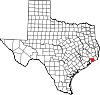
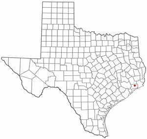
Double Bayou — CDP — Location of Double Bayou, Texas
Coordinates: 29°46′N 94°40′W / 29.767°N 94.667°W Country United States State Texas County Chambers Time zone Central (CST) (UTC-6) – Summer (DST) CDT (UTC-5) ZIP code Area code(s) 409 FIPS code GNIS feature ID Double Bayou is an unincorporated area in Chambers County, Texas, United States.
Education
The Anahuac Independent School District operates schools in the area.
External links
- Double Bayou, Texas from the Handbook of Texas Online
Galveston Bay Area HistoryLarge cities 
Other cities Anahuac · Beach City · Clear Lake Shores · Dickinson · El Lago · Deer Park · Friendswood · Kemah · La Marque · La Porte · League City · Nassau Bay · Morgan's Point · Seabrook · Shoreacres · Taylor Lake Village · Texas City · WebsterCDPs and non-
municipalitiesBacliff · Bayview · Clear Lake City (part of Houston/Pasadena) · Double Bayou · San Leon · Smith PointCounties Subregions Bodies of
waterArmand Bayou · Cedar Bayou · Clear Creek · Clear Lake · Dickinson Bay · Galveston Bay · Lake Anahuac · Moses Lake · San Jacinto River · Taylor Lake · Trinity Bay · Trinity RiverMajor ports Barbours Cut · Bayport · Texas CityNature
preservesAnahuac National Wildlife Refuge · Armand Bayou Nature Center · Baytown Nature Center · Pine Gully Park · Texas City Prairie PreserveMunicipalities and communities of Chambers County, Texas Cities Anahuac | Baytown‡ | Beach City | Cove | Mont Belvieu‡ | Old River-Winfree‡ | Shoreacres‡ | Seabrook‡ | Texas City‡
CDPs Unincorporated
communitiesDouble Bayou | Hankamer | Monroe City | Oak Island | Seabreeze | Smith Point | Turtle Bayou | Wallisville
Footnotes ‡This populated place also has portions in an adjacent county or counties
Coordinates: 29°41′34″N 94°37′45″W / 29.69278°N 94.62917°W
Categories:- Populated places in Chambers County, Texas
- Unincorporated communities in Texas
- Greater Houston
- Galveston Bay Area

Wikimedia Foundation. 2010.