- Beach City, Texas
Infobox Settlement
official_name = Beach City, Texas
settlement_type =City
nickname =
motto =
imagesize =
image_caption =
image_
mapsize = 250px
map_caption = Location of Beach City, Texas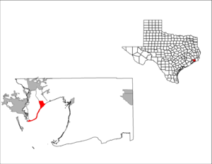
mapsize1 = 250px
map_caption1 =subdivision_type = Country
subdivision_name =United States
subdivision_type1 = State
subdivision_name1 =Texas
subdivision_type2 = County
subdivision_name2 = Chambersgovernment_footnotes =
government_type =
leader_title =
leader_name =
leader_title1 =
leader_name1 =
established_title =
established_date =unit_pref = Imperial
area_footnotes =
area_magnitude =
area_total_km2 = 11.5
area_land_km2 = 11.5
area_water_km2 = 0.0
area_total_sq_mi = 4.4
area_land_sq_mi = 4.4
area_water_sq_mi = 0.0population_as_of = 2000
population_footnotes =
population_total = 1645
population_density_km2 = 143.2
population_density_sq_mi = 370.9timezone = Central (CST)
utc_offset = -6
timezone_DST = CDT
utc_offset_DST = -5
elevation_footnotes =
elevation_m = 6
elevation_ft = 20
latd = 29 |latm = 42 |lats = 9 |latNS = N
longd = 94 |longm = 51 |longs = 46 |longEW = Wpostal_code_type =
postal_code =
area_code =
blank_name = FIPS code
blank_info = 48-06200GR|2
blank1_name = GNIS feature ID
blank1_info = 1381006GR|3
website =
footnotes =Beach City is a city in Chambers County,
Texas ,United States . The population was 1,645 at the 2000 census.Geography
Beach City is located at coor dms|29|42|9|N|94|51|46|W|city (29.702527, -94.862789)GR|1.
According to the
United States Census Bureau , the city has a total area of 4.4square mile s (11.5km² ), all of it land.Historical development
To prevent annexation by the nearby City of Baytown eight miles to the northwest, this community voted in April 1966 to become incorporated. [ [http://www.tsha.utexas.edu/handbook/online/articles/BB/hjb27.html TSHA Online - Texas State Historical Association ] ]
Demographics
As of the
census GR|2 of 2000, there were 1,645 people, 623 households, and 490 families residing in the city. Thepopulation density was 370.9 people per square mile (143.0/km²). There were 714 housing units at an average density of 161.0/sq mi (62.1/km²). The racial makeup of the city was 95.62% White, 1.58% African American, 0.12% Native American, 0.06% Asian, 1.76% from other races, and 0.85% from two or more races. Hispanic or Latino of any race were 4.74% of the population.There were 623 households out of which 35.6% had children under the age of 18 living with them, 70.5% were married couples living together, 6.1% had a female householder with no husband present, and 21.2% were non-families. 16.2% of all households were made up of individuals and 6.1% had someone living alone who was 65 years of age or older. The average household size was 2.64 and the average family size was 2.97.
In the city the population was spread out with 25.8% under the age of 18, 7.0% from 18 to 24, 28.0% from 25 to 44, 29.8% from 45 to 64, and 9.4% who were 65 years of age or older. The median age was 40 years. For every 100 females there were 103.8 males. For every 100 females age 18 and over, there were 102.5 males.
The median income for a household in the city was $70,104, and the median income for a family was $75,439. Males had a median income of $55,268 versus $33,750 for females. The
per capita income for the city was $28,421. About 2.8% of families and 4.0% of the population were below thepoverty line , including 3.8% of those under age 18 and 0.8% of those age 65 or over.Transportation
RWJ Airpark , a privately-owned airport, is located in Beach City.Education
A northeastern part of the city is zoned to
Barbers Hill Independent School District .A southwestern part of the city is zoned to
Goose Creek Independent School District .Zoned schools include: [" [http://www.gccisd.net/zone/ Street Name Search] ." "
Goose Creek Independent School District ".]
* Lorenzo de Zavala Elementary School (Baytown)
* Horace Mann Middle School (Baytown)
* Sterling High School (Baytown)References
External links
*

Wikimedia Foundation. 2010.