- Carlingford, New South Wales
-
Carlingford
Sydney, New South Wales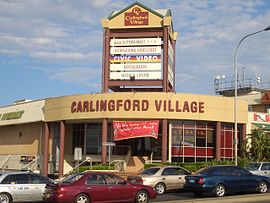
Carlingford Village Shopping CentrePopulation: 21,365 (2006 census) Postcode: 2118 Area: 7.9 km² (3.1 sq mi) Location: 22 km (14 mi) north-west of Sydney CBD LGA: The Hills Shire, Hornsby Shire, City of Parramatta State District: Baulkham Hills
Castle Hill
Epping
ParramattaFederal Division: Bennelong
Berowra
ParramattaSuburbs around Carlingford: North Rocks West Pennant Hills Beecroft North Parramatta Carlingford Epping Oatlands Telopea Eastwood Carlingford is a suburb of Sydney, in the state of New South Wales, Australia. Carlingford is located 22 kilometres north-west of the Sydney central business district in the local government areas of the The Hills Shire, Hornsby Shire and the City of Parramatta. Carlingford is on the north-eastern outskirts of the Greater Western Sydney region and is on the south-eastern outskirts of the Hills District and western outskirts of Northern Suburbs.
Contents
History
Originally, the area of Carlingford was called Mobbs Hill, named after the ex-convict settler William Mobbs, who is credited for bringing oranges to Australia. Carlingford received its current name in 1886 after a vote by the residents. The name was suggested by Frederick Cox after he heard one of his employees describe similarities between Mobbs Hill and the town of Carlingford, County Louth, located in the east of Ireland. Carlingford in Ireland derived its name from Scandinavian origins, from the time of the Viking invasions and settlements.[1] Carlingford may also have been named in honour of Lord Carlingford, who was Under-secretary to the Colonies.[2]
The area was settled in the mid-1800s and, at the time, was an agricultural area on the outskirts of Sydney. Like much of the Hills District, Carlingford was a significant orange-growing area for the city. Pennant Hills Road, then a major arterial road from Parramatta to the northern suburbs, was a major route of transportation for agricultural produce from the area. When the train line which terminated at Carlingford railway station, then known as Simpson's Railway, was completed in 1896, it too, became a major route for the area. Carlingford Produce, a gardening and agricultural-materials seller located next to the train station, is located in the former train workshops. This store, much like James Ruse Agricultural High School (see below) remain as testament to the agricultural history of the suburb.
In April 1923 the Wesley Central Mission established the Dalmar Children's Homes on 15 acres (61,000 m2) of land near Marsden Road in the eastern end of the suburb. The property eventually had many cottages, together with a hospital, an orchard and vegetable gardens. The land is now the site of the Alan Walker Retirement Village.
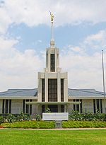
The suburb was also home to several homes for children operated by the Anglican Diocese of Sydney since the 1920s: The Church of England Boys' Home, Church of England Girls' Home, and the Havilah Children's Home, Tress Manning Temporary Care, and Field Cottage. Land owned by the homes has since been developed for housing, with street names such as Trigg, Marella, Carramar, Buckland and Lisgar reflecting the names of individual houses or Anglican Home Mission Society services. Boys' Home buildings and grounds are now the regional base and Sydney Australia Temple of The Church of Jesus Christ of Latter-day Saints. Girls' Home property in the south of the suburb has become, since 1974, Anglicare's Kingsdene Special School for severely to profoundly intellectually disabled children, as well as the American International School.
As Sydney rapidly expanded, following World War II, Carlingford underwent rapid urbanisation. James Ruse Agricultural High School, established in 1959, is a testament to the agricultural history of Carlingford as well as the rapid pace of urbanisation; which soon made the school, and its large farm, somewhat of an anomaly amongst the 1970s- and 1980s-style houses which dominate the suburb. More recently, in the 1990s, the government policy of urban consolidation has seen the development of high-density units and apartment blocks around the town centre and the train station. There have also been redevelopments of older houses into medium-density townhouses, and duplex housing.
In 1961, the HMS K13 memorial was unveiled, and stands as a prominent feature in Carlingford, passed by thousands of motorists along Pennant Hills Road each day.
 Carlingford Court Shopping Centre
Commercial areas
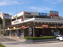
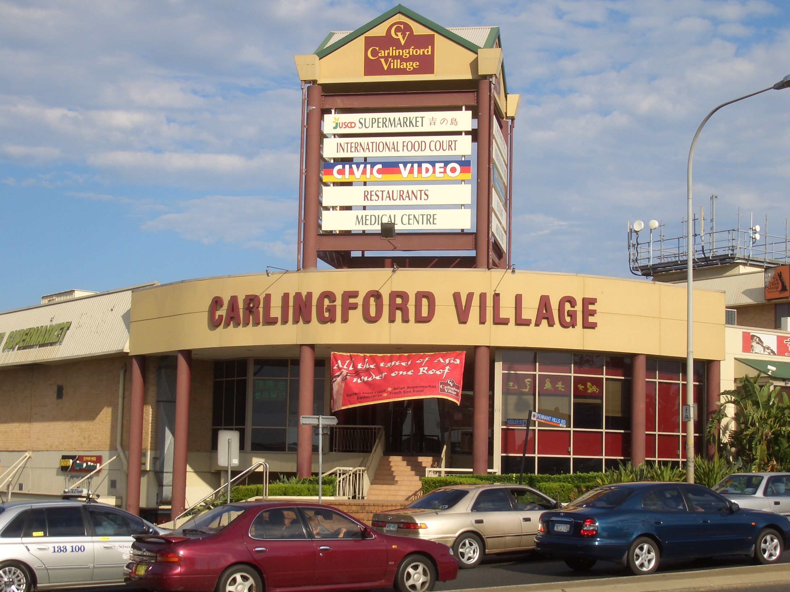
The Carlingford town centre is located on Pennant Hills Road and comprises a shopping strips and two shopping centres, Carlingford Court and Carlingford Village. The shopping strip, near Carlingford railway station, includes Carlingford Bowling Club, the only pub in Carlingford.
Carlingford Court, managed by GPT, is a typical large suburban shopping centre featuring supermarkets, discount department stores, specialty shops and a Fitness First. The centre underwent major reconstruction in the late 1990s and underwent minor redevelopment after the Myer department store closed on March 31, 2006. Carlingford Village is a smaller shopping complex, which has many Asian food outlets.
Transport
As with much of Sydney, Carlingford has relatively limited public transport access, which is reflected in the low public transport patronage by commuters. In the 2001 census, 6% of commuters travelled to work via trains while 2% used buses.[citation needed]
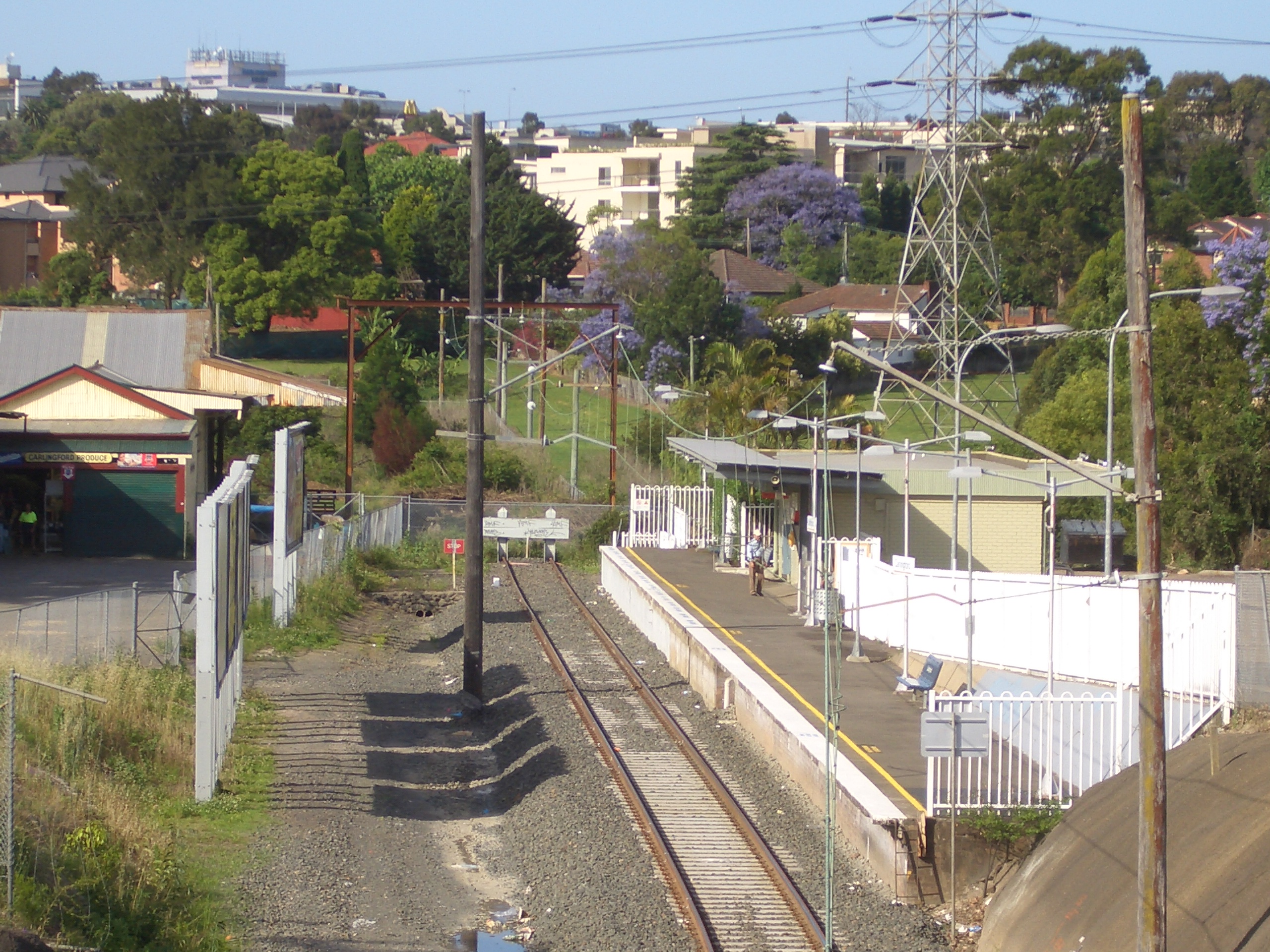
 The end of the line at Carlingford railway station
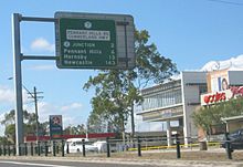 Cumberland Highway, Carlingford
Railway
Carlingford railway station is the terminus of the Carlingford Line on the CityRail network. The Carlingford Line, which opened on 20 April 1896 as a private railway, then as a public line on 1 August 1901,[3] is a mostly single-track line. There is currently only one service in the early morning which connects to the city directly, at other times a train-change at Clyde, is necessary to reach other stations, and consequently the service has a low patronage, though it is quite popular during peak hours. As part of the CityRail Clearways Project, a passing loop was promised to the Carlingford Line with two services per hour all day to become effective in 2010. This was however scrapped in the 2008 mini-budget.
Roads
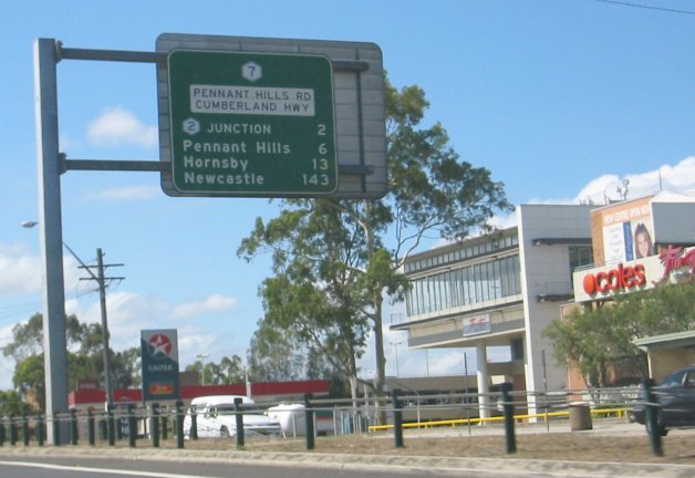
Because of the limited public transport most residents travel to work by cars. In the 2001 census, 60% stated their main method of getting to work was driving their own vehicle.[citation needed] The Cumberland Highway, a major north-south route through greater Sydney, intersects Carlingford in the form of Pennant Hills Road. As well, many motorists commuting from the Hills District and the growing north-west areas of Sydney travel through Carlingford to the city.
The M2 Hills Motorway, part of the Sydney orbital road, runs through northern Carlingford providing a route to the city and North Sydney. Since the Westlink M7 Motorway was finished, completing the Sydney Orbital, it has replaced the Cumberland Highway as the north-south national highway.
The area of Carlingford to the east of Pennant Hills Road and North of Carlingford Road, was built mostly in the years, post WWII. There is an area of streets named after famous North African battle fields. Wattle Place is named for the wattle trees right beside it, on Robbie Crescent, the road that crosses Wattle Place.
Buses
Buses are the main form of public transport to/from Carlingford. Current bus routes operated by Sydney Buses operate to various suburbs including West Ryde, Parramatta, Eastwood and Epping.
Current bus routes operated by Hillsbus operate to various suburbs including Castle Hill, Baulkham Hills, Blacktown and Macquarie Park.
Schools
Carlingford is the location of a large number of public and private schools.
- AIS The International School, Sydney (previously American International School)
- Carlingford High School
- Carlingford Public School
- Carlingford West Public School
- Cumberland High School
- James Ruse Agricultural High School (selective)
- Murray Farm Public School
- Roselea Public School
- St Gerard's Primary Catholic School
- Tara Anglican School for Girls
Churches
 LDS Sydney Australia Temple, Carlingford
As with much of northern Sydney, Carlingford also has a comparatively large number of Christian churches of many denominations. These include:
- Carlingford Baptist Church
- Carlingford Uniting Church
- Marsden Road Uniting Church
- St. Gerard Majella Catholic Church
- St. Paul's Anglican Church
- Iglesia Ni Cristo
- Christian City Church, Carlingford
- Parramatta City Presbyterian Church
The Pacific headquarters and Sydney Australia Temple of The Church of Jesus Christ of Latter-day Saints was constructed in Carlingford in 1984.
Sport
Carlingford has many sporting clubs participating in many different sports, and at many locations around the Hills District including:
- Carlingford Baseball
- Carlingford Netball Club (NetSetGo accredited)
- Redbacks Football Club Formerly Carlingford Redbacks Soccer Club
- Carlingford Cricket
- North Rocks Soccer Club
- Carlingford United Football Club
- Carlingford Comets Netball Club
- Roselea Football Club
- Roselea Ladybirds Netball Club
Services
The Carlingford telephone exchange is located at 413 North Rocks Rd. It serves telephony for Carlingford and nearby suburbs such as Dundas Valley, Telopea and North Rocks.
A major electricity substation, operated by Integral Energy, is located at the corner of Pennant Hills Road and Jenkins Road. The same site also houses one of the major communications relay towers in northern Sydney. The substation previously had a rail siding from the adjacent Carlingford Line; the siding was opened in 1954, and closed in the late 1980s.[4]
Population
Demographics
Australian Bureau of Statistics data from the 2006 census records the population of Carlingford as 21,365 residents, with 10,682 males and 10,683 females.[5] The median age of people in Carlingford was 39, compared with 37 for the whole of Australia.[5]
Place of Birth In the 2006 Census, 86.3% of people living in Carlingford were Australian citizens.[5] 55.1% of people were born in Australia, with 9.4% born in China, 5.6% in Hong Kong, 3.2% in the Republic of Korea, 2.6% in England and 2.1% in India.[5]
Languages In the 2006 Census, 54.4% of people only spoke English at home, while 14.5% spoke Cantonese, 8.4% spoke Mandarin, 3.9% spoke Korean, 1.9% spoke Arabic and 1.2% spoke Tamil.[5]
Religion In the 2006 Census, 23.4% of people identify themselves as Catholic, 19.5% have no religion, 16.5% of people are Anglican, 5.5% are Buddhists and 5.3% belong to the Uniting Church.[5]
Politics
Carlingford falls under the jurisdiction of three Local Government Areas: the City of Parramatta in the south, Hornsby Shire in the north-east, and The Hills Shire in the north-west. Similarly, it falls under several Commonwealth (Berowra, Bennelong, Parramatta) and State (Epping, Baulkham Hills, Parramatta, The Hills) electoral divisions/districts.
Carlingford is the most populous suburb within The Hills Shire Council's East Ward and it elected two Liberal Councillors (Clr Andrew Jefferies and Clr Larry Bolitho) and one ALP Councillor at the September 2008 elections. Councillors elected from Hornsby Shire in C Ward (containing Carlingford) have generally been of a conservative nature. Most of the electoral divisions that Carlingford lies within have historically been held by the Liberal Party of Australia. The exception is the electoral division and district of Parramatta which include sections south of the Parramatta River, making the overall seats more marginal in nature.
The Commonwealth Electoral Divisions of Berowra, currently held by the Hon. Philip Ruddock MP is a safe Liberal seat. The Commonwealth Electoral Division of Bennelong, recently lost by Maxine McKew MP was a marginal ALP seat. It is now in possession of the Australian Liberal Party. The Commonwealth Electoral Division of Parramatta, currently held by Ms Julie Owens MP is also a marginal ALP held division.
The State Electoral Districts of Baulkham Hills, currently held by Mr Wayne Merton MLA; Epping, currently held by Greg Smith MLA; and The Hills, currently held by Shadow Environment Minister Mr Michael Richardson MLA; are safe Liberal seats. The State Electoral District of Parramatta, currently held by Ms Tanya Gadiel MLA.
References
- ^ Mason, Thomas H., The Islands of Ireland, BT Batsford Ltd., London, 1936, chapter 1
- ^ [1]
- ^ Bozier, Rolfe, "New South Wales Railways: Carlingford Railway Station". Accessed 4 July 2007.
- ^ Forsyth, J.H. (ed.) (1988-93), Stations & Tracks; Vol. 1: "Main Suburban & Branches -- Illawarra & Branches". State Rail Authority of New South Wales: Sydney, p. 74.
- ^ a b c d e f Australian Bureau of Statistics (25 October 2007). "Carlingford (State Suburb". 2006 Census QuickStats. http://www.censusdata.abs.gov.au/ABSNavigation/prenav/LocationSearch?collection=Census&period=2006&areacode=SSC11187&producttype=QuickStats&breadcrumb=PL&action=401. Retrieved 2007-09-08.
- Australian Bureau of Statistics (2002). Basic community profile: Carlingford (SSC 11446). Retrieved 19 May 2005.
- Australian Electoral Commission Divisional Profile for Bennelong. Retrieved 4 January 2006.
- Australian Electoral Commission Divisional Profile for Berowra. Retrieved 4 January 2006.
- Australian Electoral Commission Divisional Profile for Mitchell. Retrieved 4 January 2006.
- Australian Electoral Commission Divisional Profile for Parramatta. Retrieved 4 January 2006.
- Australian Electoral Commission Definitions of 'marginal', 'fairly safe' and 'safe'. Retrieved 4 January 2006.
External links
- Carlingford Court homepage
- Carlingford, New South Wales is at coordinates 33°46′37″S 151°02′53″E / 33.777°S 151.048°ECoordinates: 33°46′37″S 151°02′53″E / 33.777°S 151.048°E
Australian Bureau of Statistics (25 October 2007). "Carlingford (State Suburb". 2006 Census QuickStats. http://www.censusdata.abs.gov.au/ABSNavigation/prenav/LocationSearch?collection=Census&period=2006&areacode=SSC11187&producttype=QuickStats&breadcrumb=PL&action=401. Retrieved 2007-09-08.
Suburbs and localities within The Hills Shire · Hills District · Western Sydney · Sydney Annangrove · Baulkham Hills · Beaumont Hills · Bella Vista · Box Hill · Burnside · Carlingford · Castle Hill · Cattai · Crestwood · Glenhaven · Glenorie · Hillside · Kellyville · Kenthurst · Maroota · South Maroota · Middle Dural · Nelson · North Rocks · Oatlands · Rogans Hill · Rouse Hill · Sackville North · West Pennant Hills
Suburbs and localities within the City of Parramatta · Western Sydney · Sydney Camellia · Carlingford · Chester Hill · Clyde · Constitution Hill · Dundas · Dundas Valley · Eastwood · Epping · Ermington · Granville · Harris Park · Model Farms · Northmead · Oatlands · Old Toongabbie · Parramatta · North Parramatta · Pendle Hill · Rosehill · Rydalmere · South Granville · Telopea · Toongabbie · Winston Hills · Wentworthville · Westmead
Suburbs within Hornsby Shire | North Shore | Hills District | Sydney Arcadia · Asquith · Beecroft · Berowra · Berowra Heights · Berowra Waters · Berrilee · Brooklyn · Canoelands · Carlingford · Castle Hill · Cheltenham · Cherrybrook · Cowan · Dural · Epping · Fiddletown · Forest Glen · Galston · Glenhaven · Glenorie · Hornsby · Hornsby Heights · Kangaroo Point · Laughtondale · Maroota · Middle Dural · Milsons Passage · Mount Colah · Mount Ku-ring-gai · Normanhurst · North Epping · Pennant Hills · Round Corner · Thornleigh · Wahroonga · Waitara · Westleigh · West Pennant Hills · Wisemans Ferry
Categories:- Suburbs of Sydney


Wikimedia Foundation. 2010.