- Oatlands, New South Wales
-
Oatlands
Sydney, New South Wales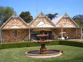
Oatlands Golf ClubPopulation: 5,350[1] Postcode: 2117 Location: 23 km (14 mi) north-west of Sydney CBD LGA: City of Parramatta, The Hills Shire State District: Parramatta Federal Division: Parramatta Suburbs around Oatlands: North Rocks Carlingford Carlingford North Parramatta Oatlands Telopea North Parramatta Rydalmere Dundas Oatlands is a suburb of Sydney, in the state of New South Wales, Australia. Oatlands is located 23 kilometres north-west of the Sydney central business district in the local government areas of the City of Parramatta and The Hills Shire. Oatlands is considered to be part of the Greater Western Sydney area.
The suburb extends from the south-east of Kissing Point Road and Vineyard Creek to the north-west bordering Pennant Hills Road and the North Rocks area.
Contents
History
The name originally comes from Oatlands House, which was one of the earliest homes in the Parramatta district, being built in the 1830s by Percy Simpson. While it has been suggested that name reflects the first sowing of oats in Australia, this can't be confirmed. Instead, the name appears to be taken from Oatlands Park in England, which was close to the lands of Lord Dundas, for whom the neighbouring suburb was named. In 1840, the land was sold to James Bettington, who used it for sheep farming. Oatlands House is now used as function centre, with the surrounding land forming the Oatlands Golf Course, which was opened in 1931. Oatlands was defined as a new suburb in 1991.[2] Prior to this, the area had been known as West Dundas.
Landmarks
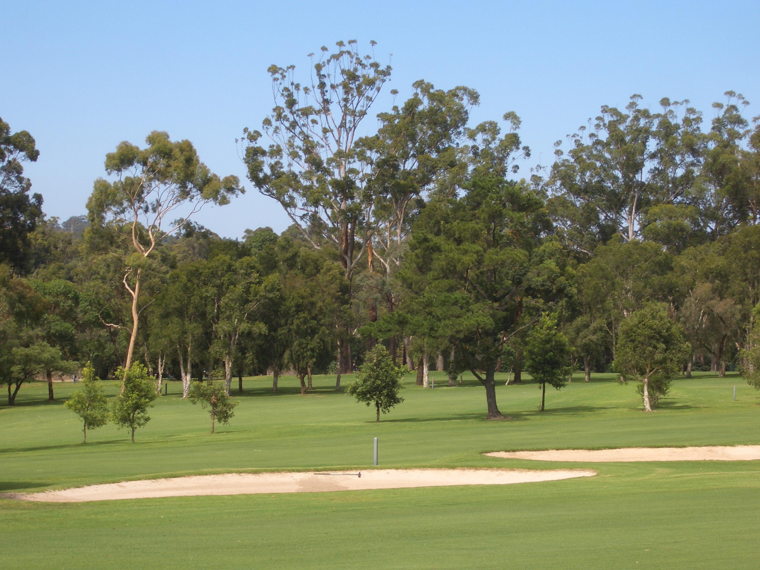
Oatlands is home to the historic Oatlands House, located within the grounds of the Oatlands Golf Club. Annual events include the NSW Women's Open Championship, attracting professional golf athletes and media attention to the area. Winners of this event include Laura Davies, former world number one. The Club is well renowned in the Sydney area and is recognised as Australia's best par 70 course.
Oatlands also includes the area known as Burnside, which was the site of Burnside Homes, the children's homes established by Sir James Burns in 1911. Although not used for children's homes any more, the area is still the site of the headquarters of UnitingCare Burnside, an agency of the Uniting Church in Australia. The name is also used by Burnside Public School, which was built on land belonging to the trust. The area contains mainly new housing developments such as Burnside Gardens Estate.
-

Oatlands Golf Course
Commercial area
There is a small shopping area featuring a post office, supermarket, fruit shop, liquor store, chicken shop, hairdressers, butcher, real estate, chemist and newsagency.
School
- Oatlands Public School is located on Belmore Street.
- Burnside Public School
References
- ^ Australian Bureau of Statistics (25 October 2007). "Oatlands (State Suburb)". 2006 Census QuickStats. http://www.censusdata.abs.gov.au/ABSNavigation/prenav/LocationSearch?collection=Census&period=2006&areacode=SSC11757&producttype=QuickStats&breadcrumb=PL&action=401. Retrieved 2008-04-08.
- ^ The Book of Sydney Suburbs, Compiled by Frances Pollen, Angus & Robertson Publishers, 1990, Published in Australia ISBN 0-207-14495-8, Page 25
- "Oatlands House History". Oatlands House site. Archived from the original on June 15, 2005. http://web.archive.org/web/20050615041711/http://oatlands-house.com.au/history.asp. Retrieved September 14, 2005.
- "Oatlands History". Oatlands Golf Course site. Archived from the original on June 15, 2005. http://web.archive.org/web/20050615204130/http://oatlandsgolf.com.au/History.html. Retrieved September 14, 2005.
- "Burnside Public School history". Burnside Public School site. http://www.burnside-p.schools.nsw.edu.au/profile_history.html. Retrieved September 13, 2005.
External links
- Oatlands, New South Wales is at coordinates 33°47′38″S 151°01′55″E / 33.794°S 151.032°ECoordinates: 33°47′38″S 151°01′55″E / 33.794°S 151.032°E
Suburbs and localities within the Northern Suburbs (Sydney) · Hornsby Shire · City of Parramatta · City of Ryde · Municipality of Hunters Hill · Sydney Beecroft · Carlingford · Cheltenham · Cherrybrook · Denistone · Denistone East · Denistone West · Dundas · Dundas Valley · East Ryde · Eastwood · Epping · Ermington · Gladesville · Henley · Hunters Hill · Huntleys Cove · Huntleys Point · Linley Point · Macquarie Park · Marsfield · Meadowbank · Melrose Park · North Epping · North Ryde · Oatlands · Pennant Hills · Putney · Riverview · Ryde · Telopea · Tennyson Point · Thornleigh · West Pennant Hills · West Ryde · Westleigh · Woolwich ·
Suburbs and localities within The Hills Shire · Hills District · Western Sydney · Sydney Annangrove · Baulkham Hills · Beaumont Hills · Bella Vista · Box Hill · Burnside · Carlingford · Castle Hill · Cattai · Crestwood · Glenhaven · Glenorie · Hillside · Kellyville · Kenthurst · Maroota · South Maroota · Middle Dural · Nelson · North Rocks · Oatlands · Rogans Hill · Rouse Hill · Sackville North · West Pennant Hills
Suburbs and localities within the City of Parramatta · Western Sydney · Sydney Camellia · Carlingford · Chester Hill · Clyde · Constitution Hill · Dundas · Dundas Valley · Eastwood · Epping · Ermington · Granville · Harris Park · Model Farms · Northmead · Oatlands · Old Toongabbie · Parramatta · North Parramatta · Pendle Hill · Rosehill · Rydalmere · South Granville · Telopea · Toongabbie · Winston Hills · Wentworthville · Westmead
Categories:- Suburbs of Sydney
-

Wikimedia Foundation. 2010.