- Gladesville, New South Wales
-
Gladesville
Sydney, New South Wales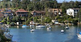
Bedlam Point, GladesvillePopulation: 10,833[1] Established: 1830 Postcode: 2111 Location: 9 km (6 mi) north-west of Sydney CBD LGA: - Ryde City Council
- Municipality of Hunter's Hill
State District: Lane Cove Federal Division: Bennelong, North Sydney Suburbs around Gladesville: East Ryde Hunters Hill Hunters Hill Tennyson Point Gladesville Huntleys Point Putney Abbotsford Henley Gladesville is a suburb of Sydney, New South Wales, Australia. Gladesville is located 9 kilometres north-west of the Sydney central business district, in the local government areas of the City of Ryde and the Municipality of Hunter's Hill and is part of the Northern Suburbs area.[2]
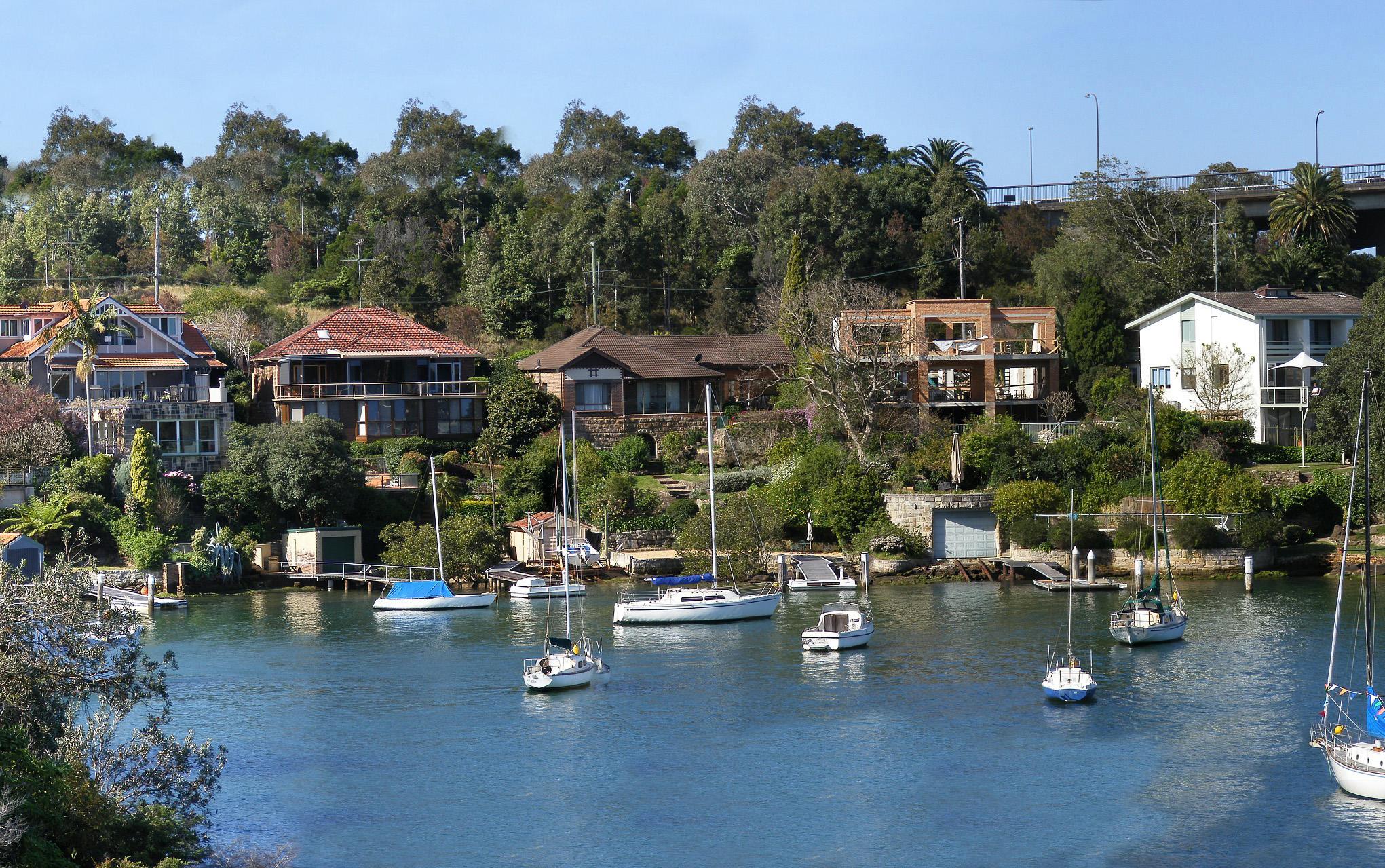
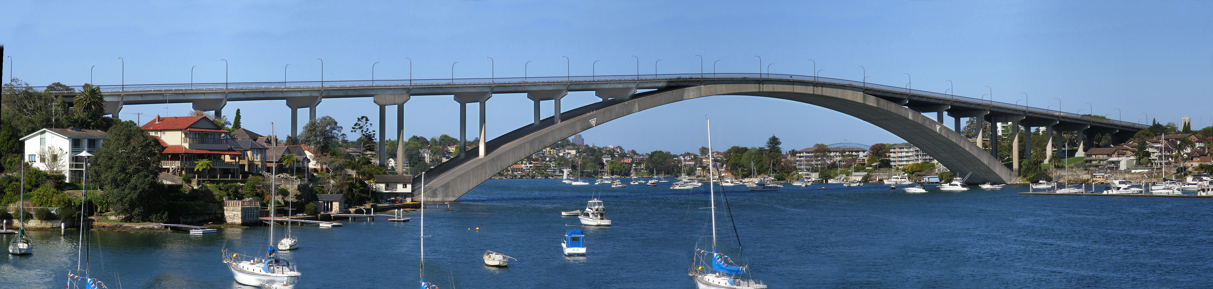
Gladesville prides itself on its riverside views and bush settings along the Parramatta River. The Gladesville Bridge, a Sydney landmark that links the North Shore to the Inner West takes its name from the suburb.
Contents
History
The area was first called Doody’s Bay when European settlement began with a land grant being made to convict artist, John Doody in 1795. Others to receive grants in the district were William House (1795), Ann Benson (1796) and Charles Raven (1799). By 1836, John Glade, an emancipist, was issued with the deeds to Doody’s grant, which he had purchased in 1817.[citation needed] Glade expanded his property with the purchase of a number of adjoining holdings. After John Glade’s death in 1848, his land was sold to a Sydney solicitor, Mr W. Billyard, who subsequently subdivided and sold the land in November 1855, naming it Gladesville.[citation needed]
A major milestone in the development of the suburb was the establishment of the Tarban Creek Lunatic Asylum in 1838,[3] on the banks of the Parramatta River.It was the first purpose-built mental asylum in New South Wales. Much of the architecture was designed by Colonial Architect Mortimer Lewis and built between 1836 and 1838. In 1869 it became the Gladesville Hospital for the Insane, and in 1915 the Gladesville Mental Hospital. In 1993, it was amalgamated with Macquarie Hospital to form the Gladesville Macquarie Hospital. In 1997, inpatient services were consolidated at Macquarie Hospital at North Ryde. The Gladesville complex includes many buildings which are now listed on the Register of the National Estate.[4]
One of the hospital's acquisitions was a two-storey sandstone house called The Priory, in Salter Street. It was built in the late 1840s, possibly by the Stubbs family, and featured an east-looking face in the Georgian style, and a west face with a gable and painted sundial. In the 1850s it was sold to the Marist Fathers, a French group who had an influence on the early development of Hunters Hill. The hospital acquired it in 1888; it was listed on the Register of the National Estate in 1978.[5]
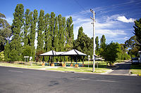 Banjo Paterson Park
Another historical landmark is the cottage Rockend, where the poet Banjo Paterson lived in the 1870s and 1880s. It was built circa 1850 and is still preserved and open to the public in Banjo Paterson Park, Punt Road. It is listed on the Register of the National Estate. The site joins the Bedlam Bay walk, where remnants of the Great North Road exists and the walls of the Bedlam Bay Ferry. Banjo Paterson lived in the sandstone house (now a restaurant) whilst attending Sydney Grammar School. The house was owned by his Grandmother and was frequented by many artists and writers. Banjo Paterson recalled in his radio interview in 1935 the river had declined and was now lined with factories. However he could still remember when; "the wood-boat and the fruit boats, something like 7 ton yachts in size and capacity, would hoist mainsail and jib in the early morning, and come howling down the river with the westerly wind behind them, hoping to get far enough down to meet the north-easter before the wind failed. If the wind died away and they were left in the doldrums – well, they didn’t worry. They anchored and caught themselves feeds of fish which they cooked on their little galley fires, the scent of frying re-bream mixing not unhappily with the aroma of guavas, grapes, and the big hautboy strawberries which now seem to have gone out of fashion. Then, when the tide turned, they would up with the anchor and drift down till they opened up to the harbour where there was always some sort of breeze. They would strike Sydney some time or other, and would deliver their cargo into horse-drawn carts and then point the boat’s nose up river again, back to the gardens and the spitting of fire wood with wedges and American axes."[6][7]
Halmeg Linseed oil was manufactured on a 5 acre Mill located at the end of Punt Road, overlooking Looking Glass Bay. The linseed oil was used in the manufacture of lead paint and varnish, as well as putties, caulking compounds, printing inks and linoleum. The production plant was established in 1923. The revolutionary extraction process did not work at first. Despite this, one hundred guests toured the new mill at its official opening. Harold Meggit, owner of the plant, increased employees wages, also advising that there would be no jobs, no wages if a new solution to distil the oil could not be found. The employees put forward hundreds of suggestions, and two were implemented, producing the finest linseed oil in the industry. In later years, Halmeg was the first to produce Safflower Oil in Australia. It also introduced a profit sharing scheme for its employees. The site closed in 1974.[8]
Commercial area
Gladesville is serviced by a commercial district centering around Victoria Road, the suburb's main thoroughfare, and by a small shopping centre (Gladesville Shopping Village) located off Cowell Street. A number of restaurants are situated within the commercial parts of Gladesville, and serve a variety of foods including Thai, Indian, Vietnamese, Greek, Mexican and Italian. Entertainment venues include the Bayview & Sawdust Hotels as well as the Gladesville RSL Club.
Transport
Public transport includes ferry and bus services. A number of bus services run along Victoria Road, between the Sydney CBD and Parramatta, and along Pittwater Road to Chatswood and Woolwich.
Schools
There are two primary schools in the suburb: Gladesville Public School and Our Lady Queen of Peace Catholic Primary School. As well as a High School: Riverside Girls High School
Population
66.1% of residents in Gladesville are Australian-born, compared with 60.4% of Sydney residents.[1][9]
 Gladesville Bridge
-

Trim Place, Gladesville
-
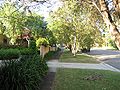
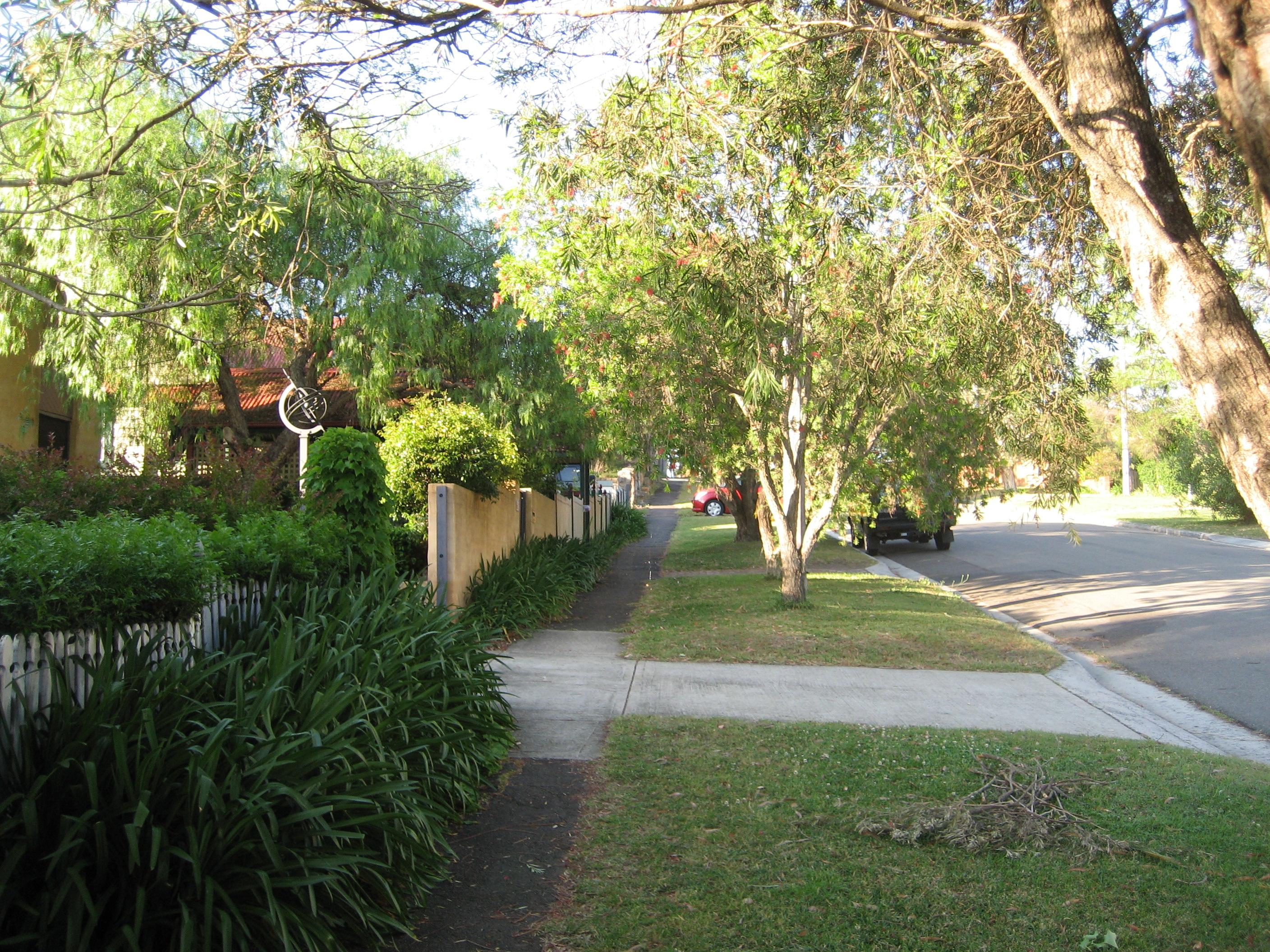
Local street in Gladesville
-
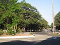
Ryde Road, Gladesville connecting to |Hunters Hill.
-
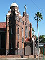
Our Lady Queen of Peace Catholic Church (1925), Victoria Road
-

Rockend, where Banjo Paterson lived
-
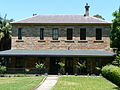
The Priory, Salter Street
-
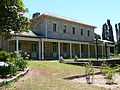
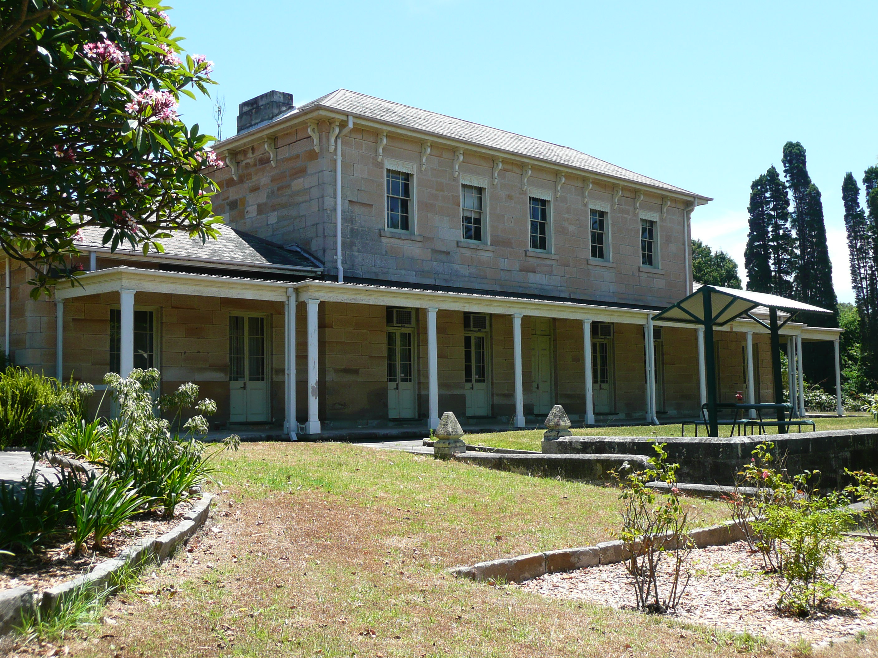
Former Medical Superintendent's Residence, Gladesville Mental Hospital
-
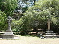
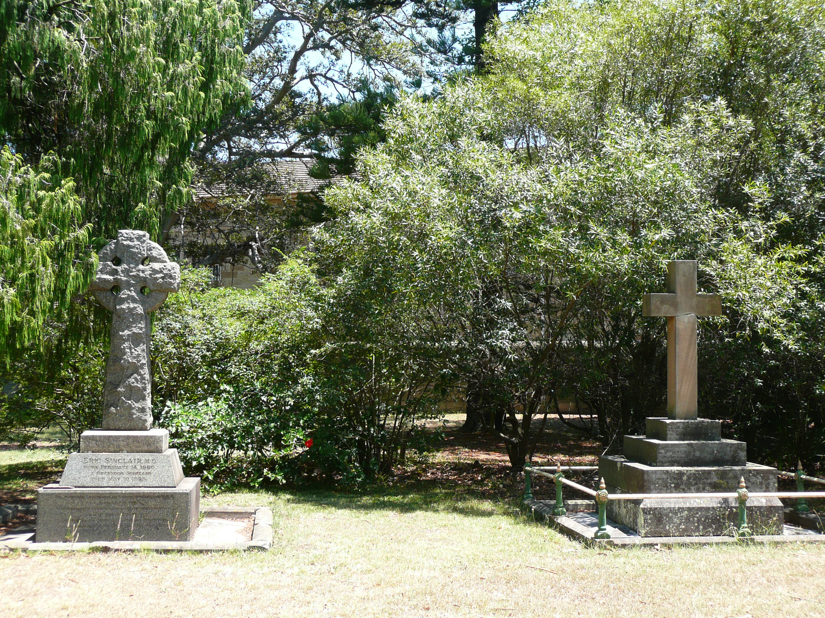
Graves of former doctor, left, and superintendent, Gladesville Mental Hospital
References
- ^ a b Australian Bureau of Statistics (25 October 2007). "Gladesville (State Suburb)". 2006 Census QuickStats. http://www.censusdata.abs.gov.au/ABSNavigation/prenav/LocationSearch?collection=Census&period=2006&areacode=SSC11401&producttype=QuickStats&breadcrumb=PL&action=401. Retrieved 2008-03-23.
- ^ Gregory's Sydney Street Directory, Gregory's Publishing Company, 2007
- ^ Government Records:Retrieved 12th January 2009
- ^ The Heritage of Australia, Macmillan Company, 1981, p.2/29
- ^ "The Priory, Salter St, Gladesville, NSW, Australia (entry AHD2640)". Australian Heritage Database. Department of Sustainability, Environment, Water, Population and Communities. http://www.environment.gov.au/cgi-bin/ahdb/search.pl?mode=place_detail;place_id=2640. Retrieved 16 January 2009.
- ^ 'On the River' by A.B. Paterson, broadcast 14 July 1935, in The Ryde Recorder, Vol 7 No. 1, 1st February 1973, p4. Source: Focus on Ryde, a local studies resource, Ryde Bicentenary Schools and Youth Task Force, May 1992
- ^ Ryde River Walk Masterplan at Ryde City Council
- ^ Ryde River Walk Masterplan at Ryde City Council
- ^ Australian Bureau of Statistics (25 October 2007). "Sydney (Major Statistical Region)". 2006 Census QuickStats. http://www.censusdata.abs.gov.au/ABSNavigation/prenav/LocationSearch?collection=Census&period=2006&areacode=11&producttype=QuickStats&breadcrumb=PL&action=401. Retrieved 2008-03-23.
External links
- Gladesville, New South Wales is at coordinates 33°50′00″S 151°07′00″E / 33.8333°S 151.1167°ECoordinates: 33°50′00″S 151°07′00″E / 33.8333°S 151.1167°E
- Gladesville Town Centre
- Discover Hunters Hill
- Gladesville Community Website
- Ryde District Historical Society Website
Suburbs of the City of Ryde · Northern Suburbs · Sydney Denistone · Denistone East · Denistone West · East Ryde · Eastwood · Gladesville · Macquarie Park · Marsfield · Meadowbank · Melrose Park · North Ryde · Putney · Ryde · Tennyson Point · West Ryde
Suburbs within the Municipality of Hunter's Hill · Lower North Shore · Sydney Gladesville · Henley · Hunters Hill · Huntleys Cove · Huntleys Point · Woolwich
Categories:- Suburbs of Sydney


Wikimedia Foundation. 2010.