- Mount Kuring-gai, New South Wales
-
Mount Kuring-gai
Sydney, New South Wales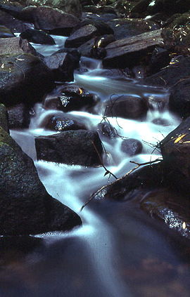
Cascades along Calna CreekPopulation: 1,550[1] Postcode: 2080 Location: 31 km (19 mi) from Sydney CBD LGA: Hornsby Shire State District: Hornsby Federal Division: Berowra Suburbs around Mount Kuring-gai: Berrilee Berowra Heights Berowra Hornsby Heights Mount Kuring-gai Ku-ring-gai Chase National Park Hornsby Heights Mount Colah North Turramurra Mount Kuring-Gai is a suburb of northern Sydney, in the state of New South Wales, Australia. Mount Kuring-gai is located 31 kilometres north-west of the Sydney central business district, in the local government area of Hornsby Shire.
Mount Kuring-gai is located approximately 7 km north of Hornsby. Its neighbouring suburbs are Berowra to the north, and Mount Colah to the south. Surrounded by bushland, it borders Ku-ring-gai Chase National Park. There are several bushwalks starting in the suburb including the Great North Walk and a path to Apple Tree Bay.
Contents
History
Ku-ring-Gai is an Aboriginal word that means hunting ground of the men. This area was once the home and hunting ground of the Ku-ring-gai Aborigines. The railway station opened in August 1903 and was named Kuring-gai. The 'Mount' was added to the name in 1933.
Commercial areas and transport
The suburb is divided in two by the Pacific Highway, Northern railway line and the F3 Sydney-Newcastle Freeway.
The eastern side is home to a primary school, community hall and sports oval. The western side has a shopping centre, Mount Kuring-gai railway station and telephone exchange. The east and west sides are connected by a road bridge and a pedestrian bridge.
In 2010, an Aldi shopping centre was incorporated into the shopping centre on the western side.
Mount Kuring-Gai also has an industrial area which is home to many diverse businesses such as a hot air balloon manufacturer, electronics companies, a school paint manufacturer, a book publisher and the bus depot of Transdev TSL - Shorelink.
See also
- Dangar Island
- Hawkesbury River Railway Bridge
- Hawkesbury River
- Ku-ring-gai Chase National Park
- Scotland Island
- Church Point Ferry
- Pittwater Council
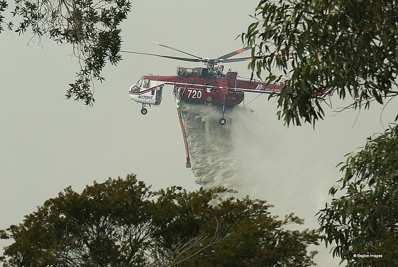
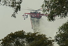 "Shania" (N720HT) dumping water at Mount Kuring-gai in April 2007
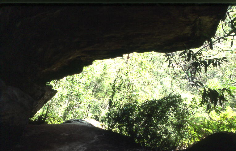
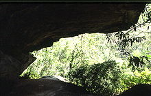 Rock shelter in Lyrebird Gully, where lyrebirds are occasionally seen
References
- The Book of Sydney Suburbs, Compiled by Frances Pollen, Angus & Robertson Publishers, 1990, Published in Australia ISBN 0-207-14495-8
Coordinates: 33°38′44″S 151°07′52″E / 33.64543°S 151.13115°E
Suburbs within Hornsby Shire | North Shore | Hills District | Sydney Arcadia · Asquith · Beecroft · Berowra · Berowra Heights · Berowra Waters · Berrilee · Brooklyn · Canoelands · Carlingford · Castle Hill · Cheltenham · Cherrybrook · Cowan · Dural · Epping · Fiddletown · Forest Glen · Galston · Glenhaven · Glenorie · Hornsby · Hornsby Heights · Kangaroo Point · Laughtondale · Maroota · Middle Dural · Milsons Passage · Mount Colah · Mount Ku-ring-gai · Normanhurst · North Epping · Pennant Hills · Round Corner · Thornleigh · Wahroonga · Waitara · Westleigh · West Pennant Hills · Wisemans Ferry
Categories:- Suburbs of Sydney
- Sydney geography stubs

Wikimedia Foundation. 2010.