- Cottage Point, New South Wales
-
Cottage Point
Sydney, New South Wales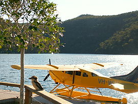
A waterplane lands next to the Cottage Point InnPopulation: 196 [1] Postcode: 2084 Location: 38 km (24 mi) north of Sydney CBD LGA: Warringah Council State District: Pittwater Federal Division: Mackellar Suburbs around Cottage Point: Brooklyn Brooklyn Coasters Retreat Berowra Cottage Point Morning Bay Mount Kuring-gai Ku-ring-gai Chase National Park Akuna Bay Cottage Point is a suburb of northern Sydney, in the state of New South Wales, Australia. Cottage Point is located 38 kilometres north of the Sydney central business district, in the local government area of Warringah Council and is part of the North Shore region.
Cottage Point is located in the Ku-ring-gai Chase National Park at the confluence of Cowan Creek and Coal and Candle Creek. It is accessible by Cottage Point Road off Liberator General San Martin Drive. [2]
References
External links
- Cottage Point, New South Wales is at coordinates 33°37′15″S 151°12′08″E / 33.62091°S 151.20225°ECoordinates: 33°37′15″S 151°12′08″E / 33.62091°S 151.20225°E
The Hawkesbury River region, New South Wales, Australia Islands of the Hawkesbury National parks Explorers of the region Bridges and ferries Hawkesbury River Railway Bridge · Mooney Mooney Bridge · Lower Portland Ferry · Sackville Ferry · Webbs Creek Ferry · Wisemans FerryAdjoining rivers, bays and creeks Shires City of Hawkesbury · Hornsby Shire · Pittwater Council · City of Gosford · The Hills Shire · City of PenrithEvents Suburbs of Warringah Council | Northern Beaches | Sydney Allambie Heights · Beacon Hill · Belrose · Brookvale · Collaroy · Collaroy Plateau · Cottage Point · Cromer · Curl Curl · Davidson · Dee Why · Duffys Forest · Forestville · Frenchs Forest · Freshwater · Ingleside · Killarney Heights · Manly Vale · Narrabeen · Narraweena · North Balgowlah · North Curl Curl · North Manly · Oxford Falls · Queenscliff · Terrey Hills · Wheeler HeightsCategories:- Suburbs of Sydney
- Sydney geography stubs

Wikimedia Foundation. 2010.