- North Curl Curl, New South Wales
-
North Curl Curl
Sydney, New South Wales
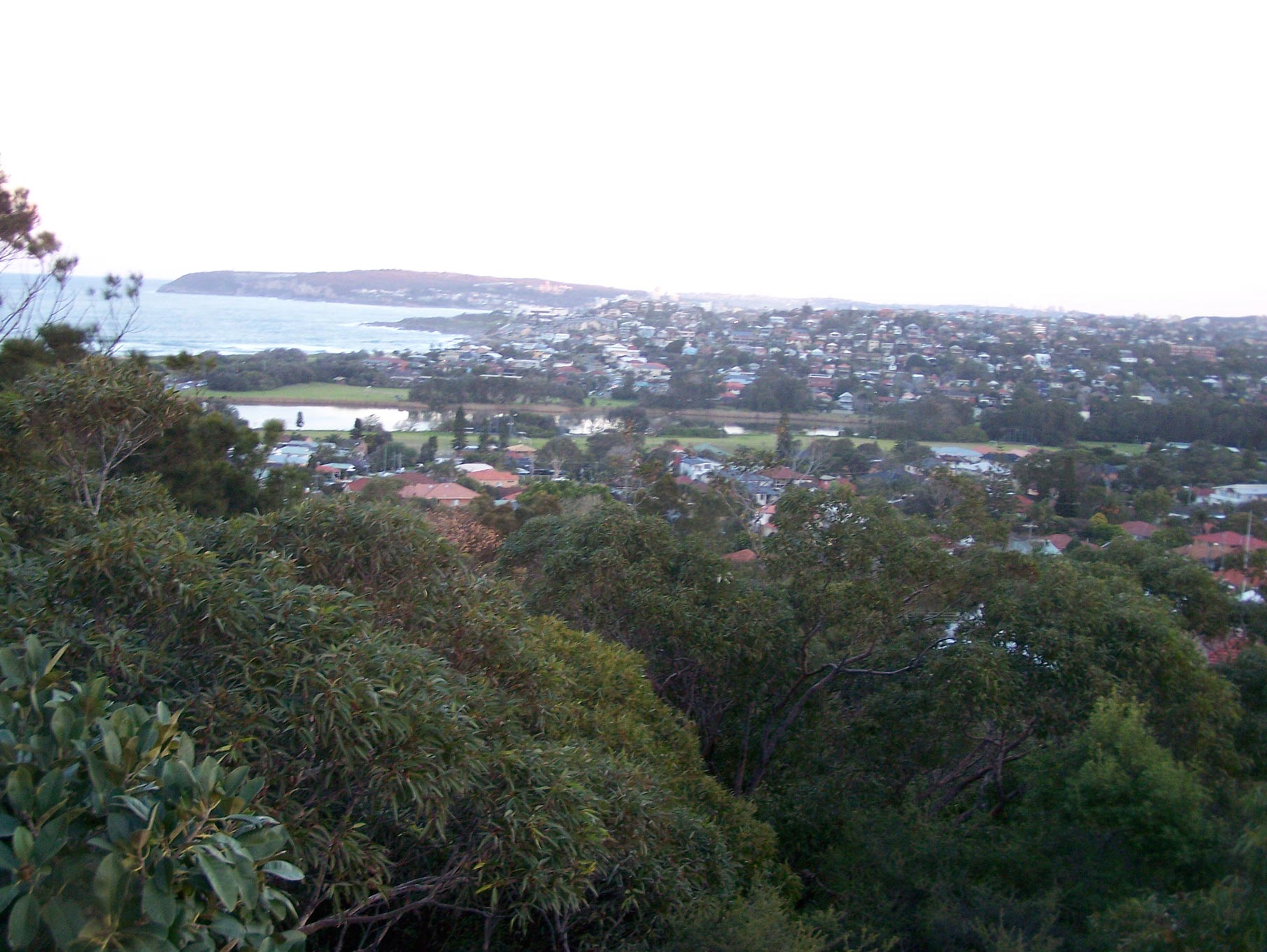
North Curl Curl from Wingala ReservePopulation: 3,371[1] Postcode: 2099 Location: 19 km (12 mi) north-east of Sydney CBD LGA: Warringah Council State District: Manly [2] Federal Division: Warringah Suburbs around North Curl Curl: Narraweena Dee Why Brookvale North Curl Curl Tasman Sea North Manly Curl Curl North Curl Curl is a suburb in northern Sydney, in the state of New South Wales, Australia. North Curl Curl is located 19 kilometres north-east of the Sydney central business district, in the local government area of Warringah Council and is part of the Northern Beaches region.
Contents
History
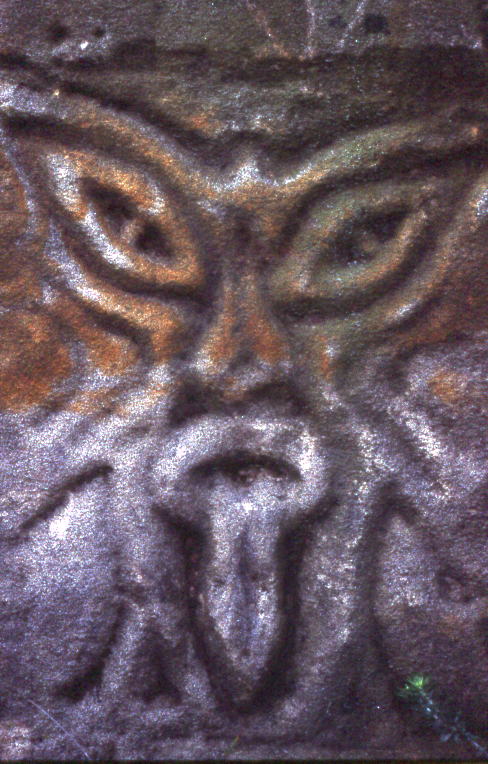
 Rock carving at North Curl Curl Beach
Curl Curl may be derived from the Aboriginal phrase curial curial, meaning river of life.[3]
The name Curl Curl Lagoon was originally applied to Manly Lagoon, which empties into the ocean at Queenscliff, and the current Curl Curl Lagoon was named Harbord Lagoon. This was a result of the land grant of 'Harbord' originally being much larger than the suburb that later bore this name. The names were changed as a part of a renaming program in the 1980s to reflect the true location of the lagoons.[4].
Geography
 North Curl Curl Beach at sunset
Curl Curl Lagoon and Greendale Creek separate North Curl Curl from Curl Curl in the south. To the west the border with Brookvale runs along Harbord Road. Wingala is an 'urban place' as classified by the Geographical Names Board in the north and western parts of the suburb, lying on the southern slopes of a hill that overlaps into Dee Why. Headland Road marks the northern boundary, while the Tasman Sea lies to the east.
North Curl Curl Beach sits on the south-eastern border, south of Dee Why Head and lying under its cliffs, and is divided from Curl Curl Beach by the mouth of the lagoon. The suburb is generally characterised by the sometimes steep southern slopes of Wingala Hill and Dee Why Head to the north, which flatten out into the former floodplain of the lagoon towards the south.
Sport and recreation
The North Curl Curl Surf Life Saving Club patrol North Curl Curl Beach. North Curl Curl Knights are the local rugby league side, with the colours of green and gold.
Sport and recreation facilities exist in the extensive parks and playing fields areas to the north of the Lagoon, including the Bowling Club (formerly the Curl Curl Women's Bowling Club but now run by Dee Why RSL Club), Curl Curl Youth Club, soccer fields, baseball fields, cricket pitches, netball courts, as well as rugby league and rugby union fields.
Surfing is a big part of the area, and many local competitions take place here, such as CUBA, Curl Curl Longboarders and others.
Schools
North Curl Curl has two public schools, Curl Curl North Public School and Manly Selective Campus of the Northern Beaches Secondary College, formerly Manly Boys High School. It also has one private school, St. Luke's Grammar School.
References
- ^ Australian Bureau of Statistics (25 October 2007). "North Curl Curl (State Suburb)". 2006 Census QuickStats. http://www.censusdata.abs.gov.au/ABSNavigation/prenav/LocationSearch?collection=Census&period=2006&areacode=SSC11723&producttype=QuickStats&breadcrumb=PL&action=401. Retrieved 2007-07-01.
- ^ "NSW EC - Manly". Electoral Commission NSW. http://www.elections.nsw.gov.au/state_government_elections/electoral_districts/all_districts_/manly. Retrieved 2007-07-01.
- ^ "Geographical names register extract: Curl Curl". Geographical Names Board of New South Wales. http://www.gnb.nsw.gov.au/name_search/extract?id=JPYbBKsySX. Retrieved 2007-09-10.
- ^ "Manly Daily article". Cumberland newspapers. http://www.manlydaily.com.au/article/2007/12/08/7740_news_feature.html. Retrieved 2007-12-10.
External links
- North Curl Curl, New South Wales is at coordinates 33°45′52″S 151°17′50″E / 33.76450°S 151.29730°ECoordinates: 33°45′52″S 151°17′50″E / 33.76450°S 151.29730°E
Suburbs of Warringah Council | Northern Beaches | Sydney Allambie Heights · Beacon Hill · Belrose · Brookvale · Collaroy · Collaroy Plateau · Cottage Point · Cromer · Curl Curl · Davidson · Dee Why · Duffys Forest · Forestville · Frenchs Forest · Freshwater · Ingleside · Killarney Heights · Manly Vale · Narrabeen · Narraweena · North Balgowlah · North Curl Curl · North Manly · Oxford Falls · Queenscliff · Terrey Hills · Wheeler HeightsCategories:- Suburbs of Sydney

Wikimedia Foundation. 2010.