- Freshwater, New South Wales
Infobox Australian Place | type = suburb
name = Freshwater
city = Sydney
state = nsw
caption =
lga = Warringah Council
stategov = Manly
fedgov = Warringah
postcode = 2096
est =
pop = 7,873
area =
propval =
near-nw = Brookvale
near-n = Curl Curl
near-ne =
near-w = North Manly
near-e = "Tasman Sea "
near-sw = Manly
near-s = Queenscliff
near-se =
dist1 = 17
dir1 = north-east
location1=Sydney CBD Freshwater , formely known as Harbord, is a
suburb of northernSydney , in the state ofNew South Wales ,Australia . Freshwater is located 17kilometres north-east of theSydney central business district , in the local government area ofWarringah Council and is part of theNorthern Beaches region.History
Aboriginal Culture
The area was once home to the Kuring-gai people and evidence of their habitation remains today in the form of rock engravings, open campsites, and rock shelters.
European Settlement
The first Crown grant of land in the area was to Thomas Bruin on
27 September 1815 and consisted of fifty acres directly opposite the beach. The Manly Land Company subdivided and named the property Freshwater Estate in December 1884.In 1886 W M Gordon surveyed the subdivision named Harbord Estate. The land, divided into two sections, north and south of
Curl Curl Lagoon (now namedManly Lagoon) was offered for sale in August 1886. The Harbord Estate was named to honour the wife of New South Wales GovernorLord Carrington (1885-1990). Before her marriage,Lady Carrington was the Honourable Cecelia Harbord.For many years, the beach and the district behind it was known as Freshwater. However, some time after the naming of Harbord Estate, a number of residents began to believe that the holiday image of Freshwater should be upgraded by a name change to Harbord. The change of name attracted much controversy and debate and occasionally became quite heated. When the first local district school was built in 1912, a petition was sent to the Minister of Education requesting it should be called Harbord Public School. The Minister declined and officially opened it Freshwater Public School. Pressure was then directed towards renaming the post office. The Postmaster-General finally accepted the views of those who wanted a residential image and Freshwater officially became Harbord on
1 September 1923 . ["The Book of Sydney Suburbs", Compiled by Frances Pollen, Angus & Robertson Publishers, 1990, Published in Australia ISBN 0-207-14495-8 ]In 2003 the Harbord Chamber of Commerce submitted a request to
Warringah Council to support an application to theGeographical Names Board of New South Wales to rename the suburb of Harbord to Freshwater. In public consultation 774 voted in favour and 161 voted against with the results recorded in council minutes on8 March 2005 . Harbord was finally officially renamed Freshwater on12 January 2008 .Australian Home of Surfing
In December 1914,
Duke Kahanamoku , the world sprint swimming champion, was touring Australia. He selected timber from a Sydney firm to fashion a board modelled on those used in his nativeHawaii , and during a demonstration to the press, introduced surf board riding to Australia at Freshwater Beach on Thursday24 December . It was the first recorded time that anyone had surfed the clean waves beyond the break in Australian waters using this Hawaiian-style surfing technique.It was so popular that a second spur of the moment demonstration was given on a Sunday in January 1915. Duke topped the performance by taking a local young girl, Isabel Letham on the board with him to surf the waves. Isabel went on to become a pioneer of Australian surfing. The board has been kept in a display in the
Freshwater Surf Club since 1952. There is now a statue of Kahanamoku on the headland at Freshwater.Landmarks
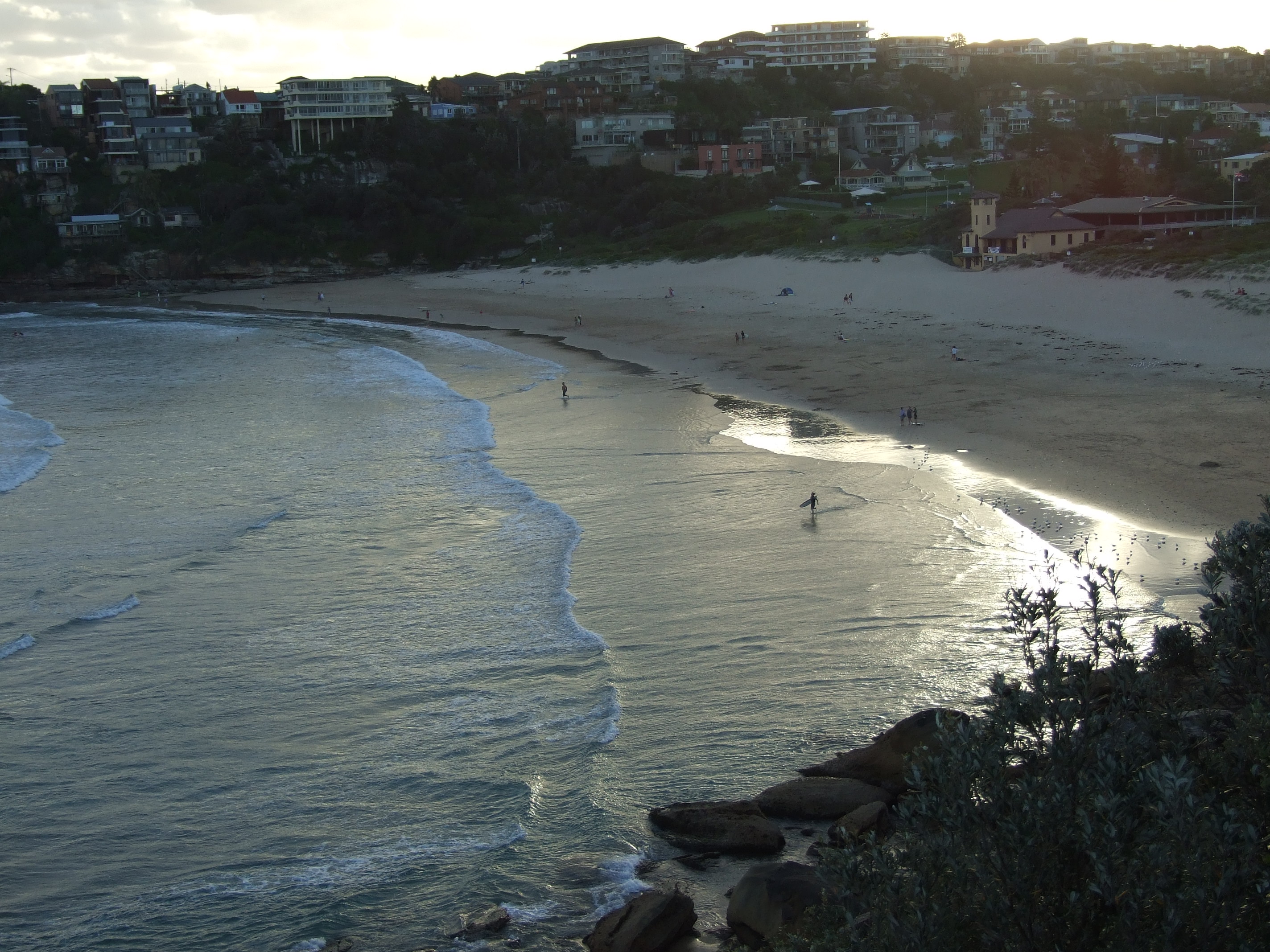
Freshwater Beach is between Curl Curl and Queenscliff and lies on the Manly toCurl Curl Beach walk.The Harbord Beach Hotel is 200 metres from the beach and is known to locals as the “Harbord Hilton”, due to its previous state of disrepair prior to renovations.Fact|date=September 2008 Harbord Diggers, an RSL club, has bowling greens and views of the ocean. Freshwater has two schools, Harbord Primary School and Freshwater Senior Campus.
References
External links
* [http://www.harborddiggers.com.au/ Harbord Diggers]
Wikimedia Foundation. 2010.