- Cootamundra, New South Wales
Infobox Australian Place | type = town
name = Cootamundra
state = nsw
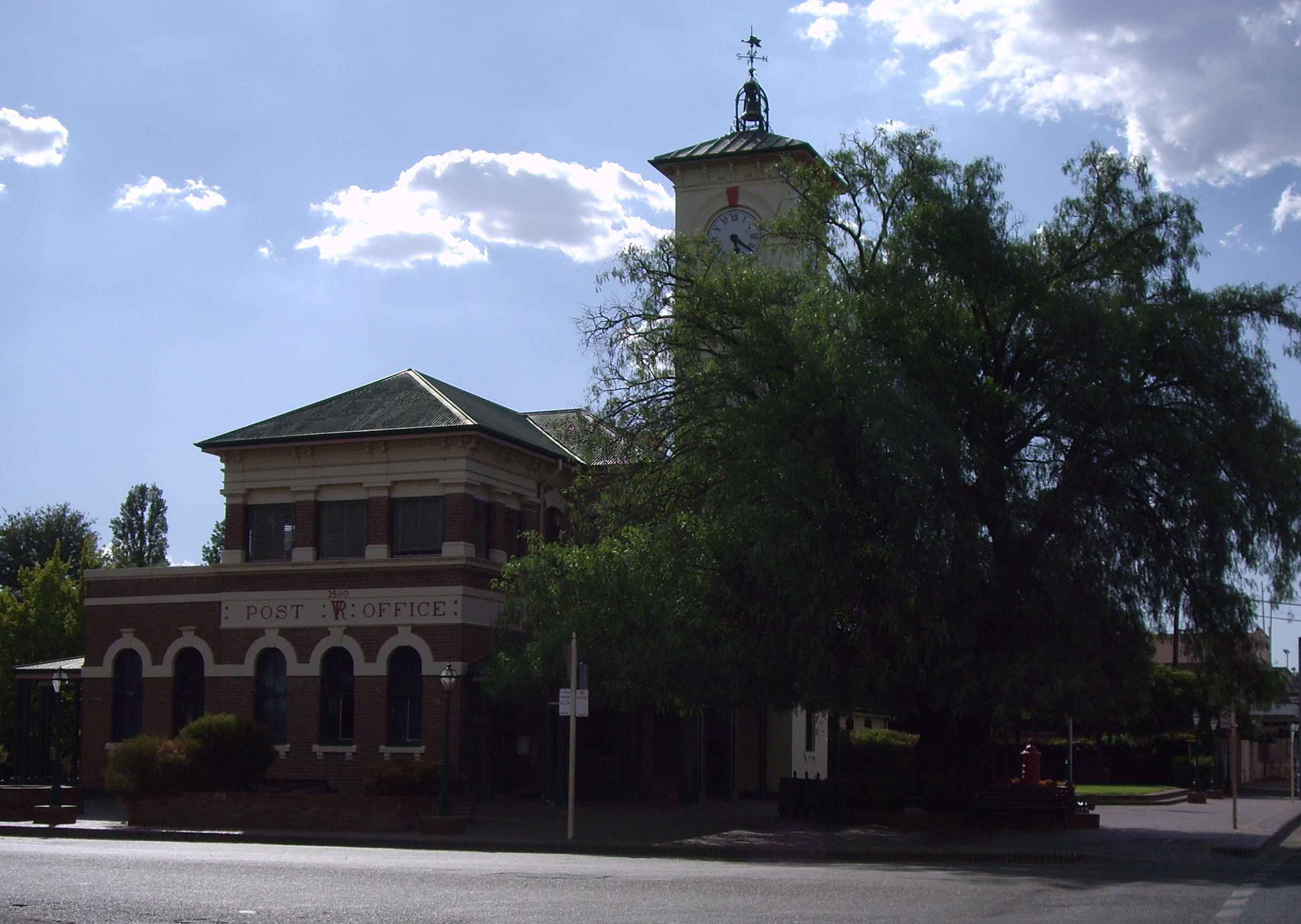
caption = Cootamundra Post Office
postcode = 2590
lga = Cootamundra Shire
est = 1861
pop = 5,566
elevation= 318
maxtemp = 22.3
mintemp = 8.4
rainfall = 626.1
county = Harden
fedgov =Riverina
stategov =Burrinjuck
dist1 = 390
location1=Sydney
dist2 = 161
location2=Canberra Cootamundra is a town and Local Government Area in the South West Slopes region of
New South Wales ,Australia and within theRiverina . At the 2006 census, Cootamundra had a population of 5,566.Census 2006 AUS
id = UCL122000
name = Cootamundra (Urban Centre/Locality)
quick = on
accessdate = 2008-03-22] It is located on theOlympic Highway at the point where it crosses the Muttama Creek, between Junee and Cowra. Although it is bypassed by theHume Highway , itsrailway station is on the Main Southern line, part of theMelbourne -to-Sydney line.Sir Donald Bradman AC,
Australia ncricket er universally regarded as the greatestbatsman of all time was born in Cootamundra. The town pride in this fact is displayed in general signage and marketing material and the home where "The Don" was born is a fully restored visitor site open to the public 7 days per week.Cootamundra is the home of the Cootamundra Wattle (Acacia Bayliana). Every year there is a large 'Wattle Time' Festival (which happens when the wattle starts to bloom) with an art show and festivities.
History
The land where Cootamundra now stands is a part of the
Wiradjuri tribal lands, and the name 'Cootamundra' is probably derived from the Wiradjuri word 'guudhamang' (also spelt 'gudhamang', see below), meaning 'turtle'. [cite book |last=McNicol |first=Sally |coauthors=Hosking, Dianne |year=1994 |chapter=Wiradjuri |title=Macquarie Aboriginal Words |location=Sydney |publisher=Macquarie Library |pages=97] Colonists and their domestic livestock arrived in the Cootamundra area more than a decade before colonial officials established a presence in the region. Vague references suggest bloody encounters between settlers and Wiradjuri. The grandfather of Mat Sawyer, a grazier at Bethungra, just south of Cootamundra, ‘fought the blacks’ to establish Eulomo, his large grazing property, Sawyer noted in 1937. [Jennifer Baldry, "Swords Scythes and Shears: A History of the Sawyers of Bethungra New South Wales and Related Families", privately published, Wallendbeen, 1989, p. 61.] Placenames chosen during the squatting period allude to atrocities. Eulomo station was once part of Ironbong squatting run. Colonial records made in the 1840s name an eroding waterway on the boundary of Ironbong ‘Slaughter House Gully’. [Colonial Secretary’s Office, ‘Claims to Leases of Crown Land’, Supplement to the New South Wales Government Gazette, 27 September 1848, p. 1318.] West of Cootamundra, near Temora, settlers called a rise ‘Killing on the Pinnacle’. [‘Amended descriptions of the Tymora and Rock runs’, 15 March 1869, copy held by Jim Main, Cootamundra.] Ned Ryan, a squatter who had based himself at Galong to the east of Cootamundra in the early 1830s, was probably one of the first to graze stock around Cootamundra and Wallendbeen. [Richard Littlejohn, "An Australian Pioneer: Alexander Mackay 1815-1890", privately published, Wallendbeen, 1992, p. 20.] ‘Ryan had a lot of trouble with the blacks’, wrote the popular writer Frank Clune after speaking with Donald Mackay of Wallendbeen station in the early 1940s. [Frank Clune, "Last of the Australian Explorers: The Story of Donald Mackay", Angus and Robertson, Sydney, 1942, p. 17.] Ryan abandoned his western holdings around Cootamundra and Wallendbeen. Absentee squatter John Hurley established a vast squatting run, with a base on Cootamundry Creek, in the late 1830s. His workers were soon in conflict with local Wiradjuri. In 1839 around Congou Creek, north of Cootamundra, Hurley's men were forced to remove livestock ‘owing to the depredations of the blacks’. [Kenneth Mackay, ‘Pioneers of 1837-60’, Sydney Mail, 3 January 1923.]After an initial period of conflict, local Wiradjuri were allowed to camp on the Cootamundra squatting run held by John Hurley. Surveyor James Gormly recorded a 'blackfellows camp' on the pastoral station in 1859, when he witnessed the burial of an elderly Wiradjuri warrior who settlers called 'Billy the Ram'. The old man died in the camp on Cootamundra station. Riding past, Gormly saw Wiradjuri digging a grave near Cootamundry Creek. He noticed Billy’s body wrapped in a blanket and a possum skin rug. Wiradjuri people also camped at Muttama, a squatting run on Muttama Creek just downstream from Cootamundra held in the early decades of pastoralism by Irish migrant Francis Taaffe. It appears that Muttama station may have been a rare place of refuge for Aboriginal people during the violent early years of colonisation. James Gormly knew Francis Taaffe, and thought the squatter acted with justice and humanity towards Wiradjuri people. Gormly noted that Taaffe gave generous amounts of food to local clanspeople camped on the station. [James Gormly, ‘Early Days in this District’, Gormly family records, Charles Sturt University Regional Archives, Wagga. ]
According to a local promotional booklet published in 1972, the placename Cootamundra ‘is derived from an Aboriginal word “Gooramundra” or “Goodamundry”, the meaning of which is given variously as “turtles”, “marsh or swamp”, “low lying”.’ Recent linguistic research reveals the original placename as being ‘Gudhamangdhuray’, a Wiradjuri name for an area of Muttama Creek swampland and for the local clan. ‘Gudhamang’ is a species of freshwater turtle, possibly the eastern snake-necked turtle, and the suffix ‘-dhuray’ means ‘having’ or ‘with’. Like other Australian Aboriginal groups or individuals who identify with a particular species, Gudhamangdhuray clanspeople probably saw freshwater turtles as kin, as family to care for and receive life from, descended from the same ancestral Dreaming figure as themselves. [Deborah Rose, Diana James and Christine Watson, Indigenous Kinship with the Natural World in New South Wales, NSW National Parks and Wildlife Service, Hurstville, 2003.] According to explorer and anthropologist Alfred Howitt, the ‘Kuta-mundra’ clan was a major Wiradjuri group between the southern tablelands in the east and the western Riverina plains. Howitt recorded the meaning of ‘Kuta-mundra’ as ‘river turtle’. The swampy place on Muttama Creek where colonists established the town of Cootamundra, he noted, was the heart of Gudhamangdhuray clan territory. [George Main, "Heartland: the regeneration of rural place", UNSW Press, Sydney, 2005.]
It is likely that at the time of British colonisation, freshwater turtles were ecologically, socially, and spiritually significant to Gudhamangdhuray people. Local people took responsibility for nurturing turtle populations in Muttama Creek swampland. In return, freshwater turtles gave life and identity to people. Hunting was forbidden there by law, allowing populations of the reptiles to flourish undisturbed. In good seasons, the animals spread beyond sanctuary boundaries into areas where turtle hunting was permitted. During droughts and other disruptive natural events, sanctuary law ensured turtles survived to repopulate local waterways.
Mary Gilmore grew up southwest of Cootamundra at Brucedale, in Wiradjuri country near Wagga Wagga. In the winter of 1878, she moved to Cootamundra to begin her working life assisting her uncle, George Gray, a Cootamundra schoolteacher. The writer and poet explained how Wiradjuri applied sanctuary laws to protect and nurture animals and plants. Places reciprocated the protection and life people gave to other species and local ecologies: "Allbillabong s, rivers, and marshes were treated as food reserves and supply depots by the natives. The bird whose name was given to a place bred there unmolested. The same with plants and animals. Thus storage never failed". [George Main, "Heartland: the regeneration of rural place," UNSW Press, Sydney, 2005.]Cootamundra was incorporated as a township on
August 9 ,1861 , and the first settlers bought their lots in early 1862. Like many other towns in the Riverina, it was originally populated by those attracted by thegold rush of the 1860s, but became a quiet yet prosperous agricultural community after the local deposits were exhausted.The development of the town, especially after the arrival of the Great Southern Railway in 1877, brought dramatic social and ecological changes. In 1896 a journalist visiting Cootamundra noted that the swampland was ‘now drained by the growth of the town.’ He described how the life of the turtle swamp had vanished: "Few, indeed, of the travellers who happened to camp near the site of the present town some thirty years ago only, and who were wont to be lulled to sleep by the sibilant sounds of insect life and the nocturnal croakings of the festive bull-frog, issuing from the swamp close by, could dream that the evolution of time has brought about such a change as has taken place here. The lake is dried up, the voice of the turtle and the quack of the wild duck is no longer heard in the land, the bull-frog is silent, and on the scene of these midnight revels has sprung up with remarkable rapidity a splendid town, of which more anon." [Cootamundra Herald, 25 January 1896.]
Wiradjuri survivors of disease and violence maintained links with Cootamundra throughout the nineteenth century. James Gormly mentioned ‘the blackfellows camp, which stood near Mr. Hurley’s Cootamundra station’ in the 1850s. [James Gormly, ‘Early Days in this District’, Gormly family records, Charles Sturt University Regional Archives, Wagga. ] When the Great Southern Railway arrived several decades later, agricultural development and closer settlement displaced Wiradjuri people from pastoral station campsites. Ecological fragmentation and the local extinction of many food species made life a struggle. Sanctuary law protecting turtles in Cootamundra swampland and other species elsewhere could no longer be enforced. Dispossessed and hungry families gathered at a fringe camp on the outskirts of Cootamundra. ‘Arranged with police to help me get the children tomorrow’, Warangesda missionary John Gribble noted in his diary after arriving in Cootamundra in January 1882. The missionary took fourteen ‘mostly young Natives’ to Warangesda, the "Cootamundra Herald" reported, far southwest beside the Murrumbidgee River. In the Cootamundra camp, Gribble faced strong opposition from elders: "Feb. 1st. Rose early. Albert and I sought and found out blacks camp. Found about 30 men, women, and children, all in a sad state of semi-nakedness and hunger. Gave a man some money to buy bread. Talked kindly to all about Warangesda. Several seemed willing to go. But some of the older ones were very free in opposing my suggestion. I hope to get about a dozen away with me." Perhaps with help from accompanying policemen, John Gribble overcame the resistance of parents and elders: "Friday 3rd. Took 12 poor waifs and strays from Cootamundra to the mission station. All at home gave the newcomers a most hearty welcome." [John B Gribble, 1882 diary, Australian Institute of Aboriginal and Torres Strait Islander Studies, MS 1514/1, Item 3.]
According to historian Peter Kabaila, the town’s fringe camp dispersed when the Cootamundra Aboriginal Girls Training Home opened in 1912. [Peter Kabaila, "Wiradjuri Places: The Murrumbidgee River Basin", Canberra, 1998, p. 59] Wiradjuri distanced their children from the new institution and the close reach of Aborigines Protection Board officers. Under the authority of the Board, Aboriginal girls from across New South Wales were brought to the Training Home, where they were trained as domestic servants. Inside the Home, Protection Board officers tried to expunge Aboriginal identity and culture from the hearts and minds of residents. "Our traditional language was banned and punishment was meted out to those who used it", recalled Iris Clayton. [Clayton and Barlow, "Wiradjuri of the Rivers and Plains", Melbourne, 1997, p. 9.] Lesley Whitton, another former resident of the Home, explained the agenda of the Aborigines Protection Board. Erasure of Aboriginality offered Aboriginal girls a position at the bottom of Australian society: "At the Home we were taught to cook, sew, wash and iron. Some of the girls were obviously unhappy and unsettled. The police brought them back. I’ve never been involved in Aboriginal issues before, because we were not taught Aboriginal culture at the Home. Some of the girls who were reared in the culture on the missions and reserves lost out when they were moved to the Home. Aboriginal culture was cut right there." [Lesley Whitton, in Kabaila, "Wiradjuri Places: The Murrumbidgee River Basin", p. 68.]
As part of the official 'Reconciliation' movement of the 1990s, many Cootamundra people welcomed back visiting former residents of the Training Home. During several events aimed at recognising the damage caused by social policies of the past, Aboriginal women who spent time in the Home visited Cootamundra again and attended various functions. In another act of Reconciliation, the Cootamundra Shire Council was one of the first in the region to erect 'Wiradjuri Country' signs on Shire boundaries.
Timeline of Cootamundra
* 1847 - "Cootamundra Run", a large stock run, is the first colonist settlement in the area.
* 1861 - The site of Cootamundry is published in the NSW Government Gazette
* 1862 - Gold mining commences at the nearby "Muttama Reef" mine.
* 1864 - The first church (Anglican) and post office are established.
* 1875 - The first school in the district opens
* 1877 - Cootamundra's railway connection opens onNovember 1 .
* 1884 - Cootamundra is first gazzetted as a municipality
* 1896 - Cootamundra Cycling Club formed by the Mayor's wife, Alex Johnson.
* 1908 -Donald Bradman (later Sir Donald Bradman) is born in Cootamundra. Bradman is generally acknowledged to be the best everbatsman in the sport ofcricket .
* 1942 - OnDecember 3 , theHMAS Cootamundra , named for the town, is launched.
* 1982 - In November 1982, the Aviation companyMasling Industries was formed by the late Jack Masling OAM. This was restructured in June 1993 after the unfortunate death of the owner - Tony Masling.References
* [http://www.fallingrain.com/world/AS/2/Cootamundra.html FallingRain Map - elevation = 303m]
External links
* [http://www.cootamundra.local-e.nsw.gov.au/ Cootamundra Shire Council]
* [http://www.cootamundra.com/ Cootamundra - New Country Living]
* [http://www.unswpress.com.au/isbn/0868408735.htm/ Heartland: the regeneration of rural place]
* [http://www.womenaustralia.info/biogs/AWE0979b.htm Cootamundra Domestic Training Home for Aboriginal Girls]
Wikimedia Foundation. 2010.