- Crows Nest, New South Wales
-
Crows Nest
Sydney, New South Wales
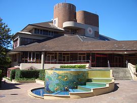
Crows Nest Community CentrePostcode: 2065 Location: 5 km (3 mi) north of Sydney CBD LGA: North Sydney Council State District: Willoughby Federal Division: North Sydney Suburbs around Crows Nest: Willoughby Naremburn Cammeray St Leonards Crows Nest Cammeray Wollstonecraft Waverton North Sydney Crows Nest is a suburb on the lower North Shore of Sydney, New South Wales, Australia. Crows Nest is located 5 kilometres north of the Sydney central business district, in the local government area of North Sydney Council.
Contents
History
Crows Nest was originally part of a 524-acre (2.12 km2) land grant made to Edward Wollstonecraft in 1821.[1] The grant extended from the site of the present day Crows Nest to Wollstonecraft. Edward Wollstonecraft built a cottage, the 'Crow's Nest' and, according to his business partner Alexander Berry, chose the name "on account of its elevated and commanding position".[2] Berry later built a more substantial Crow's Nest House on the estate in 1850, taking the name of the earlier cottage.[3] This site is now the building site of North Sydney Demonstration School and the gates of Crows Nest House (added in the 1880s) still stand at the Pacific Highway entrance to the school. Berry died at Crows Nest House on 30 November 1873.[4]
Commercial area
Crows Nest is a significant commercial district which is noted for its variety of shops and restaurants. It is centred on the junction of five main roads about 1 kilometre north by northwest of the original site of Crows Nest House.
Transport
The Warringah Freeway runs along the northern border of Crows Nest and the Pacific Highway is a major road along the western border.
-
Willoughby Road, view north to Naremburn
References
- ^ State Library of New South Wales (1993), Guide to the papers of the Berry, Wollstonecraft and Hay Families, http://acms.sl.nsw.gov.au/_transcript/2007/D00007/berry1.pdf, retrieved 20 October 2009
- ^ Alexander, Berry (1912). Reminiscences. Angus & Robertson, Sydney. p. 172.
- ^ Placenames Australia (March 2007). "Placenames from house names in Sydney suburbs". Newsletter of the Australian National Placenames Survey: 5. http://www.anps.org.au/documents/March_2007.pdf. Retrieved 27 October 2009.
- ^ The Book of Sydney Suburbs, Compiled by Frances Pollen, Angus & Robertson Publishers, 1990, Published in Australia ISBN 0-207-14495-8
External links
- Crows Nest, New South Wales is at coordinates 33°49′34″S 151°12′18″E / 33.82613°S 151.20505°ECoordinates: 33°49′34″S 151°12′18″E / 33.82613°S 151.20505°E
- North Sydney Heritage Centre, Stanton Library, From Land Grant to Subdivision, A walking tour of the Berry Estate, Wollstonecraft, http://www.northsydney.nsw.gov.au/resources/documents/HW_LandGrant_Subdivision.pdf, retrieved 27 October 2009
- Crows Nest at the Open Directory Project
Suburbs of the North Sydney Local Government Area · North Shore · Sydney Cammeray · Cremorne · Cremorne Point · Crows Nest · Kirribilli · Kurraba Point · Lavender Bay · McMahons Point · Milsons Point · Neutral Bay · North Sydney · St Leonards · Waverton · WollstonecraftList of Sydney suburbs Categories:- Suburbs of Sydney
- Sydney geography stubs
Wikimedia Foundation. 2010.


