- Berowra, New South Wales
Infobox Australian Place | type = suburb
name = Berowra
city = Sydney
state = nsw
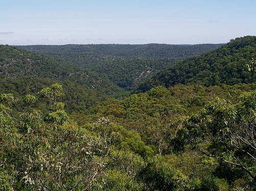
caption = Looking north over Berowra Regional Valley Park
lga = Hornsby Shire
stategov = Hornsby
fedgov = Berowra
postcode = 2081 [ [http://www.censusdata.abs.gov.au/ABSNavigation/prenav/LocationSearch?locationLastSearchTerm=berowra+&locationSearchTerm=berowra+&newarea=SSC11087&submitbutton=View+QuickStats+%3E&mapdisplay=on&collection=Census&period=2006&areacode=SSC11087&geography=&method=Place+of+Usual+Residence&productlabel=&producttype=QuickStats&topic=&navmapdisplayed=true&javascript=true&breadcrumb=PL&topholder=0&leftholder=0¤taction=104&action=401&textversion=false&subaction=1 Australian Bureau of Statistics] ]
est =
pop = 4,281
area = 8.7
propval =
near-nw = Berowra Heights
near-n = Berowra Heights
near-ne = Cowan
near-w = Berrilee
near-e = Brooklyn
near-sw = Mount Kuring-gai
near-s = Mount Kuring-gai
near-se = Cottage Point
dist1 = 38
dir1 = north
location1=Sydney CBD Berowra is a
suburb of northernSydney , in the state ofNew South Wales ,Australia . Berowra is located 38 kilometres north of theSydney central business district , in the local government area ofHornsby Shire and is part of the North Shore region. Berowra is south-east of the suburbs of Berowra Heights and east of Berowra Waters.Location
Berowra is bounded to the east by the F3
Sydney-Newcastle Freeway , Pacific Highway and main northern rail line. Berowra Valley Bushland Park sits to the west and to the north is theMuogamarra Nature Reserve . Berowra Creek is located to the west. Berowra's elevation is 220 m above sea level, which may have brought about its original meaning - an aboriginal word meaning 'many winds' or 'high winds’. Fact|date=December 2007Commercial Area
Berowra is largely residential with a small retail precinct lining the Pacific Highway near the train station. In May 2007 a new shopping complex opened on Turner Road in Berowra Heights. Leading up to the opening, the Berowra & District Community raised over $750,000 in BSX listed shares to buy a franchise of the Bendigo Bank. The Community Bank became one of the first to open its doors in the new complex. This was a landmark development for the future prospects of the area as the last Bank in the area closed its doors in 1996.
Transport
By road, Berowra has access to the F3
Sydney-Newcastle Freeway heading north or south and is approximately 15 minutes drive from the major regional shopping centre ofHornsby, New South Wales . The Berowra railway station is serviced by trains from both the Main North Line and the Newcastle and Central Coast railway lines providing regular services to Sydney and the Central Coast / Newcastle areas.History
Berowra is an Aboriginal word that means "place of many winds". The Berowra area has many Aboriginal carvings and is the place that found the world’s oldest living amphibian fossil.
European Settlement
One of the early land grants in the Berowra area was to John Crumpton in 1867. George Collingridge was granted 88 acres in 1880 and played a part in having the Northern railway line extended, so that a station was opened at Berowra in 1887. He also supported the building of a post office in 1900 and a road to Berowra Waters which opened in 1902. Mary Wall was granted 60 acres of land near Goodwyn Road off the Pacific Highway in 1887. Part of her grant meant she had to be there once a week and so she would walk at night through the bush from Surry Hills and tend to her farm. ["The Book of Sydney Suburbs", Compiled by Frances Pollen, Angus & Robertson Publishers, 1990, Published in Australia ISBN 0-207-14495-8 ]
The area grew when the Pacific Highway and railway were built and settlers loved the fishing and surrounding bush. Mainly living in tents, the original settlers lived a tough existence and helped everyone. The first school was set up in Mary Wall's house before it was moved to what is now the Old District Hall at the roundabout, on the corner of Berowra Waters Road and Crowley Road.
Schools
Berowra has two public primary schools (Berowra Public and Wideview Public), plus St Bernards (a Catholic primary school), and Berowra Christian Community School (years K-6)
Population
Demographics
At the 2006 census, the population of Berowra (postcode 2081) was 4,281, split evenly: 50.1% (2,143) males and 49.9% (2,138) females. [ [http://www.censusdata.abs.gov.au/ABSNavigation/prenav/LocationSearch?locationLastSearchTerm=berowra+&locationSearchTerm=berowra+&newarea=SSC11087&submitbutton=View+QuickStats+%3E&mapdisplay=on&collection=Census&period=2006&areacode=SSC11087&geography=&method=Place+of+Usual+Residence&productlabel=&producttype=QuickStats&topic=&navmapdisplayed=true&javascript=true&breadcrumb=PL&topholder=0&leftholder=0¤taction=104&action=401&textversion=false&subaction=1 Australian Bureau of Statistics] ]
Of the 1,496 dwellings in Berowra, 85% are freestanding houses with the remainder consisting of townhouses or units, according to the 2001 census ref|CowanCensus. At the time of the 2001 census, 99 people stated they lived in caravans. It is likely these would have been residents of the now-closed La Mancha Caravan Park located on the Pacific Highway and slated for redevelopment as medium density housing. The median weekly household income is $1,200 - $1,499 and the mean household size consists of 3.1 individuals.
Notable Residents
*
Matt Dunning ,rugby union playerSee also
*
Scotland Island
*Church Point Ferry External links
* [http://www.berowra.net Berowra Community Home Page and Directory]
* [http://www.thebushtele.com.au The Bush Telegraph: Local newsletter for Berowra and surrounding areas]
* [http://www.gnb.nsw.gov.au/name_search/extract?id=ujIOwptL Geographical Names Board of NSW reference for Berowra]References
# Note that because the suburbs of Cowan and Berowra share the same postcode, the data provided by the 2001 Census more accurately reflects details for both Berowra and Cowan, rather than just for Berowra alone.
See also
*
Scotland Island
*Church Point Ferry External links
* [http://www.berowra.net Homepage for the Berowra community]
* [http://www.thebushtele.com.au The Bush Telegraph: Local newsletter for Berowra and surrounding areas]
* [http://www.gnb.nsw.gov.au/name_search/extract?id=ujIOwptL Geographical Names Board of NSW reference for Berowra]
Wikimedia Foundation. 2010.