Wisemans Ferry, New South Wales
- Wisemans Ferry, New South Wales
Infobox Australian Place | type = town
name = Wisemans Ferry
state = nsw
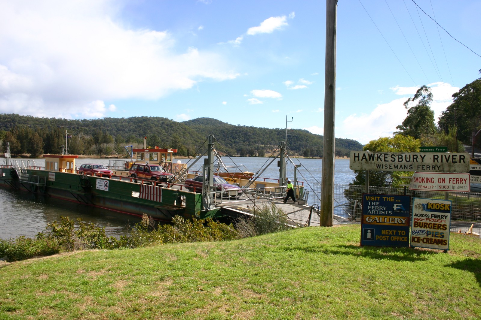
caption = The ferry over the Hawkesbury River
lga = Hornsby Shire
lga2 = Baulkham Hills Shire
lga3 = City of Hawkesbury
lga4 = City of Gosford
postcode = 2775
est = 1827
parish = Cornelia, Frederick
stategov = Gosford, Hawkesbury
fedgov = Macquarie, Berowra
dist1 = 75 | dir1 = NW | location1= Sydney
dist2 = 44 | dir2 = NNE | location2= Windsor
near-nw = Colo Heights
near-n = Lower Macdonald
near-ne = Lower Macdonald
near-w = Webbs Creek
near-e = Gunderman
near-sw = Leets Vale
near-s = Maroota
near-se = Laughtondale
Wisemans Ferry is a town north of Sydney, in the state of New South Wales, Australia. It is located in the Hornsby Shire and Baulkham Hills Shire local government areas.
The town is named after Solomon Wiseman, a former convict who received a land grant in the area from Governor Macquarie in 1817. [cite web|url=http://www.smh.com.au/news/new-south-wales/wisemans-ferry/2005/02/17/1108500200126.html|title=Wisemans Ferry|publisher=Sydney Morning Herald|accessdate=17 September|accessyear=2007] Wiseman established a ferry service on the Hawkesbury River in 1827 for the transport of produce, and provisions to the convicts building the Great North Road. The ferry service is still running to this day.
The town is now a tourist spot with picnic and barbecue facilities. As well as a rich convict and colonial heritage in the area, the Dharug National Park and Yengo National Park are close by.
ee also
*Scotland Island
*Church Point Ferry
External links
* [http://www.convicttrail.org Great North Road - Convict Trail]
References
Wikimedia Foundation.
2010.
Look at other dictionaries:
Sackville North, New South Wales — Sackville North Sydney, New South Wales Population: 272 (2006 Census) Postcode: 2756 Location … Wikipedia
Mount Colah, New South Wales — Mount Colah Sydney, New South Wales The Caltex petrol station North of the Colonnade shops on the Pacific Highway. Population … Wikipedia
St Albans, New South Wales — Infobox Australian Place | type = suburb name = St Albans city = state = NSW caption = lga = City of Hawkesbury postcode = 2775 pop = 72 (2006 Census) dist1 = 94 location1= Sydney CBD area = propval = stategov = fedgov = Division of Greenway near … Wikipedia
Mooney Mooney, New South Wales — Mooney Mooney Central Coast, New South Wales Population: 313 (2002 estimate)[1] Postcode: 2083 … Wikipedia
Church Point, New South Wales — Church Point Sydney, New South Wales Church Point Post Office Pop … Wikipedia
Cottage Point, New South Wales — Cottage Point Sydney, New South Wales A waterplane lands next to the Cottage Point Inn Populati … Wikipedia
Webbs Creek, New South Wales — Infobox Australian Place | type = suburb name = Webbs Creek city = Sydney state = NSW caption = lga = City of Hawkesbury postcode = 2775 pop = 204 (2006 Census) dist1 = 77 location1= Sydney CBD area = propval = stategov = fedgov = Division of… … Wikipedia
Mangrove Mountain, New South Wales — Mangrove Mountain Central Coast, New South Wales Population: 948 (2006 census) Postcode: 2250 Location … Wikipedia
Lower Macdonald, New South Wales — Infobox Australian Place | type = suburb name = Lower Macdonald city = Sydney state = NSW caption = lga = City of Hawkesbury postcode = 2775 pop = 247 (2006 Census) dist1 = 78 location1= Sydney CBD area = propval = stategov = fedgov = Division of … Wikipedia
North Epping, New South Wales — North Epping Sydney, New South Wales North Epping retail area Population … Wikipedia