- U.S. Route 6 in Colorado
-
This article is about the section of U.S. Route 6 in Colorado. For the entire length of the highway, see U.S. Route 6.
U.S. Route 6 
Route information Maintained by CDOT Length: 467.284 mi[1] (752.021 km) Major junctions West end: 

 I-70 / US-6 / US-50 at Utah state line
 US 50 in Grand Junction
 US 24 in Minturn
 US 40 near Empire
 SH 470 near Golden


 I-25 / US 85 / US 87 / US 287 in Denver
 I-270 in Commerce City
 I-76 from Commerce City to Fort Morgan
 US 34 in Fort Morgan
 US 385 in Holyoke
East end:  US-6 at Nebraska state line
Highway system United States Numbered Highways
List • Bannered • Divided • Replaced←  SH 5
SH 5SH 7  →
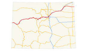
→In the U.S. state of Colorado, U.S. Route 6 (US 6) is an east–west highway stretching from Colorado to Nebraska. Much of the route overlaps other highways in Colorado, and as a result, much of US 6 is unsigned.
Route description
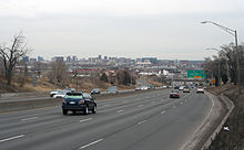
US 6 is concurrent with Interstate 70 for a significant portion of its length from the Utah state line to Denver. Within the city limits, US 6 follows Denver's 6th Avenue (known as "6th Avenue Freeway"). The highway then travels north briefly, and follows Interstate 76 for most of its length east of Denver. It is unsigned while it is overlapped. The highest altitude along US 6 is 11,990 feet (3,650 m) at Loveland Pass, where it crosses the Continental Divide. It continues down Clear Creek Valley until it reaches I-70, where it is briefly overlapped until I-70 leaves Clear Creek Valley. US 6 continues down Clear Creek and into Denver, where it turns into a freeway with 6 lanes. East of Denver, it continues east while joined with I-76 until it reaches Sterling, where it diverges from the interstate. The last town in Colorado it passes is Holyoke.
Major intersections
- Note: only major junctions are shown on overlaps with Interstate Highways.
County Location Mile[1] #(for overlaps) Destinations Notes Mesa 0.000 
 I-70 west / US-50 – Salina
Western terminus of US 6 in Colorado Mack 11.212 11  I-70 west- Salina, UT
East end of I-70 overlap Loma 15.132 15  SH 139 north – Loma, Rangely
Fruita 19.781 19  SH 340 east- Colorado National Monument, Redlands
Grand Junction 25.998 26  I-70 east – Denver
East end of I-70 overlap 27.885 F Road 28.006 24 Road north, Redland Parkway south 29.125 25 Road 30.270 
 I-70 Bus. east / US 50 – Delta
East end of US 50 overlap 34.375  I-70 Bus. west
West end of I-70 Bus. overlap Clifton 36.442  SH 141 south
36.885 F Road 37.651 44  I-70 west – Grand Junction
West end of I-70 overlap 45.332 46 Cameo 46.867 47 Road E Former port of entry 49.015 49  SH 65 east – Grand Mesa
61.648 62 De Beque Garfield Parachute 75.152 75 Parachute, Battlement Mesa 81.236 81 Rulison 86.850 87  I-70 east – Denver
East end of I-70 overlap Rifle 90.422  SH 13 north – Rifle, Meeker
109.000  I-70 west – Grand Junction
West end of I-70 overlap 111.328 111 South Canyon Creek Road Glenwood Springs 114.295 114 West Glenwood 116.380 116  SH 82 – Glenwood Springs, Aspen
118.640 119 No Name 120.954 121 Grizzly Creek – Hanging Lake 122.588 123 Shoshone Access Road Eastbound exit and westbound entrance 124.970 125 Hanging Lake Eastbound exit and westbound entrance Hanging Lake Tunnel 128.314 129 Bair Ranch Road Eagle 133.384 133 Dotsero 139.533 140  I-70 east – Denver
East end of I-70 overlap 158.111  SH 131 north – Wolcott
159.002  SH 131 south- To I-70
174.54 171 
 I-70 west / US 24 east – Minturn, Leadville
West end of I-70 overlap Vail 173.319 173 West Vail 175.872 176 Vail Ski Area – Vail Museum 179.866 180 East Vail Summit 190.095 190 Vail Pass, Shrine Pass Road 195.298 195  SH 91 south – Copper Mountain, Leadville
198.254 198 Officers Gulch Frisco 200.995 201 Main Street 202.352 203  SH 9 south – Frisco, Breckenridge
West end of SH 9 overlap Silverthorne 205.423 205 
 I-70 east / SH 9 north – Dillon, Silverthorne
East end of I-70 overlap Clear Creek 229.325  I-70 west – Grand Junction
West end of I-70 overlap 218.346 218 Herman Gulch Road 221.297 221 Bakerville Silver Plume 225.719 226 Silver Plume Georgetown 227.910 228 Georgetown 231.889 232  US 40 west – Empire, Granby
West end of US 40 overlap 233.047 233 Lawson Eastbound exit only 234.209 234 Downieville, Lawson 235.005 235 Dumont Westbound exit and eastbound entrance 237.660 238 Fall River Road Idaho Springs 238.885 239  I-70 Bus. east – Idaho Springs
239.652 240  SH 103 south – Mount Evans
241.125 241  I-70 Bus. west
Signed as exit 241A (I-70 Bus.) and exit 241B (E Idaho Springs Road) eastbound 242.980 243 Hidden Valley, Central City 251.001 
 I-70 east / US 40
East end of I-70/US 40 overlap 257.296  SH 119 north – Central City
Jefferson Golden 271.60 
 SH 58 east / SH 93 north – Golden, Boulder
273.397  SH 470 east – Colorado Springs
275.12  US 40 (Colfax Avenue)
275.656  SH 470 – Colorado Springs
West end of 6th Ave freeway 276.003  I-70 – Grand Junction, Denver
Lakewood 276.998 Indiana Street 277.002 Union Boulevard, Simms Street 277.31  SH 391 (Kipling Street)
278.795 Garrison Street 280.83  SH 121 (Wadsworth Blvd)
281.984  SH 95 (Sheridan Blvd)
282.33 Knox Court Denver Denver 283.86  SH 88 (Federal Blvd)
284.47  I-25 – Colorado Springs
East end of 6th Ave freeway/South end of I-25 overlap 286.272 209C 8th Avenue 287.310 210A  US 40 (Colfax Avenue, I-70 Bus./US 287) – Downtown Denver
287.661 210C Auraria Parkway Northbound exit and southbound entrance 288.008 210B 17th Avenue Southbound exit (to 20th Avenue) is via exit 211 289.167 211 23rd Avenue 289.985 212 Speer Boulevard – Downtown Denver Signed as exits 212A (south) and 212B (north) 290.425 212C 20th Street 291.479 213 Park Avenue, West 38th Avenue 290.090  I-25 – Fort Collins
292.090 214A  I-70 – Limon, Grand Junction
North end of I-25 overlap/West end of I-70 overlap 292.815 275A Washington Street Eastbound signed exit 274 293.226 275B  SH 265 north (Brighton Boulevard)
292.661 275C York Street / Josephine Street Eastbound exit and westbound entrance 293.194 276A 
 I-70 east / US 85 north
East end of I-70 overlap (final) Adams Commerce City 294  I-270 – Limon
294.550  SH 2 east
295.995  I-76 west – Arvada
West end of I-76 overlap 296.466 10 88th Avenue 297.114 11 96th Avenue 298.345 12  US 85 north – Greeley, Brighton
East end of US 85 overlap; no eastbound entrance Commerce City 302.285 16  SH 2 (Sable Boulevard) / 120th Avenue – Denver International Airport
304.661 18  E-470 south – Limon,
  Denver International Airport
Westbound exit and eastbound entrance Brighton 305.219 20 136th Avenue 307.828 21 144th Avenue 308.626 22 Bromley Lane 310.994 25  SH 7 west – Lochbuie, Brighton
Weld Hudson 316.269 31  SH 52 – Hudson, Fort Lupton
319.220 34 Kersey Road 324.160 39 Keenesburg (I-76 Bus. south) 333.302 48 Roggen 334.007 49 Painter Road Westbound exit and eastbound entrance 342.652 57 County Road 91 345.225 60  SH 144 east – Orchard
Morgan 348.226 64 Wiggins Eastbound exit and westbound entrance 350.314 66A 
 SH 39 / SH 52 – Goodrich, Wiggins
350.535 66B  US 34 west – Greeley, Estes Park
West end of US 34 overlap; westbound exit and eastbound entrance 357.219 73 Long Bridge Road 359.789 75 
 US 34 east / I-76 Bus. east – Fort Morgan
East end of US 34 overlap 364.054 79  SH 144 – Weldona
Fort Morgan 365.243 80  SH 52, Fort Morgan
366.993 82 Barlow Road – Fort Morgan 370.076 86 Dodd Bridge Road 373.368 89 Hospital Road 375.042 90 
 SH 71 to US 34 – Brush, Akron, Limon, Snyder
Signed as exits 90A (south) and 90B (north) 379.192  I-76 east – Sterling
East end of US I-76 overlap Logan Atwood 405.187  SH 63 south – Akron
Sterling 412.061  SH 14 west – Fort Collins
412.689  US 138 east- Julesburg
414.116  I-76 west – Fort Morgan, Julesburg
414.317  SH 61 south – Otis
Fleming 431.121  SH 55 north
Phillips Haxtun 444.295  SH 59 – Yuma, Sedgwick
Holyoke 457.213  US 385 – Wray, Julesburg
467.284  US-6 east – Imperial
Eastern terminus of US 6 in Colorado References
- ^ a b Colorado Department of Transportation, Highway Data, accessed July 2007
Freeways in the Denver-Aurora Metropolitan Area Radial Circumferential Connecting Proposed W-470 U.S. Route 6
Previous state:
UtahColorado Next state:
NebraskaCategories:- U.S. Highways in Colorado
- U.S. Route 6
- Colorado River
Wikimedia Foundation. 2010.


