- Rifle, Colorado
Infobox Settlement
official_name = City of Rifle, Colorado
other_name =
native_name =
nickname =
settlement_type =City
motto = Embracing our past, shaking hands with our future
imagesize =
image_caption =
flag_size =
image_
seal_size =
image_shield =
shield_size =
image_blank_emblem =
blank_emblem_type =
blank_emblem_size =
imagesize =
image_caption =
flag_size =
image_
seal_size =
image_shield =
shield_size =
image_blank_emblem =
blank_emblem_type =
blank_emblem_size =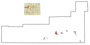
mapsize = 250px
map_caption = Location in Garfield County and the state ofColorado
mapsize1 =
map_caption1 =
image_dot_
dot_mapsize =
dot_map_caption =
dot_x =
dot_y =
pushpin_
pushpin_label_position =
pushpin_map_caption =
pushpin_mapsize =
subdivision_type = Country
subdivision_name = USA
subdivision_type1 = State
subdivision_name1 = flag|Colorado|name=State of Colorado
subdivision_type2 = Countycite web | url = http://www.dola.state.co.us/dlg/local_governments/municipalities.html | title = Active Colorado Municipalities | format =HTML | publisher = State of Colorado, Department of Local Affairs | accessdate = 2007-09-01]
subdivision_name2 = Garfield County
subdivision_type3 =
subdivision_name3 =
subdivision_type4 =
subdivision_name4 =
government_footnotes =
government_type = Home Rule Municipality
leader_title =Mayor
leader_name = Keith Lambert
leader_title1 =
leader_name1 =
leader_title2 =
leader_name2 =
leader_title3 =
leader_name3 =
leader_title4 =
leader_name4 =
established_title = Founded
established_date = 1882 [http://www.rifleco.org/ City of Rifle website] ]
established_title2 = Incorporated
established_date2 =August 18 ,1905 cite web | url = http://www.colorado.gov/dpa/doit/archives/muninc.html | title = Colorado Municipal Incorporations | format =HTML | publisher = State of Colorado, Department of Personnel & Administration, Colorado State Archives | date =2004-12-01 | accessdate = 2007-09-02]
established_title3 =
established_date3 =
area_magnitude =
unit_pref = Imperial
area_footnotes =
area_total_km2 = 11.2
area_land_km2 = 11.1
area_water_km2 = 0.1
area_total_sq_mi = 4.3
area_land_sq_mi = 4.3
area_water_sq_mi = 0
area_water_percent =
area_urban_km2 =
area_urban_sq_mi =
area_metro_km2 =
area_metro_sq_mi =
area_blank1_title =
area_blank1_km2 =
area_blank1_sq_mi =
population_as_of = 2000
population_footnotes =
population_note =
population_total = 10000
population_density_km2 = 605.7
population_density_sq_mi = 1577.7
population_metro =
population_density_metro_km2 =
population_density_metro_sq_mi =
population_urban =
population_density_urban_km2 =
population_density_urban_sq_mi =
population_blank1_title =
population_blank1 =
population_density_blank1_km2 =
population_density_blank1_sq_mi =
timezone = Mountain (MST)
utc_offset = -7
timezone_DST = MDT
utc_offset_DST = -6
latd = 39 |latm = 32 |lats = 13 |latNS = N
longd = 107 |longm = 46 |longs = 58 |longEW = W
elevation_footnotes = GR|3
elevation_m = 1630
elevation_ft = 5348
postal_code_type =ZIP code cite web | url = http://zip4.usps.com/zip4/citytown.jsp | title = ZIP Code Lookup| format =JavaScript /HTML | publisher =United States Postal Service | accessdate = December 24 | accessyear = 2007]
postal_code = 81650
area_code = 970
blank_name = FIPS code
blank_info = 08-64255
blank1_name = GNIS feature ID
blank1_info = [http://geonames.usgs.gov/pls/gnispublic/f?p=gnispq:3:::NO::P3_FID:0174045 0174045]
website = [http://www.rifleco.org/ City of Rifle]
footnotes =
founder = Abram MaxfieldThe City of Rifle is a Home Rule Municipality in Garfield County,
Colorado ,United States . The population was 6,784 at the 2000 census. The town is a regional center of thecattle ranching industry located alongInterstate 70 and the Colorado River just east of theRoan Cliffs , which dominate the western skyline of the town. The town was founded in 1882 by Abram Maxfield, and was incorporated in 1905 along Rifle Creek, near its mouth on the Colorado. The creek is named for an incident involving white trappers in the late 19th century. According to local lore, one of the trappers accidentally left hisrifle along the creek, giving it its name. [Rifle Shots: The Story of Rifle, Colorado compiled by the Reading Club of Rifle, Colorado, 1973.]Interesting Facts
On August 10, 1972,
Christo completed the Valley Curtain project at Rifle Gap, a few miles north of the town of Rifle. The completed curtain hung for only 28 hours before it was ripped by a gust of wind. ["Valley Curtain." Christo and Jeanne-Claude. 1 Dec 2007A portion of the film
Vanishing Point was filmed in Rifle. Scenes include a shot of Kowalski's car crossing a white metal bridge and confronting Utah state patrol cars.Rifle Mountain Park, located 12 miles north of Rifle, is maintained by the City of Rifle. It is popular with rock climbers. ["Mountain Project: Climbing Rifle Mountain Park." Mountain Project. 29 Oct 2001. 1 Dec 2007
An organization called
Campaign to Save Roan Plateau is currently engaged in an effort to minimize oil and gas drilling on the top of the Roan Plateau (which natives call the Bookcliffs). The Roan Plateau is accessible from the JQS Trail, located 3 miles north of Rifle, or from the Piceance Creek road. [Save Roan Plateau. 1 Dec 2007Geography
Rifle is located at coor dms|39|32|13|N|107|46|58|W|city (39.536992, -107.782709)GR|1.
According to the
United States Census Bureau , the city has a total area of 4.3 square miles (11.2 km²), of which, 4.3 square miles (11.1 km²) of it is land and 0.04 square miles (0.1 km²) of it (0.92%) is water.Demographics
As of the
census GR|2 of 2000, there were 6,784 people, 2,493 households, and 1,710 families residing in the city. Thepopulation density was 1,581.1 people per square mile (610.6/km²). There were 2,586 housing units at an average density of 602.7/sq mi (232.7/km²). The racial makeup of the city was 91.54% White, 0.44% African American, 0.68% Native American, 0.27% Asian, 0.04% Pacific Islander, 4.75% from other races, and 2.28% from two or more races. Hispanic or Latino of any race were 16.26% of the population.There were 2,493 households out of which 41.8% had children under the age of 18 living with them, 54.8% were married couples living together, 8.9% had a female householder with no husband present, and 31.4% were non-families. 25.5% of all households were made up of individuals and 8.1% had someone living alone who was 65 years of age or older. The average household size was 2.68 and the average family size was 3.22.
In the city the population was spread out with 30.9% under the age of 18, 9.2% from 18 to 24, 34.4% from 25 to 44, 17.1% from 45 to 64, and 8.5% who were 65 years of age or older. The median age was 31 years. For every 100 females there were 106.1 males. For every 100 females age 18 and over, there were 105.7 males.
The median income for a household in the city was $42,734, and the median income for a family was $48,714. Males had a median income of $36,517 versus $25,527 for females. The
per capita income for the city was $17,376. About 3.4% of families and 6.4% of the population were below thepoverty line , including 7.8% of those under age 18 and 9.8% of those age 65 or over.ee also
*
Colorado municipalities References
External links
* [http://www.rifleco.org/ City of Rifle website]
** [http://www.dot.state.co.us/App_DTD_DataAccess/Downloads/CityMaps/Rifle.pdf CDOT map of the Town of Rifle]
* [http://www.citizentelegram.com/home.php Citizen Telegram newspaper]
* [http://www.riflechamber.com/ Rifle Area Chamber of Commerce]
* [http://parks.state.co.us/Parks/riflegap Rifle Gap State Park]
Wikimedia Foundation. 2010.