- Kota Kinabalu
-
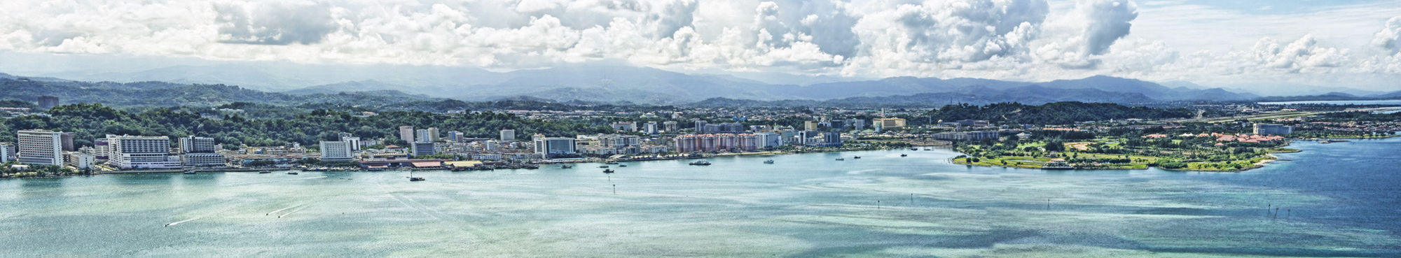
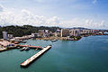
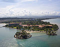
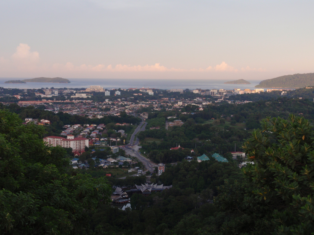
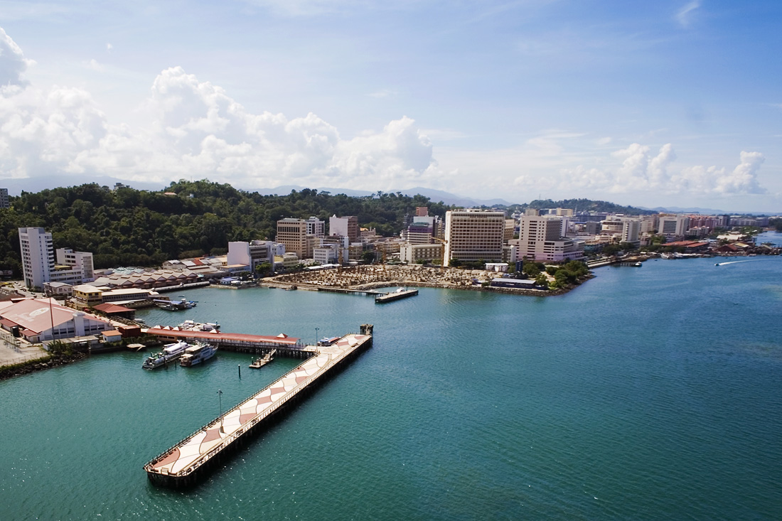
Kota Kinabalu View of the Kota Kinabalu city.
Flag
SealNickname(s): "Nature Resort City", KK Location in Malaysia and Sabah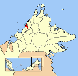
Country Malaysia State Sabah Settled by BNBC 1882 Declared capital of North Borneo 1946 Granted city status February 2, 2000 Government – Mayor Datuk Abidin Madingkir Area – City 351 km2 (136 sq mi) Population (2009) – City 617,972 – Density 1,760.6/km2 (4,543.9/sq mi) – Urban 600,000 – Metro 900,000 Time zone MST (UTC+8) Postcode 88xxx; 89xxx Area code(s) 088 Website http://www.dbkk.sabah.gov.my 1 World Gazetteer Kota Kinabalu (pronounced [ˈkota kinaˈbalu]), formerly known as Jesselton,[1] is the capital of Sabah state in East Malaysia. It is also the capital of the West Coast Division of Sabah. The city is located on the northwest coast of Borneo facing the South China Sea. The Tunku Abdul Rahman National Park lies on one side and Mount Kinabalu, which gave the city its name, is nearby. Kota Kinabalu proper has a population of 617,972 while the larger urban area has an estimated population of 900,000. It is the largest urban centre in Sabah and the sixth largest in Malaysia.[2]
Kota Kinabalu is often known as K.K. within Malaysia and internationally. It is a major tourist destination and a popular gateway for travellers visiting Sabah and Borneo.[3] Kinabalu National Park is located about 90 kilometres from the city and there are many tourist attractions in and around the city. Kota Kinabalu is also one of the major industrial and commercial centres of East Malaysia. These two factors combine to make Kota Kinabalu one of the fastest growing cities in Malaysia.[4][5]
Contents
History
In the late 1800s, the British North Borneo Company (BNBC) began to establish colonies throughout North Borneo (now Sabah). In 1882, the Company founded a small settlement in the area known as Gaya Bay which was already inhabited by the Bajau people. The first settlement was on Gaya Island (Pulau Gaya). In 1897, this first settlement was burned and destroyed by the indigenous Bajau freedom fighter led by Mat Salleh.[6]
After the rebellion, the Company decided to relocate the settlement to the more easily defended mainland opposite Pulau Gaya. A nearby fishing village named Api-Api (see Original names below), was the next settlement of the Company. This new location was then designated as the main harbour and port, as well as the terminus for the North Borneo Railway. It was expanded and renamed Jesselton, named after Sir Charles Jessel, the then Vice Chairman of the Company.
Eventually, Jesselton became a major trading post of North Borneo, dealing in rubber, rattan, honey, and wax. The new railway was used to transport goods to Jesselton harbour. The Malay and Bajau uprisings during these times were not uncommon, and the Company worked to quell the long-standing threat of piracy in the region.
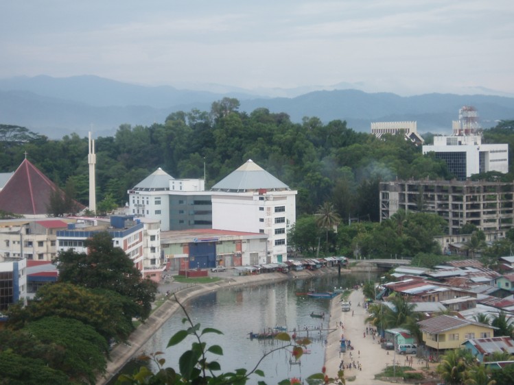
 City centre and coast.
Jesselton was razed by the retreating British early in World War II to prevent it from falling into the hands of the Japanese. After the Japanese takeover of Borneo, it was again renamed Api. Several rebellions against the Japanese military administration took place in Api. One major rebellion occurred in 1943 by the group called Kinabalu Guerrillas, consisting of local inhabitants. Japanese forces quelled the rebellion after its leader, Albert Kwok, was arrested and executed in 1944.[7] At the later stages of the war, what remained of the town was destroyed again by Allied bombings as part of the Borneo Campaign in 1945, leaving only three buildings standing. The war in North Borneo ended with the official surrender of the Japanese 37th Army by Lieutenant General Baba Masao in Labuan on September 10, 1945.
After the war, the British North Borneo Company returned to administer Jesselton but was unable to finance the huge costs of reconstruction. They gave control of North Borneo to the British Crown in 1946. The new colonial government elected to rebuild Jesselton as the capital of North Borneo instead of Sandakan, which had also been destroyed by the war.[8]
When North Borneo together with Sarawak, Singapore & Federation of Malaya formed the Federation of Malaysia in 1963, the state became known as Sabah and Jesselton remained its capital. Jesselton was renamed Kota Kinabalu on September 30, 1968 and received official city status from the Malaysian government on February 2, 2000.
 View of Likas Bay at dawn. On the far right is Mount Kinabalu.
Etymology
Kota Kinabalu is named after Mount Kinabalu, situated about 50 kilometres east-northeast of the city. Kinabalu is derived from the name Aki Nabalu meaning the "revered place of the dead", in which, Aki means "ancestors" or "grandfather", and Nabalu being a name for the mountain in the Dusun language.[9] There is also a source claiming that the term originated from Ki Nabalu, where Ki meaning "have" or "exist", and Nabalu meaning "spirit of the dead".[10]
Kota is a Malay word for a "fort", "town", or a "city". It is also used formally in a few other Malaysian towns and cities, for example, Kota Bahru, Kota Tinggi, and Kota Kemuning. It could also be used informally to refer to any towns or cities. Henceforth, a direct translation of the name Kota Kinabalu into English would be "City of Kinabalu" or "Kinabalu City".
Wendy Suart wrote in her book on North Borneo, The Lingering Eye, "there is in the [Sabah] State Museum a Dutch map of Borneo and the Celebes dated 1657 in which the settlement where Jesselton was to stand is clearly labelled Api Api. It may have some connection with the seaside tree with breathing roots that bears the same name."[11] Another explanation is that the name Api Api is derived from the devastating fire which occurred in the city's early years ('Api' means 'fire' in the Malay language). In Chinese, the city is known as 'Api', which is the Hakka pronunciation for 亚庇 (Simplified Chinese; Traditional Chinese: 亞庇; 'Ya bi' in Mandarin Chinese).
Original names
Besides Jesselton, there have been a number of other theories as to the original name for Kota Kinabalu. The most popular, as mentioned above, is Api-Api, or simply Api, which is a Malay word meaning 'Fire'. It was apparently named as such by the mainly Bajau locals to commemorate the burning of the British administrative office on Pulau Gaya (Gaya Island) instigated by Mat Salleh,[12] as well as other incidents of arson normally perpetrated by pirates. There are claims, however, that Kota Kinabalu was actually named after a nearby river called Sungai Api-Api. Besides Api-Api, another suggested historical name is Deasoka, which roughly means "below the coconut tree" in the Bajau language.[13] The Bajau locals purportedly used this name to refer to a village on the southern part of the city which was filled with coconut trees. Another name was Singgah Mata which literally means "transit eye", but can be loosely translated as "pleasing to the eye". It is a name purportedly given by fishermen from Pulau Gaya referring to the strip of land which today is downtown Kota Kinabalu.[14] Today, all these names have been immortalised as names of streets or buildings around the city. Some examples are Lintasan Deasoka, Api-Api Centre and Jalan Singgah Mata.
Capital city
 Location of Kota Kinabalu district and the city within the West Coast Division of Sabah.
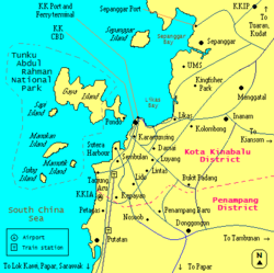 A rough map of Kota Kinabalu city and urban area. Blue lines indicate main roads, grey lines indicate railway lines, and pink dotted lines indicate district boundaries.
Being the capital city of Sabah, Kota Kinabalu plays an important role in the political and economic welfare of the population in the entire state. It is the seat of the state government where almost all of their ministries and agencies are based. Most of the Malaysian federal government agencies and departments are also located in Kota Kinabalu. The Sabah State Legislative Assembly is located at nearby Likas Bay. There are four Members of Parliament (MPs) representing four parliamentary constituencies in the city: Sepanggar (P.171), Kota Kinabalu (P.172), Putatan (P.173), and Penampang (P.174). The city also elects 9 representatives to the state legislature from the state assembly districts of Karambunai, Inanam, Likas, Api-Api, Luyang, Tanjung Aru, Petagas, Kepayan, and Moyog.[15]
Local authority and city definition
The city is administered by Dewan Bandaraya Kota Kinabalu (Kota Kinabalu City Hall). The current mayor of Kota Kinabalu is Abidin Madingkir, who took over from Datuk Iliyas Ibrahim on January 31, 2011. Datuk Iliyas in turn became the second mayor of the city after taking over from Datuk Abdul Ghani Rashid in 2006. The city obtained city status on February 2, 2000, and prior to this it was administered by Majlis Perbandaran Kota Kinabalu (Kota Kinabalu Municipal Council/Kota Kinabalu Town Hall).
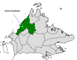
The city is defined within the borders of what is the district, formerly the municipality, of Kota Kinabalu. With an area of 351 square kilometres, it is the smallest but the most populous district in Sabah.[16] It encompasses Tanjung Aru and Kepayan in the south, up to Telipok and Sepanggar in the north. The urban expanse of the city however extends into the district of Penampang[17] on the south of the city border, which includes the towns of Donggongon and Putatan. The combined area of Kota Kinabalu (district) and the built up areas in Penampang can also be described as Kota Kinabalu (urban area). The district of Penampang has an area of 466 square kilometres, and is administered by Majlis Daerah Penampang (Penampang District Council).[18]
On one end of the scale, Kota Kinabalu may sometimes only refer to, especially by local inhabitants, the city centre or central business district, area near the sea facing Pulau Gaya. On the other end of the scale, it may also refer to the metropolitan area which includes urban Kota Kinabalu, and the surrounding towns of Papar and Kinarut, in the south, and Tuaran and Tamparuli, in the north, being within its zone of influence.
International relations
Several countries have set up their consulate in Kota Kinabalu including Australia, Brunei, Finland, Indonesia, Japan and Sweden.[19]
Kota Kinabalu currently has four sister cities.[20]
 - Yongin, South Korea
 - Ratchaburi Province, Thailand
 - City of Rockingham, Australia
 - Vladivostok, Russia
Geography
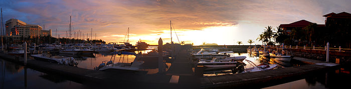
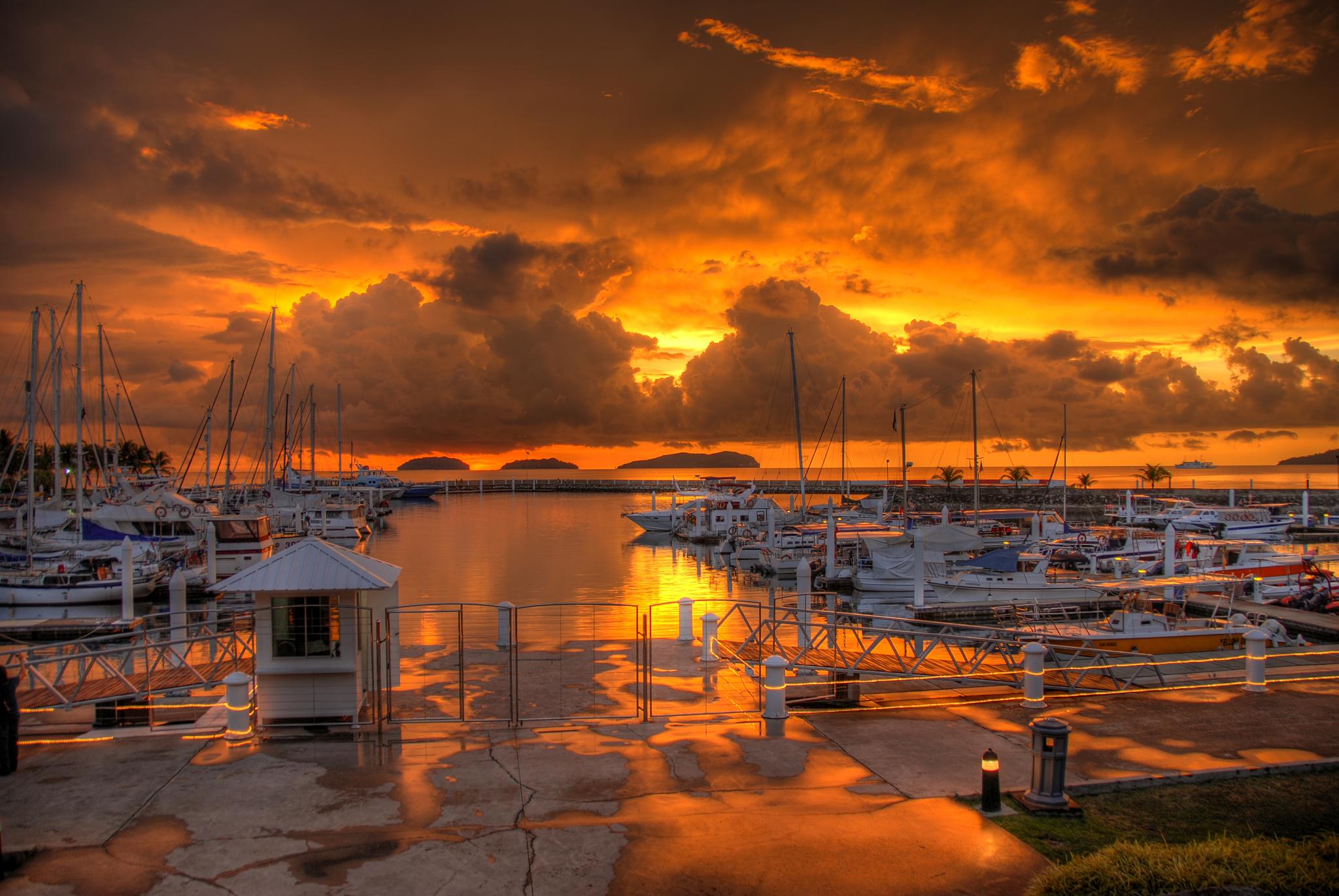
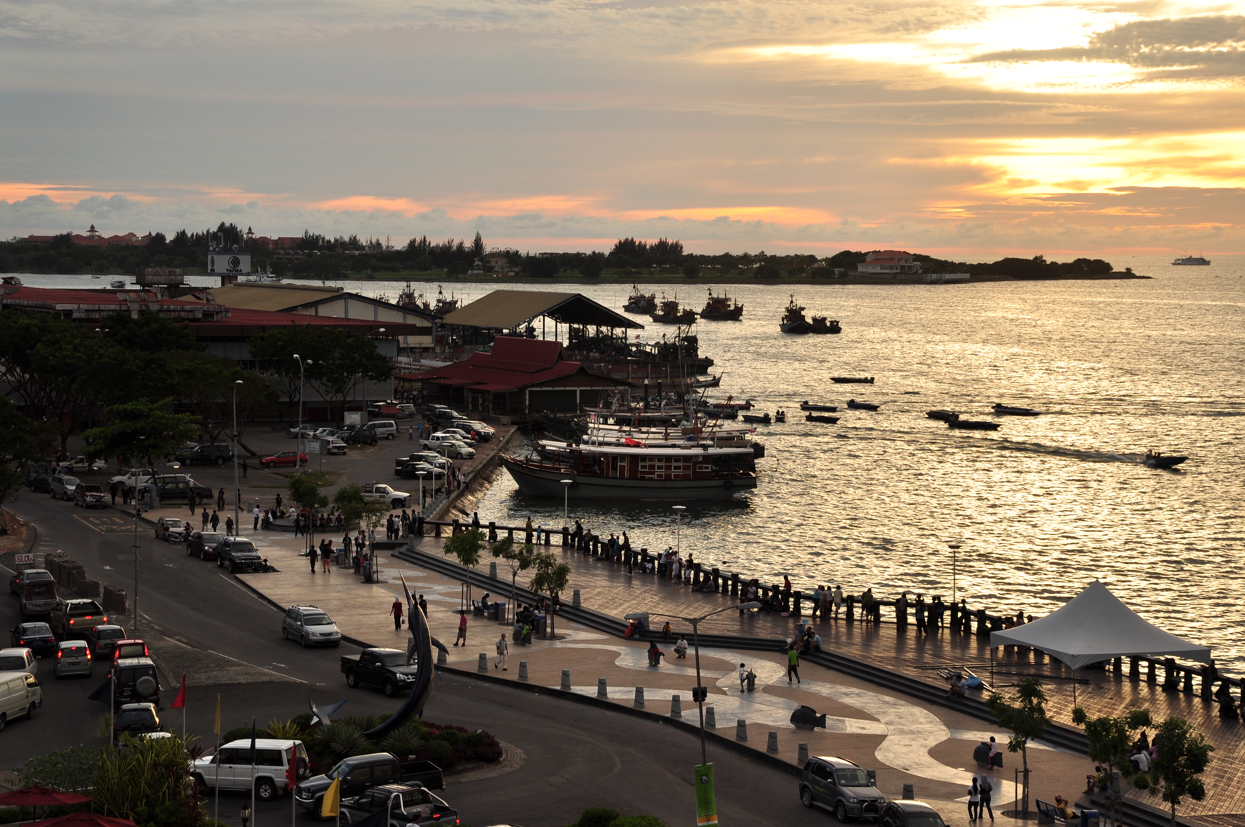
 Sunset over Sutera Harbour, Kota Kinabalu.
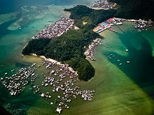
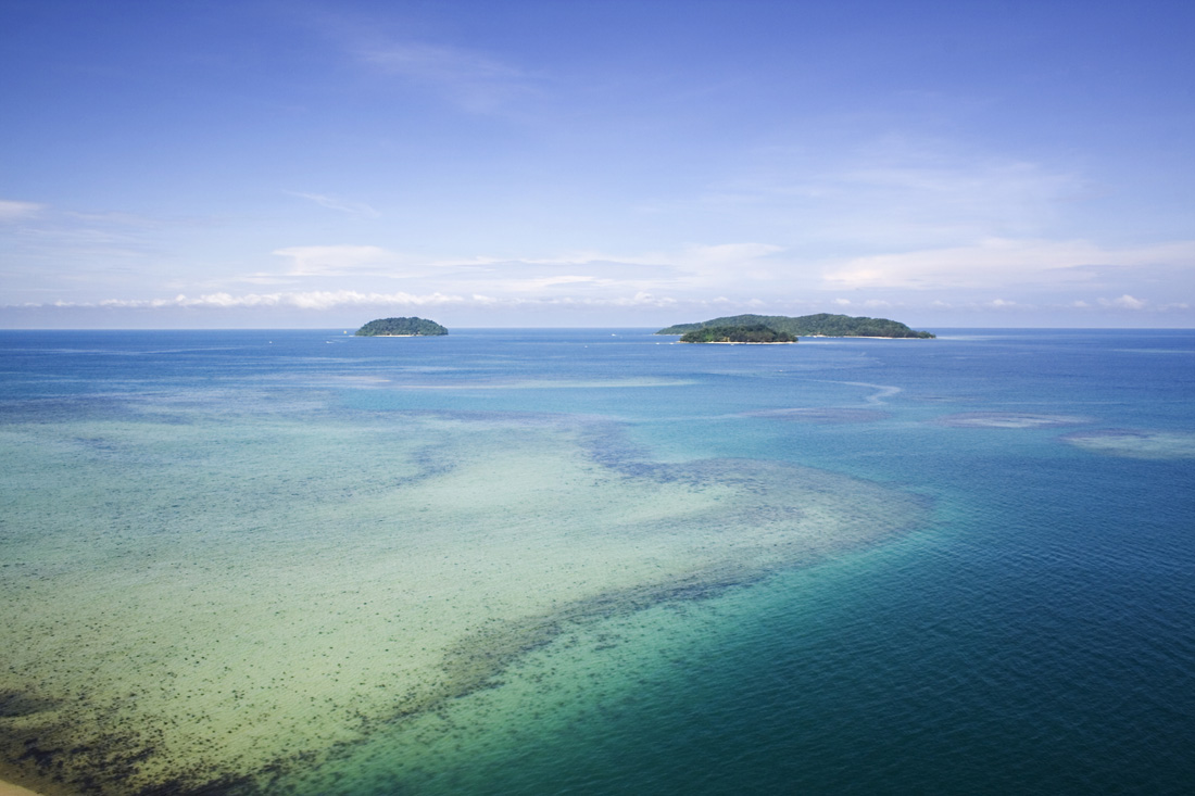
Kota Kinabalu is located on the west coast of Sabah. The city lies on a narrow flatland between the Crocker Range to the east and the South China Sea to the west. There are six islands off the coast of the city. The largest is Pulau Gaya, the site of the first British settlement. Approximately 8,000 people live there.[21] The smaller islands, mainly uninhabited, are named Pulau Sapi, Pulau Manukan, Pulau Sulug, Pulau Mamutik and Pulau Sepanggar to the north.[22] Sepanggar island is located north of the National Park opposite Sepanggar Bay.
 City centre.
Flat land is at a premium in the city centre, and there is a strict limit to the height of buildings: the airport is 7 km away, and the city is directly in the flight path. Most of the Central Business District (CBD) today is built on land reclaimed from the sea. The original local plant life has largely disappeared, but several hills within the city (too steep for building) are still clothed with tropical rainforest. One of these is Signal Hill, which confines the CBD to the shore. In the area of Likas Bay the remnants of an extensive mangrove forest was nearly lost.[23] In 1996, a perceptive state government stepped in and declared 24 acres (97,000 m2) of the forest as a protected area. This forest is now known as the Kota Kinabalu City Bird Sanctuary. The sanctuary was given additional protection as a State Cultural Heritage Site in 1998.[23]
The five islands (of Gaya, Sapi, Manukan, Sulug, Mamutik) opposite the city, and their surrounding waters, are also preserved as the Tunku Abdul Rahman National Park. The park was named in honour the first Prime Minister of Malaysia, Tunku Abdul Rahman. This is a popular recreational spot for tourists and local people.[24] The Kota Kinabalu city centre, mostly business and government, includes Karamunsing, the port area (Tanjung Lipat), Signal Hill, Kampung Air, Sinsuran, Segama, Asia City, Gaya Street (Old Town), Bandaran Berjaya, Api-Api, Sutera Harbour and Sembulan. Outlying neighbourhoods and residential suburbs include Kepayan Ridge, Tanjung Aru, Petagas, Kepayan, Lido, Lintas, Nosoob, Bukit Padang, Luyang, Damai, Likas and Kolombong. The city is growing steadily and the urban sprawl extends to the towns of Inanam, Menggatal, Sepanggar, Telipok and south of the district border to Donggongon, Putatan, and Lok Kawi.[25]
Kota Kinabalu is generally isolated from the rest of the country; it is located about 1,624 kilometres (1,009 mi) from Kuala Lumpur in Peninsular Malaysia[26] and 804 kilometres (500 mi) from Kuching in the neighbouring state of Sarawak.[27]
Climate
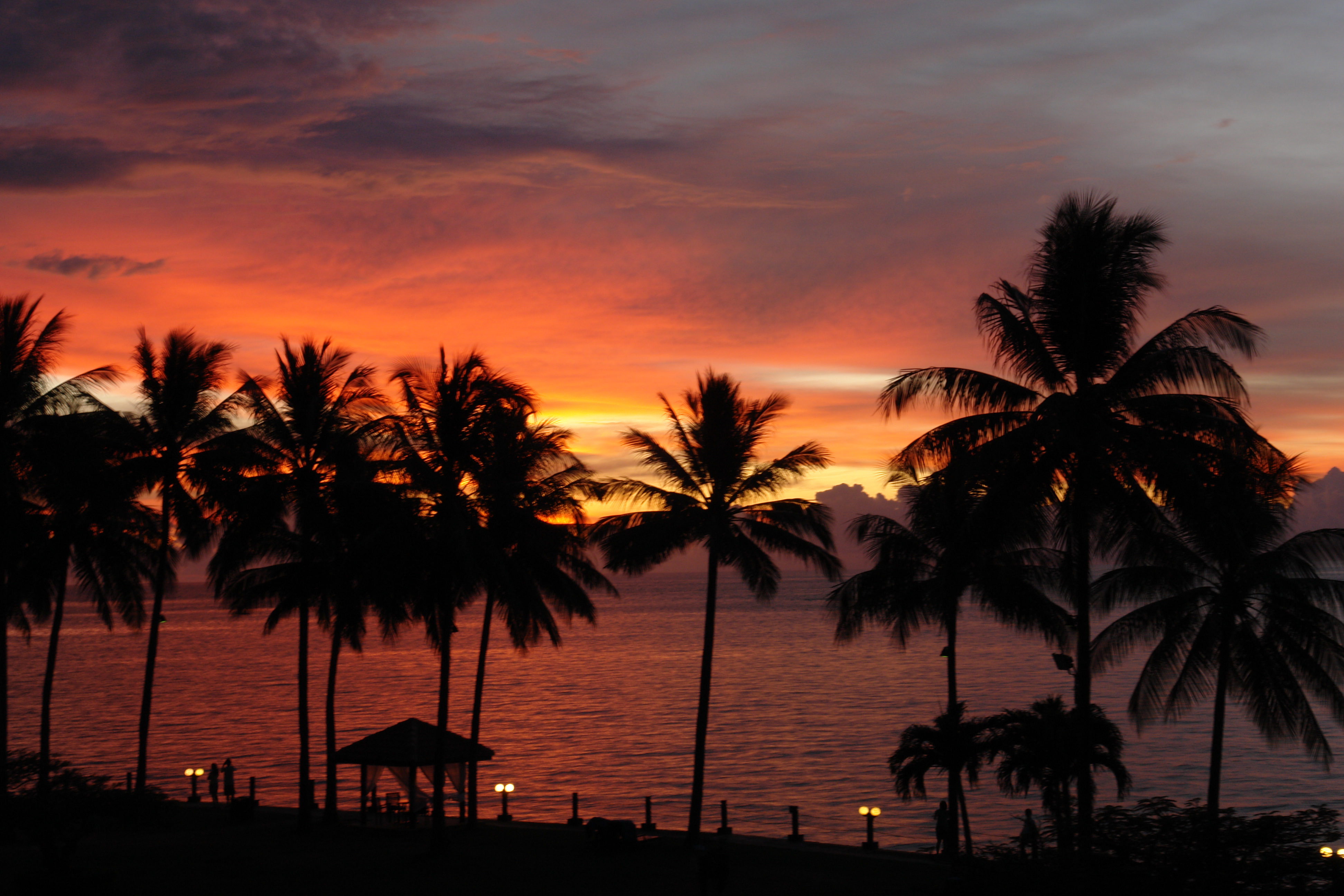
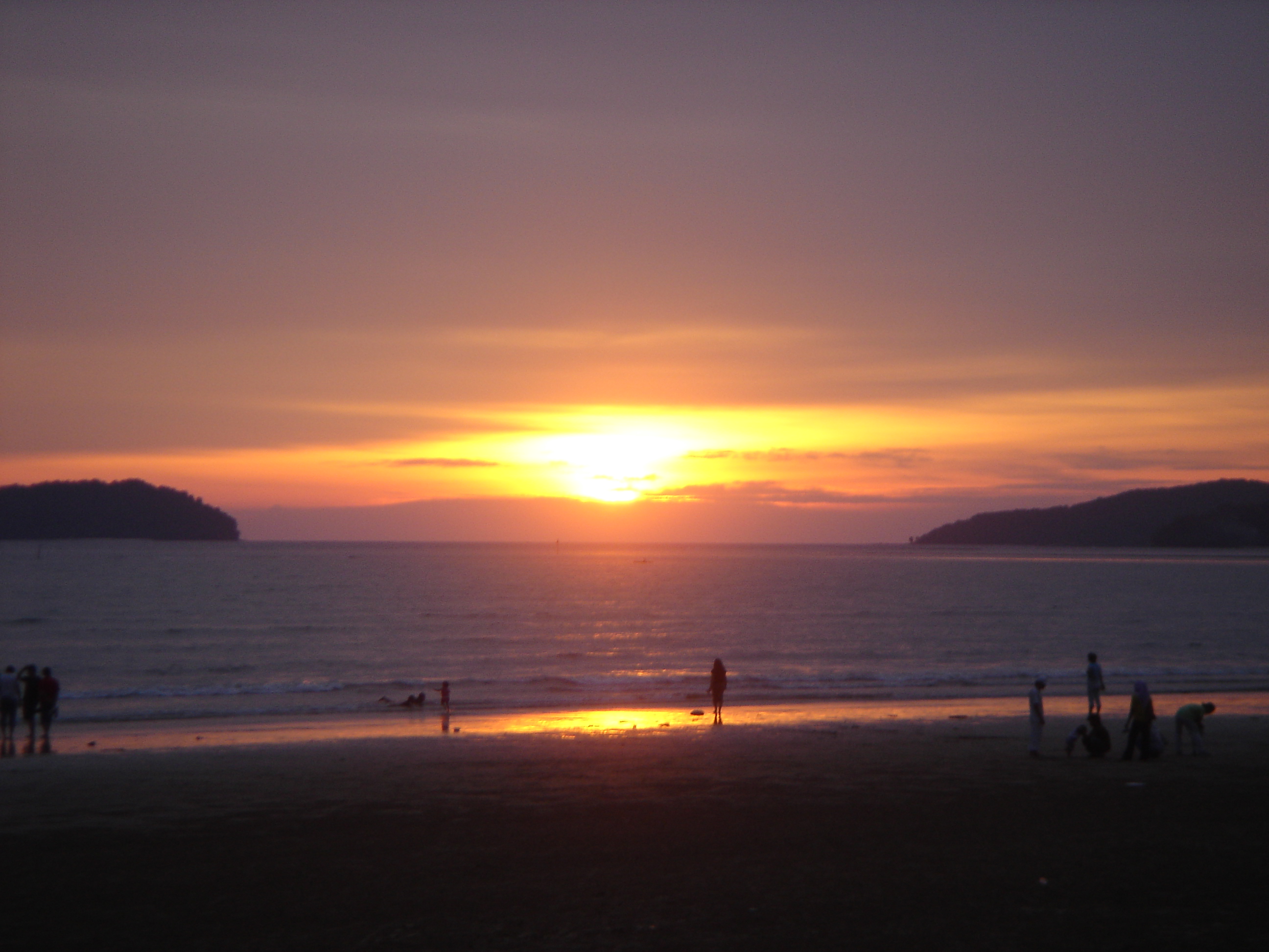
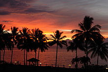 A tropical sunset over the sea in Kota Kinabalu.
Kota Kinabalu features a tropical rainforest climate, under the Koppen climate classification. However, the city has noticeably wetter and drier seasons. Two prevailing monsoons characterize the climate of this part of Sabah, the Northeast Monsoon and the Southwest Monsoon. The Northeast Monsoon occurs between November and March with cooler temperatures and less rainfall, while the Southwest Monsoon occurs between May and September, which brings warmer temperatures and more rainfall. There are also two successive inter-monsoons from April to May and from September to October.[28] Temperature variation throughout the year is small. However, April and May are generally the hottest months, while December and January are often the coolest. During this period (December and January), some surge of cold winds blowing from Siberia occasionally can drop the early morning temperature to 20 °C.[29] Rainfall varies markedly through the year. February and March are typically the driest months while rainfall peaks in the inter-monsoon period around October. Relatively humidity is quite high throughout the year.[30]
Climate data for Kota Kinabalu Month Jan Feb Mar Apr May Jun Jul Aug Sep Oct Nov Dec Year Average high °C (°F) 29
(84)29
(84)30
(86)31
(87)31
(87)31
(87)30
(86)30
(86)30
(86)30
(86)30
(86)30
(86){{{year high C}}}
(86)Average low °C (°F) 22
(71)22
(71)23
(73)23
(73)23
(73)23
(73)23
(73)23
(73)23
(73)23
(73)23
(73)23
(73){{{year low C}}}
(71)Precipitation mm (inches) 119
(4.69)60
(2.36)74
(2.91)128
(5.04)228
(8.98)290
(11.42)258
(10.16)259
(10.2)310
(12.2)351
(13.82)304
(11.97)251
(9.88)2,700
(106.3)Source: http://www.weatherbase.com/weather/weather.php3?s=964710&refer=&units=metric Demography
There have not been any official or popular adjectives, or demonyms, to describe the people of Kota Kinabalu. A simple way to describe the people of the city can be "orang K.K.", where orang means "person" or "people" in Malay. The terms "K.K-ites"[5] and "K.K-ians" have also been used to a limited extent. People from Sabah are called Sabahan.
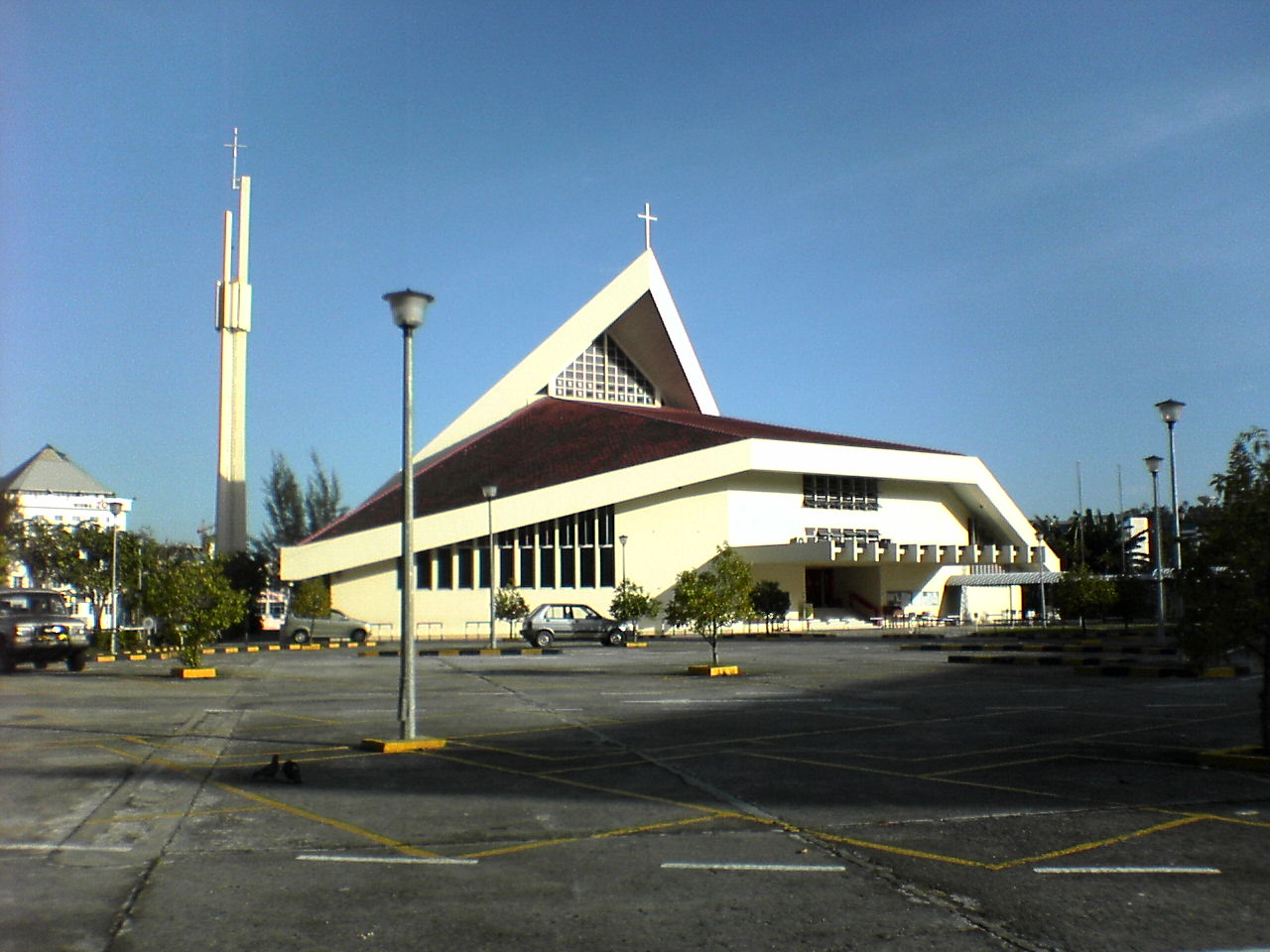
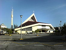 Sacred Heart Cathedral.
Ethnicity and religion
Malaysian Census 2010 Report indicates that Kota Kinabalu has a population of 436,100.[31] The city's population today is a mixture of many different races and ethnicities. The city consists of mainly Bruneian Malay, Kadazan-Dusun, Rungus, Murut, Chinese and Bajaus. The Chinese are mostly Hakkas and can be found mainly in the Luyang area. The area of Penampang is populated mainly by Kadazans, while the Bajaus mainly reside in Likas, Sembulan and Karambunai. The Malays and Bajaus are Muslims. The Kadazans here mainly practice Christianity, whilst the Chinese are mainly Buddhists or Christians. There are a small number of Hindus, Sikhs, Animists, and a small number of secularists also exist.
There is also a sizeable Filipino population in the city. The first wave of migrants arrived in the late 15th century during the Spanish colonisation, while some are refugees arriving in the early 1970s because of the troubles in southern Philippines. A significant number of them today, however, consists of migrant workers arriving from the late 1970s onwards. Most of the earlier migrants have been naturalised as Malaysian citizens, however there still remains some living without proper documentation around the city as illegal immigrants.[32] Most of the Filipino migrants are Suluks coming from the southern parts of Philippines. There are also a number of Indonesian migrants living around the city, mostly coming from Celebes, Java, Flores of the Lesser Sunda Islands.[33]
There is a small population of Indians, Pakistanis and Eurasians scattered around the city. More recently the number of expatriates living in the city, either temporarily or permanently, have also increased. Most have come from South Korea, Japan, Australia, and Europe.
Interracial marriages are not uncommon and Kadazan-Chinese intermarriages are particularly common. The mixed race offspring of Kadaza and Chinese are referred to as Sino-Kadazans or simply "Sinos".
Languages
The people of Kota Kinabalu mainly speak Malay Bahasa Melayu, with a distinct Sabahan accent. However, as almost 50% of Kota Kinabalu residents are of Chinese descent, many also speak Chinese dialects. Huìyáng Hakka (Simplified Chinese: 惠阳客家话; Traditional Chinese: 惠陽客家話) and Mandarin are the main dialects spoken by the Chinese. Additionally, most Chinese are also able to speak the Cantonese dialect, though with widely varying levels of fluency. Almost all residents are also able to speak the English language, especially the younger generation. However, some find difficulty in speaking fluently due to a limited vocabulary and the general lack of usage of the English language as a conversational lingua franca among Sabahans as a whole.
The number of Bahasa Kadazandusun speakers is thought to have dropped significantly throughout Sabah especially in larger towns or cities like Kota Kinabalu. However, some efforts can be seen to have been taken by some to revive the usage of the language. Kadazan has been considered an endangered language, along with the culture of ethnic Kadazans.[34] Today most of the people are also able to converse in basic English.
Economy
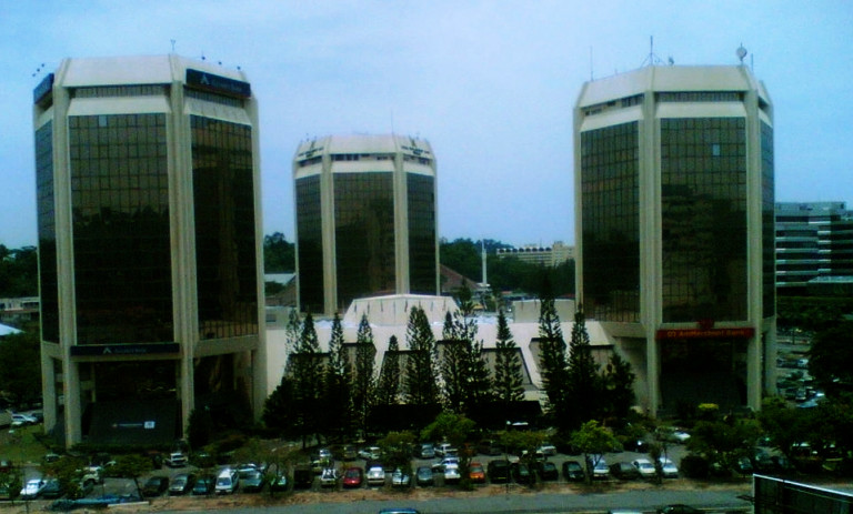
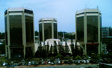 Wisma Tun Fuad Stephens.
Besides being the capital city, Kota Kinabalu is also the main industrial and commercial centre for Sabah. The economy is dominated by the primary sector of industry. Historically, the secondary sector dominated the economy, but due to rapid urbanisation and economic development, this sector of economy is slowly diminishing. More recently, a move towards a more tertiary based industry has become more apparent, especially with regards to the boom in the tourism industry.[3] Many state-level, national-level and international commercial banks, as well as some insurance companies have their headquarters or branches here.
The overseas Chinese population also contributes to the development of KK since their immigration in the late 19th century. Their original role involved 'koo-li' (slavery work) and today many Chinese work as shopowners.
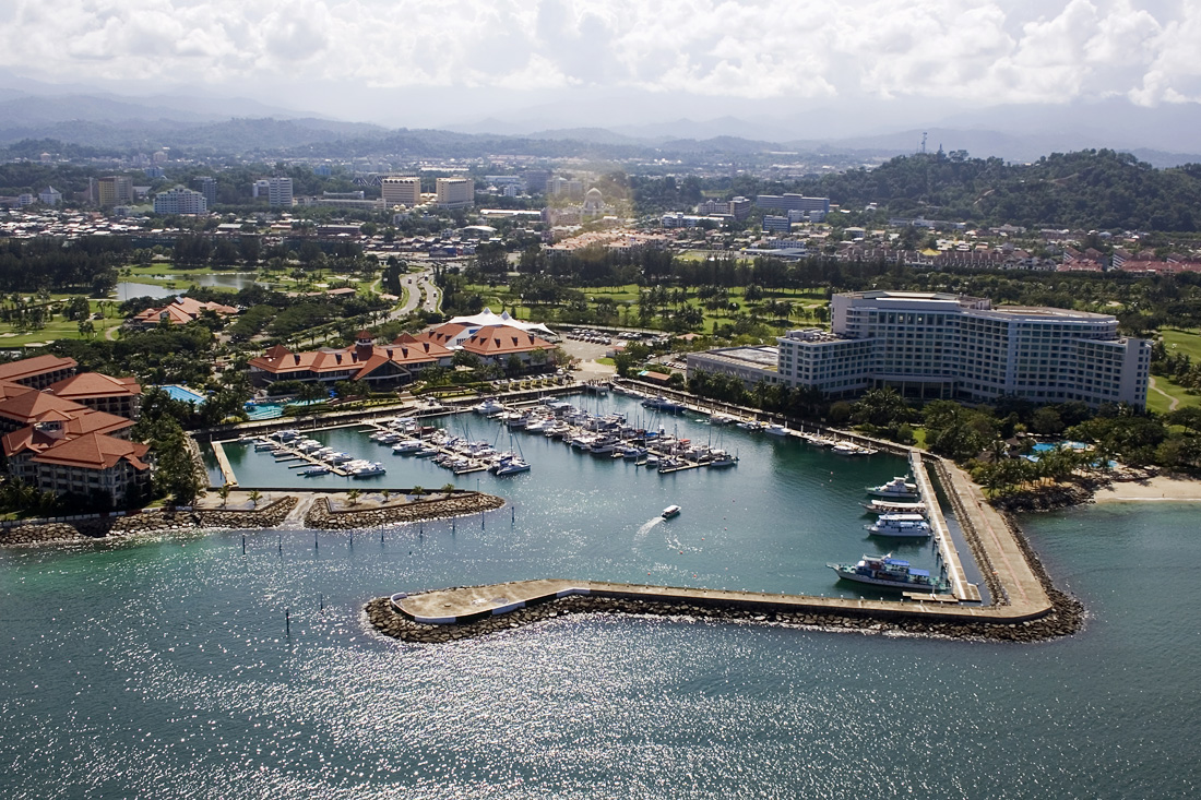
A number of industrial and manufacturing companies also have plants here especially in the industrial districts of Likas, Kolombong, and Inanam. The ongoing construction of the 8,320-acre (33.7 km2) Kota Kinabalu Industrial Park (KKIP) in Sepanggar is intended to boost the city's industrial and commercial activity making it a major growth centre in East Malaysia, as well for the BIMP-EAGA (Brunei-Indonesia-Malaysia-Philippines East ASEAN Growth Area) region.[35] Kota Kinabalu also hosts numerous national, regional, and international conferences or trade fairs every year including the biennial Sabah International Expo, the Asia Pacific eTourism Conference by the United Nations Conference on Trade and Development (UNCTAD), the ASEAN Australian Engineering Congress, and many others. These events are normally held at the Sutera Harbour resort.
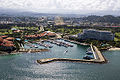
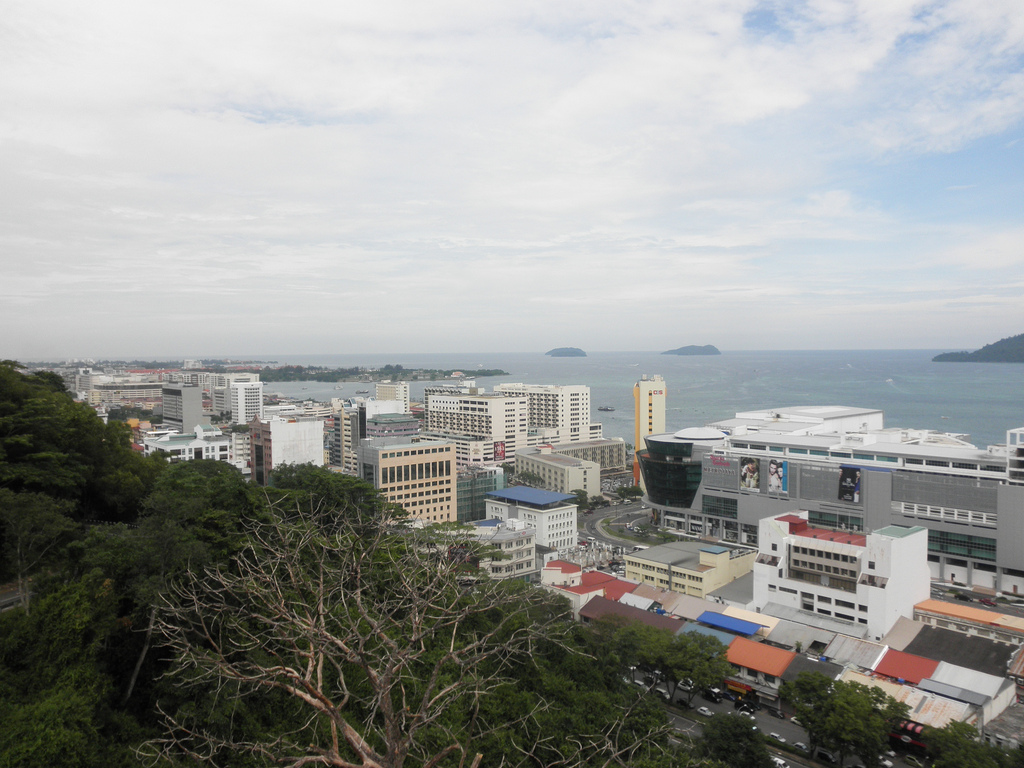
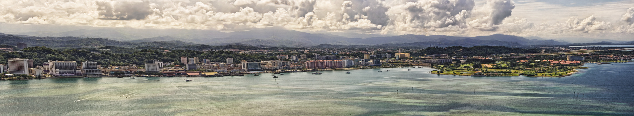
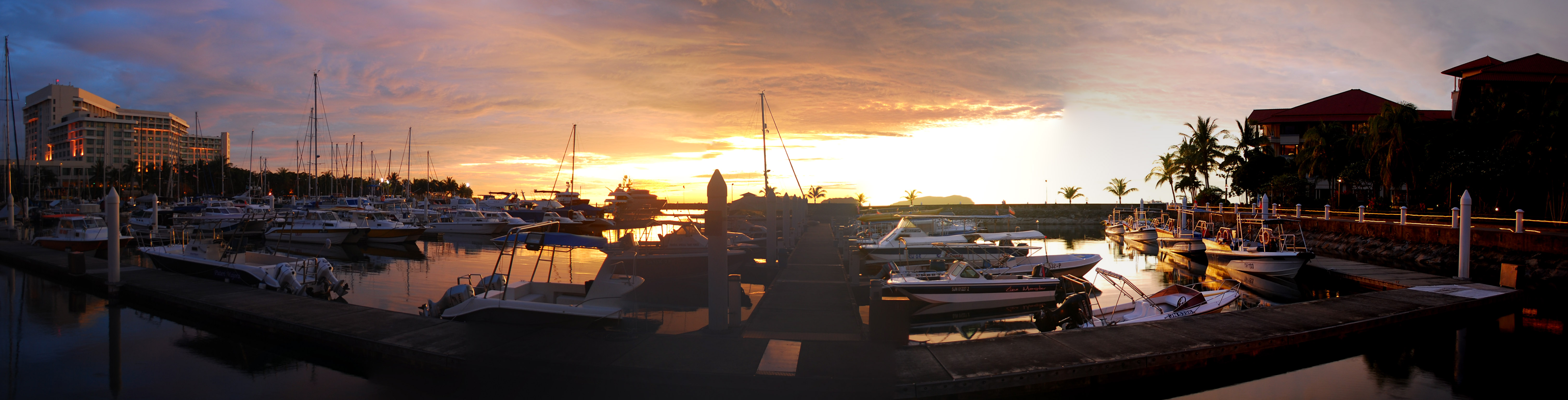
 A panorama of Kota Kinabalu from South China Sea. Sutera Harbour resort at the right side
Transportation
Land
The internal roads linking different parts of the city are generally state roads constructed and maintained by the state Public Works Department. Most major internal roads are dual-carriageways. One of the major road here is Jalan Lintas-Jalan Tuaran Bypass, which together serves almost as a ring road, circling the city and connecting the districts and suburbs surrounding the city, namely, Putatan, Penampang, Luyang, Likas, Inanam, Menggatal, Sepanggar, and Tuaran. There is currently no freeway in the city nor in any part of Sabah. The city is linked by highways to distant towns around Sabah and these are mainly federal roads maintained by the national Public Works Department. Highway routes from Kota Kinabalu include:
- Kota Kinabalu - Tamparuli - Kudat-Kota Marudu
- Kota Kinabalu - Tamparuli - Ranau - Sandakan - Tawau - Serudong (part of the Pan Borneo Highway)
- Kota Kinabalu - Keningau - Lawas - Brunei - Miri - Kuching - Sematan (part of the Pan Borneo Highway)
- Kota Kinabalu - Keningau - Kalabakan - Tawau
Public transportation:
Regular bus services operate around the city. Minibuses or vans are also used besides buses as an alternative public transportation. There are two main bus terminals in the central business area. The terminal along Jalan Tun Razak provides internal bus services towards different part of the city and its outskirts. Another terminal near Bandaran Berjaya provides intercity services towards destinations south of the city (Papar, Tenom, Beaufort, and others). The North Kota Kinabalu Bus Terminal in Inanam provides intercity buses heading towards destinations north and north-east of the city (Tuaran, Kudat, Ranau, Sandakan, Tawau, Semporna, and others). Taxicabs too can be found around the city.
A railway system formerly known as the North Borneo Railway was established in 1896 by the British North Borneo Company. It was built for the main purpose of transporting commodities from the interior to the port in Kota Kinabalu during the British occupation. The railway line connects Kota Kinabalu with Tenom and several other towns in between, and it is the only railway system operating in East Malaysia. Today the railway is known as Sabah State Railway, and it provides daily services for commuters, travellers, as well as for cargo transportation. A separate company operates the leisure tour also called the North Borneo Railway, which caters mainly for tourists.[36] The train station and terminus is located in Tanjung Aru.
Air
Kota Kinabalu International Airport (KKIA) (ICAO Code : WBKK) provides flights linking the city with other domestic and international destinations. It is a secondary hub for Malaysia Airlines and AirAsia and it consists of two terminals. It is the second busiest airport in Malaysia after Kuala Lumpur International Airport and is one of the main gateways into Sabah and East Malaysia.[37] Some destinations include : Bandar Seri Begawan, Shenzhen, Seoul, Shanghai, Guangzhou, Hong Kong, Macau, Manila, Cebu, Singapore, Taipei, Kaohsiung, and other cities, both within and outside of Malaysia. It is also a secondary hub for MASWings, which serves flights to smaller towns and rural areas in East Malaysia.
Sea
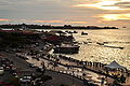
 A panoramic view of the sunset at Sutera Harbour Resort.
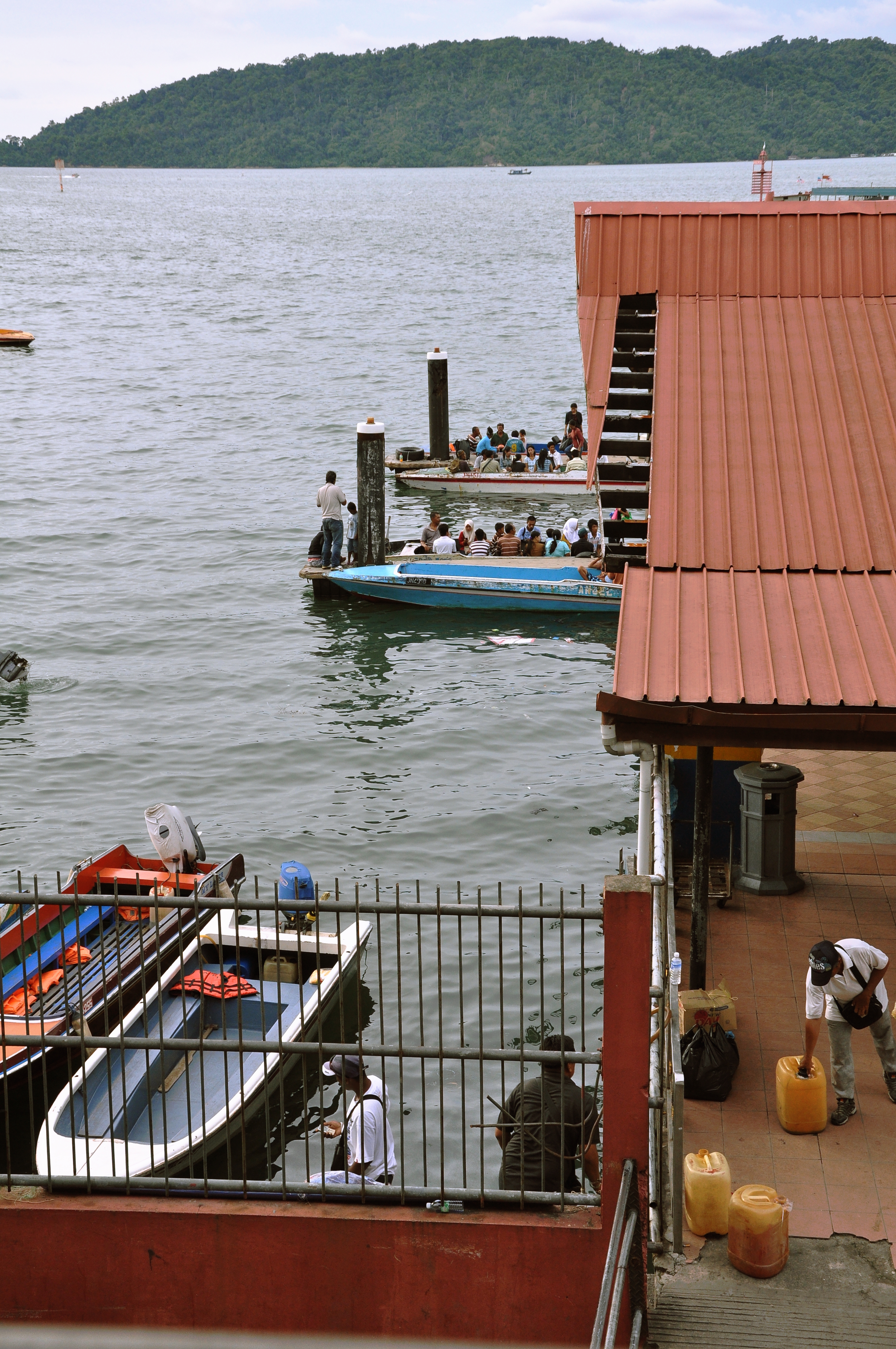
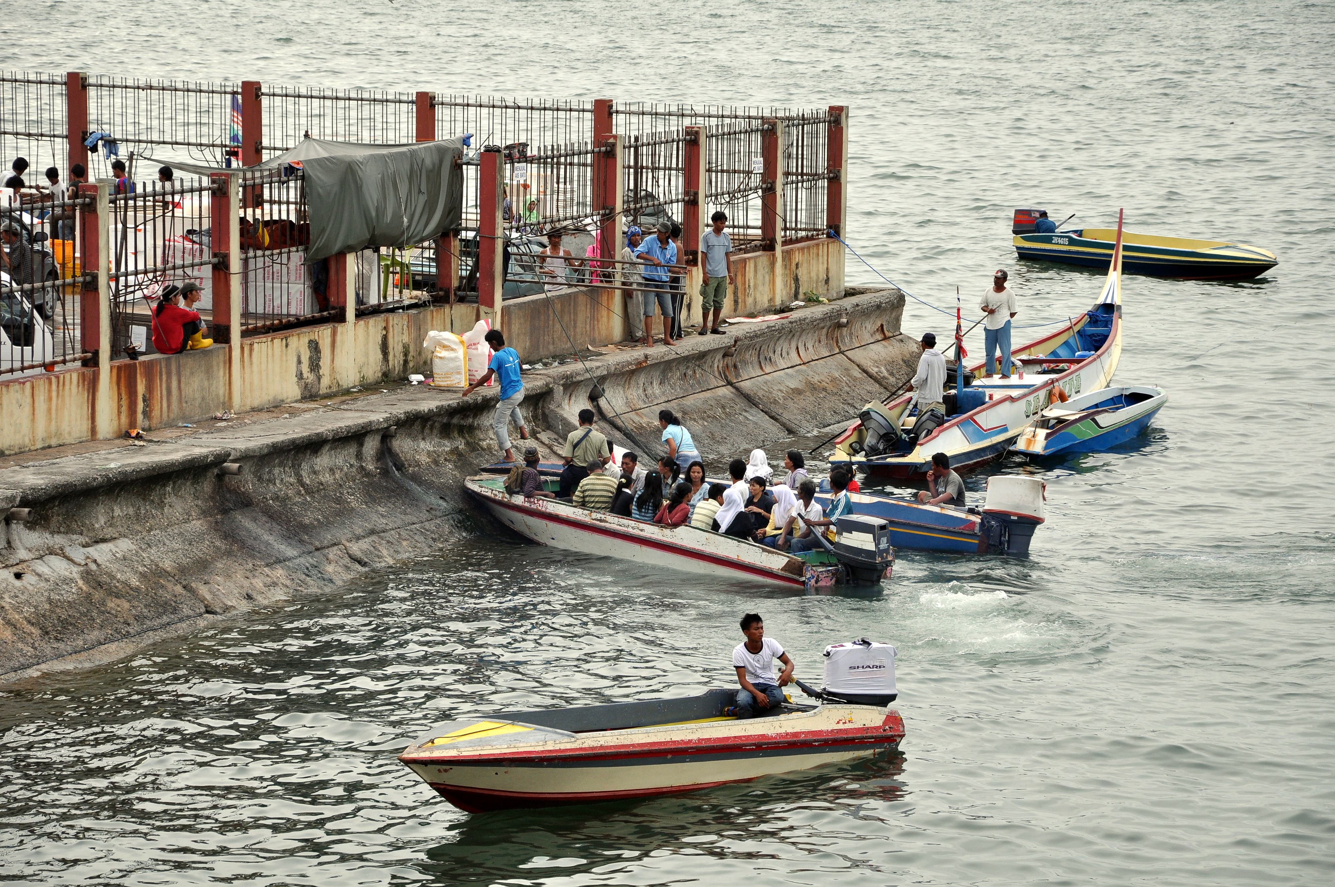
 Kota Kinabalu Ferry Terminal provides daily services to Pulau Manukan, as well as other islands, throughout the day. On the right is a typical boat used to ferry passengers around.
Kota Kinabalu has two ports: Kota Kinabalu Port and Sepanggar Bay Container Port (SBCP). Kota Kinabalu Port mainly loose/bulk cargo, while SBCP operates as a naval base for the Royal Malaysian Navy, oil depot and all containerised cargo.[38] In 2004, Kota Kinabalu Port handled about 3.6 million tonnes of freight cargo, the third highest in the state after Sandakan Port, and Tawau Port.[16] It however handles the most number of containers in the state, with 153,793 Twenty-foot equivalent units (TEU) of containers handled in 2006. Sepanggar Bay Port will have the capacity to handle 200,000 TEU annually when its container terminal is completed.[39] All ports in Sabah are managed and operated by Sabah Ports Sdn Bhd.[40]
Kota Kinabalu Ferry Service is a passenger ferry terminal located at Jesselton Point near the K.K. port. It provides ferry and motorboat services to the nearby islands for tourists as well as for commuters living on the islands. There are also regular scheduled ferry services to Labuan.
Other utilities
Courts of law and legal enforcement
The court complex is located along Jalan Pantai in the city centre. It contains the High Court, Sessions Court, and the Magistrate Court.[41]
The Sabah Police Contingent Headquarters is located in Kepayan. There are two district headquarters in the city, the Kota Kinabalu District police headquarters is located in Karamunsing, and the Penampang District headquarters. Both also operate as police stations. Other police stations are found in KKIA, Tanjung Aru, Putatan, and Menggatal. Police substations (Pondok Polis) are found in Luyang, Likas, Telipok, and Babagon.[42] The city's traffic police headquarters is located along Lorong Dewan nearby Gaya Street, and the marine police is located nearby the city ferry terminal along Jalan Tun Razak.
Kota Kinabalu Central Prison is located in Kepayan. Temporary lock-ups or prison cells are found in most police stations around the city.
Healthcare
There are three public hospitals and one public health clinic in Kota Kinabalu. Queen Elizabeth General Hospital, located along Jalan Penampang is the largest public hospital in Sabah. Built in 1957, it is the most important healthcare centre in the city and one of only three general hospital in Sabah. Another hospital is the Hospital Pakar Likas (Likas Specialist Hospital). Hospital Mesra Bukit Padang (Bukit Padang Mental Hospital) which opened in 1971, provides psychiatric services for the entire state. The health clinic, Klinik Kesihatan Luyang, is located about 6 kilometres from the city centre. There are a number of public dental clinics around the city, and also rural clinics in the outskirts.[43]
Sabah Medical Centre in Damai is the largest private hospital in Sabah. Another private centre is the Damai Specialist Centre. There are many other private clinics operating around the city.[44]
 UMS Chancellory Building.
Education
See also: List of schools in SabahThere are many government or state schools in and around the city. Among the well-established and prestigious boarding schools in Sabah is Sekolah Menengah Sains Sabah which is located at Bukit Padang. KK's most notable secondary schools are Sekolah Menengah Taman Tun Fuad, Sekolah Menengah Likas, Sekolah Menengah Kebangsaan Perempuan Likas, Sekolah Menengah La Salle, Sekolah Menengah Kebangsaan St. Francis Convent, Sekolah Menengah All Saints, Sekolah Menengah Stella Maris, Sekolah Menengah Saint Michael, Maktab Sabah, KK High School, Sekolah Menengah Lok Yuk and Sekolah Menengah Shan Tao. There are also a number of independent private schools in the city. Among them are Sabah Tshung Tsin Secondary School, Kian Kok Middle School, Maktab Nasional and Seri Insan Secondary School. Classes usually begin at 7am and end at 1pm except for boarding schools, in which classes begins as early as 6.30 and end at 2pm. Children aged 7 are subjected to attend primary education which consists of six years learning while those aged 13 could pursue their study in lower secondary education for three years. After completing their Lower Secondary Examination, students enter Upper Secondary education, where they will be streamed into either the Science stream or Arts stream based on their examination result. Students chosen to be enrolled at boarding schools will be placed into the science stream. Currently, there are four boarding schools in Sabah.
There are two international schools teaching the British Curriculum. Sayfol International School Sabah teaches from Kindergarten to GCE A Levels, taken at age 18 (pre - university). Sayfol International School is the sister school to the old-established and highly successful Sayfol International School in Kuala Lumpur. Kinabalu International School (KIS) is part of the Federation of British International Schools in South and East Asia (FOBISSEA). Both these English medium schools are located in Bukit Padang. Another international school is the Kinabalu Japanese School, one of four Japanese schools in Malaysia. It caters to children's of Japanese expatriates working and living around the city.
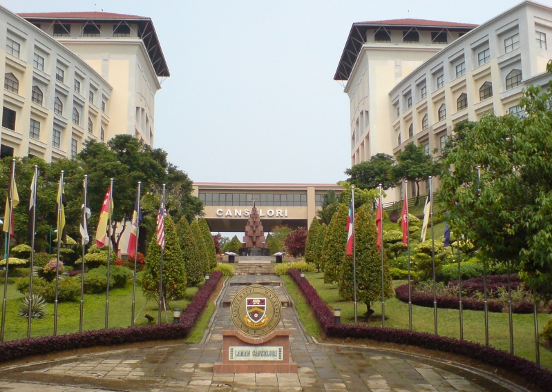
Universiti Malaysia Sabah (UMS) is the largest university in Sabah and was founded in 1994. Its main campus is located on a 999-acre (4.04 km2) piece of land, on a hill facing the South China Sea at Sepanggar Bay, about 10 kilometres north of the city centre. It also has a branch campus in Labuan. It is considered as one of the most beautiful universities in Malaysia.[citation needed] The oldest University in Sabah is Universiti Teknologi MARA Sabah which was co-founded by UiTM and Yayasan Sabah in 1973. The university has earned local and national reputation.[citation needed] There is also a number of private colleges operating in the city which are Universiti Tun Abdul Razak, AlmaCrest International College, INTI College, Kinabalu Commercial College, and Informatics College. An established Public College Tunku Abdul Rahman also available at Donggongon area. Many affluent residents send their children overseas to pursue either secondary or tertiary education.
Libraries:
The Sabah State Library Headquarters is located off Jalan Penampang and is the largest library in the state. Other public libraries include Kota Kinabalu City (Regional) Library, Penampang Branch Library, and Menggatal Village Library. These libraries are operated by the Sabah State Library department.[45] Other libraries or private libraries can be found in schools, colleges, or university campus.
Culture and leisure
Attractions and recreation spots
Cultural
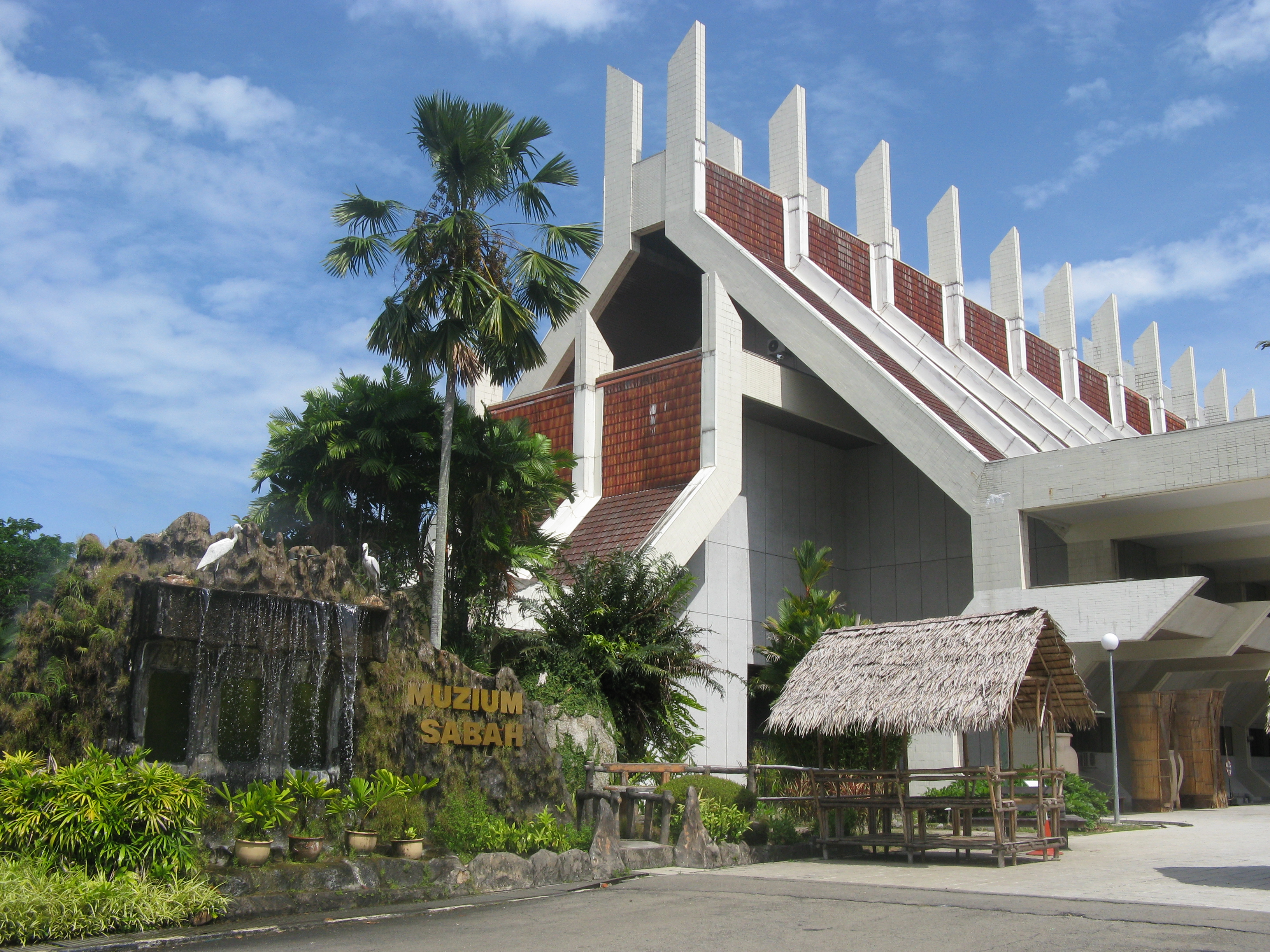
 Sabah Museum, the main museum of Sabah.
There are a number of cultural venues in Kota Kinabalu. The Sabah Museum, situated near the Queen Elizabeth Hospital, is the main museum of Sabah. Around the vicinity of the museum is the Science and Technology Centre, Sabah Art Gallery, and the Ethno Botanic Garden. Wisma Budaya Art Gallery in the city centre hosts some national as well as regional art exhibitions. The Hongkod Koisaan building in Penampang is home to the Kadazan-Dusun Cultural Association (KDCA). It hosts the annual Kaamatan or Harvest Festival, and the concurrently held Unduk Ngadau beauty contest in March. Monsopiad Cultural Village (Kampung Monsopiad) features cultural shows relating to the Kadazan-Dusun culture. It is named after the legendary Kadazan-Dusun headhunting warrior, Monsopiad.
Historical
The Padang Merdeka or Town Padang (field) is the site where the declaration of Sabah's independence and formation of Malaysia took place. The declaration was announced by Sabah's first Chief Minister, Tun Fuad Stephens, on September 16, 1963, also known as Malaysia Day. Today the site hosts the annual City Day celebration on February 2, Merdeka Day celebration on August 31, and a number of other celebrations and functions.
The Atkinson Clock Tower nearby Bandaran Berjaya, was built by Mary Edith Atkinson in 1905 in memory of her son Francis George Atkinson. It was formerly used as a navigation aid for ships. It is one of only three pre-World War II buildings to survive the war. The Petagas War Memorial, located nearby KKIA, is a reminder of those who died opposing the Japanese forces during World War II. It is situated at the place where the Kinabalu Guerillas were killed by the Japanese army in 1944. The Double Six Monument, located in Sembulan, a memorial which marks the site of the June 6, 1976 plane crash known as the Double Six Tragedy most notably the first Chief Minister of Sabah, Tun Fuad Stephens.
 Sunset at Tanjung Aru beach. Pulau Sulug can be seen on the left and Pulau Manukan on the right of the horizon.
Leisure and conservation areas
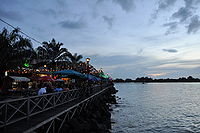 The boardwalk in Kota Kinabalu at dusk.
There are many leisure spots and conservation areas around Kota Kinabalu. Anjung Samudra (KK Waterfront) is a waterfront entertainment spot in the city centre which features restaurants, cafes, pubs, and a nightclub. The Royal Sabah Turf Club in Tanjung Aru hosts weekly horse racing events but had since closed and moved to Tambalang Race Course in Tuaran due to the expansion of Kota Kinabalu International Airport. The North Borneo Railway which begins its journey from Tanjung Aru station, offers scenic tour of the countryside in the West Coast Division and the Interior Division. The railway journey ends in the town of Tenom. Sutera Harbour Golf & Country Club near the city centre was built wholly on reclaimed land. It features a golf and country club, a marina, and two hotels.
Tanjung Aru, located about 6 kilometres from the city centre, is one of the beaches in the West Coast. It derived its name from casuarina trees (locally called Aru trees) that grows on the shoreline.[46] The beach is over 2 kilometres in length and is complemented with a number food and drink stalls, restaurants, and night entertainment clubs. Within the Tanjung Aru vicinity lies the Kinabalu Golf Club, Prince Philip Botanical Park, K.K. Yacht Club, and Shangri-La's Tanjung Aru Beach Resort. This beach is famous for its sunset.
Located within the Likas Bay area is the Kota Kinabalu City Bird Sanctuary. With an area of 24 acres (97,000 m2), it is the only remaining patch of mangrove forest that once existed extensively along the coastal region of Kota Kinabalu.[47] It was designated in September 1996 by the State Government to assist and foster a better understanding and awareness of the value of wetlands area. The Sabah Zoological and Botanical Park (Lok Kawi Wildlife Park) in Lok Kawi, about 20 kilometres south of the city, is the first zoo in Sabah. Set on a 280-acre (1.1 km2) piece of land, it is arguably the largest zoo in Malaysia.[48] The Green Connection aquarium just outside the centre of KK showcases the fish, coral and reptile biodiversity of Sabah, with exhibits on many of the aquatic ecosystems of Sabah. At The Green Connection you can see 5 of the top ten wildlife Icons of Borneo: Sharks, Rays, Coral, Fish and Snakes.
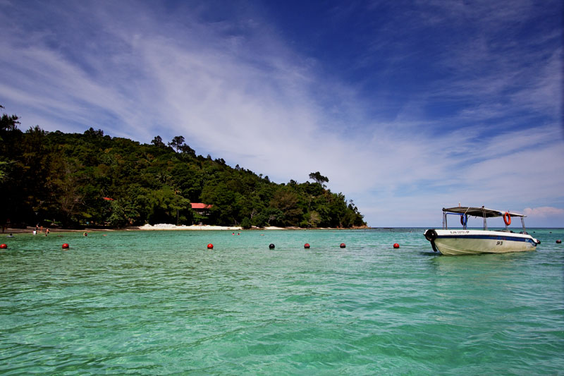
Tun Fuad Stephens Park, located in Bukit Padang, is a popular jogging and hiking spot among locals. It is surrounded by forests and also features a man-made lake. It has a few food stalls and restaurants. Tunku Abdul Rahman Park is a National Park consisting of the islands of Sapi, Mamutik, Manukan, Sulug and Gaya. It is a popular spot for snorkelling. The park is about 15 to 30 minutes boat ride away from the city ferry terminal. Babagon River, in Penampang, and Kiansom Falls near Inanam are also popular places for picnics and leisure bathing.
Outside the city, Crocker Range National Park, located about 70 kilometres away from the city near Keningau, is a popular spot for jungle trekking and camping. Kota Kinabalu is also the gateway to one of the most popular national parks in Malaysia, Kinabalu National Park. The park is a two hour drive away from the city and it contains Mount Kinabalu which is the 10th highest peak in South-East Asia, and the highest in Malaysia. The Rafflesia Forest Reserve near Tambunan, 30 kilometres away from Kota Kinabalu, is also within the Crocker Range National Park boundary. The world's largest flower species, the Rafflesia, can be found here. Nearby here is the Gunung Emas Highland Resort which is another spot famous for its scenery and cool climate. The Tuaran Crocodile Farm, about 30 kilometres north of the city, has around 1000 crocodiles in its enclosure, making it the largest of its kind in Sabah.[citation needed]
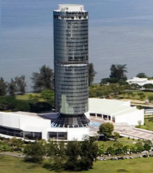 The Tun Mustapha Tower.
Other sights
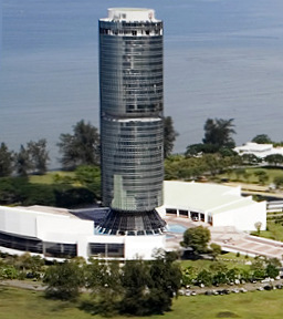
Tun Mustapha Tower (formerly Sabah Foundation Building) is about a 10-minute drive from the city centre. This 30-storey glass building is supported by high-tensile steel rods, one of only four buildings in the world that is built with this method. At 122 metres, it is the second tallest building in the island of Borneo after Wisma Sanyan in Sibu and followed by the Ministry of Finance Building, Brunei in Bandar Seri Begawan, Brunei Darussalam.
Other buildings and sites in the city are the stilt villages found in the areas of Sembulan, Tanjung Aru, Kampung Likas, and Kampung Pondo in Pulau Gaya. These houses are built on coastal shallow waters and are typical homes for the Bajau and Suluk inhabitants.
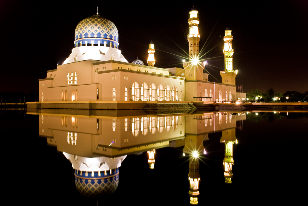
The Sabah State Mosque in Sembulan is the largest mosque in Sabah. The City Mosque on Likas Bay is another significant landmark in the city.
The Signal Hill Observatory near the CBD offers a scenic view of the city centre, the islands, and the sea.
Shopping
 Filipino Market along the waterfront.
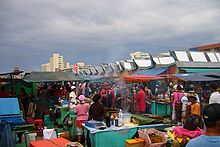
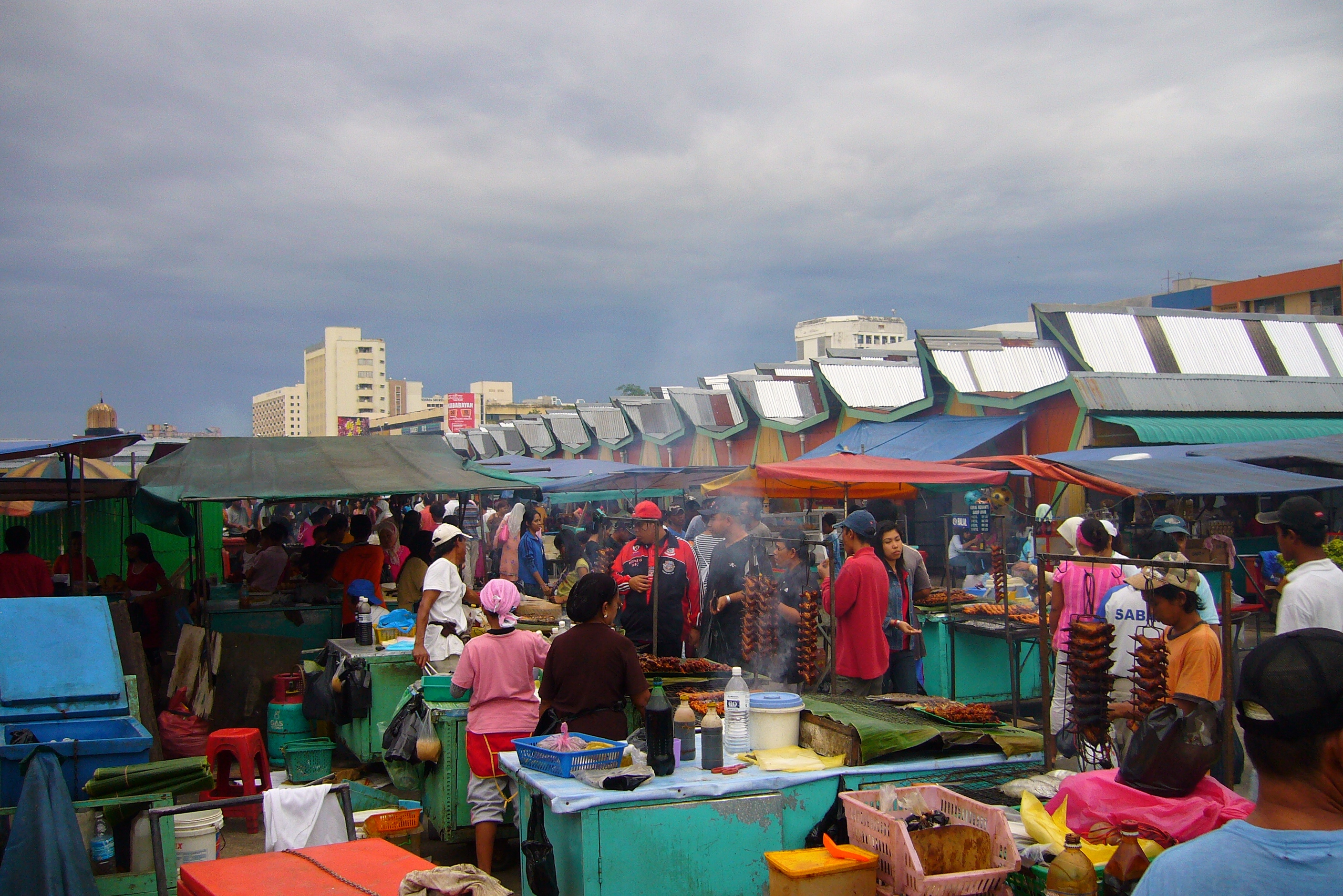
Kota Kinabalu also features a number of shopping malls, which attract many visitors. These include Kompleks Karamunsing, Centre Point, Wisma Merdeka, Warisan Square, Plaza Wawasan, Kompleks Asia City, City Mall, KK Plaza, and the largest hypermall in 1 Borneo. Newly constructed Malls in Kota Kinabalu includes Suria Shopping Mall which currently holds GSC Kota Kinabalu and also Megalong Shopping Mall situated in the district of Penampang. Karamunsing, where Kompleks Karamunsing is situated, is an area that has more computer shops per capita than anywhere else in Sabah.[49] The weekly Gaya Street Sunday Market features a gathering of locals hawkers selling a wide range of items from traditional ethnic cultural souvenirs to pets and flowers. The Kota Kinabalu Handicraft Market (formerly known as the Filipino Market) features vendors selling traditional handicrafts, souvenirs and foodstuffs.
Entertainment
There are five cinemas in Kota Kinabalu - 2 Golden Screen Cinemas (commonly known as GSC), Cathay Cineplex, Growball Cineplex and Megalong Cineplex. GSC is located inside Suria Shopping Mall and in another inside 1Borneo. Both GSC outlets holds 8 cinema halls respectively. Suria Shopping Mall has 2 3D halls while 1 Borneo has 1 3d hall. Growball Cineplex and Megalong Cineplex also have 1 3d hall at each cineplex respectively.[49] Suria Mall and Sutera Harbour Marina contain bowling alleys, and pool tables.
Sports
The Likas Sports Complex in Kota Kinabalu provides various sporting and recreational facilities for public use. It has, among others, a 20,000-seater football (soccer) stadium, badminton, tennis, and squash courts, a gymnasium, an Olympic size swimming pool, a driving range, hockey fields and a new Youth Challenge park consisting of an international standard skate park and indoor climbing centre www.sicc.com.my. It is the largest sports complex in the state and has hosted numerous national as well as international sporting events. Likas Stadium is home for Sabah FA football team (Sabah Rhinos) which is currently competing in the Malaysian Premier League. There is another sports complex in Penampang which also has a full-sized football stadium.
There are four golf courses in Kota Kinabalu; Sabah Golf and Country Club in Bukit Padang, Kinabalu Golf Club in Tanjung Aru, Sutera Harbour Golf and Country Club, and Karambunai Golf and Country Club.
Kota Kinabalu has played host to a number of national sporting events such as the 2002 Sukma Games, international tournaments such as the 1994 Karate World Championships[50] and the 2008 BWF Super Series Masters Finals badminton tournament.[51] It is also the starting point of the annual international Borneo Safari 4x4 Challenge.[52] Kota Kinabalu also hosts and is one of the circuits for the F2 Powerboat UIM World Cup Series in December every year since 2007.[53]
Notable personalities
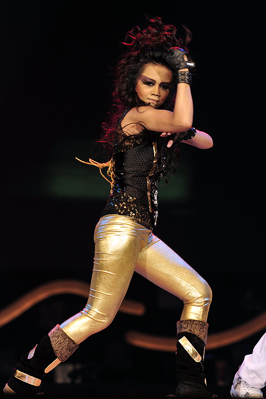
Kota Kinabalu is home to a number of independent musicians who have had success in West Malaysia such as singer-songwriters Pete Teo, Taiwan based Gary Chaw aka Gary Cao/Cao Ge, and acoustic guitar virtuoso Roger Wang. It is also the native city of Popular Malaysian television personality, Daphne Iking. Australian-based R&B singer Che'Nelle (Cheryline Lim) came from Kota Kinabalu. The winner of the 6th season of Akademi Fantasia, Stacy Angie is from Kota Kinabalu, formerly based on Penampang.
Music
Kota Kinabalu is home to one of Asia's favourite Jazz Festival. Called the KK Jazz Festival, it became an annual event that promises to be a spectacular world-class affair.[54] International performers such as Son2nos (Venezuela), award-winning Korean jazz diva Nah Youn Sun, Hong Kong's own Junk Unit, Malaysia's Double Take, Atilia and Mood Indigo from UK have all previously performed at the festival.[55]
Bandwidth Street Press is Kota Kinabalu's only free to pick up monthly magazine that promotes local Sabah music inside their contents. The magazine which was launched in March 2009, was supported by the local government and was referred by Sabah's Minister of Culture, Environment & Tourism, YB Datuk Masidi Manjun, as a publication that will introduce and promote new local musicians while serving up the latest information on the local entertainment scene.[56]
Photo gallery
-
View of the KK waterfront at sunset
-

Southern Kota Kinabalu
-
Sinsuran shophouses
-

Employees Provident Fund Building
-
South View of the KK City (CBD)
-
Panorama View of Kota Kinabalu from South China Sea
-
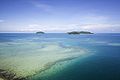
Ocean View with 3 island from City of Kota Kinabalu
-
Sutera Harbour Resort
-
Shangri-la Tanjung Aru Beach Hotel
-
Sabah Foundation Building
-
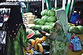
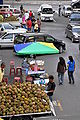
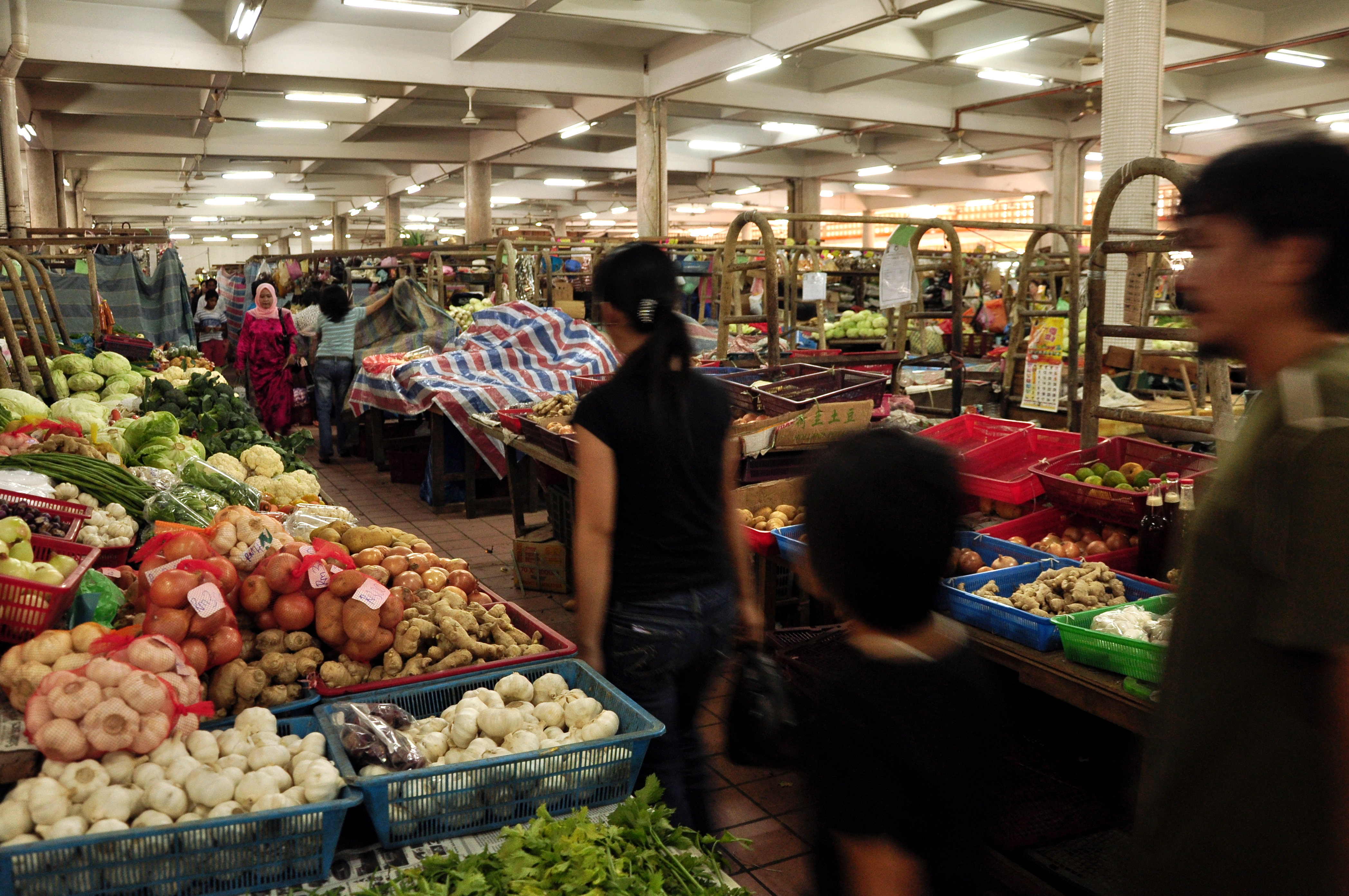
Woman buying watermelon in KK market
-
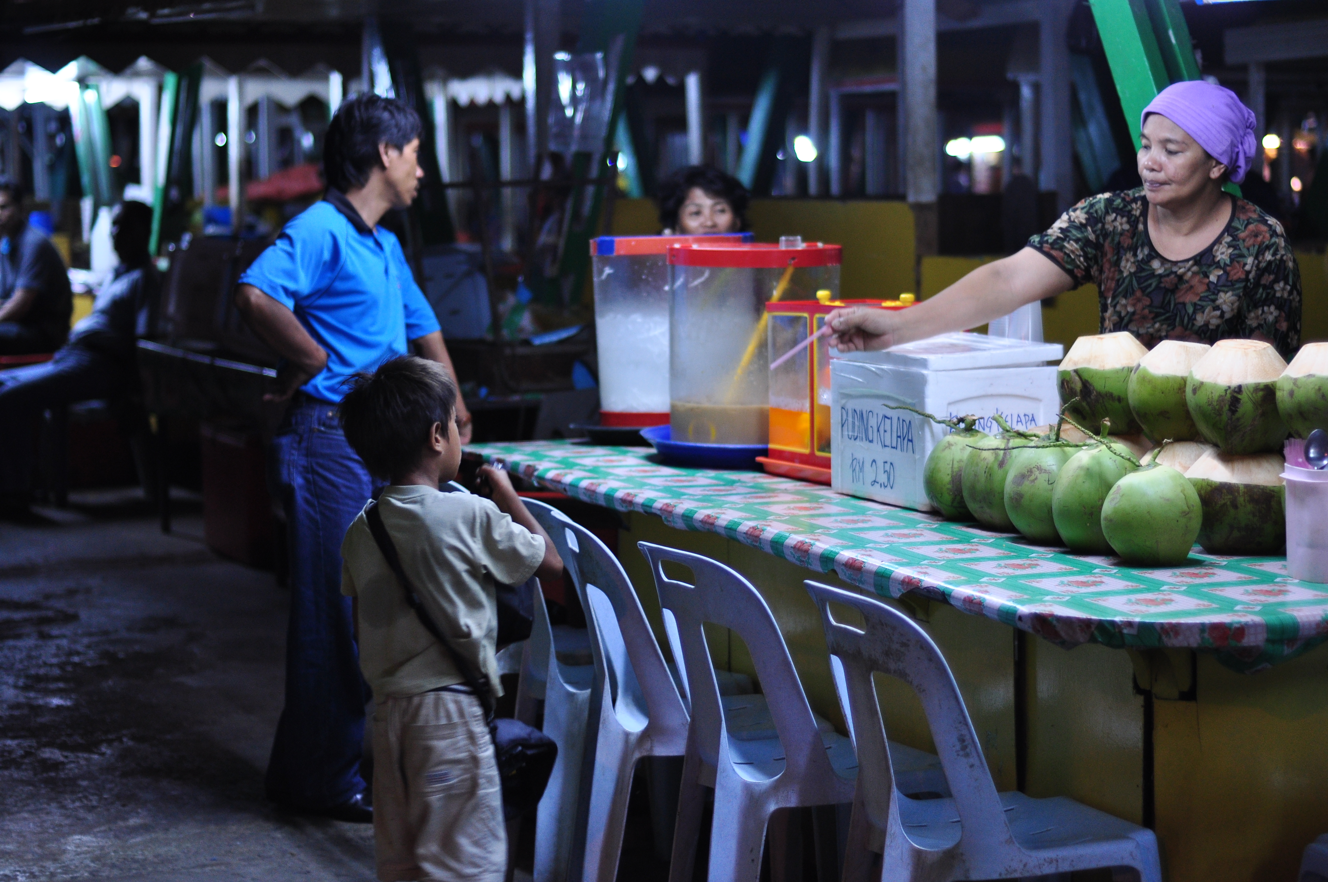
Child buying coconut drink in a market
-
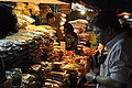
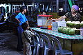
Man buys from stall in market at night
-

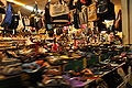
A market in KK
-
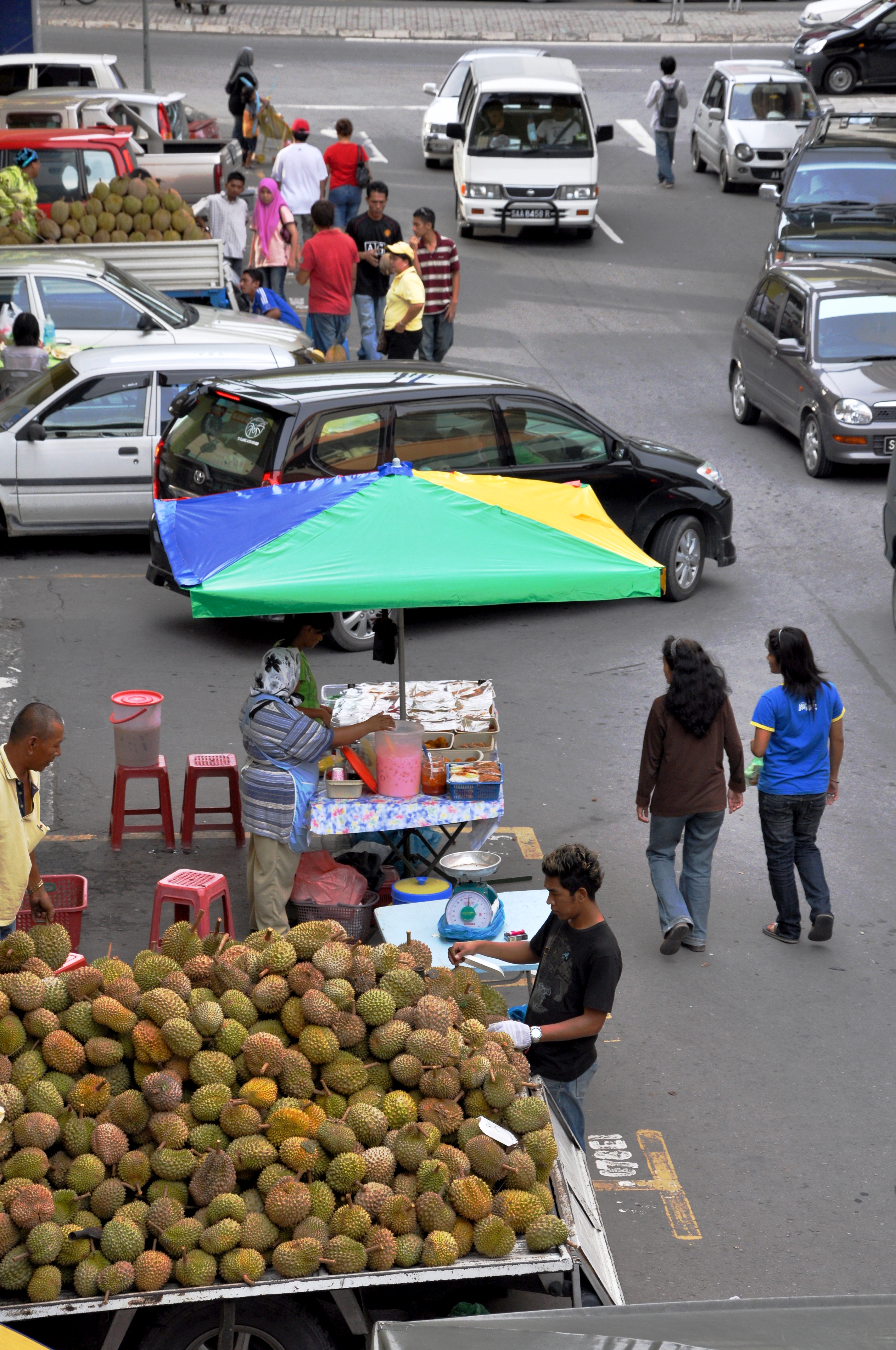
Durian being sold in a KK street
-
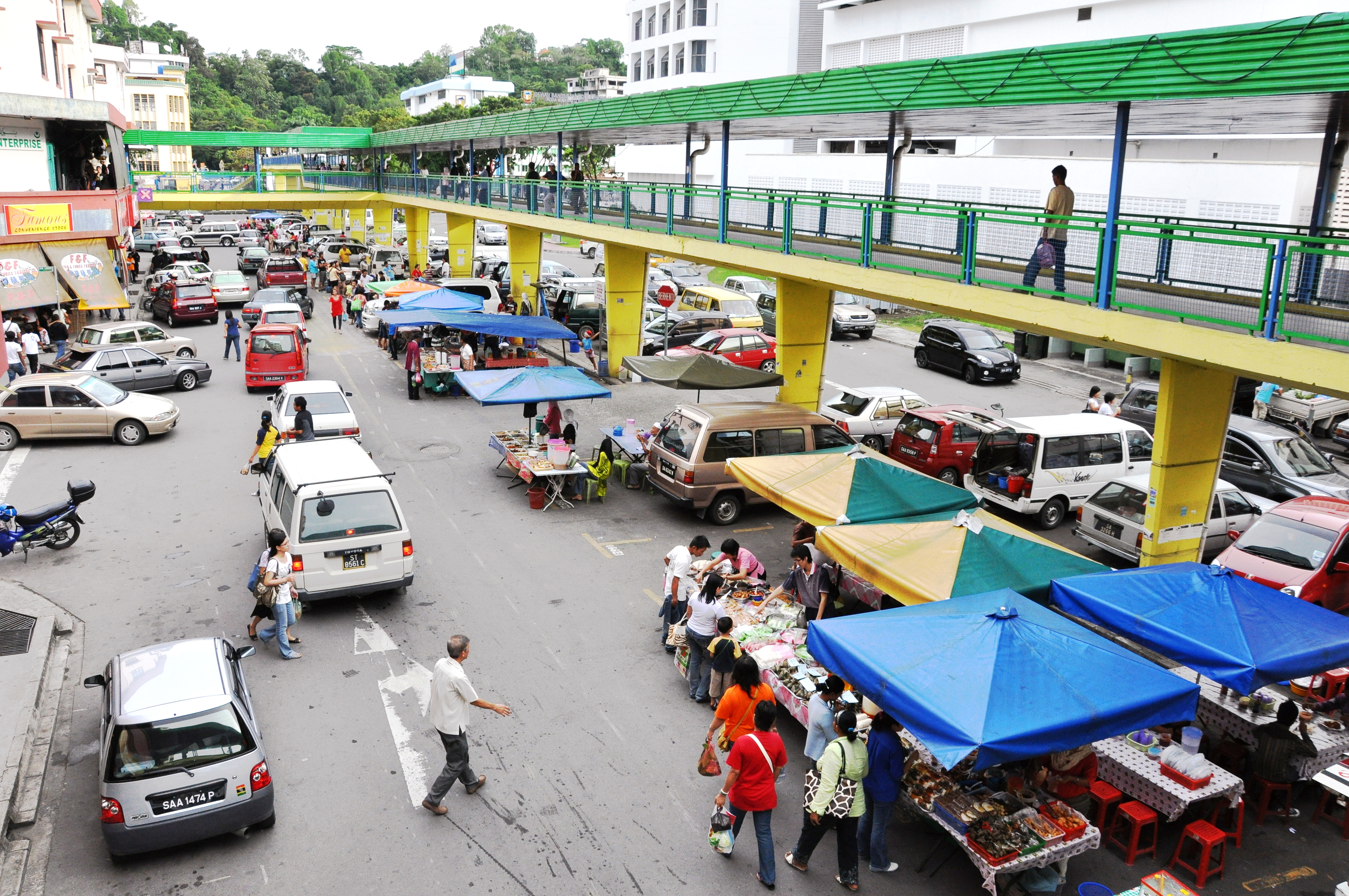
KK street
-
Jetty used to go to Gaya Island Filipino village
-
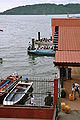
Makeshift boat drop-off point near fish market
-
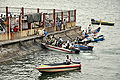
Boats waiting by the KK waterfront
-
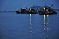
Fishing boats seen from the KK waterfront
-
Shops in the Center Point Mall
See also
- Archdiocese of Kota Kinabalu
References
Footnotes
- ^ "Kota Kinabalu". ABC Sabah. http://www.abcsabah.com/index.php/kota-kinabalu/. Retrieved 2009-08-12.
- ^ Urban area figure obtained after combining population Kota Kinabalu with Putatan and Donggongon; Helders, Stefan. "Malaysia: metropolitan areas". World Gazetteer. http://www.world-gazetteer.com/wg.php?x=1173152037&men=gcis&lng=en&des=gamelan&dat=32&geo=-152&srt=pnan&col=ohdq&va=x&pt=a. Retrieved 2007-03-06.
- ^ a b "Tourism hub set to lift Sabah real estate". TheStar. 2007-06-11. http://biz.thestar.com.my/news/story.asp?file=/2007/6/11/business/17978745&sec=business. Retrieved 2008-01-15.
- ^ With a 233% increase in population from 1991 to 2007; Helders, Stefan. "Malaysia: largest cities and towns and statistics of their population". World Gazetteer. http://www.world-gazetteer.com/wg.php?x=1171083875&men=gcis&lng=en&des=gamelan&dat=32&geo=-152&srt=pnan&col=ohdq&va=&pt=c. Retrieved 2007-04-06.
- ^ a b Muguntan Vanar (September 20, 2010). "Rapid development in Kota Kinabalu has its drawbacks". The Star, Malaysia. http://thestar.com.my/metro/story.asp?file=/2010/9/20/southneast/7043091&sec=southneast. Retrieved 2011-01-03.
- ^ "Mat Salleh Fort". History of Malaysia. Perpustakaan Negara Malaysia (National Library of Malaysia). http://sejarahmalaysia.pnm.my/portalBI/detail.php?section=sm04&spesifik_id=312&ttl_id=49. Retrieved 2007-04-08.
- ^ Fujio, Hara. "The 1943 Kinabalu Uprising in Sabah". Anti-Japanese Movements in Southeast Asia During World War II. Association for Asian Studies, Inc. USA. http://www.aasianst.org/absts/1996abst/inter/i181.htm. Retrieved 2007-03-04.
- ^ "Sabah's Heritage: A Brief Introduction to Sabah's History". Muzium Sabah, Kota Kinabalu. 1992. http://www.sabah.org.my/bi/know_sabah/history.asp. Retrieved 2008-01-15.
- ^ "Mount Kinabalu". Virtual Malaysia. http://www.virtualmalaysia.com/destination/mount%20kinabalu%2Fkinabalu%20park.html. Retrieved 2007-04-02.
- ^ Sorudim, Lesaya (2005-05-02). "KINABALU: Kina Balu , Aki Nabalu, or Ki Nabalu?". KDCA Publications. http://www.kdca.org.my/index.php?option=com_content&task=view&id=101&Itemid=112. Retrieved 2008-01-15.
- ^ Wendy Suart (1993) The Lingering Eye page 55, footnote
- ^ "History of Sabah". Sabah Travel Guide. http://www.sabahtravelguide.com/features/. Retrieved 2007-03-08.
- ^ "Original name still a poser". TheStar. 2000-02-02. http://161.139.39.251/akhbar/history/2000/st00202.htm.[dead link]
- ^ Sawatan, Jackson. "Adakah Gaya Sekadar 'Singgah mata' Untuk Pembangkang?". BERNAMA. Archived from the original on 2007-09-29. http://web.archive.org/web/20070929043515/http://www.mykmu.net/modules.php?name=News&file=article&sid=2698. Retrieved 2007-03-08.
- ^ "Parliament and State Legislative Assemblies". Election Commission of Malaysia. Archived from the original on 2007-10-14. http://web.archive.org/web/20071014013014/http://spr.gov.my/index/parnstlass.htm. Retrieved 2008-01-15.
- ^ a b Monthly Statistical Bulletin: Sabah. Department of Statistics Malaysia, Sabah. January 2007
- ^ "Satellite image of Kota Kinabalu". Google Maps. http://maps.google.com/?ie=UTF8&om=1&z=11&ll=5.944583,116.087036&spn=0.329866,0.466919&t=k. Retrieved 2007-03-17.
- ^ "Main Page". Penampang District Council. http://www.sabah.gov.my/md.ppg/. Retrieved 2008-01-15.
- ^ http://iguide.travel/Kota_Kinabalu/Communication/Consulates
- ^ "Another city wants to be KK’s sister". Borneo Post. 2010-04-23. http://www.theborneopost.com/?p=25808. Retrieved 2010-05-04.
- ^ "Cops storm Pulau Gaya, clash leaves one dead, four injured". The Star. 2006-08-05. http://thestar.com.my/news/story.asp?file=/2006/8/5/nation/15060803&sec=nation.
- ^ Google Maps, retrieved 2008-12-14
- ^ a b WWF Malaysia, A City Oasis, December 28, 2006. WWF Malaysia website, retrieved 2008-12-14 Untitled Document
- ^ Sabah Parks website, retrieved 2008-12-14
- ^ Sabah Travel Guide website, retrieved 2008-12-14
- ^ Distance from Kuala Lumpur, Malaysia to Kota Kinabalu, Malaysia. Retrieved on 2009-06-05
- ^ Distance from Kuching, Malaysia to Kota Kinabalu, Malaysia. Retrieved on 2009-06-05
- ^ Coastal Profile of Sabah, Sabah State Government website, retrieved 2008-12-14 3 CLIMATE (Part I)
- ^ Cooler mornings, Daily Express Newspaper Online, Sabah, Malaysia, retrieved 2010-9-17 Cooler mornings | Daily Express Newspaper Online, Sabah, Malaysia.
- ^ "Kota Kinabalu climate graphs". Allmetsat. http://en.allmetsat.com/climate/philippines.php?code=96471. Retrieved 2008-12-14.
- ^ http://www.statistics.gov.my/ccount12/click.php?id=1620
- ^ Sadiq, Kamal. "When States Prefer Non-Citizens Over Citizens: Conflict Over Illegal Immigration into Malaysia" (PDF). International Studies Quarterly (2005) 49. University of California–Irvine. pp. 101–122. http://www.cri.uci.edu/pdf/ISQ2005FinalCopy.pdf. Retrieved 2007-03-13.
- ^ Mantra, Ida Bagoes (1998). "Indonesian Labor Mobility to Malaysia (A Case Study: East Flores, West Lombok, and The Island of Bawean)" (DOC). National Workshop on International Migration at Yogyakarta. Population Studies Center, Gadjah Mada University, Indonesia. http://www.unesco.org/most/apmrlabo6.doc. Retrieved 2007-03-15.
- ^ Reid, Anthony (1997). "Endangered Identity: Kadazan or Dusun in Sabah". Journal of Southeast Asian Studies, Vol. 28. http://www.questia.com/PM.qst?a=o&se=gglsc&d=5000484947&er=deny. Retrieved 2008-01-15.
- ^ "Introduction". Kota Kinabalu Industrial Park. Archived from the original on 2007-09-30. http://web.archive.org/web/20070930023621/http://www.kkip.com.my/DataBases/KKIPWeb.nsf/IntroPage?OpenPage. Retrieved 2007-04-09.
- ^ The tour, North Borneo Railway. Retrieved April 9, 2007.[dead link]
- ^ "KKIA to become key air hub". The Star. 2007-02-15. http://thestar.com.my/news/story.asp?file=/2007/2/15/nation/16889464&sec=nation.
- ^ "Sepanggar Container Port Terminal ready". Daily Express (UK). 2006-08-08. http://dailyexpress.com.my/news.cfm?NewsID=43646.
- ^ "SPSB raih pendapatan RM157.9j" (in Malay). Berita Harian. http://www.bharian.com.my/m/BHarian/Friday/Ekonomi/20070302061825/Article/. Retrieved 2007-03-07.[dead link]
- ^ "Sabah Ports Sdn Bhd". Suria Group. Archived from the original on 2007-12-26. http://web.archive.org/web/20071226202935/http://www.suriagroup.com.my/sabahports/spsb_main2.htm. Retrieved 2008-01-15.
- ^ "List of court addresses". Malaysian Court. http://www.kehakiman.gov.my/courts/address.shtml. Retrieved 2007-03-02.
- ^ "Direktori: Alamat dan telefon PDRM". Royal Malaysian Police. Archived from the original on September 30, 2007. http://web.archive.org/web/20070930193932/http%3A//www.rmp.gov.my/contact/contact_page.cfm%3Fmod%3D20%26recID%3D%252015%26con%3D15%26Dis%3D6. Retrieved 2007-04-02.
- ^ "Senarai hospital kerajaan". Ministry of Health. Archived from the original on 2007-09-27. http://web.archive.org/web/20070927040704/http://www.moh.gov.my/MohPortal/govhospPublic.jsp?search=&search3=12&action.x=&action.y=&action=search. Retrieved 2007-04-02.
- ^ "List of member hospital". Association of Private Hospitals of Malaysia. Archived from the original on 2007-03-05. http://web.archive.org/web/20070305153006/http://www.hospitals-malaysia.org/index.cfm?menuid=4#Sabah. Retrieved 2007-04-02.
- ^ "Introduction". Sabah State Library Online. Archived from the original on 2007-09-30. http://web.archive.org/web/20070930015405/http://www.ssl.sabah.gov.my/aboutus/introduction.asp. Retrieved 2007-04-09.
- ^ Cuti Malaysia - Sabah
- ^ Sabah Wetlands Conservation Society, Sabah, Malaysia
- ^ "Sabah's first zoo ready soon". Daily Express (Malaysia). 2005-02-22. http://www.dailyexpress.com.my/news.cfm?NewsID=32749.
- ^ a b "Reign226's Guide to Kota Kinabalu, Sabah". Malaysia Students. 2006-06-06. http://www.malaysia-students.com/2006/06/reign226s-guide-to-kota-kinabalu-sabah.html.
- ^ "WKF World Championships results". Karate News. http://www.karatenews.us/Tournament%20Results/WKFresults.html. Retrieved 2008-12-20.[dead link]
- ^ "Lee Chong Wei claims win at Kota Kinabalu tourney". Taipei Times. 2008-12-19. http://www.taipeitimes.com/News/sport/archives/2008/12/19/2003431531. Retrieved 2008-12-20.
- ^ "Borneo 4x4 Safari 2008". mysinchew.com. 2008-07-31. http://www.mysinchew.com/node/14488. Retrieved 2008-12-20.
- ^ "F2000 powerboat race heads for Sabah". The Star. 2007-10-10. http://thestar.com.my/sports/story.asp?file=/2007/10/10/sports/20071010120504. Retrieved 2009-08-18.
- ^ "KK Jazz Fest promises to be world-class affair". Daily Express. 2007-07-20. http://www.dailyexpress.com.my/news.cfm?NewsID=51471. Retrieved 2010-08-20.
- ^ "4th Edition of KK Jazz Festival Returns in June". Virtual Malaysia. 2010-06-02. http://www.virtualmalaysia.com/news/4th%20edition%20of%20kk%20jazz%20festival%20returns%20in%20june%202010.html. Retrieved 2010-08-20.
- ^ "Local music industry has government’s support". New Sabah Times. 2009-05-25. http://www.newsabahtimes.com.my/nstweb/fullstory/28850. Retrieved 2010-08-20.
Others
- Sabah State Government and DANCED (Danish Co-operation for Environment and Development): Sabah Integrated Coastal Zone Management (ICZM)
- Department of Statistics Malaysia, Sabah: "Monthly Statistical Bulletin, January 2007: Sabah". ISSN 18231659
External links
Coordinates: 5°58′17″N 116°05′43″E / 5.9714°N 116.0952°E
 Sabah
SabahDivisions Cities Towns Beaufort • Beluran • Bingkor • Bongawan • Donggongon • Inanam • Kalabakan • Keningau • Kimanis • Kinabatangan • Kinarut • Kota Belud • Kota Marudu • Kuala Penyu • Kudat • Kunak • Kundasang • Lahad Datu • Membakut • Menggatal • Nabawan • Papar • Pensiangan • Pitas • Putatan • Ranau • Sapulut • Semporna • Sepanggar • Sindumin • Sipitang • Sook • Tambunan • Tamparuli • Telipok • Telupid • Tenom • Tongod • Tuaran • WestonIslands Balambangan Island • Banggi Island • Berhala Island • Gaya Island • Manukan Island • Jambongan Island • Kapalai Island • Lankayan Island • Layang Layang Island • Libaran Island • Ligitan Island • Mabul Island • Malawali Island • Mantanani Islands • Sebatik Island • Selingan Island • Sipadan Island • Tabawan Island • Tiga Island • Timbun Mata IslandSDC cities and towns SDC infrastructure SDC tourism SDC Educational Cities in Malaysia Alor Setar • George Town • Ipoh • Johor Bahru • Kota Kinabalu • Kuala Lumpur • Kuala Terengganu • Kuching • Malacca Town • Miri • Petaling Jaya • Shah Alam • Subang JayaCategories:- Kota Kinabalu
- Populated places in Sabah
- Ports and harbours of Malaysia
- State capitals in Malaysia
- Populated places established in 1882


Wikimedia Foundation. 2010.