- Pulau Manukan
-
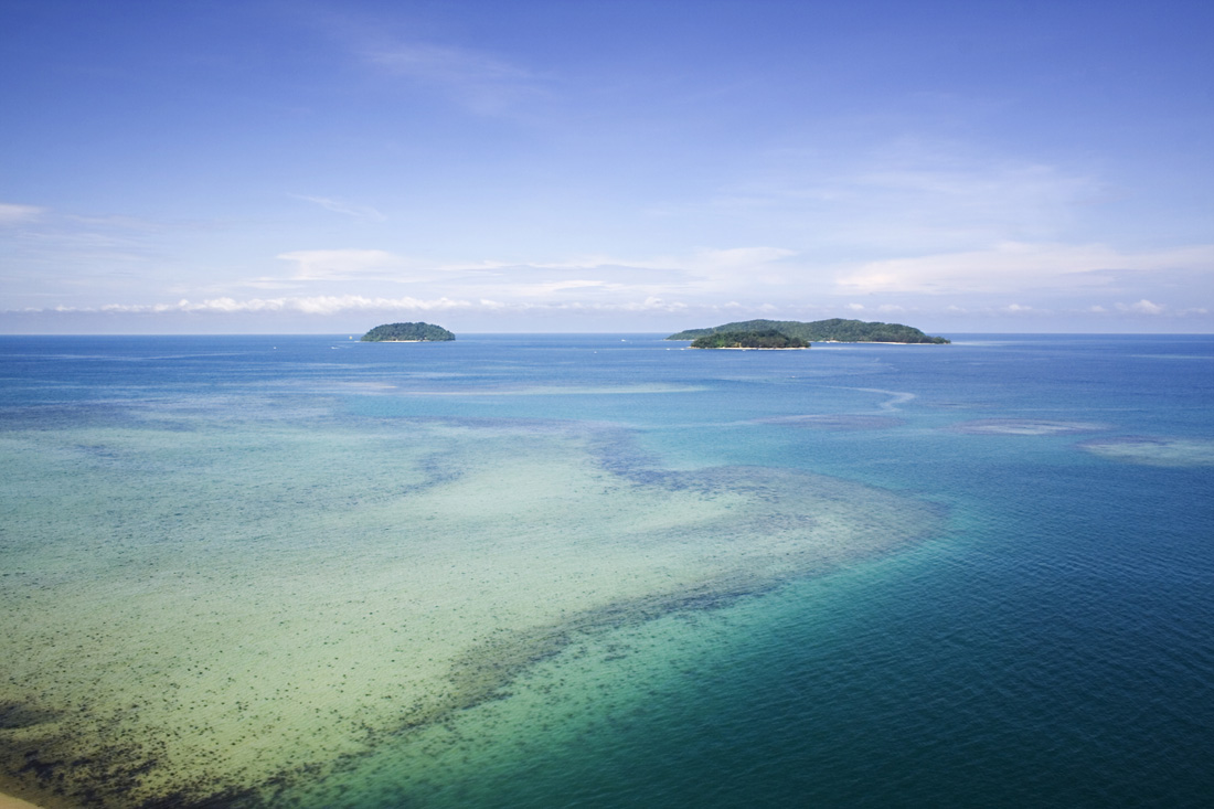
 A seaview of Mamutik, Sulug and Manukan
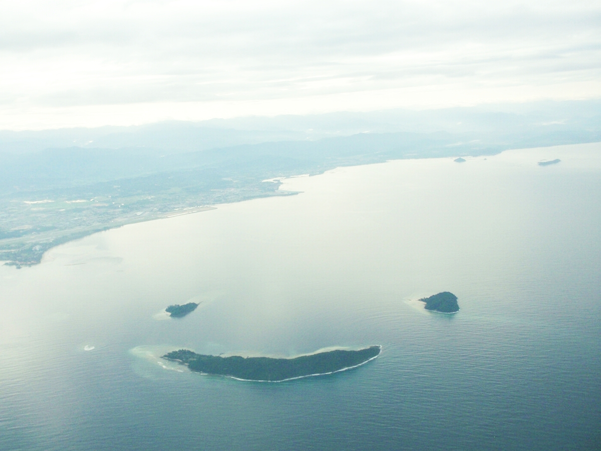
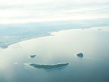 An aerial view of Mamutik (top left), Sulug (top right) and Manukan (bottom) resembling a smiling face.
 Kota Kinabalu Ferry Terminal provides daily services to Pulau Manukan, as well as other islands, throughout the day. On the right is a typical boat used to ferry passengers around.
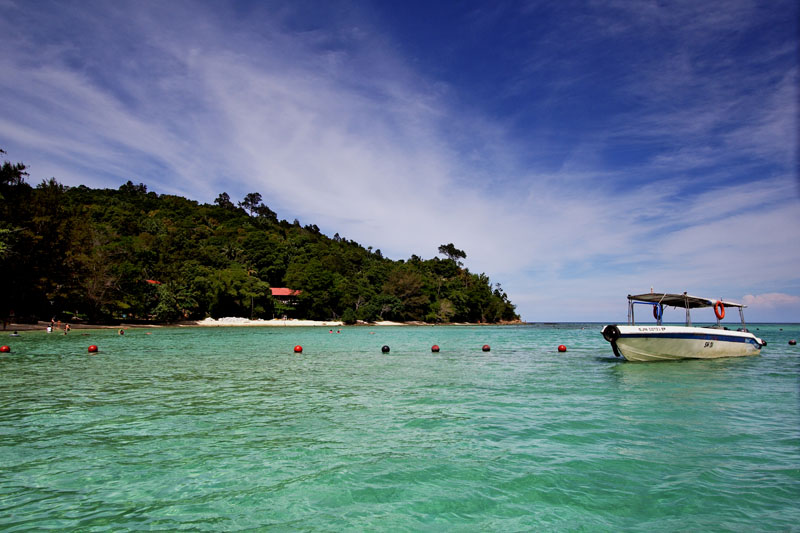
Pulau Manukan is the second largest island in the Tunku Abdul Rahman National Park, Malaysia's first marine national park. It is located in the East Malaysian state of Sabah, just off the coast of Kota Kinabalu and is easily accessible by boat.
Manukan is the most popular island with Kota Kinabalu residents. Manukan has some good stretches of beaches on the southern coastline. The best beach is on the eastern tip of the island. Offshore of Manukan are coral reefs, which is ideal for snorkeling, diving and swimming.
Out of the 5 islands making up Tunku Abdul Rahman National Park, Manukan features the most developed tourist facilities that includes 20 units of chalets, a clubhouse, and few restaurants and a diving centre. Recreation facilities include a swimming pool, football field, Volleyball and Sepak Takraw courts. Infrastructural facilities include support-water, electricity, desalination plant, sewerage system, and even a solar public telephone. It is covered in dense vegetation and has hiking trails.
Jesselton Point Ferry Terminal in downtown Kota Kinabalu is the ferry terminal for those heading to the islands in Tunku Abdul Rahman National Park. This ferry terminal is also the departure point for patrons staying at the Manukan Island Resort.
History
Before the Ice Age, the island formed part of the Crocker Range mass of sandstone and sedimentary rock on the mainland. However, about one million years ago, the melting ice brought about changes in the sea level and parts of the mainland were cut off by the sea to form the islands of Gaya Island, Sapi Island, Manukan Island, Mamutik Island and Sulug Island. Evidence of this can be seen from the exposed sandstone of the coastline forming the cliffs, caves, honeycombs and deep crevices.
Jesselton Point Ferry Terminal in downtown Kota Kinabalu is the ferry terminal for those heading to the islands in Tunku Abdul Rahman Marine Park (Gaya Island, Sapi Island, Manukan Island, Mamutik Island and Sulug Island). This ferry terminal is also the departure point for patrons staying at either Manukan Island Resort or Gayana Resort.
In 1974, the major part of Pulau Gaya and Pulau Sapi was gazetted as Tunku Abdul Rahman National Park, covering an area of 8,990 acres (36.4 km2). In 1979, the park was increased to 12,185 acres (49.31 km2) with the inclusion of the three nearby islands of Pulau Manukan, Pulau Mamutik and Pulau Sulug.
 Sabah
SabahDivisions Cities Towns Beaufort • Beluran • Bingkor • Bongawan • Donggongon • Inanam • Kalabakan • Keningau • Kimanis • Kinabatangan • Kinarut • Kota Belud • Kota Marudu • Kuala Penyu • Kudat • Kunak • Kundasang • Lahad Datu • Membakut • Menggatal • Nabawan • Papar • Pensiangan • Pitas • Putatan • Ranau • Sapulut • Semporna • Sepanggar • Sindumin • Sipitang • Sook • Tambunan • Tamparuli • Telipok • Telupid • Tenom • Tongod • Tuaran • WestonIslands Balambangan Island • Banggi Island • Berhala Island • Gaya Island • Manukan Island • Jambongan Island • Kapalai Island • Lankayan Island • Layang Layang Island • Libaran Island • Ligitan Island • Mabul Island • Malawali Island • Mantanani Islands • Sebatik Island • Selingan Island • Sipadan Island • Tabawan Island • Tiga Island • Timbun Mata IslandCategories:- Sabah geography stubs
- Islands of Sabah
Wikimedia Foundation. 2010.