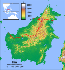
- Membakut
-
Membakut Coordinates: 5°28′0″N 115°47′0″E / 5.466667°N 115.783333°E Country  Malaysia
State  Sabah
SabahArea - Total 132.8 km2 (51.3 sq mi) Population (2010) - Total 21,900 - Density 164.9/km2 (427.1/sq mi) Membakut is a subdistrict in Sabah, Malaysia. Located in the district of Beaufort in the Interior Division, it is one of the stops for the North Borneo Railway.
External links
 Sabah
SabahDivisions Cities Towns Beaufort • Beluran • Bingkor • Bongawan • Donggongon • Inanam • Kalabakan • Keningau • Kimanis • Kinabatangan • Kinarut • Kota Belud • Kota Marudu • Kuala Penyu • Kudat • Kunak • Kundasang • Lahad Datu • Membakut • Menggatal • Nabawan • Papar • Pensiangan • Pitas • Putatan • Ranau • Sapulut • Semporna • Sepanggar • Sindumin • Sipitang • Sook • Tambunan • Tamparuli • Telipok • Telupid • Tenom • Tongod • Tuaran • WestonIslands Balambangan Island • Banggi Island • Berhala Island • Gaya Island • Manukan Island • Jambongan Island • Kapalai Island • Lankayan Island • Layang Layang Island • Libaran Island • Ligitan Island • Mabul Island • Malawali Island • Mantanani Islands • Sebatik Island • Selingan Island • Sipadan Island • Tabawan Island • Tiga Island • Timbun Mata IslandCategories:- Sabah geography stubs
- Populated places in Sabah
Wikimedia Foundation. 2010.

